
National Forests in North Carolina


The national forests in North Carolina offer a wide variety of outdoor recreation opportunities. From the mountains to the sea, there are many exciting adventures awaiting your visit to these national forests. Please keep in mind that all outdoor recreational activities on the Croatan, Pisgah, Nantahala and Uwharrie national forests, including activities at recreation sites, have inherent risks due to the natural setting in which they occur. We strongly encourage you to visit our regional Outdoor Safety in the South website before planning your trip. This site provides valuable information on weather safety, wildlife safety and much more. Always remember, your safety is your responsibility.
RecAreaDirections
Forest Supervisor's Office 160 Zillicoa St. Suite A Asheville, NC 28801 828-257-4200
Open with Google MapMisc
| Stay Limit | |
| Reservable | false |
| Keywords | |
| Map Link | |
| Contact Phone | |
| Contact Email |
Permits info
Facilities
Lake Powhatan Glamping Campground
List of CampsitesOverview
Located just minutes from the popular city of Asheville, North Carolina, Lake Powhatan Glamping is the perfect, all inclusive getaway. The campground is convenient to a variety of cultural and natural attractions, including art and music venues, shopping, breweries, restaurants, and scenic drives on the Blue Ridge Parkway. Onsite you'll enjoy numerous hiking and biking trails as well as lakeside recreational opportunities. Learn more about Lake Powhatan .
The custom designed glamping sites are brand new at Lake Powhatan! Choose one of 12 fully furnished canvas platform tents in the heart of the national forest for your next mountain adventure. Experience nature and outdoor recreation without sacrificing the comforts and luxuries of home. Learn more about glamping near Asheville .
Recreation
Visitors have a number of different activities to choose from. Kids love the lake's sandy swimming beach and anglers enjoy the calm waters for trout fishing. The French Broad River, popular for fishing, wading and tubing is also nearby. The use of personal watercraft in the lake is STRICTLY PROHIBITED due to potential introduction of foreign material to the Lake Powhatan riprarian ecosystem.
The forest is known for its hiking and mountain biking trails (44 miles of them!), several of which are located near the campground.
Facilities
Check-in time begins at 4pm. Check-out time is 11am. Glamping check-in is two hours later and check-out an hour earlier than regular campsites. This is to ensure proper cleaning of the glampsites.
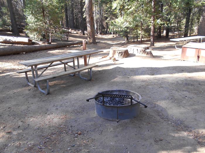
The shaded, private campsites are organized into four loops, all within walking distance of the lake. The 12 glamping sites are available in the upper Hardtimes Loop. The facility provides fully furnished platform tents, picnic tables, charging station, lantern posts and campfire rings with grills, in addition to restrooms with hot showers and flush toilets. Visitors can purchase ice and firewood at the gatehouse.
The power units have approximately 1000Wh (12.0V, 1,000Ah). They are excellent for recharging phones, laptops, and tablets, illuminating small lights, etc. They are not intended for heavy uses of heaters, large fans, cooking equipment or other heavy electronics. Units cannot be recharged quickly (once the power unit is drained it takes 18 hours to re-charge), so guests should use the power available conservatively. Charge times for various devices are located on the units and if damage or impairment of the normal operation of the unit occurs guests will be liable.
Group parties or special events are not permitted. Be aware that quiet hours begin at 10:00 p.m.
Due to the natural outdoor environment and the fabrics and canvas of the tent, as well as comfort for future guests, we do not allow smoking inside the tent or on the tent porch.
Please also be considerate and remove dirty/muddy shoes or boots on the tent porch.
Natural Features
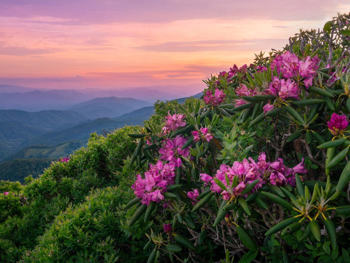
The campground is situated in a heavily wooded area on the banks of Lake Powhatan in the Appalachian Mountains of western North Carolina. The elevation is 2,200 feet. The surrounding land boasts mile-high peaks, cascading waterfalls and slopes thickly forested with hardwoods and conifers.
Nearby Attractions
Among the more popular nearby destinations are Sliding Rock, Looking Glass Falls, the scenic Blue Ridge Parkway, The NC Arboretum and the Biltmore Estate.
contact_info
For facility specific information, please call (828) 577-7278.Wolf Ford Horse Camp Campground
List of CampsitesOverview
Wolf Ford Horse Camp is a reservation only campground located in the Pisgah Ranger District of Pisgah National Forest, near the town of Brevard. The campground is designed and intended for equestrian use. This campground provides access to a comprehensive network of multiple use trails, as well as creeks, streams, and waterfalls, which the Pisgah is known for. In addition to its many waterfalls, Pisgah Ranger District is famous for its scenic vistas and the Cradle of Forestry, which is located only a short 4 mile drive from the campground itself.
Wolf Ford Horse Camp is located 3.2 miles down Yellow Gap Road, gravel Forest Service Road 1206, therein providing a serene escape from the main visiting traffic on Highway 276. Consequently, this campground provides the perfect launching point to explore many different destinations in the Forest, including the Blue Ridge Parkway, 276 Corridor, and countless other waterfalls accessed off of the district's many gravel Forest Service roads.
After you make your reservations online, we highly reccomend a stop to our visitor center located right off Route 276 near the forest entrance for help in creating your itinerary. The visitor center provides a wide variety of resources and local experts happy to answer any of your questions.
Recreation
Pisgah Ranger District contains over 100 miles of equestrian use trails. Beyond trails, there are also plenty of Forest Service roads that enable miles more of recreational use. Wolf Ford provides the perfect access point for many of these trails and roads, enabling a variety of lengths and difficulty levels.
The forest provides a perfect blend of natural and cultural history, best seen through the Forest Heritage National Scenic Byway and a trip to the Cradle of Forestry, the first school of forestry in America. In addition, the nearby Blue Ridge Parkway affords hundreds of miles worth of scenic views, including long mountain vistas, roadside waterfalls, and pastoral farmland.
Finally, all National Forests in North Carolina property is considered North Carolina gamelands. See the North Carolina Wildlife Resources Commission for rules and restrictions.
Facilities
This campground is remote with pit toilets. No water or electricity is available.
Natural Features
This campground is located near the confluence of many creeks, as well as the South Fork of the Mills River. Additionally, the area is home to a wide variety of bird species and animal species ranging from chipmunks to black bears. Finally, the campground affords plenty of shade with large trees including maples, oaks, poplars, birches, and pines, that create a patchwork quilt of beauty in the fall season.
Nearby Attractions
Wolf Ford Horse Campround is within a short distance of the Cradle of Forestry, Pisgah Inn & Restaurant on the Blue Ridge Parkway, North Carolina Wildlife Education Center and Fish Hatchery, Dupont State Forest, and the town of Brevard just down the mountain from this strategic location. Within Brevard one can enjoy blocks of shops and restaurants on Main Street, or seek out guides for fishing, riding, hiking, or floating expeditions in and around Pisgah National Forest.
Charges & Cancellations
If Yellow Gap Road (FSR 1206) is administratively closed, all reservations will be refunded.
Mortimer Campground Campground
List of CampsitesOverview
Mortimer Campground is a small campground nestled within the Wilson Creek Wild and Scenic River Corridor south of Grandfather Mountain. Located at the site of an old Civilian Conservation Corps (CCC) camp, the 17-site campground is surrounded by lush forests, gentle streams, and a large scenic river popular for swimming, fishing, and kayaking.
Recreation
Visitors to the campground can enjoy a variety of activities including fishing, swimming, day hiking, mountain biking, kayaking, picnicking, and scenic driving. Swimming holes along Thorps Creek provide wading opportunities on hot summer days. Nearby Wilson Creek, designated as a National Wild and Scenic River in 2000, is well known for its excellent trout fishing, swimming, kayaking, and rugged features. History buffs will enjoy exploring the remnants of the once booming timber town of Mortimer as well as an old CCC work center. Two Forest Service trails depart from the campground. The Thorps Creek trail provides a short (approx. 1/4 mile) hike to Thorps Creek Falls. The more strenuous Schoolhouse Ridge Trail connects to the campground via the .2 mile Bill Vines trail and provides a 3 mile ridgeline excursion with beautiful views before connecting to the Wilson Ridge Trail. Many other Forest Service trails are within a short drive of the Campground, including Hunt Fish Falls, North Harper Creek Falls, and Little Lost Cove Cliffs. The area also boasts a network of scenic mountain biking trails.
Facilities
The campground provides a variety of campsites. There is an upper and lower loop. The lower loop features 5 tent-only walk-in sites with a central parking lot. The upper loop includes 14 fully accessible, barrier free sites which can accommodate small RVs up to 35ft. Most sites include a tent pad, picnic table, lantern post, and fire ring. Flush toilets, hot showers, running water, and bear-proof trash and recycling receptacles are provided. A Campground host is on site to provide visitor assistance.
Natural Features
Located in a rich mountain hardwood forest at an elevation of 1,400 ft., Mortimer Campground provides a secluded streamside setting shaded by large hemlocks and pine trees. Thorps Creek runs along the east side of the campground before feeding into the Wild and Scenic Wilson Creek, a popular destination for a variety of activities. Hardwood forests cover the mountain peaks on either side of the valley and multiple mountain feeder creeks can be found nearby. The Mortimer area provides beautiful scenery year-round, from stunning fall foliage displays to abundant spring and summer wildflowers.
Nearby Attractions
The Wilson Creek Visitor Center is 3.2 miles from the Mortimer Campground and provides information on the Wilson Creek area and has a photograph and artifact collection that tells the history of the area. The towns of Blowing Rock and Morganton are located within an hour’s drive of the campground, to the north and south respectively. Both towns offer a variety of restaurants, gas stations, grocery stores, and medical facilities. The Julian Price Memorial Park and Campground is located 24 miles north of Mortimer Campground and is a well-known destination for hiking, canoeing, fishing, and camping. Mortimer Campground is 21 miles away from Linville Falls, and the Linville Gorge Wilderness Area. The Gorge offers breathtaking views and numerous hiking trails. The Campground is 17 miles from the popular Grandfather Mountain State Park, the highest peak on the eastern escarpment of the Blue Ridge Mountains.
contact_info
This location is unstaffed. To speak with our main office for general information, please call: (828) 652-2144.Cliffside Lake Shelters Campground
List of CampsitesOverview
Cliffside Lake Recreation Area is a large Day Use area outside of Highlands, NC in Nantahala National Forest. The site offers access to Cliffside Lake where visitors can fish and swim. Cliffside is also home to several trailheads, including the popular Ranger Falls Trail. A $5 per car parking fee is charged for all visitors. Picnic shelters are available for reservation and are the perfect venue for a family reunion, school group, or church outing.
Recreation
Cliffside Lake Recreation Area offers six hiking trails ranging from easy to moderate, as well as trout fishing, picnicking and swimming. Boating is not permitted. Cliffside is a short drive from Dry Falls, Whitewater Falls, and Rainbow Falls. Cliffside is also adjacent to the well maintained and secluded Van Hook Glade Campground. The nearby Cashiers Valley offers recreationalists a plethora of activities such as hiking, cycling, fishing, rock climbing, and whitewater. Nearby Whiteside Mountain is the perfect hike for an adventurous family with young children.
Facilities
The Cliffside Lake Picnic shelters offer visitors a large covered area with picnic tables, grills, and vault toilets. These shelters must be reserved in advance.
Visitors can utilize the beach and swimming area (no lifeguard on duty), a fishing pier, flush toilets near the beach, and several small uncovered picnic areas complete with tables and grills.
Natural Features
Cliffside Lake is located adjacent to the beautiful Cullasaja Gorge where visitors can see several large waterfalls a short walk from Highway 64. The site is nestled between three beautiful mountains, all of which can be explored on the extensive trail system. At 4,118 feet elevation, visitors will enjoy the cooler temperatures that the unique temperate rainforest ecosystem brings to the Blue Ridge Mountains. The calm waters of Cliffside Lake offer anglers of all ages a unique opportunity to catch multiple species including trout, bass, and bream.
Nearby Attractions
A morning or late afternoon drive down scenic Highway 64 is sure to present visitors with amazing views. The quaint town of Highlands has a general store and several fantastic restaurants, while the larger town of Franklin has shopping, grocery stores and performing arts.
Whiteside Mountain Activity Pass
COVE CREEK UPPER GROUP CAMP Campground
List of CampsitesOverview
Cove Creek Upper Group Camp is one of two group campsites nestled along Cove Creek in the lush forests of the Appalachian Mountains. The facility can accommodate large groups of up to 60 people and offers year-round opportunities for hiking, mountain biking, fishing and picnicking in one of the most scenic areas in the state.Recreation
Campers can easily relax with a book or deck of cards in the shaded camping area, or seek out activities close by. The area is a hub for numerous hiking, backpacking and mountain biking trails, some of which can be accessed from the campground. Hikers can follow a trail along the creek that leads to a scenic waterfall. Great trout fishing is also available in the creek and river.For visitors wishing to learn more about the area, interpretive programs may be available upon request.
Facilities
The Upper Group Camp site can accommodate up to 60 people at a time. The facility is shaded with plenty of room for tents and RVs. It is equipped with picnic tables, vault toilets, grills, campfire rings and drinking water.Natural Features
The campground lies in Pisgah National Forest. The surrounding land boasts mile-high peaks, cascading waterfalls and slopes thickly forested with hardwoods. The group camping area is adjacent to both Cove Creek and the beautiful Davidson River. Visitors should note that two creek crossings are required on the road leading to the upper group camp. Heavy rains may temporarily make crossing impossible; a four-wheel drive or high clearance vehicle is highly recommended and all crossings are attempted at users own risk.Nearby Attractions
The city of Asheville, North Carolina, is about an hour away and offers numerous cultural attractions, art galleries, shops and restaurants.contact_info
For facility specific information, please call (828) 577-4910.DAVIDSON RIVER Campground
List of CampsitesOverview
Davidson River Recreation Area offers camping and outdoor activities for the whole family. The campground boasts several loops of shaded campsites, as well as access to hiking trails, fishing spots, waterfalls and several nearby attractions within Pisgah National Forest. It lies just four miles west of the town of Brevard and less than an hour from the city of Asheville. The facility is open year-round.Recreation
The forest is known for its hiking trails, several of which are near the campground. Hikers can challenge themselves with the 12.3-mile Art Loeb Trail, the 3.7-mile North Slope Trail or a 1.5-mile walking trail.The Davidson River offers excellent trout fishing, plus tubing and swimming, which are kid-friendly favorite activities. Visitors wishing to learn more about the area can attend educational programs in summer and fall.
Facilities
Campsites are organized into eight loops and some are adjacent to the water. Sites are mostly shaded and equipped with picnic tables, tent pads, lantern posts and campfire rings with grills. The facility also provides hot showers and restrooms with flush toilets in each loop. Campers can purchase ice and firewood on-site and rent bikes nearby.Natural Features
The campground is located in Pisgah National Forest at an elevation of 2,150 feet. The surrounding land boasts mile-high peaks, cascading waterfalls and slopes thickly forested with hardwoods and conifers. The group camping area is adjacent to the beautiful Davidson River.contact_info
For facility specific information, please call (828) 577-4558.Nearby Attractions
Several natural and cultural attractions are within close proximity to the campground. Sliding Rock, Looking Glass Falls and the scenic Blue Ridge Parkway are among the more popular sites. The small town of Brevard offers various amenities and services, and visitors can take a trip to Asheville to visit art galleries, shops and restaurants.Charges & Cancellations
Any cancellations must be taken care of directly with recreation.gov. Note that this facility does not provide refunds for No Shows or incliment weather.KUYKENDALL GROUP CAMP Campground
List of CampsitesOverview
Large groups enjoy this cozy mountain campground in the Pisgah National Forest of western North Carolina. Ample opportunities for recreation exist in the area, including hiking, picnicking, scenic driving, swimming, fishing, mountain biking and more.Recreation
This is a great place for campers to simply relax in the woods and listen to the sound of the creek. Visitors can also explore the area's numerous hiking trails, check out crystal clear waterfalls or fish for trout in the creek and a nearby lake.Facilities
Kuykendall Group Camp has a shaded camping area for tents and RVs. The site is equipped with picnic tables, vault toilets, lantern posts, campfire rings with grills and drinking water.Natural Features
Kuykendall Group Camp is just 4 miles from the town of Brevard and about an hour from the city of Asheville. The site is located in the Appalachian Mountains at an elevation of 2,600 feet. The surrounding national forest boasts mile-high peaks, cascading waterfalls and slopes thickly forested with hardwoods. The group camping area is adjacent to Kuykendall Creek.Visitors should note that creek crossing is required on the road leading to the campground. Heavy rains may temporarily make crossing difficult; a four-wheel drive or high clearance vehicle is recommended.
Nearby Attractions
The city of Asheville is about an hour away and offers numerous cultural attractions, art galleries, shops and restaurants. The quaint mountain community of Brevard is also nearby and has various amenities and services.contact_info
For facility specific information, please call (828) 577-4910.LAKE POWHATAN Campground
List of CampsitesOverview
Glamping sites are now available at Lake Powhatan! Experience nature and outdoor recreation without sacrificing the comforts and luxuries of home. Choose one of 12 custom designed, fully furnished canvas platform tents in the heart of the national forest for your next mountain adventure, only 10 minutes from downtown Asheville, NC. Learn more about glamping near Asheville . To book your glamping site, click here.
Located just minutes from the popular city of Asheville, North Carolina, Lake Powhatan has something for everyone. The campground is convenient to a variety of cultural and natural attractions, including art and music venues, shopping and dining in Asheville, scenic driving on the Blue Ridge Parkway, numerous hiking trails and lakeside recreation.
Recreation
Visitors have a number of different activities to choose from. Kids love the lake's sandy swimming beach and anglers enjoy the calm waters for trout fishing. The French Broad River, popular for fishing, is also nearby. Note that use of personal watercraft is STRICTLY PROHIBITED in the lake due to potential introduction of foreign material to the Lake Powhatan riprarian ecosystem.
The forest is known for its hiking and mountain biking trails, several of which are located near the campground.
Facilities
The shaded, private campsites are organized into four loops, all within walking distance of the lake. The facility provides picnic tables, tent pads, lantern posts and campfire rings with grills, in addition to restrooms with hot showers and flush toilets. A few sites have full hookups. 12 glamping tents are available in the upper Hardtimes Loop. Campers can purchase ice and firewood from the gatehouse.
Natural Features
The campground is situated in a heavily wooded area on the banks of Lake Powhatan in the Appalachian Mountains of western North Carolina. The elevation is 2,200 feet. The surrounding land boasts mile-high peaks, cascading waterfalls and slopes thickly forested with hardwoods and conifers.Nearby Attractions
Among the more popular nearby destinations are Sliding Rock, Looking Glass Falls, the scenic Blue Ridge Parkway, The NC Arboretum and the Biltmore Estate.contact_info
For facility specific information, please call (828) 577-7278.Charges & Cancellations
Any cancellations must be taken care of directly with recreation.gov. Note that this facility does not provide refunds for No Shows or incliment weather.NORTH MILLS RIVER Campground
List of CampsitesOverview
North Mills River Campground is a rustic mountain getaway in Pisgah National Forest in western North Carolina. Located just outside the popular city of Asheville, the campground provides access to a variety of cultural and natural attractions, including an arboretum, the scenic Blue Ridge Parkway and numerous hiking, fishing and mountain biking opportunities.Recreation
The forest is known for its hiking and mountain biking trails, several of which are near the campground. Mills River offers excellent trout fishing, as well as tubing and swimming, which are kid-friendly favorite activities. Visitors wishing to learn more about the area can attend educational programs during the summer.Facilities
This is a relatively small facility with campsites organized into two loops on opposite sides of the river. Sites are mostly shaded and lie within a short distance of the water.The facility provides picnic tables, tent pads, lantern posts and campfire rings with grills, in addition to restrooms with hot showers and flush toilets. Campers can purchase firewood and fire starter on-site.
Natural Features
The campground is situated in the Appalachian Mountains at an elevation of 2,200 feet. The surrounding land boasts mile-high peaks, cascading waterfalls and slopes densely forested with hardwoods. The group camping area is adjacent to the beautiful, shallow waters of the Mills River.Nearby Attractions
Several natural and cultural attractions are within close proximity to the campground. Sliding Rock, Looking Glass Falls and the scenic Blue Ridge Parkway are among the most popular sites. The small town of Brevard offers various amenities and services, and visitors can take a trip to Asheville to visit art galleries, music venues, shops and restaurants.contact_info
For facility specific information, please call (828) 577-4167.VAN HOOK GLADE Campground
List of CampsitesOverview
Van Hook Glade is a scenic, secluded campground in the heart of the Nantahala National Forest. Convenient for families and anglers, the campground is in close proximity to hiking trails, scenic views, waterfalls and a nearby lake.Recreation
Campers can easily relax with a book or deck of cards in the shaded campsites, or seek out many activities close by. A short trail in the campground leads to the Cliffside Lake Recreation Area, which offers six hiking trails ranging from easy to moderate, as well as trout fishing, picnicking and swimming. Boating is not permitted.Van Hook glade is a short drive from Dry Falls and Whitewater Falls.
Facilities
Van Hook Glade offers 18 secluded sites, all equipped with picnic tables, tent pads, lantern posts and campfire rings with grills. Hot showers and flush toilets are also provided, and firewood is available for purchase on-site.Natural Features
The campground is located just 4 miles from the scenic and cultural attractions of Highlands, North Carolina, offering shady campsites in a heavily wooded and secluded area situated on rolling hills. The elevation is 4,118 feet, and the calm waters of Cliffside Lake sit adjacent.Nearby Attractions
A morning or late afternoon drive down scenic Highway 64 is sure to present visitors with amazing views. The quaint town of Highlands has a general store and various attractions, while the larger town of Franklin has shopping, a casino, grocery stores and performing arts.COVE CREEK LOWER GROUP CAMP Campground
List of CampsitesOverview
Cove Creek Lower Group Camp is one of two group campsites nestled along Cove Creek in the lush forests of the Appalachian Mountains in western North Carolina. The facility can accommodate large groups of up to 60 people and offers year-round opportunities for hiking, mountain biking, fishing and picnicking in one of the most scenic areas in the state.Recreation
Campers can easily relax with a book or deck of cards in the shaded camping area, or seek out activities close by. The area is a hub for numerous hiking, backpacking and mountain biking trails, some of which can be accessed from the campground. Hikers can follow a trail along the creek that leads to a scenic waterfall. Great trout fishing is also available in the creek and river.For visitors wishing to learn more about the area, interpretive programs may be available upon request.
Facilities
The Lower Group Camp site can accommodate up to 60 guests at a time. The facility is shaded with plenty of room for tents and RVs. It is equipped with picnic tables, vault toilets, campfire rings and drinking water.Natural Features
The campground lies in Pisgah National Forest. The surrounding land boasts mile-high peaks, cascading waterfalls and slopes thickly forested with hardwoods. The group camping area is adjacent to both Cove Creek and the beautiful Davidson River.Visitors should note that creek crossing is required on the road leading to the campground. Heavy rains may temporarily make crossing impossible; a four-wheel drive or high clearance vehicle is recommended.
contact_info
For facility specific information, please call (828) 577-4910.Nearby Attractions
The city of Asheville, North Carolina, is about an hour away and offers numerous cultural attractions, art galleries, shops and restaurants.WHITE PINE SOUTH GROUP CAMP Campground
List of CampsitesOverview
White Pine South Group Camp is one of two group campsites nestled along Avery Creek in the lush forests of the Appalachian Mountains. The facility provides tent camping year-round and can accommodate families, scout troops and other groups of up to 25 people.Visitors have access to a number of recreation opportunities, including hiking, swimming, mountain biking, fishing and picnicking, in one of the most scenic areas in the state.
Recreation
The forest is known for its hiking and mountain biking trails, several of which are close to the campground. Avery Creek and the Davidson River offer great trout fishing.
Facilities
The site is equipped with picnic tables, vault toilets, lantern posts, campfire rings with grills and drinking water (***DRINKING WATER CURRENTLY NOT AVAILABLE*** Sorry for the inconvenience).
Natural Features
The campground lies in Pisgah National Forest at an elevation of 2,600 feet. The surrounding land boasts mile-high peaks, cascading waterfalls and slopes thickly forested with hardwoods. The group camping area is adjacent to Avery Creek and near the beautiful Davidson River.Nearby Attractions
The city of Asheville is about an hour away and offers numerous cultural attractions, art galleries, shops and restaurants. The small town of Brevard is also nearby and has various amenities and services.contact_info
For facility specific information, please call (828) 577-4910.CEDAR POINT CAMPGROUND Campground
List of CampsitesOverview
Cedar Point Campground and Recreation Area is located in eastern North Carolina at the junction of the White Oak River and the Bogue Sound, immediately adjacent to the Swansboro Inlet. It is within 1 mile of full service shopping, and within 2 miles of NC's Crystal Coast and the barrier island beach community of Bogue Banks.Recreation
Canoeing and fishing are popular options. Power boating is allowed on the White Oak River.Visitors can hike the Tidelands National Trail, a 1.9-mile path divided in two loops that lend themselves to wildlife viewing. Ospreys and the occasional dolphin can be viewed along the loops.
The recreation area is also home to a picnic area and shallow draft boat launch.
Facilities
The campground has 36 accessible sites with full electrical service (20/30/50 amps). A modern, state-of-the-art bath house is available, with private, hot showers. Accessible flush toilets, drinking water and a dump station are also provided.
Natural Features
Cedar Point, at the mouth of the White Oak River, is bordered by a salt marsh and a coastal forest. The salt marsh, where fresh water meets salt water, stretches out like a sea of grass. This nutrient-rich wetland is a valuable habitat for commercial seafood, including fish, shrimp, crabs and oysters.The recreation area is part of the Croatan National Forest, a 160,000-acre tract on North Carolina's coast, bordered on three sides by tidal rivers and Bogue Sound.
contact_info
For facility specific information, please call (252) 638-5628.Nearby Attractions
The campground is a short drive from the developed barrier island town of Bogue Banks.Charges & Cancellations
There is a $10.00 fee to cancel Reservations. Reservations canceled within the 3 days of arrival may result in the loss of the fee for one or more nights stay.
ARROWHEAD CAMPGROUND Campground
List of CampsitesOverview
Arrowhead Campground lies in the Badin Lake Recreation Area, a hub for outdoor activities in central North Carolina's Uwharrie National Forest. The variety of sites in the campground offer a comfortable stay for both RV and tent campers. The facility is open year-round and provides easy access to hiking, off-road vehicle riding, horseback riding, mountain biking, fishing and boating.Recreation
Badin Lake Recreation Area offers many ways for campers to enjoy the lake. Popular activities include picnicking on the shore or swimming, boating or fishing on the water. About 40 miles of non-motorized trails are available for horseback riding, mountain biking and hiking, as well as 17 miles of motorized trails for off-road vehicle riding. The surrounding land offers both big and small game hunting.Facilities
Campsites are organized into one large loop with plenty of space for RVs or tents at each site. A few tent-only sites are situated on a smaller loop to the side of the main campground. Electrical hookups (50-amp, 30-amp or 110-volt outlets) are available at sites 12-45. Most sites are accessible.Sites are equipped with picnic tables, tent pads, lantern posts and campfire rings with grills. The facility also provides hot showers and flush toilets. A dump station is located across from the pay station. A campground host is available for visitor assistance.
Natural Features
The campground lies in a dense forest of pine, oak and hickory near the shore of 5,000-acre Badin Lake.Winter temperatures range from the low 30s to upper 50s, while summer brings temperatures in the upper 80s and 90s and high humidity. The weather is pleasant in spring and fall, with high temperatures in the 60s and 70s.
Nearby Attractions
A theme park with a petting zoo, nature center and mini golf course lies just under an hour away and makes a fun day trip for families.BADIN LAKE CAMPGROUND Campground
List of CampsitesOverview
Badin Lake Campground borders the lakeshore and sits within a shaded forest, offering a year-round retreat for swimmers, boaters and anglers in central North Carolina's Uwharrie National Forest. Badin Lake Recreation Area is a hub for the area's outdoor activities, and the campground offers spacious, waterfront sites for both RV and tent campers.Recreation
Badin Lake Recreation Area offers many ways for campers to enjoy the lake. Popular activities include picnicking on the shore or swimming, boating or fishing for bass, bream, crappie and catfish on the water. Anglers and boaters have the convenience of a boat ramp 2 miles from the campground.About 40 miles of non-motorized trails are available for horseback riding, mountain biking and hiking, as well as 17 miles of motorized trails for off-road vehicle riding. The surrounding land offers both big and small game hunting.
Facilities
The campground has two loops of non-electric sites, some of which lie on the shore. Each site is near drinking water and is equipped with a table, grill, lantern post, campfire ring and tent pad. Flush toilets and showers are located in both loops. No dump station is available. The upper loop sites #23-35 are unavailable from January 1 to March 12, 2020.
Natural Features
The campground lies in a dense forest of pines and hardwoods near the shore of 5,000-acre Badin Lake.Winter temperatures range from the low 30s to upper 50s, while summer brings temperatures in the upper 80s and 90s and high humidity. The weather is pleasant in spring and fall, with high temperatures in the 60s and 70s.
Nearby Attractions
A theme park with a petting zoo, nature center and mini golf course lies just under an hour away and makes a fun day trip for families.BADIN LAKE GROUP CAMP Campground
List of CampsitesOverview
Badin Lake Group Camp offers a fun, relaxing place for clubs, families and other groups to rest and play in the Uwharrie National Forest of central North Carolina. The recreation area is a hub for outdoor activities such as hiking, off-road vehicle riding, hunting, horseback riding, mountain biking, fishing and boating. The group campground is open year-round and can accommodate groups of up to 50 people per site.
Recreation
Groups have easy access to many recreational opportunities at Badin Lake Recreation Area. The lake shore is the perfect place to watch the sunset or enjoy an afternoon picnic. The lake has plenty of calm water for swimming, boating or fishing for bass, bream, crappie and catfish. King's Mountain Point, just 1 mile from the group camp, has four accessible fishing piers, miles of shoreline and a nice swimming area. A boat ramp is located 2 miles from the campground.Back on land, about 40 miles of non-motorized trails are available for horseback riding, mountain biking and hiking, as well as 17 miles of motorized trails for off-road vehicle riding. The surrounding land offers both big and small game hunting.
Facilities
Badin Lake Group Camp offers three campsites for up to 50 people each, organized around a single loop. Each site has tables, grills and tent pads. The facility is equipped with flush toilets, vault toilets, showers and drinking water. The facility does not offer electrical hookups or a dump station.Natural Features
The campground lies in a dense forest of pines and hardwoods near the shore of 5,000-acre Badin Lake.Winter temperatures range from the low 30s to upper 50s, while summer brings temperatures in the upper 80s and 90s and high humidity. The weather is pleasant in spring and fall, with high temperatures in the 60s and 70s.
Nearby Attractions
A theme park with a petting zoo, nature center and mini golf course lies just under an hour away and makes a fun day trip for families.CANEBRAKE HORSE CAMP Campground
List of CampsitesOverview
Canebrake Horse Camp lies in the Badin Lake Recreation Area, a hub for outdoor activities in central North Carolina's Uwharrie National Forest. The facility is a scenic and restful overnight spot with both single and double campsites and numerous amenities for equestrian camping, though it is not exclusive to visitors with horses.Campers will delight in nearly 40 miles of forested horseback riding trails as well as hiking, off-road vehicle riding, mountain biking, swimming, fishing and boating opportunities in the area. The campground is open year-round.
Recreation
The equestrian trail system is extensive, with miles of forested paths wandering through forests, over hills and across streams. The trails can be accessed from Canebrake using the Home Trail, which skirts the campground. Trails range from easy to difficult, accommodating riders of every level.The recreation area also offers many ways to enjoy the lake. Campers can spend the afternoon swimming, boating or fishing for bass, bream, crappie and catfish on the water.
Back on land, off-road vehicle enthusiasts have access to 17 miles of trails, and hunters and hikers can explore the surrounding national forest.
Facilities
This campground offers many conveniences for horse campers, including a horse washing station, hitching racks, tack tables, parking spurs for horse trailers and direct access to trails.Campsites are arranged around two loops. Each site is equipped with an electric hookup, picnic table, grill, campfire ring and lantern post, and many sites are shaded. The facility also provides drinking water, showers, flush toilets and a centrally-located dump station.
Natural Features
Canebrake lies in a quiet forest of pine, oak and hickory near the shore of 5,000-acre Badin Lake.Winter temperatures range from the low 30s to upper 50s, while summer brings temperatures in the upper 80s and 90s and high humidity. Weather is pleasant in spring and fall, with high temperatures in the 60s and 70s.
Nearby Attractions
A theme park with a petting zoo, nature center and mini golf course lies just under an hour away and makes a fun day trip for families.BRIAR BOTTOM GROUP CAMPGROUND Campground
List of CampsitesOverview
Briar Bottom Group Campground is the perfect getaway for visitors to enjoy mountain scenery and easy access to hiking trails. The campground sits at the base of Mt. Mitchell, the highest peak east of the Mississippi River, in Pisgah National Forest.Recreation
With the South Toe River located near the campground, visitors will have no shortage of things to do, including picnicking, day hiking, scenic driving and trout fishing. Hikers will be pleased with a variety of trails from which to choose, including a leisurely half-mile walk through the forest or a challenging 5.6-mile hike up Mt. Mitchell.The adjacent Black Mountain Campground has a playing field, volleyball courts and horseshoe pit available.
Facilities
The facility has six separate campsites; each can accommodate up to 50 people. Sites are organized around a single loop with individual parking spurs, providing plenty of space for tents. The campground is equipped with flush toilets and campers can use showers at the adjacent Black Mountain Campground. A campground host is available for visitor assistance.Natural Features
The campground sits at an elevation of 3,040 feet. The 6,684-foot Mt. Mitchell towers over the area, with several other high peaks of the Black Mountains nearby. The lush forest in this part of the Appalachian Mountains is rich with wildlife, plants and scenery.Nearby Attractions
Groups can easily head out for a day of scenic driving along Blue Ridge Parkway or hiking in Mount Mitchell State Park.CAROLINA HEMLOCKS REC AREA Campground
List of CampsitesOverview
Carolina Hemlocks Recreation Area sits in the scenic mountains of Pisgah National Forest. This is a great place for small to medium-sized groups to swim, fish, tube, hike, camp, picnic and simply relax in the cool shade of the forest.Recreation
The river provides endless hours of fun for families and water enthusiasts, including swimming and tubing. Anglers can also try their luck for trout and smallmouth bass from the shore. Picnickers will enjoy relaxing in the shaded picnic shelter set amidst the deep woods. After eating, visitors can take a leisurely walk along a one-mile trail or get a workout on a 3.8-mile trail.Facilities
Carolina Hemlocks Recreation Area offers 35 primitive campsites, sites equipped with picnic tables, tent pads, lantern posts and campfire rings with grills. The facility provides hot showers and restrooms with flush toilets. Campers can purchase firewood, ice, tee shirts, souvenirs.
Natural Features
As the name suggests, Carolina Hemlocks Recreation Area is shaded by a thick hemlock forest with a mix of deciduous trees and rhododendrons. The facility is adjacent to the South Toe River and sits at an elevation of 2,900 feet.Nearby Attractions
Visitors can enjoy scenic driving along the Blue Ridge Parkway or hiking in Mount Mitchell State Park.BALSAM LAKE LODGE Campground
List of CampsitesOverview
Balsam Lake Lodge is nestled in the center of the 39,000-acre Roy Taylor Forest within the Nantahala National Forest. The lodge overlooks Balsam Lake and offers spectacular mountain views.The lodge opened its doors to the public when the Forest Service acquired the dwelling and lake in 1982. Since then groups have rented the lodge for meetings, recreation and environmental activities.
Recreation
Near the 8-acre lake are three short hiking trails, several fishing piers and a picnic area. The Robinson Trail, suitable for wheelchairs, leads to a dock and fishing pier. The Malonee Trail travels approximately a half-mile beside the lake to the day use area. The .3-mile Wolf Creek Trail continues beside a stream.Anglers can fish for trout in Balsam Lake. It's also open to non-motorized boating.
Facilities
The lodge's amenities include 16 twin beds (some bunks) complete with linens and pillows, and accessible kitchen with all utensils and appliances, outside grills, three bathrooms with flush toilets, one roll-in wheelchair shower, firewood, fireplace, gas heat and a phone for local or credit calls. The lodge has electricity.Natural Features
Nestled in the Blue Ridge Mountains of North Carolina, Balsam Lake Lodge offers a haven in the Nantahala National Forest. This mountain getaway can be reserved for weekends and weekdays from early April through late November. Reservations will be open from early April through late November. A dense forest of mixed deciduous and conifer trees hugs the shoreline of this tranquil lake.Nearby Attractions
Visitors to Balsam Lake Lodge can explore the rest of the Nantahala National Forest, which is especially known for its spectacular waterfalls. This includes Whitewater Falls, the highest falls east of the Rocky Mountains.Charges & Cancellations
$170 per night sunday through Thursday. $200 per night friday and saturday.JACKRABBIT MOUNTAIN Campground
List of CampsitesOverview
Jackrabbit Mountain Campground offers scenic lakeside camping in the beautiful Nantahala National Forest of southwestern North Carolina. Campers can breathe the fresh air of the forest while enjoying numerous recreation activities, including hiking, picnicking, mountain biking, fishing and water sports at Jackrabbit Recreation Area. The campground contains three seperate camping loops; Loops A is open May - September, and Loop B and C is open May - October.
Recreation
Lake Chatuge has more than 130 miles of shoreline and plenty of water for recreation. Popular water activities include boating, jet skiing, swimming and fishing. Beach access fee is not included in camping reservation fee and will require on-site payment at fee collection station. Visitors who wish to stay on dry land can explore hiking, biking and shoreline fishing. Jackrabbit Mountain Recreation Area boasts several hiking trails, and the campground has paved roads for an easy afternoon of bicycling. Mountain bikers can get their wheels dusty on approximately 14 miles of bike-friendly trails.Facilities
This large facility has three loops of well-kept campsites, some of which lie on the water's edge. Families can relax at the swimming beach (May - September), while anglers and boaters can use the boat ramp to access the water. The facility is also equipped with showers, flush toilets and picnic shelters.Natural Features
The campground is located on a peninsula on Lake Chatuge, a dammed lake on the Hiawassee River. The site sits in a mixed deciduous and pine forest at an elevation of 1,860 feet.Nearby Attractions
Local attractions include the Fires Creek recreation area and the Georgia Mountain State Fair, which occurs in late July each year.Charges & Cancellations
Changes and cancellations must be made through Recreation.gov not the HOST!!
STANDING INDIAN CAMPGROUND Campground
List of CampsitesOverview
Whether traveling with an RV or tent, Standing Indian Campground is a prime place to stop for a night or spend several days in the picturesque Nantahala National Forest. The campground's many amenities provide a comfortable home base for exploring this fun and historic section of the forest. Standing Indian is located within a 20-minute drive of Franklin, North Carolina.Recreation
The Standing Indian Basin is a premier hiking destination. The campground provides access to numerous trails, including the world-famous Appalachian Trail, which journeys from Georgia to Maine.Visitors who wish to get their feet wet can experience the Nantahala River, well-known for whitewater rafting, kayaking and trout fishing (fishing license required).
Big and small game hunting is available in the surrounding area.
Facilities
The campground has four loops with sites available first-come, first-served or by reservation. Sites are equipped with campfire rings, grills, lantern posts and picnic tables, and are in close proximity to drinking water, flush toilets and showers. A dump station is nearby. The campground also has a group camping area, Kimsey Creek.Natural Features
The campground is surrounded by 5,000' peaks and crossed by several natural streams. It sits at an elevation of 3,880 feet at the headwaters of the scenic Nantahala River, amidst lush forests of evergreen trees and rhododendrons.Charges & Cancellations
There is not a premium type site available but there is some nonelectric double site that is $40.00 per night.
SWAN CABIN Campground
List of CampsitesOverview
Nestled in a remote area of Nantahala National Forest, this primitive log cabin was built in 1931 by Frank Swan in a different location, then later it was moved to its current location near the Joyce Kilmer-Slickrock Wilderness. The cabin and the surrounding meadows are named for the Swan Family, who came to the area from Pennsylvania in the late 19th century. Swan Cabin offers a peaceful, quiet retreat where visitors can relax on the front porch and enjoy birdsong and views of the surrounding wilderness. This cabin, which sleeps up to ten people, is available from April 15 through October 31.
ATTENTION: Swan Cabin is considered remote, and is located at a high elevation where climatic conditions can be extreme and can change very quickly. Forest Service Roads 81 and 81 F that provide access to Swan Cabin are gravel roads. During certain times of the year, these roads may be muddy or covered with snow. During ideal conditions, Swan Cabin may be accessed with two wheel-drive vehicles. During muddy or snow covered conditions, four wheel-drive and higher clearance vehicles are required. Please be aware that staying at Swan Cabin requires proper preparation, thorough review of predictive weather reports, and the ability to be self-sufficient during unplanned weather events, which can happen at any time of the year. Refunds will not be issued for inclement weather conditions or the inability to access the cabin due to inclement weather conditions.
Recreation
There are several nice hikes in the area, including the 3-mile Swan Meadows and the 7-mile Stratton Bald Trails. There is an easy 5-minute hike from the cabin to a waterfall. Nearby boat ramps are available on Santeetlah Lake.Facilities
The cabin offers three rooms on the lower floor and a loft on the upper floor. Nine beds are offered, which include three double bunk frames, two single bed frames and a double bed frame. Each are strung with rope to accommodate sleeping bags. A pit toilet is located adjacent to the cabin, and a nearby spring may provide a water source, although it should be boiled or treated. There is no electricity or running water at the cabin. The cabin does not have locks on the door. A picnic table, grill and fire ring are located outside. The woodstove has been removed, so visitors are advised to bring their own heat source.
Visitors may wish to bring their own drinking water, as well as supplies and equipment for food preparation. Tents may be pitched in the surrounding meadows for groups of more than ten. All equipment must be carried in from the parking area, located approximately 100 feet from the cabin. Guests are responsible for their own travel arrangements and safety, and must bring many of their own amenities. No pets are allowed except for service animals. Hunting is also a popular activity enjoyed by visitors to the area from September through December. Hunters and their dogs may frequent the nearby trails during that time. Guests must bring their own water for drinking, cooking and cleaning purposes, as well as lanterns or flashlights, bedding, towels, cooking and eating gear, food, garbage bags, toilet paper and other necessities.
Natural Features
The Joyce Kilmer-Slickrock Wilderness is particularly known for its old-growth forest of oak, poplar and hemlock within the Joyce Kilmer Memorial Forest. This is one of the largest old-growth forests east of the Mississippi. Sun-loving wildflowers are abundant in the spring, and rhododendron, azalea and mountain laurel bloom in the late spring and early summer. The 2 major watersheds in this wilderness are Slickrock Creek and Little Santeetlah Creek. The mouth of Slickrock Creek has the lowest elevation in the wilderness at 1,086 feet. Swan Cabin is situated near the highest elevation in the wilderness: 5,341-foot Stratton Bald in the Unicoi Mountain Range.Nearby Attractions
Swan Cabin is an ideal base for exploring the pristine Joyce Kilmer-Slickrock Wilderness. Great Smoky Mountains National Park is only a short drive away and makes an excellent day trip.RATTLER FORD GROUP CAMPGROUND Campground
List of CampsitesOverview
Rattler Ford Group Campground sits near the swift-moving Santeetlah Creek in the Nantahala National Forest. Groups of up to 25 guests can enjoy the creek, which is popular for fly fishing, as well as nearby Lake Santeetlah, which provides countless water sports and activities.Recreation
The campground is located about 2.5 miles from the Avey Branch boat ramp at Lake Santeetlah, which provides visitors access to all types of water-related activities, including fishing, boating, and canoeing. Horseshoe pits and volleyball courts are available within the campground. Visitors can also enjoy a variety of hiking trails and scenic drives in the area.Facilities
The campground offers four sites, each with varying facilities, but all able to accommodate several tents and up to 25 guests. Multiple tables are available at each site, as well as lantern posts and campfire pits. Each site also provides an oversized grill. Flush toilets and drinking water are provided at the campground, as well as hot showers. Some of the sites are situated near the creek.Natural Features
Large trees and thick forests provide moderate shade for the campground, while vast meadows also allow for sunshine and open play. Nantahala is a Cherokee word meaning "land of the noonday sun," which is appropriate, as the sun only reaches the deep gorges of the western North Carolina mountains and valleys at midday.Nearby Attractions
The entrance to Joyce Kilmer-Slickrock Wilderness, which contains nearly 17,000 acres, and Joyce Kilmer Memorial Forest, containing nearly 6,000 acres of old-growth forest, is located approximately 1/4 mile from the campground.HARMON DEN HORSE CAMPGROUND Campground
List of CampsitesOverview
The Harmon Den Horse Campground is nestled on a mountainside beneath a forest of mixed hardwoods in the Pisgah National Forest. The camp is in a secluded area and the individual sites provide ample privacy. The campground is an ideal base for exploring the miles of nearby trails and enjoying the beautiful mountain scenery.Recreation
Local attractions include more than 14 miles of trails designated for horseback riding and about 40 miles for hiking. Equestrians may ride other open roads unless signed closed to horses with caution due to traffic during busy recreational seasons. Trails include the 5.4-mile Buckeye Ridge, 2.6-mile Cherry Ridge, 2.5 mile Robert Gap and 3.6-mile Cold Springs Trails. Hunting and fishing are other popular activities in the area.Facilities
Harmon Den Horse Campground has 10 camp sites with potable water (hand pump) centrally located for all sites and a vault toilet (double). Facilities provided include horse stalls and mangers that accommodate a maximum of 4 horses and 8 people at each site with a picnic table, tent pad, lantern post, fire ring and parking for a single vehicle with horse trailer. Also located within the campground is a self-service livestock manure station and watering tank (non-potable) for livestock.Natural Features
The Harmon Den Area is located on the Appalachian Ranger District, an area that stretches westward from the Great Smoky Mountain National Park's eastern boundary to Craggy Gardens on the Blue Ridge Parkway to Roan Mountain near Tennessee. Elevations range from 1,900 feet at Max Patch to 6,684 feet at Mount Mitchell. Visitors to the area will find waterfalls, lush forest undergrowth, forested peaks and miles of cold mountain streams. Wildlife in the area include bear, deer, grouse and wild turkey.Nearby Attractions
Great Smoky Mountains National Park makes an ideal day trip from Harmon Den. Max Patch is an open bald area with panaramic views and other trials for hiking include the Appalachian Trail, Cherry Creek and Groundhog Creek.CHEOAH POINT CAMPGROUND Campground
List of CampsitesOverview
Cheoah Point Campground lies on a peninsula of the vast Lake Santeetlah in the hills of western North Carolina. The lake and surrounding landscape provide countless recreational opportunities for outdoor enthusiasts.Recreation
Anglers enjoy fishing for trout, walleye, a variety of bass, bream and crappie and more in the 2,800-acre Lake Santeetlah. Boating, canoeing, jet skiing and swimming are also popular activities on the lake. Nearby, the Wauchecha Bald Trail, which begins as a an easy hike and gets progressively more difficult, provides access to the famed Appalachian Trail.Facilities
The campground provides multiple open and wooded campsites that can accommodate up to 10 guests and 2 vehicles per site. Six RV sites provide 15/30/50 amp electrical hookups. Tables and campfire rings with grills are provided at each site. Flush toilets, hot showers and drinking water are provided to help create a comfortable camping experience.Natural Features
Lake Santeetlah sits in the Nantahala National Forest, which covers 1.3 million acres of mountain lands. Old forests grace the hills and valleys, with some of the canyons reaching deep into the earth, providing ample hiking opportunities in the beautiful terrain. Cheoah Point is situated in a forest of mature hardwoods at an elevation of 1,760 feet. The campground covers steep terrain and many of the campsites overlook the lake.Nearby Attractions
Great Smoky Mountains National Park is just a short distance away, offering an ideal day trip from Cheoah point Recreation Area.CHEOAH POINT CABIN 1 Campground
List of CampsitesOverview
Located in the Cheoah Point Recreation Area in the Nantahala National Forest, this cabin is part of a campground that includes tent and RV sites. The campground is situated on a peninsula in Santeetlah Lake, surrounded by mixed hardwood forest. Cheoah Point Cabin 1 is reservable from April 15- October 31.
Recreation
Cheoah Point Recreation Area includes a campground, swim beach and boat ramp. Santeetlah Lake is ideal for fishing, power boating, non-motorized boating, sailing, jet skiing and water skiing. Anglers can find bass, walleye, trout, crappie and bream. The Wauchecha Bald Trail is located directly across from the recreation area, and starts as an easy hike , becoming more difficult throughout its eight mile length. This trail eventually leads to the well-known Appalachian Trail.Facilities
This primitive cabin has two rooms. The front room has a full bed frame and the back room has a set of bunk bed frames. Outside of the cabin is a patio with a charcoal grill, picnic table, lantern post and electric outlet unit. There are no electrical outlets inside the cabin. There is no running water inside the cabin, but there are water spigots located throughout the campground. Flush toilets and shower facilities are located approximately 150 feet away. Visitors may wish to bring mattress pads and bedding. Supplies and equipment for preparing food, in addition to a cooler, are recommended.
Natural Features
Santeetlah Lake is a man-made reservoir and offers 76 miles of shoreline surrounded by natural forest. There are many coves and inlets to discover and mountain views to enjoy. Birders will find several bird species here. Spotted sandpiper and osprey are sometimes seen in the spring and summer. Red crossbills, green herons and warblers have been known to visit during migration.Nearby Attractions
Great Smoky Mountains National Park is just a short distance away, offering an ideal day trip from Cheoah Point Recreation Area.CHEOAH POINT CABIN 2 Campground
List of CampsitesOverview
Located in the Cheoah Point Recreation Area in the Nantahala National Forest, this cabin is part of a campground that includes tent and RV sites. The campground is situated on a peninsula in Santeetlah Lake, surrounded by mixed hardwood forest, and this cabin offers a view of the lake. Cheoah Point Cabin 2 is reservable from April 15-October 31.
Recreation
Cheoah Point Recreation Area includes a campground, swim beach and boat ramp. Santeetlah Lake is ideal for fishing, power boating, non-motorized boating, sailing, jet skiing and water skiing. Anglers can find bass, walleye, trout, crappie and bream. The Wauchecha Bald Trail is located directly across from the recreation area, and starts as an easy hike, becoming more difficult throughout its eight mile length. This trail eventually leads to the well-known Appalachian Trail.Facilities
This primitive cabin has two rooms. The front room has a full bed frame and the back room has a set of bunk bed frames. Outside of the cabin is a patio with a charcoal grill, picnic table, lantern post and electric outlet unit. There are no electrical outlets inside the cabin. There is no running water inside the cabin, but there are water spigots located throughout the campground. Flush toilets and shower facilities are located approximately 150 feet away. Visitors may wish to bring mattress pads and bedding. Supplies and equipment for preparing food, in addition to a cooler, are recommended.
Natural Features
Santeetlah Lake is a man-made reservoir and offers 76 miles of shoreline surrounded by natural forest. There are many coves and inlets to discover and mountain views to enjoy. Birders will find several bird species here. Spotted sandpiper and osprey are sometimes seen in the spring and summer. Red crossbills, green herons and warblers have been known to visit during migration.Nearby Attractions
Great Smoky Mountains National Park is just a short distance away, offering an ideal day trip from Cheoah Point Recreation Area.FLANNERS BEACH CAMPGROUND Campground
List of CampsitesOverview
Located in the Neuse River Recreation Area in eastern North Carolina, Flanners Beach Campground is situated on a bluff overlooking the scenic Neuse River and within a half-hour drive from the Atlantic Ocean and Intracoastal Waterway.Recreation
The area includes a three mile non-motorized trail. Water activities abound and include canoeing, kayaking, and fishing. Hunting is also popular in the area but you must use an alternate location to access the water for these activities.
Facilities
The campground has 41 sites, 22 of which offer electrical hookup with 20/30/50 amps. Amenities include a bathhouse with private hot showers and an adjacent day-use picnic area. Check out time is 11:00am and Check in time is 1:00pm to allow for campsite to be maintained. There is a 14 day stay limit within a 30 day period. Once a 14 day stay limit is reached, the camping unit must leave the campground. Access to the beach has been closed since hurricane Florence and will continue to be until the planned restoration work has been completed.
Natural Features
The Neuse River is a coastal waterway where saltwater meets fresh, and is approximately two miles wide where the waters meet. The river empties into the Bogue Sound just a few miles down-stream.Nearby Attractions
Special places in the area include the Beaches of the Crystal Coast of North Carolina, Tryon Place (the original governor's mansion of the thirteen colonies), the third oldest town in the state and seat of Carteret County, Beaufort, NC, and Fort Macon (an original pre-Civil War Fort).
Charges & Cancellations
There is a $10.00 fee to cancel Reservations. Reservations canceled within the 3 days of arrival may result in the loss of the fee for one or more nights stay.
KING'S MOUNTAIN POINT PICNIC PAVILION (NC) Campground
List of CampsitesOverview
King's Mountain Point Day Use Area is located on the shores of Badin Lake north of Troy, NC in Montgomery County. The biggest fishing hole in the Uwharrie National Forest is Badin Lake. This 5,350-acre impoundment of the Yadkin River was built in 1917 by the Aluminum Company of America (ALCOA) to generate hydroelectric power for the aluminum plant at Badin. The eastern shore borders the National Forest and the lake is well stocked with catfish, bream, largemouth, white and striped bass.Recreation
The King's Mountain Point Day Use Area offers access to 4 accessible fishing piers, the Badin Lake Hiking Trail and a 0.5 mile paved, accessible trail around the day use area with splendid views of the lake. Additionally, there is a 9 hole, disc golf course. You can bring your own Frisbees or Discs or sign them out from our Day Use Host that is on site.Facilities
King's Mountain Point Day Use Area offers a picnic shelter with 9 picnic tables and 3 large BBQ grills. There are 6 electrical outlets of 30 amps at the picnic pavilion, but no lights built into the pavilion. The pavilion is accessible and it has flush toilets located near this facility. Additionally, there are 3 vault toilets at the day use area.Natural Features
This picnic shelter is located in a large field bordered by trees and is located on Badin Lake in the Uwharrie National Forest. This point is forested by mixed hardwoods and pines. This area has great fishing for all anglers to enjoy.PINK BEDS PICNIC SHELTER Campground
List of CampsitesOverview
The Pink Beds Picnic Shelter is the larger of two available shelters. It is adjacent to the Cradle of Forestry in America, a 6,500 acre historic site commemorating the beginning of forest conservation in the United States.Recreation
As part of the Pisgah National Forest, the Pink Beds area offers excellent hiking trails. An easy, five mile loop trail begins on the left side of the parking area. The surrounding area is ideal for other types of recreation including fishing, horseback riding, and swimming.Facilities
The area has a flush toilet restroom, 21 picnic tables, grills, an old Civilian Conservation Corps gazebo, and this larger shelter.Natural Features
Named for the rhododendron, mountain laurel and azalea that bloom in spring and summer, the Pink Beds Picnic Shelter is renowned for its scenic forest setting and small stream nearby. At an elevation of 3,280 feet, it is appealing to visitors for its relatively flat valley which sustains some very large pine trees and rare mountain bogs.Nearby Attractions
The area is next door to the Cradle of Forestry in America Historic Site, and four miles from both the Blue Ridge Parkway and Sliding Rock Recreation Area.WASH CREEK HORSE CAMP Campground
List of CampsitesOverview
Wash Creek Horse Camp is a small group area designed for equestrian use located two miles northeast of the North Mills River Recreation Area and Bent Creek of the Pisgah Ranger District.Recreation
As part of the Pisgah National Forest, a network of equestrian trails are available in the North Mills River, Trace Ridge and Wash Creek areas and are easily accessible with space for several horse trailers. Hiking, fishing and hunting are popular activities in the area. Some of these trails are shared by mountain bikers. Routes are marked with signs and colored blazes.Facilities
The campground has one site and a vault toilet and hitching posts for horses. This small group facility can accommodate 30 people and 10 vehicles.Natural Features
Wash Creek offers a remote hardwood forest setting with a small, shallow stream nearby.contact_info
For facility specific information, please call (828) 577-4910.Nearby Attractions
The site is 20 minutes from the North Mills River Recreation Area and 45 minutes from Lake Powhatan Recreation Area. It is approximately 1 hour from attractions in both Brevard and Asheville.SYCAMORE FLATS PICNIC SHELTER Campground
List of CampsitesOverview
Sycamore Flats Picnic Shelter is located along the Davidson River on the Pisgah National Forest. This picnic area was named for the sycamore trees which line the banks of the river.Recreation
Sycamore Flats Picnic Area offers excellent swimming and wading, trout fishing, and tubing opportunities on the Davidson River. There is an accessible fishing pier.Facilities
This large picnic area has 40 picnic tables with grills nearby. The reservable shelter has four picnic tables for use, plus one grill. There are two restrooms available; one is wheelchair accessible.There is a large, open field beside the picnic shelter for games and fun.Natural Features
Sycamore Flats is a beautiful, shaded picnic area that sits in the bend of the Davidson River. This picnic area is surrounded by lush hardwood forest and rhododendron.contact_info
This location is unstaffed. To speak with our main office for general information, please call: (828) 877-3265.Nearby Attractions
Pisgah National Forest offers nearly 400 miles of trails -- many are for biking, hiking and several for equestrian use. Throughout the area, visitors will discover the many beautiful waterfalls the forest is known for. Pisgah Visitor Center is just 1.5 miles up on Hwy 276 from the Sycamore Flats Picnic Shelter and offers interpretive displays, a gift shop, and a wealth of information and maps. Further up Hwy 276 is the birthplace of forestry in America--The Cradle of Forestry. Nearby is the Pisgah Fish Hatchery and Pisgah Center for Wildlife Education.CURTIS CREEK CAMPGROUND (NC) Campground
List of CampsitesOverview
Curtis Creek Campground is nestled in the mountains at the base of the Blue Ridge just minutes from the quaint town of Old Fort and less than an hour from the popular city of Asheville. Located in the first tract of National Forest land in the eastern US at the site of an old Civilian Conservation Corp (CCC) camp, the campground is surrounded by old growth forests and roaring trout streams. The gravel road through the campground ascends to the Blue Ridge Parkway, providing easy access to the Mount Mitchell area.Recreation
Visitors to the campground can enjoy a variety of activities including fishing, swimming, day hiking, picnicking, and scenic driving. Curtis Creek is well known for its excellent trout fishing. Swimming holes along the creek provide wading opportunities on hot summer days. History buffs will enjoy exploring the remains of the old CCC buildings surrounding the campground. Two Forest Service trails depart from the campground. The Hickory Branch trail provides a short (approximately 1/2 mile) hike to a series of waterfalls, and longer hikes to access the backcountry area around Mackey Mountain. Mackey Mountain and the valley of Mackey Creek contain the largest unbroken tract of old-growth forest in the Pisgah National Forest. The Snooks Nose trail provides a strenuous hike to a ridge with beautiful views, eventually ending at the Blue Ridge Parkway. Many other Forest Service trails are within a short drive of the campground, including Catawba Falls and Point Lookout trail.Facilities
The campground provides a variety of campsites. There are three loops with 25 sites. One loop is fully accessible, barrier free and can accommodate RVs up to 35ft. A second loop features dispersed tent-only roadside sites that provide a secluded forest experience. A third loop features tent-only sites in an open grassy area. All sites include a tent pad, picnic table, lantern post, and fire ring. Vault toilets, drinking water pumps, and bear-proof trash and recycling receptacles are provided. A campground host is on site to provide visitor assistance.Natural Features
Located in rich mountain hardwood forests at an elevation of 2,000 feet, Curtis Creek Campground provides a secluded streamside setting. Curtis Creek, a popular trout stream surrounded by lush rhododendron and hemlock, runs along the east side of the campground. Old-growth forests cover the mountain peaks on either side of the valley. The Curtis Creek area provides beautiful scenery year-round, from stunning fall foliage displays to abundant spring and summer wildflowers.Nearby Attractions
Curtis Creek Campground is six miles from the town of Old Fort, which has a variety of restaurants, gas stations, grocery stores, and medical facilities. Popular attractions in Old Fort include the Mountain Gateway Museum, the Old Train Depot, Davidson Fort, Catawba Falls, and Andrews Geyser. The campground is seven miles from the scenic Blue Ridge Parkway, close to Mount Mitchell State Park. Visitors can make trips to nearby Black Mountain (15 miles) and Asheville (30 miles) to visit art galleries, shops, and restaurants.OYSTER POINT CAMPGROUND Campground
List of CampsitesOverview
Oyster Point Campground is located on the banks of the Newport River, near the town of Newport, NC. The campground is just a short drive to the beaches of Atlantic Beach, NC and other coastal fishing destinations.Recreation
Canoeing and fishing are popular options. Power boating is allowed on the Newport River, however, the boat lanch at this location is a small hand launch with no vehicle access that you may use a canoe or kayak cart/dolly for assistance to get your boat to the water if desired. The Croatan Saltwater Trail weaves south between the barrier islands of the Bogue Sound and north on Adams Creek connecting to the Neuse River. This campground is also the trailhead for the Neusiok trail which is a 21-mile hiking trail that meanders through cypress swamps, loblolly pines and vast bogs of thick vegetation.
Facilities
The campground features 15 campsites and two vault toilets. Each site has a picnic table, fire grill, parking spur, tent pad and lantern post. The boat lanch at this location is a small hand launch with no vehicle access that you may use a canoe or kayak cart/dolly for assistance to get your boat to the water if desired
Natural Features
Situated in the coastal pine forest and intercostal waterway of the Croatan National Forest, which encompasses 160,000 acres in eastern North Carolina, the Newport River is 12 miles long and opens into the Bogue sound. It is popular with anglers and flatwater paddlers.Nearby Attractions
The campground is just a short drive to the towns of Newport, NC and Morehead City, NC. These towns offer full service grocery, retail, and an abundant selection of restaurants.Charges & Cancellations
There is a $10.00 fee to cancel Reservations. Reservations canceled within the 3 days of arrival may result in the loss of the fee for one or more nights stay.
Fontana Area Facility
.
Pisgah National Forest Facility
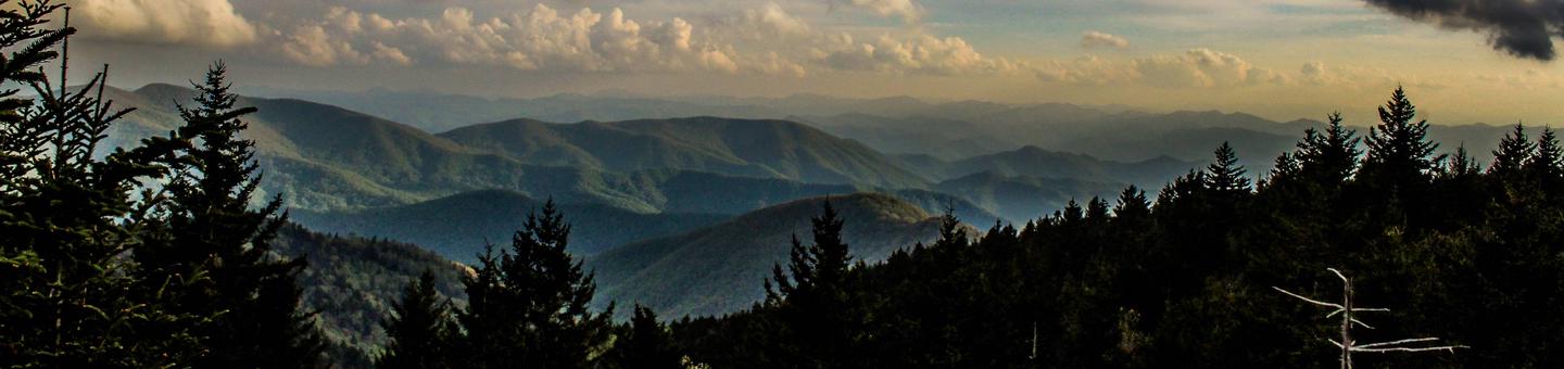
The Pisgah National Forest is a land of mile-high peaks, cascading waterfalls, and heavily forested slopes. Comprised of over 500,000 acres, the Pisgah is primarily a hardwood forest with whitewater rivers, waterfalls and hundreds of miles of trails. This national forest is home of the first tract of land purchased under the Weeks Act of 1911 which led to the creation of the national forests in the eastern United States. It is also home of the first school of forestry in the United States, now preserved at the Cradle of Forestry in America historic site, and boasts two of the first designated wilderness areas in the east. The Pisgah, Grandfather and Appalachian Ranger Districts are scattered along the eastern edge of the mountains of western North Carolina and offer visitors a variety of opportunities for outdoor recreation and enjoying the natural beauty of the mountains.
Camping and Day-use Information
Enjoy camping or a picnic at one of the many day-use areas. A list of camping and day-use areas in the Pisgah National Forest can be found here
Recreation Maps
Nantahala & Pisgah National Forest Maps
Directions to Frequently Requested Places
NC Arobretum and Bent Creek Area
Cradle of Forestry (Scenic Route)
Be Safe
The national forests in North Carolina offer a wide variety of outdoor recreation opportunities. From the mountains to the sea, there are many exciting adventures awaiting your visit to these national forests. Please keep in mind that all outdoor recreational activities on the Croatan, Pisgah, Nantahala and Uwharrie national forests, including activities at recreation sites, have inherent risks due to the natural setting in which they occur. Always remember, your safety is your responsibility.
Waterfall Safety for the Summer.
Cradle of Forestry In America Heritage Site Facility
Nestled below the Blue Ridge Parkway on the Pisgah National Forest is the birthplace of forestry in America - the Cradle of Forestry.
The Cradle abounds with ways to have fun while learning about the forest, traditional Blue Ridge culture, and forest management.
Paved trails - perfect for strollers and wheelchairs - put the forest at your fingertips.
Dixon Fields Canoe Launch Facility
Primitive, low-impact canoe launch that offers dispersed camping.
Big Tom Gap TR 191A Facility
The trail provides good views including Maple Camp Bald to the northeast. It offers loop opportunities with the Buncombe Horse Range Trail, Mount Mitchell Trail and the Black Mountain Crest Trail. This narrow trail is extremely steep and follows unsteady rock debris.
Total Elevation Change: 520 feet
Degree of Difficulty: Difficult
Beginning Point: Buncombe Horse Range Trail
Ending Point: Black Mountain Crest Trail
Average Hiking Time: 1 hour (one way)
Amount of Use: Moderate
Blaze Color: Blue
Area Trail Map: South Toe River, Mount Mitchell & Big Ivy Trail Map
USGS Quad Maps: Celo and Mt. Mitchell
Elk Falls Area-Big Falls TR 172 Facility
This is a rocky trail to a popular scenic spot that has a 65 foot high waterfall along the Elk River. **Use extreme caution near the falls as fatalities have occurred at this site.**
Total Length: 0.5 mile
Total Elevation Change: 40 feet
Degree of Difficulty: Moderate
Beginning Point: Elk Park Parking Lot
Ending Point: Big Falls
Average Hiking Time: 15 minutes (one way)
Amount of Use: Heavy
Blaze Color: Yellow
Area Trail Map: None
USGS Quad Map: Elk Park
Roundtop Ridge TR 295 Facility
This trail offers a walk through oak-hickory hardwood forests. The trail provides access from Hot Springs to the Rich Mountain Fire Tower. There is loop opportunity with the Appalachian Trail.
Total Length: 3.1 miles
Total Elevation Change: 1,400 feet
Degree of Difficulty: Difficult
Beginning Point: Appalachian Trail
Ending Point: Reservoir Road, Hot Springs
Average Hiking Time: 3 hours (one way)
Amount of Use: Light
Blaze Color: Yellow Rectangle
Area Trail Map: Harmon Den/Hot Springs Trail Map
USGS Quad Map: Hot Springs
Fork Ridge TR 285 Facility
This trail steadily climbs through upland hardwood forests and rhododendron thickets. After the initial ascent, the trail mostly follows ridge tops offering views of Big Creek drainage. The best viewing times are early spring, late fall and winter. The trail can be combined with the Appalachian, Green Ridge or Jerry Miller trails to form a loop. No water is available on the Fork Trail.
Total Length: 2 miles
Total Elevation Change: 2,040 feet
Degree of Difficulty: Difficult
Beginning Point: Forest Service Road # 111
Ending Point: Appalachian Trail
Average Hiking Time: 3 hours (one way)
Amount of Use: Light
Blaze Color: Yellow Rectangle
Area Trail Map: None
USGS Quad Map: Greystone
Green Ridge TR 287 Facility
This trail begins at the gate on FR 3509 and follows gravel road for one mile. At this point, the trail leaves the gravel road and follows an old wooded road into a cove. The path then steadily climbs Green Ridge and crosses Dry Creek headwaters. The trail eventually reaches Green Ridge Mountain's crest, which it follows to its terminus with the Appalachian Trail.
Total Length: 3.6 miles
Total Elevation Change: 2,040 feet
Degree of Difficulty: Difficult
Beginning Point: Forest Service Road # 3509
Ending Point: Appalachian Trail
Average Hiking Time: 4 hours (one way)
Amount of Use: Light
Blaze Color: Yellow Rectangle
Area Trail Map: None
USGS Quad Maps: Greystone and Flag Pond
Hickey Fork TR 292 Facility
This trail provides views of waterfalls and cascades in higher elevations. The trail crosses Hickey Fork Creek on a wooden bridge and ascends the ridge adjacent to Hickey Fork Creek. Crossing the ridge into Hickey Fork Creek west prong drainage, the trail ends at Pounding Mill Trail.
Total Length: 2.3 miles
Total Elevation Change: 1,120 feet
Degree of Difficulty: Difficult
Beginning Point: Forest Service Road # 465
Ending Point: Pounding Mill Trail
Average Hiking Time: 2 hours (one way)
Amount of Use: Moderate
Blaze Color: Yellow Rectangle
Area Trail Map: None
USGS Quad Maps: White Rock and Greystone
Jerry Miller TR 286 Facility
This trail is formerly known as Whiteoak Flats Trail. The trail is especially scenic in late spring when the rhododendron and mountain laurel are in bloom. While on the trail you will be able to view a 100 foot high waterfall.
Total Length: 4.5 miles
Total Elevation Change: 2,524 feet
Degree of Difficulty: Difficult
Beginning Point: Forest Service Road # 111
Ending Point: AT at Camp Creek Bald
Average Hiking Time: 5 hours
Amount of Use: Light
Blaze Color: Yellow Rectangle
Area Trail Map: None
USGS Quad Map: Greystone (Trail #290)
Rocky Bluff Campground Campground
List of CampsitesOverview
Rocky Bluff Campground offers solitude in a wooded setting located just 3 miles south of the quaint town of Hot Springs and the majestic French Broad River. The campground is conviently located off of NC Scenic Byway 209 in the Spring Creek Gorge Area.
Recreation
Recreation opportunities abound in and around the Hot Springs area. Located on the Appalachian District of the Pisgah National Forest, Rocky Bluff Campground itself is host to three different trail heads. If you are looking for longer-distance hiking opportunities, the famous Appalachian Trail runs right through the town of Hot Springs. Other popular recreation in the area include white water rafting, kayaking, tubing and fishing on the French Broad River.
Facilities
The campground offers 18 rustic campsites that are designed for passenger car and tent camping. Accessories include picnic tables, tent pads, lantern posts and campfire rings with grills. There are restroom facilities with flush toilets on-site, as well as potable water sites located throughout the campground.
Natural Features
Rocky Bluff Campground located near Spring Creek, a North Carolina Mountain Heritage Trout Water . Winding it's way through deciduous oak forests, stocked with Brook, Brown and Rainbow trout, this creek is touted as a trout angler's paradise, making Rocky Bluff a perfect destination for your fishing camp.
Nearby Attractions
Hot Springs has been a well-known relaxation destination for centuries. The natural hot springs are a main draw for the town, along with the abundance of recreation. Visitors can also find several restaurants, art galleries, shopping, live music and festivals here.
Special Day-Use Areas Facility
http://www.cs.unca.edu/nfsnc/recreation/connections/pisgah_day_use.pdf
River Ridge Loop TR 281 Facility
This trail offers scenic views of the French Broad River year round. Picnicking, fishing and vault toilets are available at Murray Branch Picnic Area.
Total Length: 1.3 miles
Total Elevation Change: 200 feet
Degree of Difficulty: Moderate
Beginning Point: Murray Branch Recreation Area
Ending Point: Murray Branch Recreation Area
Average Hiking Time: 1 hour (one way)
Amount of Use: Moderate
Blaze Color: Yellow Rectangle
Area Trail Map: Harmon Den/Hot Springs Trail Map
USGS Quad Map: Hot Springs
Rocky Bluff Picnic Area Facility
Picnic Area is closed for repair/maintenance.
Nantahala National Forest Facility
Welcome to the Nantahala National Forest! The Nantahala National Forest lies in the mountain and valleys of southwestern North Carolina. The largest of North Carolina's four National Forests, the Nantahala encompasses 531,148 acres with elevations ranging from 5,800 feet at Lone Bald in Jackson County to 1,200 feet in Cherokee County along Hiwassee River. The Forest is divided into three Districts, Cheoah in Robbinsville, NC, Tusquitee in Murphy, NC, and the Nantahala in Franklin, NC. All district names come from the Cherokee language. "Nantahala" is a Cherokee word meaning "land of the noon day sun," a fitting name for the Nantahala Gorge, where the sun only reaches to the valley floor at midday.The Nantahala National Forest was established in 1920 under authority of the 1911 Weeks Act. This act provided authority to acquire lands for national forests to protect watersheds, to provide timber, and to regulate the flow of navigable streams. In the Nantahala National Forest, visitors enjoy a wide variety of recreational activities from whitewater rafting to camping. With over 600 miles of trails, opportunities exist for hikers, mountain bikers, horse-back riders and off-highway vehicle riders.
Camping and Day-use Information
Enjoy camping or a picnic at one of the many day-use areas. A list of camping and day-use areas in the Nantahala National Forest can be found here.
Recreation Maps
Nantahala & Pisgah National Forest Maps
Be Safe
The national forests in North Carolina offer a wide variety of outdoor recreation opportunities. From the mountains to the sea, there are many exciting adventures awaiting your visit to these national forests. Please keep in mind that all outdoor recreational activities on the Croatan, Pisgah, Nantahala and Uwharrie national forests, including activities at recreation sites, have inherent risks due to the natural setting in which they occur. Always remember, your safety is your responsibility.
Waterfall Safety for the Summer.
Nantahala Ranger District Facility
The Nantahala Ranger District stretches 250,000 acres across Macon, Jackson and Swain counties offering a variety of recreational opportunities from camping to off-highway vehicle riding. This District is a diverse, rugged, and mountainous area with raging rivers, granite walls, and waterfalls. Visitors can enjoy the remoteness of the Southern Nantahala WIlderness, a scenic drive along the Mountain Waters By-way or a view Whitewater Falls, the highest falls east of the Rocky Mountains. The Nantahala is also home to four long distance trails, the Appalachian, Bartram, Foothills, and Mountains-to Sea Trails. Come experience the outdoors and explore the Nantahala! Nantahala Ranger District, 90 Sloan Road, Franklin, NC 28734, (828) 524-6441
Blue Valley Dispersed Camping Facility
Dispersed camping in the Blue Valley area. Approximately 22 dispersed sites are available, and most have fire rings and picnic tables. A pit toilet is available. Please pack in and pack out. Wilson Lake is a short distance away offering fishing, swimming, a short trail, and wildlife viewing and birding.
Chattooga Wild and Scenic River Facility
The Chattooga River originates in the mountains of western North Carolina and runs 57 miles from North Carolina into Georgia and South Carolina. Designated as a Wild and Scenic River the Chattooga River corridor includes 15,432 acres. A section of the river also runs through the Ellicott Rock Wilderness.
Click Here for more information.
Slickrock TR 11 Facility
Slickrock TR 11
Cliffside Loop TR24 Facility
This 0.75-mile trail encircles the lake, passes through the campground and crosses over the dam and beach area.
Clifftop Vista TR 24a Facility
This 1.5-mile trail follows the same path as the Clifftop Vista Nature Trail. At the ridgetop is a gazebo, the trail offers a panoramic mountain view. After the gazebo, this more-difficult trail continues along the ridge.
Potts Memorial TR 24b Facility
This easy 0.5-mile trail travels to a white pine plantation.
Van Hook TR 24c Facility
This 0.5-mile trail is located between Van Hook Glade and Cliffside Lake. An additional 0.5-mile walk is next to a road that leads to Cliffside Lake.
Skitty Creek TR 24e Facility
This 0.5-mile trail runs between Cliffside Lake Road and U.S. 64. The trail leads to Dry Falls. To get to the falls from the trail's end, take a short walk along U.S. 64. Watch out for cars along this easy trail.
Clifftop Nature TR 24f Facility
This trail travels one mile through pine-hardwood forest and climbs to a ridgetop. Signs give trail descriptions along this trail, rated as more difficult.
Chinquapin TR 3 Facility
Chinquapin TR 3
Hurrah Ridge TR 4 Facility
Hurrah Ridge TR 4
Chattooga River TR432 Facility
Chattooga River TR432
Silver Run Falls TR435 Facility
Silver Run Falls TR435
Whitewater River TR437 Facility
Whitewater River TR437
Tuckaseegee Gorge TR438 Facility
Tuckaseegee Gorge TR438
Wolf Creek Gorge TR439 Facility
Wolf Creek Gorge TR439
Ammons Branch TR441 Facility
Ammons Branch TR441
Bearpen Gap TR442 Facility
Bearpen Gap TR442
Homesite Road TR443 Facility
This easy 1.5-mile trail starts near Cliffside Lake Dam, follows Skitty Creek and connects with a road that meets U.S. 64 halfway between Dry and Bridal Veil Falls.
Big Creek Loop TR 492 Facility
Big Creek Loop TR 492
Blue Valley Route TR493 Facility
Blue Valley Route TR493
Brush Creek Route TR 494 Facility
Brush Creek Route TR 494
Clear Creek Loop TR 495 Facility
Clear Creek Loop TR 495
Moss Gap Route TR 496 Facility
Moss Gap Route TR 496
Round Mountain Gap TR 497 Facility
Round Mountain Gap TR 497
Stewart Cove/Yellow Mountain TR498 Facility
Stewart Cove/Yellow Mountain TR498
Yellow Mountain TR5 Facility
Yellow Mountain TR5
Stewart Cove TR 5a Facility
Stewart Cove TR 5a
Little Yellow Mountain Gap TR651 Facility
Little Yellow Mountain Gap TR651
Scaly Mountain TR67a Facility
Scaly Mountain TR67a
Jones Knob TR67b Facility
Jones Knob TR67b
Whitewater Falls TR 7 Facility
Whitewater Falls TR 7
Whiteside Mountain TR70 Facility
Whiteside Mountain TR70
Glen Falls TR 8 Facility
Glen Falls TR 8
Dry Falls TR 9 Facility
Dry Falls TR 9
Panthertown Valley TR474 Facility
Panthertown Valley TR474
Wilderness Falls TR490 Facility
Wilderness Falls TR490
Greenland Creek TR488 Facility
Greenland Creek TR488
Deep Gap TR 449 Facility
Deep Gap TR 449
Overlook TR491 Facility
Overlook TR491
Big Green TR487 Facility
Big Green TR487
Turkey Knob TR 469 Facility
Turkey Knob TR 469
Mac's Gap TR482 Facility
Mac's Gap TR482
Blackrock TR447 Facility
Blackrock TR447
Riding Ford TR 450 Facility
Riding Ford TR 450
Devils Elbow TR448 Facility
Devils Elbow TR448
Powerline Road TR451 Facility
Powerline Road TR451
Rattlesnake Knob TR452 Facility
Rattlesnake Knob TR452
North Road TR 453 Facility
North Road TR 453
Granny Burrell Falls TR486 Facility
Granny Burrell Falls TR486
Appalachian TR1 Facility
This trail follows the mountain crest from Maine to Georgia and passes through Pisgah and Nantahala National Forests for more than 200 miles. Open to hikers only, the trail boasts a chain of shelters about 10 miles apart.
Detailed guidebooks for the Appalachian Trail are available at national forest offices of from the Appalachian Trail Conservancy, P.O. Box 807, Harpers Ferry, W.Va. 25425. For more information call toll-free at (888) AT-STORE 287-8673 or visit the Appalachian Trail website at www.appalachiantrail.org.
Mooney Gap TR12 Facility
Mooney Gap TR12
Pickens Nose TR13 Facility
Pickens Nose TR13
Wildcat TR14 Facility
Wildcat TR14
Stewart TR15 Facility
Stewart TR15
Locust Tree TR16 Facility
Locust Tree TR16
Camp Branch TR 16a Facility
Camp Branch TR 16a
Shot Pouch TR17 Facility
Shot Pouch TR17
Rocky Bald TR18 Facility
Rocky Bald TR18
Junaluska Gap TR19 Facility
Junaluska Gap TR19
Hickory Branch TR19a Facility
Hickory Branch TR19a
Appletree TR19b Facility
Rated as difficult, the Appletree Trail climbs 1,640 feet and connects with four other area trails. With two stream crossings, the 2.2-mile trail meanders through an array of flowering plants, such as flaming azalea and rosebay rhododendron.
To access, park and walk acros the road from Appletree Branch and follow the blue blazes to the right of the branch.
London Bald TR19c Facility
Nine miles in length one-way, the London Bald Trail climbs and contours a side slope at a high elevation and travels through a fern-covered forest floor. This difficult trail connects with the Appletree and Bartram Trail, accessed from the campground. The trailhead starts from Junaluska Road (SR 1401).
Diamond Valley TR19d Facility
Diamond Valley TR19d
Laurel Branch TR19f Facility
Laurel Branch TR19f
Nature Walk TR19g Facility
Nature Walk TR19g
Little Indian TR21 Facility
Little Indian TR21
Bear Pen Gap TR22 Facility
Bear Pen Gap TR22
Kimsey Creek TR 23 Facility
Kimsey Creek TR 23
Wesser Creek TR26 Facility
Wesser Creek TR26
Big Laurel Falls TR29 Facility
Big Laurel Falls TR29
Mooney Falls TR31 Facility
Mooney Falls TR31
Park Ridge TR32 Facility
Park Ridge TR32
Park Creek TR33 Facility
Park Creek TR33
Beech Gap TR35 Facility
Beech Gap TR35
Hurricane Creek Loop TR36 Facility
Hurricane Creek Loop TR36
Blackwell Gap Loop TR366 Facility
Blackwell Gap Loop TR366
Betty Creek Gap TR 367 Facility
Betty Creek Gap TR 367
Wilson Lick TR369 Facility
Wilson Lick TR369
Camp Shortcut TR 36b Facility
Camp Shortcut TR 36b
Cullowhee TR370 Facility
Cullowhee TR370
Rough Fork TR371 Facility
Rough Fork TR371
Grap Cove TR 372 Facility
Grap Cove TR 372
Siler Bald Shelter TR 373 Facility
Siler Bald Shelter TR 373
Siler Bald Vista TR373a Facility
Siler Bald Vista TR373a
Wayah Bald TR 374 Facility
Wayah Bald TR 374
Thomas Branch TR375 Facility
Thomas Branch TR375
Walton Interpretive TR376 Facility
Walton Interpretive TR376
Rocky Bald Loop TR 379b Facility
Rocky Bald Loop TR 379b
Long Branch TR86 Facility
Long Branch TR86
Tusquitee Ranger District Facility
This 158,900-acre district lies in the far southwestern tip of North Carolina in Cherokee and Clay Counties. The Tusquitee District has three large lakes that offer a variety of recreation. Two major rivers, the Hiwassee and Valley, provide canoeing. Three reservoirs in beautiful mountain settings provide a playground for recreation enthusiasts. Hiwassee Lake, Chatuge Lake, and Appalachia Lake offer boating, water skiing, fishing, and swimming, as well as a quiet place to relax and enjoy nature’s wonders. Chatuge Lake is excellent for sailing. The Hiwassee and Appalachia Lakes are located west of Murphy, along the Hiwassee River. Chatuge Lake spans the Georgia-North Carolina State line, south of Hayesville. For camping and picnicking, four areas are available.
Rattler Ford Campground Campground
List of CampsitesRattler Ford has four units that accommodate 25 people per unit. Showers, horseshoe pits, and a volleyball court are available. A trout stream and hiking trails are nearby.
Cable Cove Recreation Area Facility
This area offers camping and hiking, with boating access on Fontana Lake. Cable Cove is 4 miles from Fontana Dam and the Appalachian Trail. The 26 campsites are set in a wooded area near a stream.
Uwharrie National Forest Facility
There are approximately 51,000 acres of National Forest System lands in Montgomery, Randolph and Davidson Counties. The Uwharrie National Forest includes the Uwharrie Ranger District Office, located at 789 NC Highway 24/27 East, Troy, NC 27371.
At the district office you can obtain information about the area, get brouchures, camping information, trail passes, and permits. You can also obtain a Senior pass, Disabled Pass. We also have USGS Topo maps for sale.
Primitive dispersed camping is allowed throughout the Forest, except in those areas that are posted "No Camping". These sites can be found along most of Forest Service roads and trails. Please remember when using these sites to be careful with camp fires and carry out your trash and debris. Please leave your campsite in good clean condition so that others who follow you may also enjoy the Forest.
The Uwharrie National Forest is part of the 2 million acres of public lands managed by the North Carolina Wildlife Resources Commission for public hunting, trapping and fishing, and are designated as Game Lands. In addition to the appropriate basic annual hunting license, a Game Lands Privilege license must be obtained to hunt on the Uwharrie National Forest. Information concerning seasons, bag limits, and special Game Lands Restrictions are found in the annual N.C. Inlands Fishing, Hunting and Trapping Regulations Digest, available where licenses are sold.
Camping and Day-use Information
Enjoy camping or a picnic at one of the many day-use areas. A list of camping and day-use areas in the Uwharrie National Forest can be found here.
You may enjoy this story on a QR guided trail in the national forest.
Recreation Maps
Trail Strategy Documents, Presentations and Maps
Be Safe
The national forests in North Carolina offer a wide variety of outdoor recreation opportunities. From the mountains to the sea, there are many exciting adventures awaiting your visit to these national forests. Please keep in mind that all outdoor recreational activities on the Croatan, Pisgah, Nantahala and Uwharrie national forests, including activities at recreation sites, have inherent risks due to the natural setting in which they occur. Always remember, your safety is your responsibility.
- Badin Lake OHV Trails close December 18th at 8:00 am
- OHV Trails will reopen April 1st in the morning
- OHV annual passes will be available from the Uwharrie Ranger District office or the Eldorado Outpost
Uwharrie Ranger District Facility
.
Grandfather Ranger District Facility
The lands that make up the Grandfather Ranger District are those public lands that run from the McDowell/Buncombe county line on Black Mountain just east of Asheville over to US 321 between Lenoir and Blowing Rock. The Blue Ridge Parkway forms the northern boundary of the district. The Grandfather Ranger District began under the Weeks Act with the purchase of an 8,100acre tract in 1912. Now, the district covers over 192,000 acres.Enjoy your visit!
Curtis Creek Campground Campground
List of CampsitesRV and tent camping, campground host on site.
FSR 482 Facility
8 mile gravel road
Jarrett Creek Road Facility
12 mile gravel and natural surface road.
Old Fort Picnic Area Facility
Day use area; picnic shelter, tables and grills available.
Linville Gorge Info. Cabin Facility
The Linville Gorge Information Cabin, located at the north end of Old Hwy 105 (Kistler Memorial Highway), provides visitors with area information as well as maps and camping gear for sale.
Spence Ridge 233 Facility
Trail begins on FSR 210 and intersect Trail 231
Table Rock Facility
Day use area, picnic shelter, tables and grills available. Short trails travel rim of Linville Gorge to Table Rock's summit and to the Chimneys.
Wisemans' View Facility
Overlook featuring spectacular view of Linville Gorge. Paved accessible trail to the overlook. Vault toilets available
Mortimer Campground Campground
List of CampsitesRV and tent camping, campground host on site. Flush toilets and shower are available. Picnic shelter on site.
FSR 45 Watauga Turnpike Facility
A 4.5 mile gravel road.
FSR 981 Roseboro Edgemont Facility
A 4.5 mile gravel road.
Wilson Creek Visitors Center Facility
A visitors center for the Wilson Creek National Wild and Scenic River; also has interpretive displays and historical information about the towns of Edgemont, Mortimer and the Mortimer CCC camp.
Wilson Creek Wild and Scenic River Area Facility
With fantastic vistas, ridges more than 4000 feet high, whitewater rapids and trails that travel to spectacular waterfalls, Wilson Creek offers great adventures for hiking, scenic viewing, mountain biking, fishing, camping, horseback riding and backpacking.
Schoolhouse Ridge FSR 4068 Facility
A 4 mile gated road, suitable for horseback riding.
Boone Fork Campground Campground
List of CampsitesThis site is not maintained but can still be used. Campers must hike in to the developed areas, and all sites are primitive. No electric hook ups, no toilets, no running water available.
Badin Lake Recreation Area Facility
Badin Lake Recreation Area offers swimming, boating, fishing, hunting, hiking trails, equestrian trails, four-wheel drive trails, mountain biking trails & camping opportunities. Please pick up your trash! Trash cans are at all recreation sites.
Camping in Badin Lake Recreation Area
There are 4 developed campgrounds for tents, camping trailers, & RVs with flush toilets and showers & 1 tent only campground within the Badin Lake Recreation Area. For people that want electricity, flush toilets, showers & a dump station there are 2 campgrounds with these amenities. Arrowhead Campground has 48 sites for the public to use with electrical hookups at sites 12-45. These sites have 50 amp, 30 amp & 110 volt outlets. Sites 1-11 & 46-50 do not have power. Canebrake Horse Camp has 28 sites available to the public. All sites have electrical hookups with 50 amp, 30 amp & 110 volt outlets. This campground has amenities for horse use but is not exclusive to horseback riders. Some of these horse amenities are a horse washing station, hitching posts, tack tables & direct access to the trails.
Badin Lake Campground offers 34 sites for tent, camping trailer or RV camping. There are several campsites on the lakeshore of Badin Lake, which can be accessed via boat, canoe, or kayak. This campground offers flush toilets, showers & drinking water hydrants. There is no electricity and no dump station at this campground. Badin Lake Group Camp offers 3 sites for up to 50 people each. There are flush toilets, vault toilets, showers & 3 drinking water hydrants. There are no electrical hookups and there is no dump station. This campground is available by reservation only. To make reservations for any of the above listed campgrounds please call Recreation.Gov at 877-444-6777; TDD: 877-833-6777; International: 518-885-3639; or go to their website: www.recreation.gov.
The last campground in the Badin Lake Recreation Area is called Uwharrie Hunt Camp. This campground is rustic & it has 8 tent only campsites that can be accessed by a very short walk from the parking lot. There are 2 vault toilets & drinking water hydrants. Each site has a tent pad, picnic table, fire ring, grill, & lantern post.
Recreating in the Badin Lake Recreation Area
The Badin Lake Recreation Area offers a myriad of recreational opportunities. There are 17 miles of Off-Highway Vehicle (OHV) or motorized trails available for dirt bikes, ATVs, and full-sized 4-WD vehicles with the purchase of a trail pass. Primitive camping or dispersed camping can be done along the trails & at the Art Lilley Campground that is located in the Badin Lake OHV Trail Complex.
Additionally, there are approximately 40 miles of non-motorized trails available for horseback riding, mountain biking, and hiking. These trails range from easy to difficult as they traverse beautifully wooded areas, rocky outcrops, follow the Uwharrie River & many of its tributaries.
The Cove Boat Launch is located on Cove Road near Arrowhead Campground & offers access to Badin Lake for trailered boats. There is a vault toilet. There are 2 day use areas for picnicking & fishing. The King's Mt. Point Day Use Area offers 34 picnic sites, a picnic pavilion, 4 accessible fishing piers and 4 vault toilets & 2 flush toilets. Holt's Picnic Area is more rustic with a vault toilet, fishing from the shore, grills & picnic tables available.
Bald Springs #78 Facility
.
Bates TR 723 Facility
Bates Trail is 1.7 miles in length. It is blazed with yellow. It is rated as moderate. Also available to hikers and mountain bikers.
Bee Cove #421 Facility
The Bee Cove Trail is part of the Fontana system of trails for hiking, biking and equestrian use. Accessed off the Fontana Loop Trail (TR157), this section is a loop trail east of the village. Known for great views of the Fontana Dam, it is also famous for the spring wild flower displays along its length.
Trail Length: 2.7 Miles
Difficulty: Moderate
Usage: Moderate
Average Hiking Times: 90 Minutes
Beech Creek #378 Facility
.
Berner TR 721 Facility
Berner trail is .06 tenths of a mile long. It is blazed with yellow blazes. It is rated as an easy trail. Open to hikers and mountain bikers also.
Big East Fork 357 Shining Rock Wilderness Facility
.
Big Rock Loop TR 705 Facility
Big Rock Loop is 1.2 miles in length. It is blazed with Dark Green blazes. It is rated as a moderate trail. Hikers and mountain bikers are also allowed on this trail. You can also use this trail to get to the Nifty Rocks site. You have a view of the lake in the winter months.
Big Scaley #638 Facility
.
Big Snowbird Creek Facility
.
Big Stamp #520, Fires Creek Facility
.
Billy Top #637, Near Andrews Facility
.
Blackburn TR 701 Facility
Blackburn trail is 2.2 miles in length. It is blazed with Green blazes. It is rated as easy.
Bly Gap #84 Facility
.
Bristol #76, Fires Creek Facility
.
Britton Creek #280 Facility
.
Buck Creek Facility
.
Burl Tree Way TR 717 Facility
Burl Tree Way is 1.7 miles in length. It is blazed with salmon blazes. It is rated as easy.
Burnt Tree Peninsula #753, Jackrabbit Mtn Rec Area Facility
.
Burrell Cove #756, Jackrabbit Mtn Rec Area Facility
.
Buttermilk TR 720 Facility
Buttermilk trail is 1 mile in length. It is blazed with salmon blazes. It is rated as moderate.
Calderwood Reservoir Facility
.
Carroll Knob #633, Fires Creek Facility
.
Central Loop #750, Jackrabbit Mtn Rec Area Facility
.
Cheoah Point Beach Facility
.
Cheoah Reservoir Facility
.
Cherokee Lake #83, Cherokee Lake Recreation Area Facility
.
Cherokee Lake Recreation Area Facility
On Cherokee Lake.
Choga #634, Near Andrews Facility
.
Cove Boat Ramp Facility
Cove Boat Ramp offers access to Badin Lake for both motorized and non-motorized craft. A large parking area is available for vehicles and trailers.
Fishing Badin Lake
The biggest fishing hole in the Uwharrie National Forest is Badin Lake. This 5,350-acre impoundment of the Yadkin River was built in 1917 by the Aluminum Company of America (ALCOA) to generate hydroelectric power for the aluminum plant at Badin. The eastern shore borders the National Forest and the lake is well stocked with catfish, bream, largemouth, white and striped bass.
The Forest Service has one launching site at the Cove Boat Ramp. The State has two ramps on the lake. Marinas offer easy access for everything from jon-boats to pontoons. The lake is crowded with pleasure boats on spring and summer weekends. Well attended bass tournaments are usually held every weekend from March through October.
In early spring, fish are spawning and feeding well. Look for bluegill beds. These are circular depressions in the shallows. Catch them with crickets, worms or artificial bait. Fish along downed trees or stumps in the water for crappie and bass. Crappies will take minnows or jigs. For largemouth bass, you are going to have to work at it and try different lures. Look for largemouth around the rocky points.
Small spinners are always good for feeding bluegill. Fly rod experts can put a hurting on a bream bed. Most white bass anglers use a black and chartreuse jig rigged about three feet under a weighted bobber. This set-up takes crappie too. White bass and crappie are caught by the score, especially in the spring.
Carolina rigged plastic worms and lizards in assorted colors are local favorites for largemouth in the spring. Fishing live crawfish or minnows just off the bottom with a cork is an old fashioned, but effective, way to catch largemouth bass. An eight-pounder is a big'un at Badin but 3-to-4 pound fish are abundant.
The State stocks about 25,000 striper fingerlings every year and Badin is known as a dependable put-and-take striper lake. Anglers can limit-out on 5 to 12 pound fish with a rare 20-pounder. Trolling live shad is the best way to catch stripers. Bottom fishing with chicken livers or cut-up shad will land catfish and stripers. A good rule is, "bigger bait for bigger fish". Look for excited sea gulls working the water and you will likely find a school of frightened shad under attack by hungry stripers. Big, shiny top-water plugs are the way to go when that happens. Taking a striper on top water is probably the biggest thrill going on Badin Lake, unless it's winching up a 60-pound plus record catfish from the bottom.
When the turbines are running in the Tuckertown dam, shad and other fish are sucked in, chewed up and spit out downstream where hungry stripers and catfish gorge themselves on easy pickings. Anglers brave the turbulent waters and clean up while fishing cut-bait during these tailrace feeding frenzies. Thirty and forty-pound catfish are caught regularly here. Anglers may have to share the airspace with the bald eagles that have discovered this fishy feast, as the eagles are coming back to the Uwharries.
During the summer fish move to deeper water where it is cooler. The best times to fish are one hour before sunrise and one hour after sunset. Larger fish move deep because it's too hot for them in the shallows. That is when deep running crank baits work best for largemouth bass or aggressive stripers. Because fish are cold-blooded they move to deep, warm areas in the fall and will not bite as aggressively when the temperature cools down. Many largemouth bass and stripers are caught during those warm winter days that all Southern anglers appreciate.
Anglers looking to beat the crowds can fish the Uwharrie River.
Croatan Ranger District - Gamelands Facility
The NC Wildlife Resources Commission has information on hunting on public lands in North Carolina.
Thompson Loop #152 Facility
Length: 7.3 miles
Highlights: Single track, potential views of wildlife, stream crossings, old logging roads.
Difficulty: Moderate.
Thompson Loop (#152) is part of the Tsali Recration Area.
Hikers may travel the trails on any day, but mountain bikers and equestrians–the primary users–are kept separated by alternating days on the trails. Be sure to follow the trail schedule:
Jan./Feb./March/April/June/Sept./Nov./Dec.
Right Loop and Left Loop:
- Horses – Tuesday , Thursday, & Saturday
- Mountain Bikes –Monday, Wednesday, Friday & Sunday
Mouse Branch and Thompson Loop:
- Horses – Monday, Wednesday, Friday, & Sunday
- Mountain Bikes – Tuesday, Thursday, & Saturday
May/July/August/October
Right Loop and Left Loop:
- Horses – Monday, Wednesday, Friday, & Sunday
- Mountain Bikes – Tuesday, Thursday, & Saturday
Mouse Branch and Thompson Loop:
- Horses – Tuesday, Thursday, & Saturday
- Mountain Bikes – Monday, Wednesday, Friday, & Sunday
There is a per-person day use fee for trail use. Fees can be paid at either the Tsali Bike or Horse Trailheads.
Davis Creek Facility
.
Deep Gap Branch #377 Facility
.
Dickey Bell TR 91 Facility
Dickey Bell is 3.5 miles in length. It is rated as Difficult. It is blazed with orange diamond trail markers.
Dockery Creek Facility
.
Falls Dam TR 96 Facility
Falls Dam trail is 2.8 miles in length. It is rated Moderate. It is blazed with orange diamond trail markers.
Farmer Top Overlook #622, Hanging Dog Rec Area Facility
.
Fires Creek Access #635, Fires Creek Facility
.
Fires Creek Hunters Camp Facility
.
Stackhouse Boat Launch Facility
Provides boating access to the French Broad River. Open April 1st - October 30th
Woody Ridge TR 177 Facility
Steep hike along spine of the ridge that reaches an alpine opening at the junction with the Black Mountain Crest Trail.
Blaze: Yellow
Miles: 2.2
Difficulty: Difficult
Designated Activity: Hiking
Fraley TR 722 Facility
Fraley Trail is 2.5 miles in length. It is rated as difficult. It is blazed with Yellow blazes.
Franks Creek Facility
.
Greg's Loop TR 700 Facility
Greg's Loop is 1.7 miles in length. It is rated as Easy. It is blazed with Green blazes.
High Point #755, Jackrabbit Mtn Rec Area Facility
.
Home TR710 Facility
Home Trail is 2.5 miles in length. It is rated as Easy. It is blazed with Magenta blazes.
Huskins Branch #385, Fires Creek Facility
.
Indian TR 708 Facility
Indian Trail is 1.1 miles in length. It is blazed with Magenta blazes. It is rated Easy.
Josh TR 702 Facility
Josh Trail is 1.6 miles in length. It is blazed with Green blazes. It is rated Easy.
Joyce Kilmer Road NCSR #1134 Facility
.
Junaluska Creek Facility
.
Larry TR 711 Facility
Larry Trail is 1.5 miles in length. It is blazed with Magenta blazes. It is rated as Easy.
Leatherwood Loop #73, Fires Creek Facility
.
Leslie TR 704 Facility
Leslie Trail is 1.2 miles in length. It is blazed with Dark Green blazes. It is rated as Moderate.
Little Buffalo Creek Facility
.
Long Creek Facility
.
Long Hungry FDR #2586 Facility
.
Megan TR 709 Facility
Megan Trail is 1.7 miles in length. It is blazed with Magenta blazes. It is rated as Easy.
Mingus #630, Fires Creek Facility
.
Morgan TR 718 Facility
Morgan Trail is 1.7 miles in length. It is blazed with Salmon blazes. It is rated as Easy.
Mountain Creek Facility
.
Mouse Branch Loop #152A Facility
Length: 8.7 miles.
Highlights: Single track and old logging roads, potential views of wild turkey, deer and grouse in wildlife openings, old home sites.
Difficulty: Moderate
Mouse Branch Loop (#152A) is part of the Tsali Recration Area.
Hikers may travel the trails on any day, but mountain bikers and equestrians–the primary users–are kept separated by alternating days on the trails. Be sure to follow the trail schedule:
Jan./Feb./March/April/June/Sept./Nov./Dec.
Right Loop and Left Loop:
- Horses – Tuesday , Thursday, & Saturday
- Mountain Bikes –Monday, Wednesday, Friday & Sunday
Mouse Branch and Thompson Loop:
- Horses – Monday, Wednesday, Friday, & Sunday
- Mountain Bikes – Tuesday, Thursday, & Saturday
May/July/August/October
Right Loop and Left Loop:
- Horses – Monday, Wednesday, Friday, & Sunday
- Mountain Bikes – Tuesday, Thursday, & Saturday
Mouse Branch and Thompson Loop:
- Horses – Tuesday, Thursday, & Saturday
- Mountain Bikes – Monday, Wednesday, Friday, & Sunday
There is a per-person day use fee for trail use. Fees can be paid at either the Tsali Bike or Horse Trailheads.
North Shoal Creek Falls #383 Facility
.
Nottely River Connector #623, Hanging Dog Rec Area Facility
.
Omphus Ridge #75, Fires Creek Facility
.
Overflow Horse Camp Facility
Overflow Horse Camp is an open field with horse tie outs. There is no water or bathroom available.
Panther Creek Facility
.
Panther Creek FDR #2604B Facility
.
Panthertown Creek Facility
.
Phillips Ridge #388, Fires Creek Facility
.
Pine Ridge Road NCSR #1147 Facility
.
Ramsey Bend Connector #619, Hanging Dog Rec Area Facility
.
Ramsey Bend North #620, Hanging Dog Rec Area Facility
.
Ramsey Bend South #621, Hanging Dog Rec Area Facility
.
Ramsey Bluff #81, Hanging Dog Rec Area Facility
.
Ramsey Bluff Mtn Biking System Facility
.
River TR 713 Facility
River Trail is 3.6 miles in length. It is blazed with Salmon blazes. It is rated as Moderate.
Robbins TR 724 Facility
Robbins Trail is 1.7 miles in length. It is blazed with Yellow blazes. It is rated as Easy.
Rockhouse Creek #387, Fires Creek Facility
.
Rocky Mountain Loop TR 92 Facility
Rocky Mountain Loop is 2.8 miles in length. It is rated as Moderate. It is blazed with orange diamond trail markers.
Saba Beach #757, Jackrabbit Mtn Rec Area Facility
.
Saba Beach Spur #757A, Jackrabbit Mtn Rec Area Facility
.
Santeetlah Creek Facility
.
Santeetlah Creek FDR #81 Facility
.
Santeetlah Lake Facility
.
Sasafrass #632 Facility
.
Sawmill TR 93 Facility
Sawmill Trail is 1.1 miles in length. It is rated as Moderate. It is blazed with orange diamond trail markers.
Sawyer Creek Facility
.
Shinbone #80, Fires Creek Facility
.
Shoal Creek Falls #85 Facility
.
Shortoff #631, Fires Creek Facility
.
Shuler Creek Facility
.
Slab Pile TR 79 Facility
Slab Pile Trail is 1.2 miles in length. It is blazed with orange diamond trail markers. It is rated as Moderate.
Sledrunner #82 Facility
.
Sneaking Creek #752, Jackrabbit Mtn Rec Area Facility
.
Snowbird Creek Facility
.
South Fork Squally Creek Facility
.
Squally Creek Facility
.
Stecoah Creek Facility
.
Swan Cabin #2816 Facility
.
Swan Meadows #81G Facility
.
Tanager TR 715 Facility
Tanager Trail is .07 tenths of a mile in length. It is blazed with Salmon blazes. It is rated as Easy.
Tellico River Facility
.
Thompson Connector #152B, Tsali Facility
Thompson Connector (#152B) is part of the Tsali Recration Area.
Todd TR 707 Facility
Todd Trail is 2.1 miles in length. It is blazed with Dark Green blazes. It is rated as Moderate.
Tony TR 706 Facility
Tony Trail is 1.8 miles in length. It is blazed with Dark Green blazes. It is rated as Moderate.
Tsali Left Loop #38A Facility
Length: 11.9 miles
Hightlights: Single track, creek crossings.
Difficulty: Moderate
Tsali Left Loop (#38A) is part of the Tsali Recration Area.
Hikers may travel the trails on any day, but mountain bikers and equestrians–the primary users–are kept separated by alternating days on the trails. Be sure to follow the trail schedule:
Jan./Feb./March/April/June/Sept./Nov./Dec.
Right Loop and Left Loop:
- Horses – Tuesday , Thursday, & Saturday
- Mountain Bikes –Monday, Wednesday, Friday & Sunday
Mouse Branch and Thompson Loop:
- Horses – Monday, Wednesday, Friday, & Sunday
- Mountain Bikes – Tuesday, Thursday, & Saturday
May/July/August/October
Right Loop and Left Loop:
- Horses – Monday, Wednesday, Friday, & Sunday
- Mountain Bikes – Tuesday, Thursday, & Saturday
Mouse Branch and Thompson Loop:
- Horses – Tuesday, Thursday, & Saturday
- Mountain Bikes – Monday, Wednesday, Friday, & Sunday
There is a per-person day use fee for trail use. Fees can be paid at either the Tsali Bike or Horse Trailheads.
Tsali Right Loop #38 Facility
Length: 13.9 miles.
Hightlights: Single Track, creek crossings, shorter 4- and 8-mile loops possible.
Difficulty: Moderately difficult.
Tsali Right Loop (#38) is part of the Tsali Recration Area.
Hikers may travel the trails on any day, but mountain bikers and equestrians–the primary users–are kept separated by alternating days on the trails. Be sure to follow the trail schedule:
Jan./Feb./March/April/June/Sept./Nov./Dec.
Right Loop and Left Loop:
- Horses – Tuesday , Thursday, & Saturday
- Mountain Bikes –Monday, Wednesday, Friday & Sunday
Mouse Branch and Thompson Loop:
- Horses – Monday, Wednesday, Friday, & Sunday
- Mountain Bikes – Tuesday, Thursday, & Saturday
May/July/August/October
Right Loop and Left Loop:
- Horses – Monday, Wednesday, Friday, & Sunday
- Mountain Bikes – Tuesday, Thursday, & Saturday
Mouse Branch and Thompson Loop:
- Horses – Tuesday, Thursday, & Saturday
- Mountain Bikes – Monday, Wednesday, Friday, & Sunday
There is a per-person day use fee for trail use. Fees can be paid at either the Tsali Bike or Horse Trailheads.
Tulula Creek Facility
.
Tusquitee Creek Facility
.
Upper Ridge #751, Jackrabbit Mtn Rec Area Facility
.
Wauchecha Bald #47 Facility
The Wauchacha Bald Trail has not been maintained in many years and is likely impassible with fallen trees and vegetation growth.
West Buffalo Creek Facility
.
Wilson Lake Facility
.
Wolf Den TR 89 Facility
Wolf Den Trail is 1.3 miles in length. It is blazed with orange trail markers. It is rated as Easy.
Wolf Laurel Hunters Camp FDR#81F Facility
.
Wren TR 714 Facility
Wren Trail is .03 of a mile. It is blazed with Salmon blazes. It is rated as Easy.
Yellow Creek Facility
.
Yotee's Run #754, Jackrabbit Mtn Rec Area Facility
.
Art Lilley Campground Campground
List of CampsitesThe off-highway vehicle (OHV) trail system in the Uwharrie offers a variety of topography and scenery. All trails are designated for all off-highway vehicles and marked with orange diamonds. Stay on the designated trail system to help prevent soil erosion and creek sedimentation, which occur as a result of illegal trail use. FS roads cannot be used as trail connectors, but all vehicles operating on the road system must be "street legal" meaning that the vehicles are fully licensed, inspected and registered. Persons violating these regulations will be fined according to the law. NCDOT approved helmets and eye protection are required. The trail system is subject to a seasonal closure during the winter months (from Dec. 15 - April 1) in order to prevent unacceptable soil erosion and stream sedimentation. Trail passes are also required for all vehicles on the OHV trails.
Dispersed camping is allowed around this area. Also RV's and campers are allowed in the area, there are no hook ups or water available on site, but there is a vault toilet available.
Pine Cliff Equestrian Trailhead Facility
No camping allowed in this area.
Southern Trailhead Facility
Mud Gap on the Cherohala Skyway. 4400 foot Elevation. At Mud Gap, the BMT heads southerly to Whigg Meadow and ultimately 161 miles to Springer Mountain, GA. To hike northerly, go right from the intersection near the parking area. The trail continues past a civil war era monument and then through a gravel quarry used in the construction of the Cherohala Skyway. Past the quarry, the trail follows an old roadbed and crosses Forest Service Road (FS 217), approximately 1.5 miles from Mud Gap. There, the trail enters a heavily eroded area for a short distance, then climbs for approximately 2.7 miles, at which point the trail crosses the Cherohala Skyway at the Unicoi Overlook parking area.
Shelton Laurel Area Facility
The Shelton Laurel Backcountry area located in Madison County, NC is a unique part of the Appalachian Ranger District. It consists of undisturbed hardwood forests, rhododendron thickets and is full of coves, tributaries and serene mountainsides. This area provides 14.7 miles of combined hiking on five different trails, many of which intersect with loop options, and access the Appalachian Trail, as well as, Jerry Cabin Shelter. Enjoyable during all seasons, the Hickey Fork and Jerry Miller trails provide views of waterfalls and cascades in higher elevations, and are especially scenic in the late spring when the mountain laurel and rhododendron are in full bloom. Whiteoak Trail travels through beautiful hardwood forests, and in the winter provides beautiful views of the Baxter Cliffs.
Black Mountain / South Toe River Area Facility
The South Toe River area is on the Appalachian Ranger District near Burnsville, NC. This area includes the Black Mountains, the Blue Ridge, and the headwaters of the South Toe River. The Black Mountains, capped with a forest of red spruce and Fraser fir, are named for the resulting dark color. Along the South Toe River, you can camp, picnic, fish, swim, tube, bike, and horseback ride.
Buckeye Ridge TR 304 Facility
This trail has panoramic views from open fields of Max Patch, follows both trail and old road. Park on SR 1182 at Cherry Ridge trailhead.
Blaze Color: Yellow
Miles: 5.4
Difficulty: Moderate
Designated Activity: Hiking/Horseback riding
Cold Springs TR 302 Facility
Follow Cold Springs Creek through the woods. Park at junctions of NFSR 148 and 3526, or SR 1182 and NFSR 148.
Blaze Color: Yellow
Miles: 3.6
Difficulty: Moderate
Designated Activity: Hiking/Horseback riding
Cherry Ridge TR 301 Facility
Good connector trail. Follow old logging road through hardwood forest. Park on SR 1182.
Blaze Color: Yellow
Miles: 1.1
Difficulty: Difficult
Designated Activity: Hiking/Horseback riding
Wolf Ford Horse Camp Facility
Located off Yellow Gap, about three miles east of the Cradle of Forestry in America Visitors Center, this 13-site camp provides access to many miles of equestrian trails in the South Mills River area.
Laurel Mountain Connector #110 Facility
0.3 mi - Easy - This is a short and fairly easy connector trail that joins the Laurel Mountain Trail (#121) with the Pilot Rock Trail (#321). The trail itself is fairly nondescript, but is significant because it gives hikers a nice 4-mile loop from the Pisgah Inn area. It also gives mountain bikers the opportunity to face the challenge of riding up Laurel Mountain Trail then down the Pilot Rock Trail (or the reverse).
Approximate Elevation Change: 140 feet
Blaze: Yellow
Bradley Creek Composite #C18 Facility
6.2 miles — Moderate
| 0.0 miles | Start at gated road FS5015 (Bradley Creek Road). Continue past the gate on FS5015 |
| 3.3 miles | Turn right onto Bradley Creek Trail (#351) (orange blaze) |
| 5.1 miles | Turn right onto FS1206 (Yellow Gap Road) |
| 6.2 miles | Return to parking |
Old Field Gap Trailhead Facility
Old Field Gap Trailhead – This trailhead is located on Old Field Gap Road. The trailhead is signed, and parking is available, but the Burchfield Trailhead is much easier to find.
From the Old Field Gap Road Trailhead, the trail follows the gated Forest Service Road for approximately 0.5 miles to a sign post, and then continues uphill and onto a wooded ridge. The trail then crosses old forest roads, and continues to a generally heavily planted old road (FS 251C) and then west, staying at or near the top of the ridge. When that road ends, the trail drops down to a gap, then continues uphill to a major power line crossing with great views. This is a good camping area, but water on this entire section is problematic. After crossing under the powerline, the trail continues east, dropping into Kirkland Gap (the Kirkland Bushwhackers had a cabin in that area in civil war times), and continues over several small peaks to Yellow Creek Mountain, passing a large microwave radio repeater. Proceeding down from Yellow Creek Mountain, the trail continues past Lookout Rock, with some great views of the Smoky Mountain National Park, and then descends to Green Gap.
Wolf Laurel Area Facility
.
Unicoi Overlook Trailhead Facility
Unicoi Overlook Trailhead – 4400 foot elevation. The trail exits the parking area at the far western end, and descends over a bridge spanning another erosion gully, then a slight climb up to join the Forest Road just a few feet from the Beech Gap State Line. It is recommended that hikers not park at the Beech Gap area, but instead at the Unicoi Overlook Trailhead and follow the trail for 0.2 miles. This point is approximately 3.0 miles from the Mud Gap Trailhead.
Big Fat Gap Trailhead Facility
Big Fat Gap Trailhead – 3083 foot elevation.
The Big Fat Trail starts at the Big Fat Gap Trailhead, reached by a nine mile drive on the FSR # 62 Big Fat Gap Road, accessed from US Route 129 north of the Robbinsville area. This road is gated, and closed to the public from January 1 through April 1 annually.
The Big Fat Trail leaves the parking area near the information kiosk, descending steeply to Slickrock Creek in the valley below. This is a very steep trail, heavily used by fishermen and hikers to reach the valley floor. At 1.4 miles, the trail reaches a junction with the Nichols Cove Trail, then turns left, fords a small stream, and ends at the Slickrock Creek Trail junction.
Benton Mackaye #2-02 Facility
The Benton MacKaye Trail (BMT) follows a route from Springer Mountain, Georgia nearly 300 miles to the Great Smoky Mountains National Park (GSMNP). Signs are posted, but please exercise caution. Camping is allowed anywhere along the trail, except at trailheads. There are no shelters on the trail and it is considered more rustic and primitive than the Appalachian Trail. Expect to see few, if any, other hikers. Route finding skills are mandatory, as blazes are not allowed in the Joyce Kilmer-Slickrock Wilderness. On the Cheoah Ranger District, the BMT trail starts at the Mud Gap Trailhead on the Cherohala Skyway and heads northerly through a gravel quarry. Past the quarry, the trail crosses FS Road 217, then climbs until it crosses the Cherohala Skyway at the Unicoi Overlook parking area. The trail exits the parking area at the west end and descends over a bridge, then climbs to the Beech Gap State Line. The trail then follows the road to Strawberry Knob, then continues to Cold Spring Gap. At this point, follow Trail 54A, Stratton Bald Alternate to the western shoulder of Bob Bald. The trail then joins the Stratton Bald Trail, TR 54 and turns east to Bob Bald, an open area with great views to the south. The trail then continues east to the Haoe Lead Trail Junction, TR 53. The trail follows the Haoe Lead Trail to Naked Ground, a popular camping spot. Water is available a short distance down the hill on the Slickrock Creek Trail. The trail then follows the Haoe Lead Trail along the ridge to Haoe Knob. The trail continues on the Hangover Lead Trail TR 56 along the ridge and descends steeply to Big Fat Gap. From the Big Fat Gap Trailhead, the BMT exits on the Windy Gap Trail TR 400 to its junction with the Nichols Cove Trail TR 44, then continues downhill to Nichols Cove, a great camping area with water. The trail then follows the Yellow Hammer Gap Trail TR49 to its intersection with the Ike Branch Trail, TR 45. The trail continues uphill to Yellow Hammer Gap, and then follows the Tapoco Trail to the Tapoco Lodge. Leaving the Tapoco Lodge, the trail turns right, out the gate and southerly on Route 129 to Meadow Branch Road and the Burchfield Trailhead. About a mile from the trailhead is one of the most beautiful overlooks on the entire 300 mile long trail, providing views of the Hangover Ridge and the Cheoah River. The trail continues along the ridge, climbing to reach Old Field Gap Road, then follows a gated FS Road uphill and onto a wooded ridge. The trail then continues to an old road (FS 251C) and then west, staying at or near the top of the ridge. When that road ends, the trail drops down to a gap, then continues uphill to a major power line crossing with great views. This is a good camping area, but water on this entire section is problematic. The trail continues east, dropping into Kirkland Gap, and continues over several small peaks to Yellow Creek Mountain. Proceeding down from Yellow Creek Mountain, the trail continues past Lookout Rock, with some nice views of the GSMNP, and then descends to Green Gap. At Green Gap, the trail continues along the ridge to intersect the Appalachian Trail at Walker Gap. The BMT turns sharply left and descends the “Stairway to Heaven”, so named for the angle of the trail. At the bottom, it is approximately a mile to the Fontana Lodge, General Store and Post Office, and another three miles to intersect the Appalachian Trail just above the Fontana Marina Trailhead/Route 28. The BMT follows the AT through the Fontana Marina, across the Fontana Dam and up the access road to the Shuckstack Trailhead in the GSMNP.
Cheoah River Area Facility
The Cheoah River, located near Robbinsville, NC, is a nine-mile section of waterway between the Santeetlah Dam and Lake Calderwood. Typical water flows average 250 cubic feet per second (cfs), but approximately 20 times per year Brookfield Renewable Resources, Inc. releases water from the dam to mimic natural flood events to benefit a variety of endangered and threatened species that live in the river ecosystem. A secondary benefit of these releases is the recreational opportunity created by the release of approximately 1000 cfs of water, resulting in a Class IV-V whitewater run while water is being released. The US Forest Service currently permits three authorized outfitters to provide rafting opportunities during river releases, and many private boaters also use the river during these releases.
There is one primary put-in access site, two secondary access sites, and a river takeout site located at Magazine Branch on Calderwood Lake. The Cheoah River is unusual for rivers of its volume in the Southeast in that its gradient is relatively constant. This means that it is unusually continuous, more so than anything else with a similar volume of water in the Southeast. It is a whitewater run that should only be attempted by advanced to expert paddlers with the proper safety equipment and watercraft with a minimum of four internal air chambers or hard bottom canoes or kayaks, and only after careful consideration of all river hazards. The Cheoah River is one of the most difficult, technical rivers in the Southeast during high flow events. The rapids are large and continuous, with numerous hydraulics, rock ledges, vegetation, and other river features that can make self-rescue and extraction difficult. Do not attempt to float the Cheoah River during high flow release events unless you possess expert boating skills, are experienced in self-rescue in Class IV-V whitewater and using the proper gear and safety equipment, and only after a careful analysis of the river features and your own personal skill level.
Fishing on the Cheoah River is considered excellent for smallmouth bass by either fly-fishing or spinning reel with light tackle. The Cheoah River also offers brook trout, rainbow trout, and largemouth bass. Hiking trails in the vicinity include the Appalachian Trail, Benton MacKaye Trail, and numerous hiking trails in the nearby Joyce Kilmer Slickrock Wilderness. The Tapoco Lodge, built in 1930 by the Aluminum Company of America as part of hydroelectric efforts in Graham and Swain counties of North Carolina, is located on the banks of Cheoah River.
Additional information regarding Cheoah River high flow events can be found on the Brookfield Renewable Resources, Inc. website.
Cherohala Skyway Area Facility
.
Catawba Falls Facility
Follow this trail along the scenic headwaters of the Catawba River for a 4 mile round trip hike to the beautiful 100ft cascading waterfall. Historic buildings are scattered along the trail, remnants of the 1920's hydropower dam that provided power for the town of Old Fort. This hike does require several stream crossings. Be sure to wear solid boots to prevent from slipping and getting wet!
The trailhead can be accessed from Catawba River Road in Old Fort. For more information contact the Grandfather Ranger District at (828) 652-2144.
Lake TR 703 Facility
Lake Trail is 1.5 miles in length. It is blazed with Green blazes. It is rated Easy.
Curtis Creek Area Facility
Curtis Creek is a beatiful area in western North Carolina. It was the first tract of eastern forest acquired through the Weeks Act in 1911.
Joyce Kilmer-Slickrock Wilderness Area Facility
For hikers and backpackers, the Joyce Kilmer Slickrock Wilderness presents a variety of recreational hiking opportunities. There is a relatively easy two-mile long Memorial Loop Trail in the Memorial Forest, which annually greets more than 35,000 visitors, or there is a complex of hiking trails that cater to more experienced hikers, such as the 13.3 mile long Slickrock Creek Trail, considered as one of the ten toughest trails in the United States. With a 3,700 foot climb overall and 13 stream crossings, this trail is seldom completely traversed, but used in conjunction with the other trails in the Wilderness to provide excellent backpacking trips.
Other than at trailheads, camping is allowed anywhere within the Wilderness using Leave No Trace principles, but given the steepness of the topography, there are a few relatively heavily used back country camping areas. Many fishermen enter the Wilderness from the north using the Slickrock Creek Trail, Ike Branch Trail or hike down to the creek from Big Fat Gap, camping along the creek. Backpackers use the area at Naked Ground on the southern ridge, and there is an area near the Hangover that offers excellent views, but an unreliable water source. Nichols Cove area has good camping spots with abundant water, and some hikers camp near Wildcat Falls, but long sections of the various trails lack suitable spots for camping.
As a designated Wilderness, there are no trail blazes, just signs at trail junctions, so it is essential that hikers carry maps and compass, and know how to use them. It is not uncommon for very experienced hikers to get “confused” for a while in the creek area due to the multiplicity of real trails, unofficial trails, old logging trails, etc. Along the ridge, the trails are well-defined, but physically demanding.
Flat Top Mountain Area Facility
Flat Top Mountain is located in Yancey County, NC. Three different hiking trails travel through woods of poplar, oak and maple. These trails provide beautiful views of the Unaka Mountains, the Nolichucky River Gorge and its sheer rock cliffs. Named for its unique topographical shape, Flat Top Mountain is a series of mountains that level out and appear flat on top, though its elevation is 4,469 feet high. The Devil's Creek and Lost Cove trails are best known for providing access to the Lost Cove community, developed in the 1900's for establishment of the Civilian Conservation Corps. Railroad. Though it has been a ghost town for decades, several remaining structures and a cemetery can still be seen and accessed from the trail. Also, accessed from the Lost Cove Trail is a place called Joe Lewis Fields, named after the earliest settler in the area. The coordinates for Flat Top Mountain are as follows: N 36.02'54" and W 82.24'31".
Brice's Creek Area Facility
Brice's Creek Trail and Boat Launch
Cedar Point Recreation Area Facility
The Cedar Point Recreation Area, near the mouth of the White Oak River, is surrounded by a salt marsh and a coastal forest. The salt marsh, where fresh water meets salt water, stretches out like a sea of grass. This nutrient-rich wetland is a valuable "nursery" for commercial seafood, including fish, shrimp, crabs and oysters.
A small-craft boat ramp and fishing pier provides easy access to the river and its bounty. The shallow water is suited to flat-bottom boats. Canoes and kayaks can navigate the maze of canals through the salt march. From the boat ramp, paddle around the point, then pass under the boardwalk of the Tideland Trail. Be aware of the tides; an extremely low tide can leave some canals dry. The loop is shown on the map is about 2 miles and can be completed in half a day.
The campground has 36 sites with electrical hookups, a bathhouse with flush toilets, warm showers, drinking water and a ramp for shallow water boats. Picnic tables are nearby. The Cedar Point Tideland Trail crosses boardwalks to explore the salt marsh and the life above and beneath.
Common birds around the salt marsh:
Osprey*, Red-tail hawk, Turkey vulture, Fish crow, Common egret, Snowy egret, Great blue heron, Tri-colored heron, Little blue heron, Red-winged blackbird, Boat-tail grackle, Belted kingfisher.
Common birds in the forest:
Carolina chikadee, Brown-headed nuthatch, Tufted titmouse, Northern mockingbird, Brown thrasher, Caolinawren, Blue-gray gnatcatcher, Pine warbler, Northern cardinal, Rufous-sided tewhee, Eastern bluebird, Red-bellied woodpecker, Red-headed woodpecker, Pileated woodpecker
*Mostly Mar-Oct. All others are year-round residents
Common Mammals:
White-tailed deer, Raccoon
Other Common Wildlife:
Marsh periwinkle, Fiddler crabs, Blue crabs, Oysters, Mud crabs, numerous insects, Green anole lizard, Eastern fence lizard.
Massey Branch Area Facility
Massey Branch Boat Launch, Fishing Pier and Massey Branch Fitness Trail #39
Big Ivy Area, Coleman Boundary Facility
The Big Ivy, Coleman Boundary area is located on the Appalachian Ranger District near Barnardsville, NC. "Ivy" is the local name for the mountain laurel shrub.This area is beautiful, remote, mountain land with more than 30 miles of trails that you can hike, bike and ride horses.
Hot Springs Area Facility
The French Broad River and Appalachian Trail travel right through Hot Springs making the town a haven for hikers, rafters and other outdoor enthusiasts. The Hot Springs area features 44 miles of trails with 13.4 miles designated for mountain biking.
Flintlock Valley Shooting Range Facility
Flintlock Valley Shooting Range as returned to normal operation for the rifle and pistol ranges.
Open year-round, this shooting range provides 25-yard pistol and 100-yard rifle ranges.
Pass is required and can be purchased from the following locations:
Uwharrie National Forest: 789 NC Hwy 24/27 East (or 789 Biscoe Road), Troy, NC 27371 – Phone: 910-576-6391 x 0
BC Trading Post: 2000 NC Hwy 109N, Troy, NC 27371 – Phone: 910-571-0510
Eldorado Outpost: 4021 Hwy 109N, Troy, NC 27371 – Phone: 910-572-3474
Uwharrie Sportsman: 4593 Hwy 24/27W, Mt. Gilead, NC 27306 – Phone: 910-439-4336
Uwharrie Trails General Store: 4568 NC Hwy 109N Troy, NC 27371 - Phone: 910-571-0100
Passes are not sold on site and must be purchased in advance.
Users need to bring eye protection, hearing protection, and targets. Only approved targets and target stands may be used. Target stands are available on site. Approved targets include paper or cardboard targets.
Read the Range Rules and view the Flintlock Valley map for more information.
Robert Gap TR 303 Facility
Follows gated logging roads with several vistas and stream crossings. Begins and ends on SR 1182. Follow the road to make a loop.
Blaze Color: Yellow
Miles: 2.5
Difficulty: Moderate
Designated Activity: Hiking/Horseback riding
River Loop TR 200 Facility
Circles the Briar Bottom Group Campground.
Blaze Color: Yellow
Miles: 3.1
Difficulty: Moderate
Designated Activity: Hiking
Snowball TR 170 Facility
Follows ridge line from Blue Ridge Parkway to old Snowball fire tower site. Offers nice views.
Blaze Color: White
Miles: 3.0
Difficulty: Moderate
Designated Activity: Hiking
Cherry Creek TR 300 Facility
This is a steep forest trail with rock outcrops and tight switchbacks. Climbs 1,300 feet in 1.6 miles.
Blaze Color: Yellow
Miles: 1.6
Difficulty: Difficult
Designated Activity: Hiking
Catfish Area Facility
Catfish Lake Boat Launch and Waterfowl Impoundment
Ellicotts Rock TR431 Facility
Ellicotts Rock TR431
Chattooga Loop TR 433 Facility
Chattooga Loop TR 433
Helen's Loop TR 712 Facility
Helen's Loop Trail is 2.2 miles in length. It is rated as Easy. It is blazed Magenta blazes.
Little Fires Creek #386, Fires Creek Facility
.
Daniel TR 390 Facility
Daniel Trail is for 2.1 miles in length. It is rated as Extremely Difficult. It is blazed with orange diamond trail markers.
White Oak TR 293 Facility
This trail offers a walk through upland hardwood forests with winter views of Baxter Cliffs. The trail provides loop opportunities with Pounding Mill and Hickey Fork trails.
Total Length: 2.3 miles
Total Elevation Change: 1,640 feet
Degree of Difficulty: Difficult
Beginning Point: Forest Service Road # 465
Ending Point: Pounding Mill Trail
Average Hiking Time: 3 hours (one way)
Amount of Use: Light
Blaze Color: Blue Rectangle
Area Trail Map: None
USGS Quad Map: Greystone
Great Wall TR489 Facility
Great Wall TR489
Little Lost Cove Cliffs Facility
Cliffs that can be used for climbing, but any bolts or anchors found are not managed or maintained by the Forest Service.
Green Valley TR484 Facility
Green Valley TR484
Far Bald Springs #389 Facility
.
Hang Glider TR 719 Facility
Hang Glider trail is 1.4 miles in length. It is rated as Difficult. It is blazed with Salmon blazes.
Hyatt Creek Facility
.
Massey Branch Fishing Pier Facility
.
Black Swamp OHV Trailhead Facility
This trail offers eight off-highway-vehicle trail miles for riders. The trail is designated for all-terrain vehicles and trail bikes. ATVs are defined as having seat to be straddled by the operator and a handlebar for steering, with three, four, or six wheels and under 60 inches in width.
Riding off-highway vehicles at Black Swamp OHV Trail on the Croatan National Forest requires a pass sold only on Recreation.gov.
At the website, search on Black Swamp OHV and select the 1-day pass for $5 or the annual pass for $30.
You don’t need to print a copy of the day pass. You can store the pass on your smart phone or other device and show it to confirm your purchase. If you buy an annual pass, you can print the pass to display on your tow vehicle.
- Each OHV needs a pass.
- You must enter the names for each rider and a license plate for each tow vehicle that will be at the trailhead. A state driver’s license must be available to show during a law enforcement compliance check.
- Passes can be downloaded to each rider’s phone or printed at home and carried on the trail. You can email and text passes to each rider if one person is making purchases for multiple riders.
Little Green TR485 Facility
Little Green TR485
Park Creek Ridge Connector TR32a Facility
Park Creek Ridge Connector TR32a
BLACK MOUNTAIN CAMPGROUND Campground
List of CampsitesOverview
Black Mountain Campground sits in the shadow of Mt. Mitchell, the highest peak in the eastern U.S. and borders the South Toe River. Black Mountain is a mecca for the outdoor enthusiast.Recreation
With the South Toe River located adjacent to the campground, visitors will have no shortage of things to do, including picnicking, day hiking, scenic driving and trout fishing. Hikers will be pleased with a variety of trails from which to choose, including a leisurely half-mile walk through the forest or a challenging 5.6-mile hike to Mt. Mitchell.Facilities
The campground offers 37 primitive campsites with 3 campsites with electric hookups. The campsites are equipped with picnic tables, tent pads, lantern posts and campfire rings with grills. The facility provides hot showers and restrooms with flush toilets. Campers can purchase firewood, ice, tee shirts and souvenirs.Natural Features
The campground sits at an elevation of 3,040 feet. The 6,684-foot Mt. Mitchell towers over the area, with several other high peaks of the Black Mountains nearby. This lush Appalachian forest is rich with wildlife, plants and scenery.Nearby Attractions
Groups can easily head out for a day of scenic driving along Blue Ridge Parkway or hiking in Mount Mitchell State Park.Lemmons Branch Boat Launch Facility
Motorized and non-motorized boat launch for Fontana Reservoir
