
Los Padres National Forest
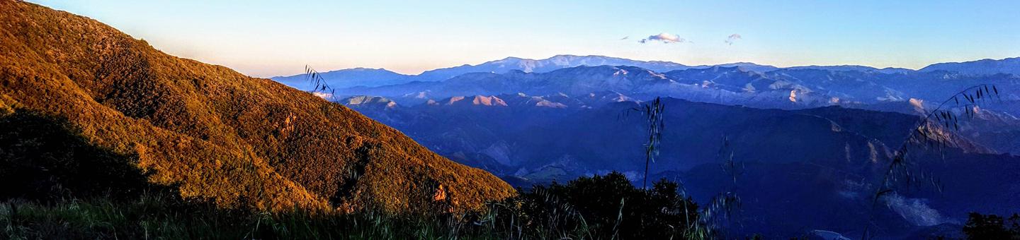
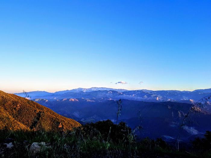
 The Los Padres National Forest features mountains, streams, rivers and beaches. Weather can vary throughout the forest and altitude ranges from sea level on the Monterey Ranger District, to almost 9,000 feet on the Mt. Pinos Ranger District.
Important Information
Accessible Recreation Opportunities
A continuing goal of the Los Padres National Forest is to make the recreational opportunities accessible to persons with disabilities. Although many of these areas already have wheelchair-accessible campsites, restrooms and trails, we are continuing to make more sites accessible.
Accessible Sites
The Forest Service has adopted the universal design approach to site accessibility which takes into consideration the differing physical capabilities of visitors. Not all locations/facilities are 100% accessible because the forest is continually adding new accessible sites. Please call ahead to the Ranger District for more information.
RecAreaDirections
Open with Google Map
Misc
| Stay Limit | |
| Reservable | false |
| Keywords | |
| Map Link | |
| Contact Phone | |
| Contact Email |
Permits info
Facilities
ARROYO SECO Campground
List of CampsitesOverview
Arroyo Seco Campground is a semi-rustic, but developed facility in California's westernmost national forest. It offers a great escape from bustling city life, into the mountain air and provides access to a variety of outdoor recreation opportunities.Recreation
The small non-body contact lake near the group campsites gives campers an edge on mountain fishing and small non-motorized boating. Anglers will find mostly bass and catfish in the lakes, and other species on occasion. A fishing license is required for visitors over 16 years of age. The nearby river offers a small beach where campers and day use visitors may wade and swim. All nearby bodies of water are dependent upon seasonal rain for levels to rise.The Ventana Wilderness, also known as "the gorge," provides ample opportunities for hiking, swimming, backpacking, hunting and horseback riding. No motorized vehicles are allowed (unless prior permission is granted by the Forest Service) beyond the gated road and parking lot. The 15.5-mile Santa Lucia Trail is available for hiking and horseback riding and provides access to the surrounding wilderness and a variety of other trails.
Facilities
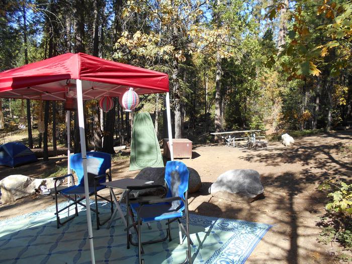
The campground offers sites that are both modern and more primitive, for single and double-family occupancy. Campsites are available for tent or RV camping, however utility hookups are not provided and there is no dump station. Some sites are level and large enough to accommodate most RVs. Roads are paved throughout the campground.Each site is equipped with a table and campfire ring with grill. Campsites in the first loop offer accessible flush toilets, coin-operated showers and drinking water. In the more primitive area of the campground, vault toilets are provided, as well as drinking water. Some sites are fully accessible.
A group campsite is available for reservations and can accommodate up to 50 people and 10 vehicles. It provides tables and a campfire circle, as well as vault toilets and drinking water.
Natural Features
The campground offers views of the Ventana Wilderness mountain peaks and one small lake (water levels depend on the season). It is nestled into the hillside, surrounded by abundant shrubbery and large oak trees. It is situated next to the Arroyo Seco River at an elevation of about 1,200 feet. A variety of birds and wildlife make their home in the area.A splash of color greets visitors at the entrance gate, where a variety of plants in bloom. In the spring and fall, the leaves on the trees change to beautiful shades of red, yellow and orange, creating a beautiful scenic landscape. In the springtime, lupines bloom all around.
Nearby Attractions
The city of Monterey provides a variety of tourism opportunities and is located about 50 miles from the campground.The west side of the Pinnacles National Monument is about 30 miles from the campground. The monument and surrounding area is popular among rock climbers during the spring and fall.
PLASKETT CREEK CAMPGROUND Campground
List of CampsitesOverview
Plaskett Creek Campground offers a beautiful location just minutes from Sand Dollar Beach, one of the largest and most popular beaches in central California. The campground gives visitors access to a variety of outdoor activities, including water play and exploration of the surrounding hills and forests. The family-friendly campground offers comfortably equipped sites, allowing anyone to enjoy a relaxing stay in the Los Padres National Forest.Recreation
A short walk leads to Sand Dollar Beach, a very popular spot for surfing, fishing, swimming, exploring, sunbathing and more. Fishing permits are required for anyone over age 16. Anglers can expect a catch of yellow perch and other coastal surf fish. The beach is dog-friendly, as long as dogs are leashed and waste is picked up.A variety of trails exist along the beach, which lead to the bluffs that overlook the beach and coves in the area. Additional hiking, mountain biking and horseback riding trails can be accessed within a short drive from the campground, and offer scenic views of waterfalls, redwood groves and mountain meadows and streams.
Facilities
The campground offers single-family sites, as well as three group campsites, for tent and RV camping. Group sites can accommodate up to 40 people and 10 vehicles. Extra vehicles will be charged an additional fee. Utility hookups are not available.Individual campsites are each equipped with a table and campfire ring with grill. Flush toilets, sinks and drinking water are provided throughout the campground. An accessible flush toilet is located near Site 10. Group sites are equipped with several tables, grills and campfire circles. Vault toilets and drinking water are provided in the group area.
Natural Features
The campground is located in west-central California, on the east side of Highway 1. Sand Dollar Beach, the largest sandy beach in the Big Sur area, is just south of the campground. The Pacific Ocean borders the campground to the west and the surf can be heard at many campsites.The campground has a park-like setting, under a scattered canopy of mature Monterey pine and cypress trees. Cedar trees provide a fragrant aroma. All sites are grassy. The campground is situated at an elevation of about 200 feet in the Los Padres National Forest.
Wildlife in the area includes fox, bobcat, deer and raccoon. Mountain lions and bears are occasionally seen in the area, although they have never entered the campground.
SAGE HILL Campground
List of CampsitesOverview
Nestled in the Santa Ynez Mountain Range, Sage Hill Campground is a great group camping spot with easy access to the Santa Ynez River. Spend time fishing or take in the epic scenery on one of the trails designed for both hikers and horseback riders.One of the campsites is designed for group equestrian camping and includes 12 corrals and a hitching post.
Recreation
Fishermen are likely to find carp, catfish, bluegill and the occasional bass that swim up from Cachuma. The Aliso Canyon Trail begins at the rear of the facility and continues to Upper Oso Campground, which is where the Santa Cruz Trail begins.The nearby Cachuma Lake Recreation Area is perfect for boating, fishing and kayaking.
Facilities
Each campsite accommodates up to 50 people, and the group equestrian site accommodates up to 60.Flush toilets, drinking water and paved roads are included, in addition to an extra large parking area to accommodate horse trailers.
The closest dump station is at Cachuma Lake.
Natural Features
The campground sits in a flat area with some sites shaded by oak trees. Sage Hill is near the river, which flows into Cachuma Lake about seven miles west. The Santa Ynez Mountains make up part of the Transverse Range along the Pacific Coast of California.The landscape may become very dry by mid-summer.
Nearby Attractions
The campground is half an hour from the thriving beach city of Santa Barbara.UPPER OSO CAMPGROUND Campground
List of CampsitesOverview
Upper Oso Campground provides ample opportunity for exploration of California's coastal mountains. It is a family-friendly campground, equipped with equestrian sites, and is close to a variety of trails and several mountain streams.Recreation
A variety of hiking, mountain biking and horseback riding trails begin in and around the campground, including the Santa Cruz Trail, which traverses 18 miles north to the San Rafael Wilderness. The 2.5-mile Aliso National Recreation Trail leads through scenic areas to a group campsite.Off-road vehicle enthusiasts enjoy the Camuesa OHV Route, which loops about 10 miles through the surrounding forest.
Fishing and swimming are available at nearby White Rock Day-Use Area, less than two miles from the campground. The Santa Ynez River is stocked with trout in the springtime.
Cachuma Lake Recreation Area, a no-body-contact reservoir, is about 10 miles northwest of the campground. It offers boating, fishing and kayaking. Anglers will find an abundance of annually stocked trout. Carp and bass are also common catches there.
Facilities
The campground is open year-round and offers around two dozen sites tent or RV camping. About 10 sites are outfitted with horse corrals and extra long, paved parking spurs. Some additional sites are available on a first-come, first-served basis.Each site is equipped with a table, campfire ring with grill and a pedestal grill. Accessible flush toilets and drinking water are provided throughout the campground. Firewood is available for purchase from the on-site campground host.
Natural Features
The campground is located in the lower Santa Ynez Recreation Area, not far from Santa Barbara. The campground has large sites scattered among plentiful oak trees that provide pleasant shade. It is situated alongside a seasonal creek, at an elevation of 1,040 feet.Nearby Attractions
The campground is located about 25 miles north of the city of Santa Barbara.MCGILL CAMPGROUND AND GROUP CAMPGROUND Campground
List of CampsitesOverview
Escape from the city to the remote and beautiful McGill Campground. The campground, bursting with views of mountains and valleys, is an ideal base for several biking and hiking trails.A dense stand of Jeffrey pine and ponderosa pine shade the campground and each campsite is nicely spaced.
Recreation
Explore the area along the accessible Exploration Trail, Mount Pinos Trail and McGill Campground Trail. McGill is for hiking and biking and meanders along 3.7 miles of scenery.Facilities
McGill has two group campsites, each having a central barbeque and gathering area. Group Camp 1 has parking for 13 vehicles, Group Camp 2 has parking for 10 vehicles. There are 73 individual campsites. Each individual campsite offers a picnic table and campfire ring.Natural Features
McGill Campground sits in a mixed tall pine forest in the Pinos Mountains, at an altitude of 7,300 feet, just over an hour's drive from the campground. It is quiet and serene landscape with terrific views of the valleys below.Nearby Attractions
Head out on the Jacinto Reyes National Scenic Byway, which travels past breathtaking cliffs, rock formations and lush riparian areas.WHEELER GORGE Campground
List of CampsitesOverview
Wheeler Gorge Campground is a great place for families to explore the Los Padres National Forest all year long. Informative tours of the area are led by forest rangers at the nearby visitor center. The campground provides scenic views of a nearby stream, as well as vast mountain vistas.Recreation
The Wheeler Gorge Nature Trail begins at the upper end of the campground. It is a relatively short loop that leads through thick vegetation along the creek banks and to a hillside view of the area. Wildflowers often bloom along the path.The creek flows near some of the campsites and a small swimming hole is frequented near the side of the highway. Fishing is rough in the area and may produce a catch of trout, but the stream is not stocked. Kayaking or canoeing in the creek is not recommended.
Educational programs, including ranger-led hikes, are offered year-round.
Facilities
The campground is open year-round and offers dozens of single-family sites for tent or RV camping. Some sites are available on a first-come, first-served basis. Parking spurs are paved and vary in length, accommodating RVs up to 35 feet.Each site is equipped with a table and campfire ring with grill. Accessible vault toilets are provided, but drinking water is not available. Visitors must bring their own water, and remove their trash from the campground.
Natural Features
The campground is adjacent to Matilija Creek, and is bordered by a mixed forest of oak and sycamore trees and evergreen shrubbery. Most sites are shaded and summer temperatures reach up to 95 degrees.The campground was originally built by Boy Scouts nearly a century ago, as well as a historical stone home that is also on-site.
Nearby Attractions
Ventura and the Pacific Ocean are about 20 miles south of the campground.HOLIDAY GROUP CAMPGROUND Campground
List of CampsitesOverview
Holiday Group Campground is a relaxing location to enjoy nature all year long; a quick escape from the bustle of the city. It provides access to a variety of recreational opportunities, including hiking, biking and horseback riding. Surrounding trails are also fun for off-road vehicle enthusiasts.Recreation
The Wheeler Gorge Nature Trail begins not far from the campground. It is a relatively short, loop trail that leads through thick vegetation along the river banks and to a scenic hillside view of the area. Wildflowers are often located along the path.The 10-mile Ortega Trail, for off-road vehicle use, is popular among experienced riders. Rocky, steep terrain takes the trail to the ridgetop.
The creek flows near some of the campsites and a small swimming hole is available nearby. Fishing is rough in the area and may produce a catch of trout, but the stream is not stocked. Kayaking or canoeing in the creek is not recommended.
Facilities
The campground offers one large group site for tent camping and can accommodate up to 50 people. An adjacent parking area provides space for 10 vehicles. Vault toilets are provided, but drinking water is not available at the campground.Campfires are allowed at the campground and visitors are asked to take precaution when using propane or gas stoves and the available on-site grills.
Natural Features
The campground is situated at the bottom of Live Oak Canyon at an elevation of 2,120 feet. It is heavily shaded and the Matilija Creek runs nearby.Nearby Attractions
Ojai is the nearest town, about 15 miles from the campground. The larger city of Ventura is about 20 miles south of the campground. The Pacific Ocean is not far from there.KIRK CREEK CAMPGROUND Campground
List of CampsitesOverview
Kirk Creek Campground is an oceanside paradise, with each site overlooking the Pacific Ocean. It offers a variety of opportunities for relaxation and recreation. The campground is located on a bluff overlooking the Pacific Ocean, and is close to a variety of scenic trails that lead visitors into the Los Padres National Forest.Recreation
There is short walk to a rocky beach from the campground. A five mile ride will take you to Sand Dollar Beach, the largest sandy beach in Big Sur. It's a very popular spot for surfing, fishing, swimming, exploring, sunbathing and more. Fishing permits are required for anyone over age 16. Anglers can expect a catch of yellow perch and other coastal surf fish. The beach is dog-friendly, as long as dogs are leashed and waste is picked up.A variety of trails exist along the beach, which lead to the bluffs that overlook the beach and coves in the area. Additional hiking, mountain biking and horseback riding trails can be accessed within a short drive of the campground, and offer scenic views of waterfalls, redwood groves and mountain meadows and streams. Directly across the highway from the campground is the Vicente Flats Trailhead, which leads into the Ventana Wilderness.
Facilities
The campground offers single-family sites for tent and RV camping. Utility hookups are not available and parking surfaces within the campground are gravel and grass. Each site is equipped with a table and campfire ring with grill. Vault toilets are provided throughout the campground.Natural Features
The campground is located on a bluff overlooking the Pacific Ocean, at an elevation of about 100 feet. It offers fantastic views of the Big Sur coastline. Campsites are spacious, open and grassy. Each site has a view of the ocean, where sunrises and sunsets are outstanding.Wildlife in the area includes fox, bobcat, deer and raccoon. Mountain lions and bears are occasionally seen, although they have never entered the campground. From November to February each year, whales migrate along the coast and can frequently be viewed from the campground.
Nearby Attractions
The Nacimiento Road, which offers a scenic drive on a paved road to an ocean overlook and picnic area, can be accessed across the road from the campground. The road climbs to the peak, 2,500 feet above sea level. Sand Dollar Beach is located 5 miles South of Kirk Creek. Sand Dollar Beach is the largest Sandy Beach in the Big Sur Area.CERRO ALTO CAMPGROUND Campground
List of CampsitesOverview
Cerro Alto Campground is a well-known hiking and mountain biking paradise. It is located a short distance from the sandy beaches of Morro Bay, where visitors enjoy surfing, fishing, kayaking, sailing, scuba diving and more. While the campground offers a serene, relaxed environment, both Morro Bay and the nearby town of Atascadero offer numerous dining opportunities, shopping, museums and other activities. Wine Tasting in the Tempelton, Paso Robles Area is also a very popular experience.Recreation
Visitors enjoy ample hiking, mountain biking and horseback riding opportunities, along with a 360-degree view of the Central California coast and inland valleys. The 4-mile Cerro Alto Trail, which leads to the peak, begins within the campground.Morro Bay beaches are less than 10 miles from the campground, offering wide sandy stretches and swimming, surfing, fishing, kayaking, sailing, scuba diving and more. An 18-hole championship golf course is located in the oceanside town.
Facilities
The campground offers single-family sites for tent or RV camping. Each site is equipped with a table and campfire ring and grill. Accessible vault toilets and drinking water are provided, but no hookups are available. Trash collection bins are scattered throughout the campground.Natural Features
The campground is situated in a mixed oak, pine and sycamore forest at an elevation of about 1,000 feet. It lies in a verdant canyon pass along a semiannual mountain creek. The roads are paved, but narrow, winding and single lane with turnouts to each site.Nearby Attractions
Paso Robles, which is quickly becoming known as a premier spot for Central Coast wines, is located 20 miles from the campground. Wine tasting tours are offered daily, or visitors can select individualized tours of numerous wineries located in the area.The campground makes a great base camp for motorcyclists or day-trippers to visit the quaint, neighboring towns of San Luis Obispo, Cayucos, Harmony and Cambria, all of which are within 35 miles of the campground.
Tours of historic Hearst Castle are also available. Visitors can spend time relaxing at the many available day spas located at nearby Avila or Grover beaches. Off-road vehicle trails are available on famous Pismo Beach.
PONDEROSA CAMPGROUND Campground
List of CampsitesOverview
Ponderosa Campground offers visitors a beautiful location to relax and enjoy nature. It runs along the Nacimiento River, which provides a variety of recreational opportunities. Swimming, fishing and wading are all enjoyed by visitors, as well as hiking and backpacking on any of the surrounding mountain trails.Recreation
The Nacimiento River provides opportunities for trout fishing and wading, as well as swimming in any of the swimming holes along its course. A variety of hiking, horseback riding and mountain biking trails can be accessed within a short drive from the campground. The trails offer scenic views of waterfalls, massive redwood groves, meadows and mountain streams.Facilities
The campground offers single-family sites for tent and RV camping. Utility hookups are not available and the parking surfaces are paved. A maximum of two vehicles is allowed for each site. Additional vehicles are not allowed in the campground.Each site is equipped with a table and campfire ring with grill. Vault toilets and drinking water are provided. Trash collection bins are available throughout the campground.
Natural Features
The campground is situated next to the river and has a scattered canopy of ponderosa pine, oak, madrone and sycamore trees, which provide ample shade in most campsites. It is located in the Los Padres National Forest in the mountains of Big Sur at an elevation of 1,500 feet. A variety of wildlife makes its home in the area.Nearby Attractions
Mission San Antonio is a short drive east of the campground. Located in the Fort Hunter Liggett Military Base, the mission is one of the oldest in California. A museum, original aqueducts and a Native American cemetery are found here.The San Antonio Reservoir Recreation Area is located about 32 miles southwest of the campground. Boating, fishing, swimming and guided tours are available.
PARADISE CAMPGROUND Campground
List of CampsitesOverview
Paradise Campground is a beautiful place to enjoy California's westernmost national forest. It provides access to a variety of recreational activities, including hiking, biking, horseback riding and more. Mountain lakes and rivers in the area offer campers plentiful fishing, boating and swimming opportunities.Recreation
The Santa Ynez River is popular for a variety of water-related recreation and can be accessed at White Rock Day-Use Area, less than half a mile from the campground.Cachuma Lake Recreation Area, a no-body-contact reservoir, is about 10 miles northwest of the campground. It offers boating, fishing and kayaking. Anglers will find an abundance of annually stocked trout. Carp and bass are also common catches.
Visitors enjoy a variety of hiking, biking and horseback riding trails. The Aliso National Recreation Trail is a popular, 2.5-mile loop that begins near the campground. Also nearby is the 18-mile Santa Cruz Trail, which provides access to a variety of other trails in the area.
The Camuesa OHV Route and its connecting trails are available within 10 miles of the campground.
Facilities
The campground offers just over a dozen sites for single and double-family tent and RV camping. Each site is equipped with a table, campfire ring with grill and a pedestal grill. Accessible flush toilets and drinking water are provided.Utility hookups are not provided. Parking spurs are paved and can accommodate most RVs. Firewood can be purchased from the campground host. The nearest fee dump station is about 11 miles away at Cachuma Lake County Park off State Route 154.
Natural Features
The developed campground is located in the Santa Ynez Mountains at an elevation of about 1,000 feet. The Santa Ynez River can be accessed through a tunnel beneath adjacent Paradise Road.The campground is nestled in an oak tree woodland that provides ample shade in most sites. Lush greenery blankets the campground and an open, level playing field allows for games and exploration.
Nearby Attractions
The city of Santa Barbara and the Pacific Ocean are about 18 miles from the campground.LOS PRIETOS Campground
List of CampsitesOverview
Los Prietos Campground is situated in the Los Padres National Forest and provides access to a variety of outdoor adventures, including water-related recreation and hiking. The family-friendly campground is green and lush and is a great place to camp in the mountains of western California.Recreation
The Santa Ynez River is popular for a variety of water-related recreation. The river can be accessed at White Rock Day Use Area, less than a half-mile from the campground.Cachuma Lake Recreation Area is no-body-contact reservoir about 10 miles northwest of the campground. It offers boating, fishing and kayaking. Anglers will find an abundance of annually stocked trout. Carp and bass are also common catches.
Visitors enjoy a variety of hiking, biking and horseback riding trails. The Aliso National Recreation Trail is a popular, 2.5-mile loop that begins near the campground. Also nearby is the 18-mile Santa Cruz Trail, which provides access to a variety of other trails in the area.
The Camuesa OHV Route and its connecting trails are available within 10 miles of the campground.
Facilities
The campground offers dozens of single-family sites for tent or RV camping. No utility hookups are available at the campground.Each site is equipped with a table, campfire ring with grill and a pedestal grill. Flush toilets and drinking water are provided. Trash collection bins are available throughout the campground.
Natural Features
The campground is nestled on the side of the Santa Ynez Mountains. Beautiful, mature oak trees provide ample shade, and abundant vegetation blankets the ground. The sites are roomy and allow for some privacy and separation.Nearby Attractions
The campground is located 19 miles from Santa Barbara and the Pacific Ocean.FREMONT CAMPGROUND Campground
List of CampsitesOverview
Fremont Campground is a family-friendly facility located just off California's western coast. It provides access to a variety of hiking, biking and horseback riding trails, as well as some off-road vehicle trails, in a scenic area.Recreation
The Santa Ynez River is popular for a variety of water-related recreation. It can be accessed at nearby White Rock Day Use Area. Cachuma Lake Recreation Area, a no-body-contact reservoir, is also nearby. It offers boating, kayaking and fishing opportunities.Visitors enjoy access to a variety of hiking, biking and horseback riding trails. The Aliso National Recreation Trail is a popular, 2.5-mile loop available close to the campground. Also nearby is the 18-mile Santa Cruz Trail, which provides access to a variety of other trails in the area. The Camuesa OHV Route and its connectors are within 10 miles.
Facilities
The campground offers more than a dozen sites for tent or RV camping. Some sites are available on a first-come, first-served basis. Large accessible sites are also available.Each site is equipped with a table, campfire ring with grill and a pedestal grill. Accessible flush toilets and drinking water are provided. Firewood is available for purchase from the host.
Natural Features
The campground is located in the Lower Santa Ynez Recreation Area of the Santa Barbara Ranger District. It is situated in an forest of mostly oak trees in hilly terrain at an elevation of about 1,000 feet. The campground is full of lush greenery and is shady.Nearby Attractions
The large city of Santa Barbara is located about 18 miles from the campground. The coast is not far beyond that.Rancho Nuevo Campground Campground
List of CampsitesRancho Nuevo Campground is a primitive campground with 2 sites on a grassy canyon bottom, 4-wheel drive access only. Road is subject to close in the winter.
Little Falls Facility
Little Falls is within Santa Lucia Wilderness.
Buckhorn Road Facility
Take Camuesa Road to the Buckhorn Road which leads to the top of Little Pine Mountain. Camuesa/Buckhorn Roads can be accessed from Upper Oso Campground parking lot 6 miles off Paradise Road. Camuesa Road is about 12 miles long. Approximately 4 miles up the Camuesa Road, the Buckhorn forks off to the north for 8 miles.
Gifford Trailhead Facility
The site is located on Hwy #166 26 miles east of Santa Maria.
This trail is currently within the Front Fire Closure area. No access. Trail is expected to reopen in early 2019.
Gifford Trailhead has one large parking area and serving hikers, equestrians. No motorized use allowed.
The Gifford trail (18E12) 2.2 miles has beautiful scenic views.
Hitching posts. Picnicking 1 table. Stock trailer parking.
Difficulty level : Easy
The trailhead is open all year.
Sulphur Springs Facility
Located in the Figueroa Mountain area. This is a very steep trail and takes you from Cedros Saddle, north to Manzana Creek and the San Rafael Wilderness. The trail drops 2,100 feet in elevation as it passes through oak woodlands and areas of pine. There is a spring about mid-way from Cedros Saddle to Manzana Creek. From Cedros Saddle, the trail also goes south two miles to Zaca Lake, a privately-owned lake and resort where refreshments may be obtained.
San Rafael Wilderness Facility
San Rafael Wilderness hikes are trails located in or near the San Rafael Wilderness area. This area is near Figueroa Mountain, to the north and east. Many of these hikes make good backpack trips, and are near the Manzana River.
Chula Vista Trailhead Facility
This trailhead is located at the end of Mt. Pinos Highway at an elevation of 8,360 ft. The trailhead provides non-vehicle access to the Mt Pinos Summit Botanical Area, Mt Pinos Condor Observation Site, the Chumash Wilderness, and the East end of the Tumamait Trail (21W03). Snowfall in winter offers opportunities for snow sports.
To get to the Tumamait Trail and the Condor Observation Site, take Forest Service Road 9N24 from the Southwest end of the Chula Vista Parking Lot for 2 miles. Difficulty: moderate.
Chula Vista Campground is approximately 500’ from the Northeast end of the Chula Vista Parking Lot. Additional wilderness campgrounds can be accessed via the Tumamait Trail.
17E10- Big Rocks Facility
Big Rocks- 17E10
Blue diamond. More difficult. Open to Motorcycles/ATVS / 4WD.
The trail is primarily used by 4x4s and ATVs. It is located on the main ridge top and intersects with the Jack Springs route. 4 Miles
Tin House - 2E04 Facility
2E05 unmaintained. Mt. Manuel trail to Tin House
Potrero John - 23W06 Facility
Potrero John Trail (23W06) WILDERNESS
Length: 1.6 miles
Difficulty: easy
Take Highway 33 north of Ojai to the trailhead at mile marker 32.10. The trail is on the right hand side of the highway. This trail provides a beautiful day hike following a stream channel into the Sespe Wilderness. It has running water most of the year. The trail ends at Potrero John Camp, but it can be fun to explore the drainage beyond the camp.
Willow Springs Trailhead Facility
Willow Springs Trailhead. Located in the Figueroa Mountain area. This is a two mile connector between the Catway Road and lower Davy Brown Trail.
Cedar Creek / Fishbowl Loop - 22W10 Facility
Open in Spring/Summer/Fall and is within the Winter seasonal closure between December 1st and April 30th
Difficulty: Moderate to difficult
Length: 14 mile loop trail for backpacking or shorter day hikes
SESPE WILDERNESS - More information on the Sespe Wilderness: www.wilderness.net
Maps: Tom Harrison Sespe Wilderness Map
Bring water!
This is a loop trail in the Sespe Wilderness. Two trailheads exist for this loop. The first trailhead is located right off the Grade Valley Road (FS 7N03) approximately five miles south of Lockwood Valley Road.
The second trailhead is located approximately seven miles south of Lockwood Valley Road along the Thorn Meadows Road (FS 7N03C). A beautiful trail located in the Sespe Wilderness, the trailhead is located on Thorn Medow Road (7N03B) a short side road off Mutah OHV Road (7N03.2). The Cedar Creek Trail connects Thorn Medow Road (7N03B) and the GeneMarshall-Piedra Blanca Trail (22W03). This trail has numerous stands of Incense Cedar trees along the upper portion. Numerous large Sugar Pine and Jeffery Pines also grow along the canyon, especially at Cedar Creek Trail Camp. The Cedar Creek Trail 21W10 climbs the canyon before descending to Fishbowls Camp at the north fork of Piru Creek, the trail then completes at Pine Mountain Lodge Camp.
West Tumamait Trailhead - 21W03 Facility
Tumamait Trail (21W03)
Difficulty: moderate to difficult
Length: 4.58 miles
CHUMASH WILDERNESS - More information on the Chumash Wilderness: www.wilderness.net
Maps: 7.5 minute USGS topographic maps (Sawmill Mountain)
The West Tumamait Trailhead (elev. 8080 ft.) is located along Cerro Noroeste Road near the summit of Cerro Noroeste east of Camp Alto Campground. Trailhead parking is along the shoulder of the road. There are no facilities at the trailhead and overnight camping is not allowed. Campo Alto Campground, with 19 individual sites, is located 0.5 miles away at the end of Cerro Noroeste Road. The Mesa Springs Trail 22W21 and Northfork Trail 22W02 may be accessed via the Tumamait Trail.
Terrace Creek - 3E22 Facility
Highway 1 to Big Sur Station
Mt. Pinos Ranger District Facility
Mt. Pinos Ranger District
Cozy Dell - 23W26 Facility
Cozy Dell Trail (23W26)
Length: 1.9 miles
Difficulty: moderate
The trailhead is located 3.3 miles north of Ojai and .1 mile south of Friends' Ranch Packing House. Do not park in the parking lot of the packing house. The trail ends at Cozy Dell Creek, where it ties into the Foothill Trail and Cozy Dell Road. From this junction, a loop can be made by following the Foothill Trail and then continuing back along the Ojai Fuel Break Road.
There are no camps or water along the way. Along this trail, large oak trees provide plenty of shade and there are spectacular views of the Ojai Valley.
Santa Lucia - 6E01 Facility
Junipero Serra Peak Trail/Indians to Arroyo Seco
16E16- Mare Springs Facility
Mare Spring. 16E16.
Blue Diamond. More difficult. Open to Motorcycles and ATV’s Only.
This is an excellent trail for the intermediate to advance rider. The trail connects to the Burnout trail on both ends and provides a challenging and scenic ride. 3.2 miles.
Horse Pasture - 4E05 Facility
Marble Peak Trail to Tassajara Road
South Fork - 3E09 Facility
Strawberry Valley to Rainbow Camp
Chumash Wilderness Facility
Chumash Wilderness 38,150 acres was established 1992 by the Los Padres Condor Range and River Protection Act. The Chumash Wilderness is situated in the Mt. Pinos Ranger District and is also near the town of Frazier Park. It includes Mt. Pinos which was an integral part of Chumash life and is still extremely important to the local Chumash residents. The vegetation is mainly pine forests in the northern portion and a combination of badlands and chaparral in the south. Hiking and camping are among the many recreational opportunities. Snow in the winter provides opportunities for winter recreation.
Black Cone - 3E14 Facility
Not recommended
Lower Oso Day Use Picnic Area Facility
The Lower Oso Day Use Pinci Area is located off Paradise Road just across the first Santa Ynez River crossing ford.
Lower Oso Day Use Area includes 28 sites, each with a picnic table, pedestal grill and parking spur. There are three flush toilet buildings for a total of eight seats. The Santa Ynez River can be accessed from the site.
Drinking water is available. There is no electricity.
Lower Oso Day Use Area is open all year. However, during high river flows Paradise Road is closed to motorized traffic.
Area amenities: Picnic tables, BBQs, Parking, trash, hiking trails, water play, flush toilets, drinking water.
Garcia Wilderness Facility
Garcia Wilderness 14,100 acres was established 1992 by the Los Padres Condor Range and River Protection Act.
The Garcia Wilderness area offers an abundance of panoramic views, solitude and a variety of lush wildflowers in springtime. Located on the Santa Lucia Ranger District, the terrain ranges from chaparral covered mountains to grasslands and abundant creekside vegetation. There are several trails leading into the area. Two hiking trails cut through the wilderness and there are 3 designated campsites.
Potrero Seco Facility
Potrero Seco Rd is closed. Call the Ojai Ranger District at 805-646-4348 for more information.
16E04- Queen Bee Facility
Queen Bee. 16E04.
Blue Diamond. More Difficult. Open to Motorcycles and ATV’s only.
This trail begins and ends at Queen Bee Road and is best suited for intermediate riders. 1.5 Miles.
16E08- Las Chiches Facility
Las Chiches Cut Off . 16E08.
Blue Diamond. More Difficult. Open to Motorcycles/ATVS / 4WD.
From the intersection of Five Points, the first section is open to all trail vehicle types, which has several steep sections that are best suited for intermediate to advanced riders. This route follows ridge tops and provides the rider with outstanding vistas of the valleys below. The last mile intersects with Las Chiches Cutoff motorcycle trail, and ends at Pozo Summit Road, where it connects to Pine Mountain trail. 6 miles.
East Tumamait Trailhead - 21W03 Facility
The East Tumamait Trailhead (elev. 8800 ft.) is located on the top of Mt. Pinos at the west end of Forest Service Road 9N24. Public vehicle access is prohibited over this road. Trailhead parking is located 2.0 miles away to the east at the Chula Vista paved parking lot at the end of Mt. Pinos Highway. Forest Road 9N24 begins at the southwest edge of this parking lot. There is one vault toilet at the trailhead. The Mt. Pinos Condor Observation Site is also located at the trailhead. The Mesa Springs Trail 22W21 and Northfork Trail 22W02 may be accessed via the Tumamait Trail.
Difficulty: moderate to difficult
Length: 4.58 miles
MT. PINOS BOTANICAL AREA & CHUMASH WILDERNESS - More information on the Chumash Wilderness: www.wilderness.net
Maps: 7.5 minute USGS topographic maps (Sawmill Mountain)
Leave No Trace Backpacking Principles: http://lnt.org/learn/7-principles
Open Spring/Summer/Fall; Mt. Pinos Highway subject to snow closures and tire chain requirements during the winter.
McMenemy Facility
This trail connects the San Ysidro and Cold Springs Trails. Mostly chaparral, with a eucalyptus grove near the San Ysidro Creek crossing. Nice views at the higher portions of the trail.
Munch Canyon Facility
Located in the Figueroa Mountain area. This trail was originally constructed as a mining access road. Evidence of old mine excavations can be found along the route. This trail connects Sunset Valley to the Davy Brown Trail in Fir Canyon. A short spur connects to the East Pinery Road.
Los Padres Dam-Big Pines - 1E02 - Facility
(via Blue Rock Ridge Trail)
Matilija Wilderness Facility
Wilderness
Davy Brown Trailhead Facility
The Davy Brown Trailhead is located approximately 13 miles from the time one turns onto Figueroa Mountain Road off of Highway 154. It is one mile past the Figueroa Campground on the left hand side of the road. The large dirt turnout parking area accommodates between 6 and 8 vehicles. The Davy Brown Trailhead leads to various connecting trails, including Munch Canyon Trail.
18E05- La Panza-Bypass Facility
La Panza - Bypass. 18E05. Blue Diamond. More difficult. Open to Motorcycles and ATV’s Only.
This trail is an easy ride for intermediate and advanced riders and goes from Queen bee summit to Burnout trail. 1.5 Miles
Ojai Ranger District Facility
The Ojai area includes the Matilija Wilderness and part of the Sespe Wilderness. The Sespe Creek Wild and Scenic River crosses this area.
Cone Peak Lookout - 4E12 Facility
Cone Peak Road to lookout at elevation of 5155 feet
Mount Manuel - 2E06 Facility
Little Sur Trail to Big Sur State Park
Upper OsoTrailhead Facility
The site is located on the Camuesa Road, 1 mile from Paradise Road.
Upper Oso Trailhead is a paved and located just past Upper Oso Campground. The trailhead has three separate parking areas and serving hikers, equestrians, and OHV trail uses. The facility has drinking water, flush toilets, trash, and picnic tables.
There are 20 single vehicle spaces available for trailhead parking and extended spaces for truck-trailer parking for off-highway vehicles (OHV's). There are an additional 20 spaces for parking close to the equestrian facilities. There is a horse trough at the trailhead.
The Santa Cruz trail (27W09) provides access to the San Rafael Wilderness. The Camuesa OHV route (5N15) provides motorcycle and ATV riding opportunities on the Camuesa and Buckhorn (9N11) OHV routes.
The trailhead is open all year. However, during high river flows Paradise Road is closed to motorized traffic.
**As of November 1, 2016, the Upper Oso Trailhead Parking Area will no longer be an Adventure Pass recreation site. Iinteragency passes will not be accepted.
This trailhead parking area will be managed by the Parks Management for the Forest Service. $10 per vehicle or you can purchase and use the Parks Management Annual Day Use Pass for $50. Pass can be purchased from the PMC at www.campone.com or by calling 805-434-1996 or purchased from the campground hosts at Paradise Campground, Upper Oso Campground or Sage Hill Campground.
Willow Creek - 5E08 Facility
Willow Creek Road
Horseshoe Springs Campground Campground
List of CampsitesNestled in large grove of oaks. Campground provides solitude for those seeking that type of experience.
Johnston Ridge - 20W12 Facility
Johnson Ridge Trail (20W12)
WILDERNESS
Length: 9.5 miles
Difficulty: northern section moderate, southern section difficult
The trailhead is near Mutau Flat, located on the Mt. Pinos Ranger District. After a rolling three miles, the trail drops steeply into Hot Springs Canyon. There is no water and little shade along the first seven miles of the trail.
After 8.5 mile from the trailhead, a side trail leads into Hot Springs Creek. At .6 miles further, there is another camp and .4 mile further is the Sespe River Trail (20W13). Prior to the June 1992 wilderness legislation, this was a popular motorcycle trail. It is now open only to horseback riders and hikers.
16E21- Burnout Facility
Burnout . 16E21.
Black Diamond. Most difficult. Open to Motorcycles and ATV’s Only.
This lengthy trail offers a wide variety of trail experiences for the intermediate and advanced riders. It traverses over ridge tops with nice vistas as well as oak and grass covered valleys. It also connects with Mare Springs trail, La Panza Bypass, Red Hill Road, and Navajo Road. Only street legal motorcycles are allowed on the Red Hill and Navajo Roads. 10 miles.
Arroyo Seco Group Campground Campground
List of CampsitesArroyo Seco Campground is a semi-rustic, but developed facility in California’s westernmost national forest. It offers a great escape from bustling city life, into the mountain air and provides access to a variety of outdoor recreation opportunities.
There is one group site at this campground and it is available by reservation only for $125.00 per night. This site can accommodate up to 50 people maximum. A total of 10 vehicles are included with the group rate; additional vehicles will cost $10.00 per vehicle. Tents only in group site.
15E11- Garcia Ridge Facility
Garcia Ridge. 15E11.
Blue Diamond. More difficult. Open to Motorcycles/ ATVS/4WD.
This ridge top route starts at Hi Mountain and Pozo/Arroyo Grande Road intersection and dead-ends at the Garcia Wilderness Boundary. This intermediate route is open to all OHV riders. 4 miles.
Gamboa-Stone Ridge - 4E11 Facility
Coast Ridge Trail to Vincente Flat
Big Falls Trailhead Facility
Big Falls Trail takes you into one of San Luis Obispo's most striking natural areas. Two dramatic waterfall settings are hidden within this amazing wooded canyon.
Marble Peak - 4E07 Facility
Arroyo Seco River to Coast Ridge Road
Sunset Valley Trailhead Facility
Located in the Figueroa Mt. area. This 2 mile trail parallels the Sunset Valley Road. It meanders through oaks, pine and chaparral.
Munch Canyon Trailhead Facility
Munch Canyon Trailhead is located on Sunset Valley Road on Figueroa Mountain. This trailhead meets up with several other trails in this general area, including the Davy Brown Trail and White Rock Trail. This trail is very popular during spring, as it produces beautiful wildflowers during a wet year. From mid-July to the end of September, this trail is utilized by hunters during deer season. The parking for this trailhead is very minimal. There is a turnout directly in front of the trailhead that would accommodate no more than 3 vehicles at a time.
Howard Creek - 22W26 Facility
Howard Creek Trail (22W26)
Length: 2.8 miles
Difficulty: moderate
Turn right on Rose Valley Road and drive .4 miles and park on the right. The trail starts on a dirt road behind a locked gate. This is one of the shortest hikes to Nordhoff Ridge where there are fantastic views of the coastline and the Ojai Valley.
15E10- Quail Facility
Quail . 15E10.
Green Diamond. Least difficult. Open to Motorcycles/ ATVS/4WD.
Quail Road can only be accessed from Fernandez Road. Only street legal vehicles can access this route. This short route leaves Fernandez Road and dead-ends on the ridge top. 1 mile
Little Sur Camp - 2E09 Facility
Bottcher's Gap to Little Sur River
Dick Smith Wilderness Facility
Dick Smith Wilderness was established in 1984 by the California Wilderness Act. Deep within the Santa Barbara Backcountry lies a knot of mountains topped by Madulce Peak. The Dick Smith Wilderness comprises 64,700 acres of diverse topography with elevations ranging from 3,700 to 6,541 feet. While chaparral is the predominant vegetation, the Madulce Peak area has some of the most beautiful stands of mixed conifers found in the Forest. The Rancho Nuevo area is more open with massive sandstone rock formations, chaparral, big cone Douglas fir and Great Basin sagebrush.
Cumbre Day Use Facility
Located among the pines high on Figueroa Mountain. Beautiful displays of wildflowers March through May.
This day use area may be closed in the winter due to wet weather. Check with the Santa Lucia Ranger District - (805) 925-9538.
17E06- Shaw Ridge Facility
Shaw Ridge. 17E06
Black Diamond. Most difficult . Open to Motorcycles/ATVS / 4WD.
This route leaves the Twin Rocks route on a spur ridge that drops into the Alamo Creek drainage and deadends. A very steep section of trail exists at the end of this route where specialized equipment is recommended. This section is recommended for advanced riders. 8 Miles.
Camuesa Connector Facility
Trail crosses the river and meanders four miles up the south slope of the river canyon to tie into Camuesa Rd.
16E09- Pine Mountain Facility
Pine Mountain . 16E09.
Black Diamond. Most Difficult. Open to Motorcycles/ATVS / 4WD.
This trail is open to all OHV riders, but is best suited for the intermediate and advanced skill levels. The trail borders the Machesna Wilderness and contains one black diamond section called the Stair Steps. This route offers some outstanding vistas of the valleys below and distant Machesna Mountain Wilderness. 7 miles
Frazier Mountain Trailhead - 20W03 Facility
Forest Development Road 20W03 is also known as OHV Trail 118 on the Mt Pinos Motor Vehicle Guide (OHV Map)
Difficulty: easy
Length: 6.0 miles
Maps: 7.5 minute USGS topographic maps (Cuddy Valley)
The Frazier Mountain Trailhead (elev. 5400 ft.) is located on the west side of Frazier Mountain Road (8N04) approximately ¾ mile south of Lockwood Valley Road and Forest Service Chuchupate Ranger Station. There is a large paved parking lot with pull-through stalls for vehicles with trailers or motor homes and a vault toilet at the trailhead. The signed Off Highway Vehicle trail starts at the southwest end of the parking lot. There is no overnight camping allowed at the trailhead, except in self-contained vehicles, but Chuchupate Campground, with 29 individual sites, is located 2 miles further south on Frazier Mountain Road.
Ozena - 23W42 Facility
This trail is located near the Ozena Fire Station just off of State Highway 33. The trail travels southward to Pine Mountain with a short Spur trail to McGuire Spring.
Goldhill Camping Area Facility
Goldhill Camping Area is an open camping location adjacent to Piru Creek at the base of Alamo Mountain. Recreational Vehicles up to 26 feet. Picnic tables, fire rings, toilets. No potable water available. Located near several Forest Service Off-Highway Vehicle (motorcycle and four-wheel drive) roads and trails and is approximately eight miles southwest of Hungry Valley State Vehicular Recreation Area.
Area ammenities: Tent camping, Trailer camping, Picnic tables, Toilets, Parking, Trash service
Salisbury Potrero - 26W01 Facility
Hike is through badland terrain and potrero grasslands.
Big Sur - 3E07 Facility
Cold Springs Camp to Pine Ridge Trail
Church Creek - 3E05 Facility
Tassajara Road to Church Creek Divide
Big Pines - 1E02 Facility
Los Padres Dam to Pat Springs Camp
Pozo - La Panza OHV Area Facility
The Pozo/La Panza area is located on the north side of the District. This 18,867-acre area has approximately 44.5 miles of routes that vary from sandy washes to a ridgeline route including a section known to expert riders as the Stair Steps. It has 300-foot drop-off within a few feet of the steps.
Map of the Pozo - La Panza OHV Area
The Adventure Pass is not required for use in this area. This is a concession-managed fee area. Day use is $10. Campgrounds are $20/night. Fee tubes are located at the OHV trailheads and campgrounds.
Santa Lucia Wilderness Facility
Santa Lucia Wilderness 18, 679 acres; established in 1978 by the Endangered American Wilderness Act.
The Santa Lucia Wilderness is located inland from Arroyo Grande and San Luis Obispo. The land is extremely rugged with chaparral-covered peaks and streamfed valleys of oaks and lush riparian vegetation. From the ridgetops you can see the vista of Morro Rock and the Seven Sisters hills of San Luis Obispo. This wilderness offers views along waterfalls and scenic streams, trails for hiking, hunting, solitude and recreation await you, just ten minutes from San Luis Obispo.
Wheeler Gorge Visitor Center Facility
The Wheeler Gorge Visitor Center which is located 8 miles north of Ojai on Highway 33, is the first dedicated Visitor Center in the almost 100 year history of the Los Padres National Forest. Since opening in June 2001, the center has served over 20,000 visitors.
The Visitor Center provides public information about Los Padres National Forest and also sells maps, trail guides, forest-related books, Adventure Passes and other items.
Trained staff can help guide you to the many and varied recreational and educational experiences available in the forest and can also help with extended backcountry trip planning for the local wilderness areas.
The Wheeler Gorge Visitor Center also serves as a hub for interpretive and educational activities and programs. These include presentations about the resources and issues of Los Padres National Forest. One of the more popular programs is the Introduction to Backpacking course. Programs are offered on Saturdays May through September.
The Visitor Center also has local wildlife displays and there is a classroom, library, large parking area and an outside picnic area.
For information about scheduled hours of operation and current programs please visit the Los Padres Forest Association website or call the Ojai Ranger Station at 805-448-6487.
Santa Lucia Ranger District Facility
The Santa Lucia Ranger District offers a diversity of outdoor opportunities. These lands are yours - to visit, to care for, but most of all, to enjoy. What are you waiting for? Pack up your family and friends and head for adventure in America's Great Outdoors. TheSanta Lucia Ranger District offers a variety of recreational opportunities... hiking and backpacking, trail riding by horse, bicycle, off-highway vehicles, camping and picnicking, and fishing, and don't forget vibrant wildflower displays each spring especially in the Figueroa Recreation Area.
Recreation passes are required for use of certain recreation sites and areas in the forest, and for certain facilities and services.Click HERE for more information about the Adventure Pass.
Click HERE for more information about where the Parks Management Annual (PMC) Day Use Pass is needed - concession managed campgrounds and day use areas in the Los Padres National Forest.
Danish Creek - 2E10 Facility
Los Padres Dam to Danish Creek Camp
Ballinger Canyon Facility
The Ballinger and Deer Park areas are geared toward OHV use. These areas provide 11 4WD roads, 12 ATV trails, and 14 motorcycle trails. Access to 4WD roads is available to both ATVs and motorcycles, and access to ATV trails is available to motorcycles.
Lower Manzana Trailhead Facility
The Lower Manzana Trailhead is located on Sunset Valley Road, approximately 1.5 miles past Davy Brown Campground. This trailhead is very popular for a number of reasons, primarily because it is a portal to the San Rafael Wilderness. The Lower Manzana Trailhead leads to a historical schoolhouse, last used in 1901. In close proximity to the schoolhouse, one will also find a historical hunting lodge known as the Dabney Cabin. This trail is also very popular for backpackers and horseback riders, as there are many primitive campsites throughout the connecting trails. The parking area is in a wide turnout within 50 feet of the trailhead and accommodates between 12 to 15 vehicles. During heavy rainfalls, the trailhead may be inaccessible.
Carmel River - 3E03 Facility
Los Padres Dam to Pine Ridge Trail. There is no access to the Carmel River, Rattlesnake, and Big Pines trails from Los Padres Dam. Several significant active slides have forced Cal Am to close their private access road to protect the public. There are no workarounds. Please stay away until Cal Am can repair the road. Please contact the Monterey Ranger District for alternate trail routes. (831) 385-5434 X 0.
Ventana Double Cone - 2E02 Facility
Skinner Ridge Trail to Ventana Double Cone
White Rock Trailhead Facility
White Rock Trailhead is located on Sunset Valley Road on Figueroa Mountain. This trailhead meets up with several other trails in this general area, including East Pinery and Munch Canyon Trail. This trail is very popular during spring, as it produces beautiful wildflowers during a wet year. From mid-July to the end of September, this trail is utilized by hunters during deer season. The parking for this trailhead is very minimal. There is no designated parking area for this trailhead. Visitors merely park adjacent to Sunset Valley Road near the trail.
Rock Front OHV Area Facility
The Rock Front area is located in the center of the Ranger District. This 15,328-acre area provides 41 miles of 4x4 trails that vary from rock-covered canyons to ridgeline trails with outstanding vistas of the Cuyama Valley.
Map of the Rock Front OHV Area
Adobe Trailhead Facility
The site is located on Hwy #166. 20 miles east of Santa Maria.
This trail is currently within the Front Fire Closure area. No access. Trail is expected to reopen in early 2019.
Adobe Trailhead has one large parking area and serving hikers, equestrians. No motorized use allowed. The facility has no drinking water and trash receptacles. Please pack your trash out.
The Adobe trail (31W03) 2.5 miles has beautiful scenic views.
Difficulty level : Easy to Moderate
The trailhead is open all year.
Upper Rose Valley Lake Day Use Area Facility
Upper Rose Valley Lake is located 4 miles off of the Rose Valley Road. Access to the lake is open all year.
Deer Park Facility
The Ballinger and Deer Park areas are geared toward OHV use. These areas provide 11 4WD roads, 12 ATV trails, and 14 motorcycle trails. Access to 4WD roads is available to both ATVs and motorcycles, and access to ATV trails is available to motorcycles.
Junipero Serra Peak - 6E01 Facility
Santa Lucia Trail
Little Sur - 1E02 Facility
Old Coast Road to Bottcher's Gap
De Angulo - 2E07 Facility
Highway 1 to Coast Ridge trail
Cerro Alto Loop Facility
Experience a climb to one of San Luis Obispo's highest points. Found within West Cuesta Ridge; Cerro Alto Loop, provides spectacular views of San Luis Obispo County, Los Padres National Forest, and the Pacific Ocean. Follow Morro Creek into pretty oak woodlands and traverse to then enjoy open grasslands.
San Rafael Wilderness Facility
n 1968 the San Rafael became the first primitive area in the Nation reclassified as wilderness under the Wilderness Act of 1964, additional acreage added in 1992 by the Los Padres Condor Range and River Protection Act. The San Rafael Wilderness is located in the San Rafael and Sierra Madre Mountain Ranges in southeastern Santa Barbara County (northern part of Santa Barbara District and Southern part of Santa Lucia District). This wilderness is mainly covered by chaparral, which consists of chamise, buckthorn ceanothus manzanita, scrub oak and yucca. You will also find potreros (grassy meadows). The two main corridors into the wilderness are the Sisquoc River and Manzana Creek. Most trails follow the creeks and rivers. These areas are called riparian zones and provide food, water, and shelter for most species of wildlife. In the water are rainbow trout, western pond turtles, and aquatic garter snakes, to name a few. Bordering the water you may find the western toad or hear the call of the pacific and California tree frogs From April through June you can hear the many songbirds that nest in riparian zones, such as the yellow warbler, house wren, orange-crowned warbler, and plain titmouse. Further from the creek, up in the brush, you will hear the scrub jay, California quail, and mountain quail. Other points of interest include the Manzana Schoolhouse and the standing ruins of homesteads along the Sisquoc River. These sites are all that remain of a vigorous farming community that settled the flats along the river around the turn-of-the-century. The South Fork Cabin is a historic Forest Service line shack that has sheltered generations of backcountry rangers. The Dabney Cabin, nestled on a small terrace above Manzana Creek, was built in 1914 as a retreat for the family of Charles Dabney.
Arroyo Seco Facility
Santa Lucia Memorial Park
Hennickson's Ridge - 3E04 Facility
Chew's Ridge to Miller Canyon
La Jolla / Ballard Trailhead Facility
La Jolla / Ballard Trailhead is located approximately 12.5 miles from the time that one turns onto Figueroa Mountain Road off of Highway 154. You will find the trailhead .5 miles past the Figueroa Station. Parking is available on the right side of the road on the dirt turnout, right before Tunnell Ranch Road. This parking area can accommodate between 5 to 6 vehicles. This trail is approximately 3 miles and leads to a primitive campsite known as Ballard. This trail is very popular during spring, as the wildflowers are spectacular during this time of year.
Located in the Figueroa Mountain area. This 5 mile trail is steep and goes into a canyon bottom where a spring feeds a cold stream. When you get to the bottom, you'll find the remains of an old CCC cabin. Ballard trail camp is in the canyon bottom. An easy hike down, hard work coming back. This trail is most popular in fall and spring. Summer finds the exposed hillsides not very inviting.
Nordhoff Ridge Road Facility
Alert - 5/1/2022 - The Nordhoff Ridge Rd is temporarily closed until further notice due to winter storm damage to the road.
Nordhoff Ridge Road is a street leagal 4-wheel drive road. Open by permit only approximately May 1 - December 15. Nordhoff Ridge Rd is a wide and hard packed 4 X 4 Road that is approximately 10 miles long. The road has a few steep climbs but features some stunning views of the surrounding mountain ranges and Valley. Disperse camping is allowed. Call (661) 805-1057 for more information.
PLEASE PACK OUT ALL OF YOUR TRASH, TOILET PAPER AND HUMAN WASTE!
There are no trash cans or trash pick up on Nordhoff Ridge Rd. Please pack out all of your trash. There are no toilets there. Please pack out your toilet paper and human waste.
Please keep this area clean for other visitors to enjoy! We appreciate your help with this.
Please keep it cleaner than when you found it.
Thank you!
Alder Creek - 20W11 Facility
Alder Creek Trail (20W11)
WILDERNESS
Length: 7.5
Difficulty: moderate trailhead to Cow Spring, difficult to Shady Camp turnoff
Take Highway 126 to Fillmore. Turn north on A Street/Goodenough Road and drive 14.1 miles to Dough Flat. This is a narrow, rough road that is traveled by large oil trucks. Be very cautious in route to trailhead. From here, you enter the Sespe Wilderness. Hike 2.5 miles north to the Bucksnort Junction. Continue west one mile to reach Cow Spring Camp. Water is usually only available here during winter and spring. Continue 3.2 miles down to Alder Creek Camp. The trail below Dripping Springs becomes narrow and sections of the tread have been destroyed from winter flooding. There are two campsites separated by the creek crossing. Continue west along the creek .8 miles to reach the junction with Trail #9.
__________________________________________________
** Trail conditions**
• Alder Creek Camp to Shady: trail is sporadic and navigating required.
• Cow Springs to McDonald Trail turnoff, 2.7 Route is narrow and trail drops significantly. 1/4 mile west of this junction, the trail drops into the "river bed". The tread was washed out in the flooding following the 2006 Day Fire. It is easier to stay in the river bed to Alder Creek Camp. This section is approximately 1/2 mile.
• Dough Flat to Cow Springs, 3.4 miles; route is easy to find. Some dense brushy areas. Stock should not go beyond this point.
16E02- Las Chiches Cut Off Facility
Las Chiches Cut Off . 16E02.
Blue Diamond. More Difficult. Open to Motorcycles/ATVS / 4WD.
This is a connector trail that intersects with Las Chiches 4x4 trail ends at Fernandez Road. Riders can continue straight and access Burnout Trail, which are both open to motorcycles onl. 0.5 Miles.
Jacinto Reyes National Scenic Byway Facility
The Jacinto Reyes Scenic Byway traverses the Ojai Ranger District and part of Mt. Pinos Ranger District of the Los Padres NF and is entirely within Ventura County. The byway is bordered by 30 miles of national forest and 7 miles of private land within the forest boundary. About .75 mile of byway is outside the national forest.
The byway travels through some of the most picturesque and diverse terrain in southern California. Spectacular vistas greet you along the entire route, and yet you are also treated to "close encounters" with beautiful cliffs, rock formations, and lush riparian areas. The unique geology, geomorphology, plant, and animal life of the area captures the interest and imagination of the casual recreationist and scientist alike. The corridor provides access to four Congressional designated wildernesses.
- Highway 33 is a state highway, maintained by the California Department of Transportation (Caltrans).
- Highway 33 is both a National Forest Scenic Byway, and a State Scenic Highway. This means that it traverses a scenic corridor of outstanding aesthetic, cultural, historic, and interpretive values.
More Byway Information.........
Matias Potrero Facility
Chaparral vegetation
La Cumbre Peak Day Use Facility
Top of the Santa Ynez Mountain Range, overlooking the city of Santa Barbara. Coulter pines, maple trees, manzanita, bay trees, chaparral. There is a ¼ mile hike past the locked gate to the picnic area on top. Next to the day use area there is an old Forest Service fire lookout tower that is closed to the public.
Stonehouse - 20W35 Facility
This picturesque trail is located adjacent to the Sespe Wilderness and follows along Mutau Creek. Access to this trail can be gained by taking the Piru Creek Trail east from Halfmoon Campground, or by taking the Johnston Ridge trail out of Mutau Flat. Travel is by foot or horse back on an easy trail 4 miles from the end of the road northeast of Mutau Flat down the Mutau Creek, or down the 4WD road from Halfmoon campground for 3 miles (Piru Trail), then on to Stonehouse. Creek water is available (purify)
Divide Peak OHV Trailhead Facility
Offers views of Santa Barbara coastline, Upper Santa Ynez Valley and San Rafael Mountains. Divide Peak Road is approximately 17 miles on East Camino Cielo from Highway 154. The parking lot for the OHV road is on the right side of East Camino Cielo 12.5 miles from Highway 154.
Buck Creek - 18W01 Facility
Spectacular views of the surrounding environment are awarded the hardy outdoor enthusiast. On this trail, steep canyons, dense stands of big cone douglas fir and rugged peaks await the visitor. Water is available from the creek (purify). Nearest supplies are at Gorman, approximately 16 miles.
Rinconada Trailhead Facility
The site is located off US 101 take Hwy 58 Santa Margarita turn right on Estrada 58 stay on Pozo road for 10 miles then turn right to Rinconada TH.
Rinconada Trailhead has one large parking area and serving hikers, equestrians. No motorized use allowed.
The Rinconada trail (14E30) 1.8 miles has beautiful scenic views.
Difficulty level : Easy to Moderate.
The trailhead is open all year.
Hitching posts. Stock trailer parking. Water trough.
Do to heavy rainfall in the area the Rinconada trail head is temporarily closed.
Willow Spur Facility
Located in the Figueroa Mountain area. This 1 mile trail is a short connector between Willow Springs Trail and upper Davy Brown Trail.
Figueroa OHV Recreation Area Facility
Catway 29W02 - This route loops around Figueroa Mountain where the trail can begin on Zaca Ridge Road or near Davy Brown Campground. More difficulty.
Zaca Ridge Road 8N02 - This route begins at Figueroa Mountain Road and follows Zaca Ridge until it meets at a dead-end. Easiest
Spruce Creek - 6E10 Facility
Salmon Creek Trail to San Carpoforo Camp
Rose-Lion Connector - 22W16 Facility
Rose-Lion Connector Trail (22W16)
Length: 1.6 miles
Difficulty: moderate
This trail connects the Rose Valley Campground with the Lion Canyon Trail (22W06). The junction is 1.3 miles south of Middle Lion Campground. This trail gives hikers wonderful views northward toward Pine Mountain and provides access to the camps and waterfalls in Lion Canyon. Parking is alongside the road near the Rose Valley Campground.
Dough Flat Trailhead Facility
Open in Spring, Summer and Fall and is within the Winter Seasonal Closure between approximately December 15th – April 30th.
Alder Creek Trail (20W11)
Difficulty: moderate from trailhead to Cow Spring Camp; difficult to Shady Camp turnoff
From the Dough Flat Trailhead, you will enter the Sespe Wilderness within ¼ mile. Hike 2.5 miles north to the Bucksnort Trail Junction. Continue west one mile to reach Cow Spring Camp. Continue 3.2 miles down to Alder Creek Camp. The trail below Dripping Springs becomes narrow and sections of the tread have been destroyed from winter flooding. There are two campsites separated by the creek crossing. Continue west along the creek .8 miles to reach the junction with Sespe River Trail (20W13). Water is usually only available here during winter and spring.
Length: 7.5 miles
SESPE WILDERNESS - More information on the Sespe Wilderness: www.wilderness.net
Maps: Tom Harrison - Sespe Wilderness Map or 7.5 minute USGS topographic maps (Devils Heart Peak)
Take Highway 126 to Fillmore. Turn north on A Street/Goodenough Road and drive 14.1 miles to Dough Flat Trailhead. This is a narrow, rough road that is traveled by large oil trucks. Be very cautious en route to trailhead. Follow the road, being careful to stay on the main road, the side roads will take you to oil well pads. The Dough Flat parking area is adjacent to the public access corridor of the Sespe Condor Sanctuary.
North Fork Matilija - 23W07 Facility
North Fork Matilija Trail (23W07)
WILDERNESS
Length: 9.1 miles
Difficulty: moderate to Middle Matilija and difficult to the north end
Southern access point is the same trailhead as the Murietta Trail (24W07). Leading off to the right after the second stream crossing, the trail enters the wilderness and follows the year-round creek. From the gate you'll reach Matilija Camp after 1.48 miles.
Further up the canyon are three more camps: Middle Matilija (4.1 miles), Upper Matilija (5.7 miles) and Maple (7.5 miles). All four camps offer shaded streamside sites. After another 1.6 miles, the trail ends at a seasonally open dirt road that leads north down Cherry Canyon to Highway 33.
For the northern access point, go 27.4 miles north of Ojai on Highway 33 and turn left on rough dirt road up Cherry Canyon. Travel 3.0 miles to the trailhead at the ridge top. Please check with the Ojai Ranger District before your visit.
Catway Day Use Facility
On the Catway Road overlooking Santa Ynez Valley
Skinner Ridge - 1E04 Facility
Bottchers Gap to Ventana Double Cone Trail; Pat Springs
Anastasia Canyon Facility
Tassajara Road to "Bear Trap"
Buck Creek Trailhead- 18W01 Facility
Buck Creek Trail (18W01)
Difficulty: moderate to difficult
Length: 11.25 miles
SESPE WILDERNESS - More information on the Sespe Wilderness: www.wilderness.net
Maps: 7.5 minute USGS topographic maps (Black Mountain)
The Buck Creek Trailhead (elev. 3060 ft.) is located at the southern end of Hardluck Campground (which is currently Closed) and Forest Service Rd. 8N24. Trailhead parking is located 3.0 miles away at the locked gate off of Los Alamos Road, located adjacent to the southern portion of Hungry Valley State Vehicular Recreation Area. There are no facilities at the parking area or trailhead.
Puerto Suelo - 3E08 Facility
Hiding Camp to Ventana Double Cone Trail
16E23- Navajo Bypass Facility
Navajo Bypass . 16E23.
Blue Diamond. More difficult. Open to Motorcycles and ATV’s Only.
Navajo Bypass starts at Friis Road and ends at Navajo Road. This trail is best suited for intermediate riders due to two steep sections in the middle of the trail. Since this trail ends on Navajo Road, the section of the road that connects to the McGinnis Creek is legal for all motorcycles and quad runners. The remainder of the Navajo Road is for street legal vehicles only. 1.5 Miles
17E07- Los Machos Facility
Los Machos- 17E07
Green Diamond. Least Difficult. Open to Motorcycles/ATVS / 4WD.
This route is a good route for beginning riders. It is located on the main ridge top of the Los Machos Hills. The route dead-ends at a locked gate. 2.8 Miles
Upper Rancho Nuevo - 24W03 Facility
From Deal Junction travel trail 24W03 for 5 miles to Upper Rancho Nuevo Camp. This camp is surrounded by pinyon pine, yucca and chaparral in a beautiful secluded canyon. This is a wilderness camp and there are no facilities located at this camp. Water is available but be sure to purify, as there are heavy minerals in the creek.
8N02 Zaca Ridge Road Facility
This route begins at Figueroa Mountain Road and follows Zaca Ridge until it meets at a dead-end. Easiest.
16E22- McGinnis Creek Facility
McGinnis Creek . 16E22.
Green Diamond. Least difficult. Open to Motorcycles and ATV’s Only.
This trail runs parallel to the creek and is level with no steep sections making it ideal for beginners. Since this trail ends on Navajo Road, the section of the road that connects to the Navajo Bypass is legal for all motorcycles and quad runners. The remainder of the Navajo Road is for street legal vehicles only. 1 mile.
Rattlesnake Creek - 2E11 Facility
Danish Camp to Little Pines
17E08- Paradise Facility
Paradise- 17E08
Blue diamond. More difficult. Open to Motorcycles/ATVS / 4WD.
This route provides access to Paradise Campground and Los Machos route. It is best suited for intermediate riders due to a steep section along the route. The route dead-ends at a locked gate. 2 Miles
Zaca Peak Facility
Located in the Figueroa Mountain area. The trail follows a ridge top west from the Zaca Peak Road. The west end of the trail drops down to the privately-owned Zaca Lake Resort. Unobstructed views of the Santa Ynez Valley and Zaca Lake basin are found along this route. This trail may be hard to locate since the 1995 Marre Fire.
North Coast Ridge - 3E10 Facility
Cone Peak Roadhead to Highway 1, at Ventana Inn
Pine Valley - 1E02 Facility
China Camp to Pine Valley
Silver Peak Wilderness Facility
This wilderness was established in 1992 by the Los Padres Condor Range and River Protection Act. On December 19, 2002 the Big Sur Wilderness and Conservation Act of 2002 added 17,055 acres to the existing wilderness for a total of 31,555 acres. Dramatic scenery, steep terrain, coastal redwood groves. The Silver Peak Wilderness is located in the southwestern portion of the Monterey Ranger District and along the famous Big Sur coastline. Hiking is available on moderate to strenuous trails, wildlife is present in more remote areas Photographic opportunities abound. Access to parts of the backcountry is by dirt roads and is open subject to weather conditions.
17E11- Jack Springs Facility
Jack Springs- 17E11
Blue diamond. More difficult. Open to Motorcycles/ATVS / 4WD.
This trail is accessible from the Big Rocks and Branch Creek routes and is well suited for intermediate riders. Some steep sections exist along this route making it a challenge for the best intermediate riders. 1.8 Mile
First Crossing Day Use Picnic Area Facility
The First Crossing Day Use Area is a 16 acre day use picnic site located off Paradise Road just before the first Santa Ynez River crossing ford.
The First Crossing Day Use Area is open all year. During high river flows Paradise Road is closed to motorized vehicles at the river ford and this facility becomes the “end of the road” for visitor vehicle access.
The site is adjacent to the Santa Ynez river and trails provide access to the river.
The facility has 50 picnic tables at 13 picnic sites accommodating 16 to 24 people each. The site consists of 130 parking spaces with one trailer parking space. There are three vault toilet buildings.
The interior roads and parking spurs are paved, all walkways are concrete and the entire site is accessible. The site is designed for large extended family groups.
There are three large garbage dumpsters located throughout the site. There is no electricity or phone service to the site.
Area amenities: Picnic tables, BBQs, Parking, trash, hiking trails, water play.
McKinley Trailhead Facility
McKinley Trailhead is located approximately 13 miles from the junction of Figueroa Mtn Road and Happy Canyon/Sunset Valley Road. In order to reach the trailhead, one must hike to the trailhead for 13 miles past the locked gate. From the trailhead one can access Big Cone Spruce Campsite and continue to the Manzana Trail in the San Rafael Wilderness.
Girard - 4E17 Facility
Cone Peak Road to Vincente Flat
Pratt - 23W09 Facility
Pratt Trail (23W09)
Length: 4.4 miles
Difficulty: moderately difficult
Begin at the trailhead area located off of Signal Street heading north of downtown Ojai. The trail ends on Nordhoff Ridge, one mile west of the old Lookout Tower. The trail's lower section ties into the Cozy Dell Trail (23W26), Foothill Trail, and the Ojai Fuelbreak Road. This system of trails and the fuelbreak provide many different day hike opportunities.
The lower end of the trail goes through private property, so please follow the signs and stay on the trail. The short-side trail to Valley View Camp leaves from the upper section.
Santa Paula Canyon (Last Chance) - 21W11 / 21W09 Facility
Santa Paula Canyon (Last Chance Trail)
(21W11 & 21W09)
PARTIAL WILDERNESS
Length: 6.0 miles to Jackson Hole
Difficulty: moderate to Jackson Hole and difficult to north end
Park in either of two dirt parking lots off Highway 150 adjacent to the entrance of Thomas Aquinas College. Walk up the college road. Please respect signs to stay on road and do not cut across open areas of campus. The road eventually splits off to the right from the college and continues through a ranch and oil well site.
Approximately 1.3 miles from the highway and after the oil wells, the route enters dense sycamore and alder stands along the creekbottom.
During the winter floods of 2005, much of the trail and road was eliminated due to high waters. Since this trail receives heavy use on weekends, we recommend hiking it on a weekday. The main attractions are a narrow gorge and beautiful waterfalls that cascade into deep pools of water.
Be very careful when hiking this trail due to the many steep drop-offs and high cliffs. After 3.4 miles, the trail passes Big Cone Camp that has campsites set in a shady grove of big cone Douglas-fir with year-round water close by. A great alternative less then a mile further up the trail is Cross Camp. This camp offers secluded, nicely arranged campsites on Santa Paula Creek (year-round water).
At 1.8 miles from Cross Camp a trail turns off to the right and drops down to Jackson Camp. The main trail continues another 0.2 miles to Jackson Hole. For the adventurous, an unmaintained trail picks up at 0.4 miles up-canyon from Jackson Hole and continues on to Last Chance Camp and Topatopa Mountains. The trail is not passable to stock beyond Big Cone Camp.
Deal Canyon - 24W10 Facility
Hiking Trail in the Mt. Pinos Ranger District.
Sespe Wilderness Facility
Introduction
The United States Congress designated the Sespe Wilderness in 1992 and it now has a total of 219,468 acres. All of this wilderness is located in Los Padres National Forest in the Ojai and Mt. Pinos Ranger Districts and is managed by the Forest Service.
Description
Sespe Wilderness provides ample evidence of past violent geological upthrusts. The landscape is bleak and jagged, and if you climb high enough, you'll find pine trees growing at odd angles on boulder-swept hillsides. Sespe Creek, the last remaining undammed river in Southern California, runs for 31.5 Wild and Scenic miles (most of it in the Wilderness), and 10.5 miles of Upper Sespe Creek are under consideration for designation. Sandstone cliffs rise as much as 500 feet above the water in places, and fabulous sandstone formations stand in portions of the area. You may see petroglyphs and other evidence of ancient Indians. You might also spot black bears, deer, mountain lions, bobcats, coyotes, rattlesnakes, red-tailed hawks, and golden eagles. The 53,000-acre Sespe Condor Sanctuary is located here, but public entry is prohibited to protect California condors. The wilderness area is a part of the fourth largest roadless region left in the Lower 48, and it's the one closest to a large metropolitan area.
Numerous trails provide access, and human use is moderate. The Gene Marshall-Piedra Blanca National Recreation Trail leads 18 miles through impressive white rocks to pleasant campsites nestled in conifers, a boon when much of the area lies without shade. The Sespe River Trail (17.5 miles) leads past cool swimming holes that thin down to shallows in the dry period, and on to Sespe Hot Springs and some of the hottest natural water in America.
Ventana Wilderness Facility
This wilderness was established in 1978 by the Endangered American Wilderness Act, first addition was in 1978 by the Endangered American Wilderness Act, second addition in 1992 by the Los Padres Condor Range and River Protection Act. On December 19, 2002 the Big Sur Wilderness and Conservation Act of 2002 added 33,967 acres to the existing wilderness bringing it to a total of 240, 026 acres. Topography of the Ventana Wilderness is characterized by steep-sided, sharp-crested ridges separating V-shaped youthful valleys. Most streams fall rapidly through narrow, vertical-walled canyons flowing on bedrock or a veneer of boulders. Waterfalls, deep pools and thermal springs are found along major streams. Elevations range from 600 feet, where the Big Sur River leaves the Wilderness, to about 5,750 feet at the Wilderness boundary circumventing Junipero Serra Peak. Marked vegetation changes occur within the Wilderness. These changes are attributed to dramatic climate and topographic variations coupled with an extensive fire history. Much of the damage to vegetation is only temporary, since fire is an integral part of this Wilderness as it is of other areas of the Forest. Much of the Ventana is covered by chaparral. This brushy vegetative cover is typical of that found throughout Southern California fire susceptible mountains. The contrast of annual grass meadows and open pine stands may be found throughout the Wilderness. Deep narrow canyons cut by the fast moving Big and Little Sur Rivers support virgin stands of coastal redwood. Small scattered stands of the endemic Bristlecone Fir may be found on rocky slopes.
Murietta - 24W07 Facility
Murietta Trail (24W07)
Length: 2.4 miles
Difficulty: moderate
Drive up Matilija Canyon Road to a locked gate and park along the road. Hike on the road .7 miles through private property. About 200 yards past the second stream crossing, the trail will be on the left. It will take you to Murietta Camp after 0.9 miles. This pleasant camp offers three shady sites in an open area under large oak trees. Water is available at Murietta Creek most of the year.
The trail continues another .8 miles to its intersection with Murietta Divide Road. Downhill this dirt road will lead 2.6 miles to the parking lot or uphill 2.3 miles to the Murietta Divide, with steep sections toward the end.
15E09- Benchmark Facility
Benchmark . 15E09.
Green Diamond. Least difficult. Open to Motorcycles/ ATVS/4WD.
This trail is a level easy-going route. It dead ends for 4x4s where it intersects with the Mare Springs trail. 1 mile.
17E12- Twin Rocks Facility
Twin Rocks- 17E12
Blue diamond. More difficult. Open to Motorcycles/ATVS / 4WD.
This route intersects Shaw Ridge and dead-ends at a locked gate. The first half-mile of this trail is steep. Once on top of the ridge you have excellent views of the Cuyama Valley and the Santa Lucia Range. 3.5 Miles
Miller Canyon - 3E04 Facility
China Camp to Los Padres Dam via Miller Canyon
17E05- Logan Ridge Facility
Logan Ridge. 17E05
Green Diamond. Least Difficult Open to Motorcycles/ATVS / 4WD.
This route is a good route for beginning riders. It is located on the main ridge top of Logan Ridge. The route dead-ends at a locked gate. (1.4 Miles)
Carrizo - 3E10 Facility
Old historic trailhead on Milpitas Road
Jackson Camp - 2E08 Facility
Pico Blanco BSA to Little Sur River
North Fork - 22W02 Facility
North Fork Matilija Trail (23W07)
WILDERNESS
Length: 9.1 miles
Difficulty: moderate to Middle Matilija and difficult to north end
Southern access point is the same trailhead as the Murietta Trail (24W07). Leading off to the right after the second stream crossing, the trail enters the wilderness and follows the year-round creek. From the gate you'll reach Matilija Camp after 1.48 miles. Further up the canyon are three more camps: Middle Matilija (4.1 miles), Upper Matilija (5.7 miles) and Maple (7.5 miles).
All four camps offer shaded, streamside sites. After another 1.6 miles, the trail ends at a seasonally open dirt road that leads north down Cherry Canyon to Highway 33. For the northern access point, go 27.4 miles north of Ojai on Highway 33 and turn left on rough dirt road up Cherry Canyon. Travel 3.0 miles to the trailhead at the ridge top. Please check with the Ojai Ranger District before your visit fro current conditions.
Chorro Grande - 23W05 Facility
Chorro Grande Trail (23W05)
Length: 5.1 miles
Difficulty: moderately difficult
Take Highway 33 north 25.8 miles to Chorro Grande Trail sign at mile marker 36.60. Hike 1.7 miles to Oak Camp where there is year-round water. It is another 2.6 miles to reach Chorro Springs Camp, which has water year-round, beneath the conifers. The trail ends on Pine Mountain Ridge at the Reyes Peak Campground after another .8 miles. On clear days, you can see some of the Channel Islands and the Matilija Wilderness from the ridge.
San Antonio - 5E04 Facility
Cone Peak to San Antonio Camp
Monterey Ranger District Facility
Monterey Ranger District
Lion Canyon - 22W06 Facility
Lion Canyon Trail (22W06)
Length: 5.5 miles
Difficulty: easy for first 2 miles, then moderately difficult
Drive 14.8 miles north of Ojai on Highway 33. The trail starts at the back of Middle Lion Campground in the Rose Valley Recreation Area where it immediately crosses the stream. You will reach two trail junctions along the way. After 1.3 miles you will reach the Rose-Lion Connector Trail (22W16) on the right. After 0.6 miles you can take side trails to East Fork Lion Camp, which is within the Sespe Wilderness, or West Fork Lion Camp. The main trail continues 3.6 miles to Nordhoff Ridge for spectacular views.
Turner Creek - 1E02 Facility
Bottchers Gap to Turner Creek Camp
17E09- Branch Creek Facility
Branch Creek – 17E09
Blue diamond. More difficult. Open to Motorcycles/ATVS / 4WD.
This route provides access to Buck Springs Campground, parallels the Big Rock route and offers a loop ride. 5.5 Miles
Camuesa Road Facility
An easy route which connects Lower Santa Ynez Recreation Area to Buckhorn Road and ends one mile from Lower Camuesa Primitive Camp. Camuesa/Buckhorn Roads can be accessed from Upper Oso Campground parking lot 6 miles off Paradise Road.
Little Mutau Trailhead 20W10 Facility
Open in Spring/Summer/Fall and is within the Winter seasonal closure between November 1st and April 30th
Little Mutau Trail (20W10)
Difficulty: moderate to difficult
Length: 9.5 miles
SESPE WILDERNESS - More information on the Sespe Wilderness: www.wilderness.net
Maps: 7.5 minute USGS topographic maps (Alamo Mountain)
The Little Mutau Trailhead (elev. 6800 ft.) is located south of Alamo Mountain Loop Road 8N01 on Sewart Mountain Forest Development Road 6N10. There is a dirt parking lot and a vault toilet at the trailhead. The signed trail starts from the southeast side of the trailhead. There is no overnight camping allowed at the trailhead, but camping is permitted at Dutchman Campground approximately 3 miles northwest on the Alamo Mountain Loop Forest Road (8N01).
Johnston Ridge Trailhead - 20W12 Facility
Open in Spring/Summer/Fall and is within the Winter seasonal closure between November 1st and April 30th
The Johnston Ridge Trailhead (elev. 4920 ft.) is located on the southeasterly end of Grade Valley Road (7N03) approximately 13 miles south of Lockwood Valley Road approximately one mile from Mutau Flats. There is a parking area with 5 parking spurs, with hitching rails for horses, and a vault toilet at the trailhead. The signed trail starts from the east side of the parking lot. There is no overnight camping allowed at the trailhead, but camping is permitted at Halfmoon and Thorn Meadows Campgrounds located along Grade Valley Road. This trailhead provides access to Stonehouse Trail (20W35), Little Mutau Trail (20W10), Sespe Hot Springs and Sespe Creek.
Prewitt Loop - 5E06 Facility
Pacific Valley Station to Highway 1
Machesna Mountain Wilderness Facility
Machesna Mountain Wilderness 19,760 acres was established 1992 by the Los Padres Condor Range and River Protection Act. Twenty-five miles from the city of San Luis Obispo, this wilderness boasts high peaks, chaparral, oak woodlands and conifer forests. Prairie falcon and tule elk live in this wilderness. Camping, hiking, are the main types of recreational uses. There is a 1500 acre Research Natural Area, dedicated to study on a unique strain of Coulter Pine.
Fishbowls Trailhead - 21W05 Facility
Open in Spring/Summer/Fall and is within the Winter seasonal closure between November 1st and April 30th
Difficulty: easy to moderate
Length: 7.9 miles
SESPE WILDERNESS - More information on the Sespe Wilderness: www.wilderness.net
Maps: 7.5 minute USGS topographic maps (Lockwood Valley)
The Fishbowls Trailhead (elev. 5000 ft.) is located on the west side of Grade Valley Road (7N03) approximately 5.5 miles south of Lockwood Valley Road. There is a parking lot with 5 parking spurs, with hitching rails for horses, and a vault toilet at the trailhead. The signed trail starts from the west side of the parking lot. There is no overnight camping allowed at the trailhead, but camping is permitted at Halfmoon and Thorn Meadows Campgrounds further south on Grade Valley Road.
Santa Barbara Ranger District Facility
Santa Barbara Ranger District
West Camino Cielo Rd - Santa Barbara RD Facility
West Camino Cielo Rd is open from Hwy 154 to Refugio Rd. Views of Channel Islands and inland areas from a ridge that rises to 4,298 feet at Santa Ynez Peak. Drive time from Hwy 154 to Refugio Rd is about 1.5 - 2 hours.
DAVY BROWN CAMPGROUND Campground
List of CampsitesOverview
Nestled on beautiful Figueroa Mountain, this charming campground sits alongside the serenely flowing Davy Brown Creek. Close to Santa Barbara, Davy Brown Campground offers some of the most tranquil camping in the Los Padres National Forest. The soothing sounds of the running creek can be heard from all campsites, making this campground a favorite for those planning a peaceful and relaxing get-away.Recreation
On hot summer days, the creek provides relief as visitors splash in the water holes located along the creek. Migrating birds, such as the exquisite western tanager, are often seen from spring to August. There are ample trails to hike, or mountain bike. From mid-August to late September, this campground is very popular with hunters during the annual deer season.Facilities
Davy Brown Campground has 13 scenic and picturesque campsites. Each campsite is equipped with fire rings, pedestal barbeques and a picnic table. There are two vault bathrooms (wheelchair accessible) spaced strategically throughout the campground. Davy Brown Campground can accommodate RVs up to 25 ft. long; hook-ups are not available. Three dumpsters are located on Figueroa Mountain Road for convenient trash disposal; none are available at this site. There is no drinking water at this site; please bring your own water.Natural Features
Davy Brown Campground is surrounded and shaded by mountains covered with valley oak, blue oak, live oak, and gray pine. The companion shrub species include manzanita, coffeeberry and redberry. A soothing creek offers diminutive waterfalls and invigorating swimming holes. Birds such as king-fishers, juncos, Stellar jays, white-breasted nuthatches, warblers and many more also make their home here.Nearby Attractions
Davy Brown Campground is the starting point for several trails, including the spectacular Davy Brown/Fir Canyon Trail. Two miles further are the Lower Manzana and Upper Manzana trailheads, entry points to the majestic San Rafael Wilderness. Los Olivios, Santa Ynez, Solvang and Buelton are within an hour's drive.WHITE OAKS CAMPGROUND Campground
List of CampsitesOverview
Amid a grove of towering trees, eight campsites create a loop within White Oaks Campground, just off Tassajara Road. In the center of this loop, an enormous berry bush, shrubbery and trees reach up to the sky, creating the visual heart of this intimate setting. Red-tail deer and small animals can be seen eating berries around the middle of the campground, giving campers a memorable sight to see. Each campsite is shaded by the natural growth of the oak and pine trees, creating a sequestered and private atmosphere.Recreation
The White Oaks Campground is 2.7 miles from the Pine Ridge Trailhead. From the campground, follow the dirt road you drove in onward to China Camp. You are under the coverage of enormous pine trees and shady oaks with a view of hills as far as the eye can see. The Santa Lucia mountain range spreads out as valleys and hilltops that you never get tired of looking at. Once you reach the trailhead, you have 23 miles of trail to explore.Facilities
Open daily, year-round. There are eight campsites located around a loop in the middle of the facility. While these campsites are mostly enjoyed by tent campers, RVs of 20 ft. or shorter could navigate into a campsite here as well. Each site includes a picnic table and fire ring. Fires are allowed only in designated fire rings. Pets are allowed. Two vault toilets are located near the campsites. You should plan to be completely self-sustainable for the duration of your trip. There is no potable water onsite. The campsites all have a good amount of space from one another and allow you to have the much-desired privacy and intimacy you want in a camping experience.Natural Features
A wide variety of shrubbery and trees decorate this beautiful area. The Santa Lucia mountain range graces you with wondrous shades of green, orange and yellow. Canyons and valleys burst with color and the oak woodlands provide important scenic landscapes and wildlife habitats. More than 90 species of birds can be found in this bird watcher's paradise. Deer, bobcats and small animals of all kinds can be seen regularly in this area. Whether they are just passing by or looking for some food to nibble on, they provide an unforgettable experience that can only come from the outdoors.Nearby Attractions
Hiking trails and mountain biking within 30 minutes. Day trips to the higher elevation and lengthy trails are about 2.7 miles from the campground.CAMPO ALTO CAMPGROUND Campground
List of CampsitesOverview
Tucked away high atop the Cerro Noroeste, you'll find solitude, serenity and unsurpassed scenery as you lose yourself in a pleasant grove of Jeffrey pines at Campo Alto Campground. Campsites are spacious, the air is filled with a pine-sweet scent, and you will enjoy end-of-the-road privacy. Invigorated by the fresh air, your inner hiker will hunger to head out on the Vincent Tumameit Trailhead to enjoy the scenic mountain vistas. Do your best to leave this natural setting just as you found it. The campsites have no barriers to block your view, so most modest sized RVs, and all tent campers fit well here.Recreation
Campo Alto Campground is best appreciated by pristine camping enthusiasts who prefer to leave the hurried life behind. Hiking into the Chumash Wilderness by day, and star gazing by night are the chosen methods of decompressing.Facilities
This seasonal campground is open daily, May - November. There are 15 single campsites that include picnic tables and fire rings, and two group campsites. Two toilets are located near the campsites. You should plan to be completely self-sustainable for the duration of your trip. There is no potable water or electricity onsite. There is no dump station. Please bring garbage bags as this facility is "Pack it in. Pack it out."Natural Features
Located at 8,250 f.t, the campground is shaded by a thick blanket of Jeffrey pine. Great views of the the Carrizo Plain to the north, Cuyama Valley, Quatal and Apache Canyons to the west, as well as views of the San Joaquin valley to the east and Lockwood Valley and Sespe ranges to the south, are also some prevalent attributes of this little piece of heaven.Nearby Attractions
Hiking trails, biking, fishing and swimming are accessed within 30 minutes. Restaurants, gas and shopping within 15 miles at Pine Mountain Club or 25 miles in Frazier Park.PINE MOUNTAIN CAMPGROUND Campground
List of CampsitesOverview
Perfectly situated high above the Sespe Wilderness offering stunning views of the valley below and the Channel Islands in the distance lies Pine Mountain Campground. You will find yourself surrounded by moderate hills, tall pine trees and the sounds of silence. At an elevation of 6,650 feet, it offers cooler temperatures on hot summer days, and a chance to let everything else go as you take in all that nature has to offer.Recreation
There is one designated trail in the area, Boulder Canyon (23W03). You may also want to walk around the surrounding hills to see the views and the trees. And just a mile up the road there are a couple of trails leaving Reyes Peak Campground - Chorro Grande Trail and Raspberry Spring Trail. Drive past the gate at the end of the paved road and you will end up at Reyes Peak Trailhead.Facilities
Pine Mountain Campground consists of six campsites fashioned in a circle with a large open area in the middle. There are tables, barbecue grills or fire rings, and one pit toilet at this campground. This is a "dry campground" so please bring your own water.Natural Features
You will find Jeffrey pine, sugar pine and white fir trees at the campground. Along the outskirts, you'll notice chaparral species. These species include manzanita, and California sage. You may also see some scrub oak. Be dazzled by wildflowers, which are abundant in the spring and early summer. Lupine, false lupine, scarlet bugler and many others round out the scenery. Keep your eyes open for red-tailed hawks soaring above the trees. If you are lucky, you may see a California condor! Other birds in the area include woodpeckers and chickadees. Deer, bear and coyote also live in the area.Nearby Attractions
Hiking trails, biking and fishing are all within 30 minutes from the campground. On a day trip south along Hwy 33, to the Rose Valley Road (6N31), you will find the Piedra Blanca trailhead located across Sespe Creek. The Gene Marshall-Piedra Blanca National Recreation Trail (22W03) in the Sespe Wilderness will lead you to nearby massive white rocks, called Piedra Blanca! It is an easy walk for the first three miles.A principal attraction to this section of the Sespe is Rose Valley Falls. This trail to the falls begins just before you enter Rose Valley Campground. Follow it for a short half mile and you will be at the base of the falls. The cliffs at the falls are arkosic sandstone and crumble easily, so tread lightly. Rose Valley Falls is the tallest waterfall in the range and while it is an easy hike to the base of the 100-foot tall lower tier of the waterfall (0.8 miles round trip with 150 feet of elevation gain), it is adventure to reach the more impressive upper tier. Please do not climb around on steep sections or get close to the edge. You will need to park outside Rose Valley Campground to hike the trails.
Another trail, the Sespe River Trail (20W13) will lead you downstream into the Sespe Wilderness. You will find some swimming holes along this walk. Remember, no mountain bicycles allowed on wilderness trails. If you would like to go on a mountain bicycle ride, take the Middle Sespe Trail (22W04) that leads up river eight miles to the west to Middle Sespe Trailhead.
REYES PEAK CAMPGROUND Campground
List of CampsitesOverview
At an elevation of 7,000 feet, Reyes Peak Campground, rises above the Sespe Wilderness and is situated along a ridge with spectacular views of the Cuyama Badlands on one side and the Pacific Ocean from the other side. On clear days you can even see some of the Channel Islands!Recreation
Several trails leave the Reyes Peak Campground area. Chorro Grande Trail is located at the gate just past the last campsite. Raspberry Spring Trail will lead you north on a short one-half mile walk through the pines. It starts at the parking area on the western edge of the campground. The Reyes Peak Trail (23W04) is moderately difficult. It leads eastward into the Sespe Wilderness for 5.8 miles to the Gene Marshall-Piedra Blanca National Recreation Trail (22W03). Remember, no mountain bikes are allowed in the wilderness.Facilities
Reyes Peak consists of six campsites situated along the southwest side of the ridge. Each campsite contains a table, barbecue grill and a fire ring. There is one pit toilet located near the first few campsites. No water is available at Reyes Peak. Make sure you bring plenty of water for your stay.Natural Features
The landscape includes Jeffrey pines, sugar pines, white fir and ponderosa pines. Wildflowers are abundant in the spring and early summer. Be dazzled by lupine, false lupine, scarlet bugler and many others. Keep your eyes open for red-tailed hawks soaring above the trees. If you are lucky, you may see a California condor! Other birds in the area include woodpeckers and chickadees. Deer, bear, and coyote also live in the area.Nearby Attractions
Hiking trails, biking and fishing are within 30 minutes. Take a day trip south along Hwy 33 to the Rose Valley Road (6N31) to the Piedra Blanca trailhead where three trails can be accessed, all located across Sespe Creek. The Gene Marshall-Piedra Blanca National Recreation Trail (22W03) in the Sespe Wilderness will lead you to nearby massive white rocks, called Piedra Blanca! It is an easy walk for the first three miles.A principal attraction to this section of the Sespe is Rose Valley Falls. This trail to the falls begins just before you enter Rose Valley Campground. Follow it for a short half-mile and you will be at the base of the falls. The cliffs at the falls are arkosic sandstone and crumble easily, so tread lightly. Rose Valley Falls is the tallest waterfall in the range and while it is an easy hike to the base of the 100-foot tall lower tier of the waterfall (0.8 miles round trip with 150 feet of elevation gain), it is adventure to reach the more impressive upper tier. Please do not climb around on steep sections or get close to the edge. You will need to park outside Rose Valley Campground to hike the trails.
Another trail, the Sespe River Trail (20W13) will lead you downstream into the Sespe Wilderness. You will find some swimming holes along this walk. Remember, no mountain bicycles allowed on wilderness trails. If you would like to go on a mountain bicycle ride, take the Middle Sespe Trail (22W04) that leads up river eight miles to the west to Middle Sespe Trailhead.
ROSE VALLEY CAMPGROUND Campground
List of CampsitesOverview
Break free from reality and take a scenic cruise along fabulous Highway 33 for a short drive from Ojai to Rose Valley Campground and Day Use Area. Whether you're day-tripping or camping, you can explore the running creek, visit the waterfalls, take a dip and hike the nearby trails and enjoy the local wildlife. Wildflowers and shady areas under cottonwood trees invite you to indulge in a rejuvenating nap.Removed just far enough from civilization, the night sky here is fantastic, especially when gazing north, a perfect place to view meteor showers, satellites, comets and other celestial phenomenon.
Recreation
Rose Valley Falls is the principal attraction to this section of the Sespe. The trail to the falls begins at the southwest area of the campground between Campsites 4 and 5. Follow it for a half-mile and you will be at the base of the falls. The cliffs at the falls are arkosic sandstone and crumble easily, so tread lightly.Rose Valley Falls is the tallest waterfall in the range. While it is an easy hike to the base of the 100-foot tall lower tier of the waterfall (0.8 miles round trip with 150 feet of elevation gain), it is an adventure to reach the more impressive upper tier. Please do not climb around on steep sections or get close to the edge. If you are not camping, you will need to park outside of the campground to hike the trails; otherwise, the day use fee for parking in the campground is $10.00.
Facilities
Rose Valley Campground has nine campsites. The campsites are very spacious, level, well-marked and well equipped with a picnic table, fire pit and/or a separate BBQ. There are enclosed trash receptacles around the park and an unlit single pit style toilet. There is no drinking water at this site; you must bring your own water.Natural Features
Rose Valley Campground is the entry point to the legendary Rose Valley Falls, a magnificent two-tier 300-foot waterfall located on the west end of the Topatopa Mountains in Los Padres National Forest. If you are lucky, you may see coyotes, deer, bobcats, mountain lions or bears, which all live in this area. Frogs and toads, or ducks swimming on the lake, are a frequent sight as are red-tailed hawks soaring high above. Vegetation includes chamise, sage and toyon; toyon is especially beautiful in the fall and winter with its bright red berries.This area is amazing during the fall; as the trees change, you will find yourself luxuriously encased by vibrant colors. If you like wildflowers, Rose Valley offers wild rose and poppies in the spring.
Nearby Attractions
Hiking trails, biking, fishing, within 30 minutes. Day trips to the higher elevation mountains for snow play in the winter. One mile away on the Rose Valley Road (6N31) is the Piedra Blanca Trailhead where there are three trails to explore, all located across Sespe Creek. The Gene Marshall-Piedra Blanca National Recreation Trail (22W03) in the Sespe Wilderness will lead you to nearby massive white rocks, called Piedra Blanca! It is an easy walk for the first three miles.TURKEY FLAT OHV STAGING AREA Campground
List of CampsitesOverview
This facility does not accept reservations.Recreation
Appealing to ATVs, quad runners, dual sports and single track riders, visitors will find access to 45 miles of marked and rated trails geared toward the beginner to experienced rider, and all accessible from your camping spot or the day use staging area. The facility even has a kids track for those beginner riders.Facilities
Open daily and year-round, Turkey Flat Campground has an open area of campsites that include picnic tables and two vault toilets. You should plan to be completely self-sustainable for the duration of your trip. There is no potable water (drinking water) onsite. There is no dump station. Near the fee/information boards is a staging area to offload gear.Natural Features
Oak, conifer and various chaparral trees dot the landscape in this rider's paradise. The terrain is mostly rocky and hard packed. On a clear day, take in the expansive views of the coastline and the Sierra Mountains, as well as peaks such as Pozo Summit (elevation 2,635 ft.) and Black Mountain (elevation 3,622 ft.).Nearby Attractions
Hiking trails, biking, fishing and shopping are all within 29 miles of the campground.Gene Marshall-Piedra Blanca (Reyes Creek TH) Facility
Gene Marshall-Piedra Blanca Reyes Creek Trail (22W03)
Difficulty: moderate to difficult
Length: 17.9 miles
SESPE WILDERNESS - More information on the Sespe Wilderness: www.wilderness.net
National Recreation Trail System - More information, Click HERE
Maps: Tom Harrison - Sespe Wilderness Map or 7.5 minute USGS topographic maps (Reyes Peak)
Start from the Reyes Creek Trailhead (elev. 4000 ft., with paved parking, vault toilet and small pipe corral) at the end of Forest Service Rd. 7N11 (Camp Scheideck Rd.). The trail ascends an unnamed drainage for 2.5 miles through oak and chaparral until reaching a saddle and then descending 0.5 miles towards Reyes Creek and Upper Reyes camp (elev. 4675 ft.). This camp has 2 stoves, one on either side of the year-round creek.
The trail continues southeast, ascending a ridge for 1.5 miles before descending towards Beartrap Creek and Beartrap camp (elev. 5100 ft.) in 0.3 miles. Beartrap camp has 5 stoves amidst cedars, alders and conifers; water is year-round.
The trail continues 2.8 miles southeast, following the creek until climbing to a saddle (elev. 6200 ft.) and then gradually descending along the headwaters of Piedra Blanca Creek to Haddock camp (elev. 6100 ft.) in 0.7 miles. This camp, set among conifers, has 4 stoves; water is generally reliable during early summer.
The Reyes Peak Trail 23W04 heads west from just upstream of Haddock camp ascending Reyes Peak until reaching Reyes Peak Trailhead (elev. 6980 ft.) in 5.8 miles. Continue southeast from Haddock camp approximately 2 miles, finally descend into Three Mile camp (elev. 5900 ft.). This camp has 3 stoves; water is generally reliable during early summer.
The trail leaves the main drainage in about .3 miles then undulates in and out of tributaries canyons for another 1.5 miles until it reaches Pine Mountain Lodge camp (elev. 6000 ft.). Pine Mountain Lodge camp has 3 fire rings water is generally reliable during the early summer but a small upstream spring can generally be relied on year-round.
The Cedar Creek Trail (21W10) heads east from Pine Mountain Lodge camp and climbs 1.3 miles to a saddle (elev. 5960 ft.) before dropping into the Piru Creek headwaters towards either Fishbowls or Cedar Creek Trailheads.
From Pine Mountain Lodge camp the trail begins a rapid descent, leaving behind the conifers and transitioning to oaks and chaparral. After 3.3 miles the trail reaches Twin Forks camp (elev. 3620 ft.), just upstream of Piedra Blanca’s north and main forks. This camp has one stove and water is reliable. Continue downstream only 0.25 miles and Piedra Blanca camp is reached (elev. 3550 ft.). This camp has 3 stoves and water is reliable.
From Piedra Blanca camp follow the trail south passing through the rock formation for which this trail is trail is named until reaching the Middle Sespe Trail (22W04) junction (elev. 3100 ft.). Head southeast for 0.4 miles until reaching another trail junction then turn southwest, crossing Sespe Creek to the Piedra Blanca Trailhead (elev. 3040 ft., with paved parking, vault toilets, and one pipe corral in 0.4 miles.
MIDDLE LION CAMPGROUND Campground
List of CampsitesOverview
Leave the city vibe behind as you meander down a winding, partially paved, narrow road that leads you into wooded Middle Lion Campground and day use area. Relax next to the running creek, take a refreshing dip, or hike the nearby trails. Tucked away in a canyon encased by chaparral and wildflower covered mountains, Middle Lion Campground is particularly beautiful in the spring and fall, but camping is great year-round.Recreation
The Lion Canyon Trail (22W06) starts at the back of the campground. After 1.3 miles you will reach the Rose Lion Connector Trail (22W16) on the right. After 0.6 miles you can take side trails to East Fork Lion Camp, which is within the Sespe Wilderness, or West Fork Lion Camp. The main trail continues 3.6 miles to Nordhoff Ridge for spectacular views. No mountain bikes are allowed in the wilderness.Facilities
Middle Lion has eight campsites. They are located along a single loop, close to a creek. While tent camping is best enjoyed in this cozy campground, there is room for RVs under 20 feet. Tables and fire rings are provided in each site. There is a vault toilet in the campground. There is no drinking water at this site, so bring your own water.Natural Features
Middle Lion Campground is surrounded by chaparral covered mountains, shaded by cottonwood trees and is next to a peaceful stream near the Sespe Wilderness area. As the trees seasonally change color, you will find yourself surrounded by vibrant yellow hues!Nearby Attractions
Hiking trails, biking, fishing are all within 30 minutes from the campground. Day trips to the higher elevation mountains for snow play are an opportunity in the winter. One mile away on the Rose Valley Road (6N31) is the Piedra Blanca trailhead where there are three trails to explore. All trails are located across Sespe Creek. The Gene Marshall-Piedra Blanca National Recreation Trail (22W03) in the Sespe Wilderness will lead you to nearby massive white rocks, called Piedra Blanca! It is an easy walk for the first three miles.A principal attraction to this section of the Sespe is Rose Valley Falls. This trail to the falls begins just before you enter Rose Valley Campground. Follow it for a short half-mile and you will be at the base of the falls. The cliffs at the falls are arkosic sandstone and crumble easily, so tread lightly. Rose Valley Falls is the tallest waterfall in the range and while it is an easy hike to the base of the 100-foot tall lower tier of the waterfall (0.8 miles round trip with 150 feet of elevation gain), it is adventure to reach the more impressive upper tier. Please do not climb around on steep sections or get close to the edge. You will need to park outside Rose Valley Campground to hike the trails.
Another trail, the Sespe River Trail (20W13) will lead you downstream into the Sespe Wilderness. You will find some swimming holes along this walk. Remember, no mountain bicycles allowed on wilderness trails. If you would like to go on a mountain bicycle ride, take the Middle Sespe Trail (22W04) that leads up river eight miles to the west to Middle Sespe Trailhead.
ESCONDIDO CAMPGROUND Campground
List of CampsitesOverview
Escondido Campground is one of the best kept secrets in the Santa Lucia Mountains. This family-friendly campground boasts scenic vistas that will take your breath away. Surrounded by spectacular rock formations and sprawling oaks this campground rests in a beautiful grassy meadow. The outdoor activities are endless. Hiking, biking, wildlife viewing, picnicking, and bird watching are just a few of the activities you can do while visiting this Los Padres National Forest gem.
Recreation
Escondido Campground has trailheads located near the campground and is only a short drive to multiple other trails with access to backpacking, hiking, biking and horseback riding. Hitching posts for your horses are available at the campground trailhead. Sandstone landscapes, wildflowers and wildlife are part of the experience in this pristine part of the forest.Facilities
Open daily and year-round, there are nine campsites and each include a picnic table and fire ring. Two vault toilets are located near the campsites. You should plan to be completely self-sustainable for the duration of your trip. There is no potable water (drinking water) onsite. There is no dump station.Natural Features
Escondido Campground has a diverse and thriving environment that contains ponderosa pine, oak madrone and sycamore trees, just to name a few. The Arroyo Seco River runs through this canyon terrain and only a short distance from the campground. A variety of wildlife viewing and backpacking opportunities await at this hidden treasure.Nearby Attractions
Hiking trails, biking, fishing, horseback riding are within minutes of this campground. The San Antonio Mission, one of the oldest of the California Missions, is within a 15-minute drive.
LA PANZA CAMPGROUND Campground
List of CampsitesOverview
La Panza Campground is full of opportunities to relax or explore the forest. Nearby is Machesna Mountain Wilderness where hiking, hunting and horseback riding are popular. Off-high vehicle (OHV) recreation is also plentiful in the area.Recreation
La Panza Campground is best enjoyed by campers who prefer a rugged outdoor experience. The Pozo La Panza 18,867-acre area has approximately 44 miles of routes that vary from sandy washes to a ridgeline route including a section known to expert OHV riders as the Stair Steps. With proximity to OHV trails, this spot will keep the adrenaline junkies enthused as well as the avid hiker. Bring your bikes, motorcycles, ATVs and four-wheel drive vehicles to enjoy the amazing trail experience!Facilities
This campground is open daily and year-round. There are 15 single and spaciously situated campsites ideal for tenting, and moderate RVs under 16 ft. Campfires are allowed only in designated fire rings. You should plan to be completely self-sustainable for the duration of your trip. There is no potable water (drinking water) or electricity onsite. There is no dump station. This is a "dry" campground with five vault toilets. The road into the campground ends cul-de-sac style, but with adequate turn around.Natural Features
La Panza Campground is situated in a canyon setting, encompassed by a gathering of established oak trees, and accented by a seasonal creek. Fox, coyote, road runner, deer, wild pig, jack rabbit, quail, and very rare black bear, all visit this area.Nearby Attractions
Lakes, trails, beautiful views, biking, hiking and off-road vehicle riding are all within minutes of the campground. The nearest shopping is 29 miles in Santa Margarita.NIRA CAMPGROUND Campground
List of CampsitesOverview
Nira Campground is a beautiful site covered in oak trees and located along Manzana Creek. Whether you come to cast a line in the river, camp and relax, ride horses, mountain bike or hike, Nira offers a scenic location with a variety of recreation activities.Recreation
Along with hiking, mountain biking, fishing and swimming, Nira Campground is a great starting point for backpacking and deer hunting expeditions into the San Rafael Wilderness. Located on Manzana Creek just upstream from the mouth of Davy Brown Creek, a trailhead provides access for various trails up and down Manzana Creek that enter the San Rafael Wilderness.Facilities
While tent camping is best enjoyed in this cozy campground, there is room for small RVs under 20 feet. Nira has 12 campsites, each site includes a picnic table, barbecue grill and/or a fire ring. Sites 1-3 are tent and car camping sites only (no RVs due to size restrictions). There is a vault toilet in the campground. There is no drinking water at this site.Natural Features
Nira Campground is surrounded and shaded by oak tree- covered mountains. Whether you're a beginner in the art of birdwatching, or an experienced birder, Nira will not disappoint. A bounty of birds such as king-fishers, juncos, Stellar jays, white-breasted nuthatches, warblers and many more flourish in this section of the Los Padres National Forest.Nearby Attractions
The Manzana River runs through the campground where swimming and fishing are favorite activities. The trailhead for San Rafael Wilderness is easily accessible. Los Olivios, Santa Ynez, Solvang and Buelton are all within a one hour's drive.NAVAJO FLATS CAMPGROUND Campground
List of CampsitesOverview
Navajo Flat Campground, off-highway vehicle (OHV) Trailhead and day use area is an ideal location for OHV enthusiasts to enjoy the many trails in the surrounding area. A multi-use trail system that includes routes designated for motorcycles and all-terrain vehicles (ATVs) is located adjacent to this campground, known as a mecca for motorized fun.Recreation
Navajo Flat Campground, OHV trailhead and day use area is best appreciated by true OHV enthusiasts. ATVs, quad runners, dual sports and single track riders will find easy access to 45 miles of marked and rated trails all accessible from your campsite. There is also a kid's track/beginner track located within the facility boundary. Motorized access leads to a wide variety of non-motorized activities such as hiking, fishing, hunting and equestrian trails.Facilities
Open daily and year-round, Navajo Flat Campground has six campsites, five of which include a shaded canopy structure, all include a fire ring and picnic table. There is one vault toilet. You should plan to be completely self-sustainable for the duration of your trip. There is no potable water (drinking water) or electricity onsite. There is no dump station. This facility is "Pack it in. Pack it out."Natural Features
Oak, conifer and various chaparral trees dot the landscape in this rider's paradise. The terrain is mostly rocky and hard packed. The views of the coastline and the Sierra Mountains on clear days can be enjoyed from the higher peaks such as Pozo Summit. Navajo Flat Campground, OHV trailhead and day use area includes a kiosk outlining information about the ecosystem, Tread Lightly and Leave No Trace ethics, as well as an OHV trail map of the area.Nearby Attractions
Hiking trails, hunting, mountain biking, fishing and shopping are all within 29 miles of the campground.BALLINGER CAMPGROUND Campground
List of CampsitesOverview
Tucked away in the high desert, surrounded by scenic views of the badlands in the Los Padres National Forest, Ballinger Campground and day use area offers the perfect getaway for those looking to access off-highway vehicle (OHV) trails. Explore 11 four-wheel drive roads, 12 all-terrain vehicle (ATV) trails, and 14 motorcycle trails, which include loose dirt, hard pack, sand, steep hills, and a few jumps and berms.
Recreation
The Ballinger Campground and day use areas are best appreciated by OHV enthusiasts. ATVs/Quad Runners/Dual Sports/Single track, will find access to 68 miles of marked and rated trails that range from novice-friendly hard packed trails, twisty sand washes, open play areas to steep and rugged black diamond, all accessed from your scenic high desert camping spot.
Facilities
Open daily and year-round, the campground includes 13 campsites each with a picnic table and fire ring. Two vault toilets are located near the campsites. You should plan to be completely self-sustainable for the duration of your trip. There is no potable water onsite. To the left of the fee/information boards is a "staging area" to offload gear. There is no dump station.
The campsites have no barriers or boulders, so all sizes of toy haulers, trailers and campers do well here.
Natural Features
Junipers, lupine and tall scrub and brush surround Ballinger Canyon, just inland of California's Central Coast and regionally bound by the Sierra Madre and Caliente Mountain Ranges.
Nearby Attractions
Hiking trails, biking and fishing are easily accessed within 30 minutes from Ballinger Campground. Day trips to the higher elevation mountains for snow play in the winter.
MEMORIAL CAMPGROUND Campground
List of CampsitesOverview
Escape the hustle and bustle of the city at Memorial Park -- a scenic and remote campground tucked away in the Santa Lucia Mountains. A beautiful trout stream surrounded by spectacular rock formations and sprawling oaks are just a few of the of the attributes of this unspoiled family-friendly campground.Recreation
Memorial Park Campground has trailheads located right in the campground and is just a short drive to multiple other trails just waiting for backpacking, hiking, biking and horseback riding. These trails offer a variety of experiences for the outdoor enthusiast. Sandstone landscapes, wildflowers and wildlife are part of the experience in this pristine part of the forest.Facilities
Open daily and year-round, there are eight campsites each with a picnic table and fire ring. Two vault toilets are located near the campsites. You should plan to be completely self-sustainable for the duration of your trip. There is no potable water (drinking water) onsite. There is no dump station.Natural Features
Along with breathtaking view, Memorial Park's landscape includes ponderosa pine, oak madrone and sycamore trees just to name a few. A thriving trout stream runs along the campground as well as unique rock formations meant for exploring.Nearby Attractions
Hiking trails, biking, fishing, and horseback riding trails are within minutes of the campground. The San Antonio Mission, one of the oldest of the California Missions, is within a 15-minute drive.MT. PINOS CAMPGROUND Campground
List of CampsitesOverview
Mount Pinos or in the Native American Chumash language, "Iwihinmu," was considered to be the center of the world, the point where everything was in balance. At 7,800 feet, the campground, bursting with views of mountains and valleys, is an ideal base for several biking and hiking trails. The dark and clear night skies make this a picture-perfect stargazing setting.Recreation
Ride your bicycle to the top of Mount Pinos or hike the Mount Pinos Trail, McGill exploration trail, or enjoy the views of the valleys below from your campsite.Mount Pinos is considered to be one of the best star gazing locations in California due to its dark skies, extremely low light pollution and frequently clear skies. It is a favorite place for amateur astronomers. On a clear day, you can see the entire San Joaquin Valley and the surrounding mountain ranges.
Facilities
This seasonal campground is open daily, May through November. There are 19 single campsites that include picnic tables and fire rings. Fires are allowed only in designated fire rings. RVs over 22 ft. and trailers are not recommended. There are two vault toilets. You should plan to be completely self-sustainable for the duration of your trip. There is no potable water (drinking water) or electricity onsite. There is also no dump station.Natural Features
Along with views of the Lockwood Valley and Frazier Mountain, Mt. Pinos Campground is best appreciated by camping enthusiasts who prefer being nestled within the shaded enclave of Jeffery pines that dominate the scenery.Nearby Attractions
Hiking trails, biking, fishing and swimming are all within 30 minutes of the campground. Restaurants, gas and shopping are within 15 miles at Pine Mountain Club or 19 miles in Frazier Park. Lake of the Woods and Frazier Park are about 10 miles to the east. Lockwood Valley and Cuddy Valley are located at the base of Mt. Pinos.CHUCHUPATE CAMPGROUND Campground
List of CampsitesOverview
Nestled near the Tejon Pass, your escape from the city to this remote and beautiful high desert hide-away awaits. This perfectly primitive-style campground is a favorite "retreat from the heat." Conveniently located, Chuchupate Campground is just minutes from Los Angeles. Ditch the cell phone and the laptop, and leave the grind behind. Following a serpentine ascent to Chuchupate, you will take in views of the Lockwood Valley; through the pines you can glimpse Frazier Mountain and the Tehachapi Mountains.Recreation
Hikers who want a bit of a challenge can make a day trip from Chuchupate Campground up the Frazier Mountain Trail with some panoramic views of Lockwood Valley and the high desert. The lower portion of the hike is almost entirely exposed and can be hot during the summer, but the upper half is pleasantly shaded. The Dark Sky element at Chuchupate makes it a favorite for star gazing. This campground also offers access to miles of OHV recreation.Facilities
This seasonal campground is open daily May through November. There are 29 single and spaciously situated campsites ideal for tent camping, and RVs under 24 ft. Campfires are allowed only in designated fire rings. Pets are allowed. You should plan to be completely self-sustained for the duration of your trip. There is no potable water or electricity onsite. There is no dump station. This is a "dry" campground with six vault toilets. The road through the campground is narrow in places and long trailers are not advised due to obstructions and difficult angles into the campsites.Natural Features
Chuchupate is the Chumash name for California rock parsnip or celery weed, a yellow-flowered plant that grows amidst the scrub-oak and manzanita here. During the late spring, the hillside is accented by wildflowers including Matilija poppies, Indian paintbrush and lupines. The campground is sufficiently shaded by hearty pinyon pines.Nearby Attractions
Trails, beautiful views, biking, hiking, off-road vehicle riding all within minutes. There is a small market, deli and pizza parlor at the intersection of Lockwood Valley Road and Cuddy Valley Road. Frazier Park located nearby offers several other dining options.REYES CREEK CAMPGROUND Campground
List of CampsitesOverview
Hammock spots, dipping holes and a fishing stream make Reyes Creek Campground an ideal hideaway. Located near the Sespe Wilderness alongside Reyes Creek you will find renewal and replenishment, Reyes Creek-style.
Recreation
Trail hiking, fishing, swimming, group camping, mountain biking, hunting, horseback riding, nature viewing, and recreational mining are favored activities. Day trips to higher elevation snow play in the winter is also enjoyed.Facilities
Reyes Creek Campground has 24 generously spaced campsites, ideal for tents, pickup truck campers, small RVs or small van conversion campers. RVs over 22 ft. are not recommended. Please bring all the water you will need for your stay as there is no water available. Six vault toilets service the campground.The road through the campground is narrow in places so RVs should be aware of obstructions and difficult angles into the campsites.
Natural Features
This shaded streamside campground located at 3,500 feet elevation boasts an ample supply of riparian oak and cottonwood trees. The creek area is well shaded and runs year-round. Overhead you may catch a glimpse of red-tailed hawks soaring above the trees. If you are lucky, you may see a California condor!
Nearby Attractions
Located south of Ozena Valley, this campground provides access to the Sespe Wilderness via the Reyes Creek Trail linking to the Piedra Blanc National Recreation Trail. This site is the trailhead for Gene Marshall-Piedra Blanca National Recreation Area ideal for hiking or mountain biking.CHINA CAMP CAMPGROUND Campground
List of CampsitesOverview
Pleasantly nestled under a large canopy of pine trees, China Camp is a campground where peace and quiet is commonplace. The spacious campsites allow you to set up camp with more than enough space between you and your neighbors. As you drive into the campground you are overtaken by the sweet smell of pine and the natural beauty surrounding the campground.Recreation
China Camp offers trails along the hillside and a trailhead which begins in the campground. The Pine Ridge trailhead begins across from the campground bulletin board. This 23-mile trail offers stunning views of the Santa Lucia mountain range which are covered in towering oaks trees.Facilities
The campground offers 10 campsites, with campsites 1 - 5 open year-round and campsites 6 - 10 open only in the summer season. The campground is suitable for tent and car camping, but is not recommended for RVs over 20 feet. Fires are allowed only in designated fire rings, however, always check local fire restrictions prior to your arrival. Two vault toilets are located near the campground bulletin board. You should plan to be completely self-sustainable for the duration of your trip. There is no potable water (drinking water) onsite. There is no dump station.Natural Features
China Camp is surrounded by oak and pine trees, providing ample shade for visitors. Bobcats, coyotes and black tailed deer roam the rolling, lush hills. Red tailed hawks and turkey vultures can be seen soaring above the trees, so bring along some binoculars and make sure to keep an eye out. The melody of chirping of birds during the day time complimented by the sounds of crickets at night provide the textbook balance of unspoiled nature.Nearby Attractions
Hiking and biking trails are within 10 - 15 minutes from the campground. Backpacking and mountain biking the trails nearby is a popular activity in the area.MT. FIGUEROA CAMPGROUND Campground
List of CampsitesOverview
Experience life elevated when you enjoy vistas of wildflowers, star gazing, and summer campouts atop Figueroa Mountain. Lose yourself in a grove of beautiful red manzanita, oaks and pines as Figueroa Campground lifts your spirits and your senses. Take a leisurely walk up the mountain ridge to watch a beautiful sunset or walk the trail around the campground to see the wildlife and all of nature's beauty.During the spring season, the area features an amazing wildflower display. This easily accessed pedestal in the pines is also very popular with hunters during the annual deer season.
Recreation
Trails, horseback riding, off road vehicle use, mountain biking, fishing, camping, backpacking, seasonal hunting, shooting and photography are all popular recreational uses on Figueroa Mountain. Figueroa Campground serves as a centralized location to various trailheads, including the Davy Brown/Fir Canyon and Ballard Trails. On Figueroa Lookout Road, you will also find amazing views of rolling hills and the shimmering Pacific Ocean in the distance.Facilities
Figueroa Campground has 33 campsites and each site has fire rings, pedestal barbeques and a picnic table. Hard packed soil makes several of the sites accessible to the three, double vault, wheelchair accessible bathrooms. Figueroa Campground can accommodate RVs up to 25 ft. long; hook-ups are not available. Three dumpsters are located on Figueroa Mountain Road for convenient trash disposal. There is no drinking water at this site; please bring your own water.Natural Features
Figueroa Campground is surrounded and shaded by red manzanita and a variety of oak and pine trees. During spring, Figueroa Campground is an ideal place to camp while you enjoy the magnificent wildflower displays that Figueroa Mountain has to offer. This is also the home of numerous spring migrating birds, such as the exquisite western tanager, which breeds and raises its young on Figueroa Mountain until August.Nearby Attractions
A few miles away, Davy Brown Campground is the starting point for several trails, including the spectacular Davy Brown/Fir Canyon Trail. Two miles further are the Lower Manzana and Upper Manzana trailheads, entry points to the majestic San Rafael Wilderness. Los Olivios, Santa Ynez, Solvang and Buelton are within an hour's drive.Arroyo Seco Trailhead Facility
This trailhead offers access to the popular area of the Arroyo Seco River known as The Gorge and is notable for the long string of swimming holes with crystal clear water flowing through narrow rock walls. This spot also allows hikers to enter the Ventana Wilderness along the Marble Peak Trail leading to backcountry camps such as Willow Springs and Strawberry.
Area amenities: Parking, picnic table, water hydrant, portable toilets.
