
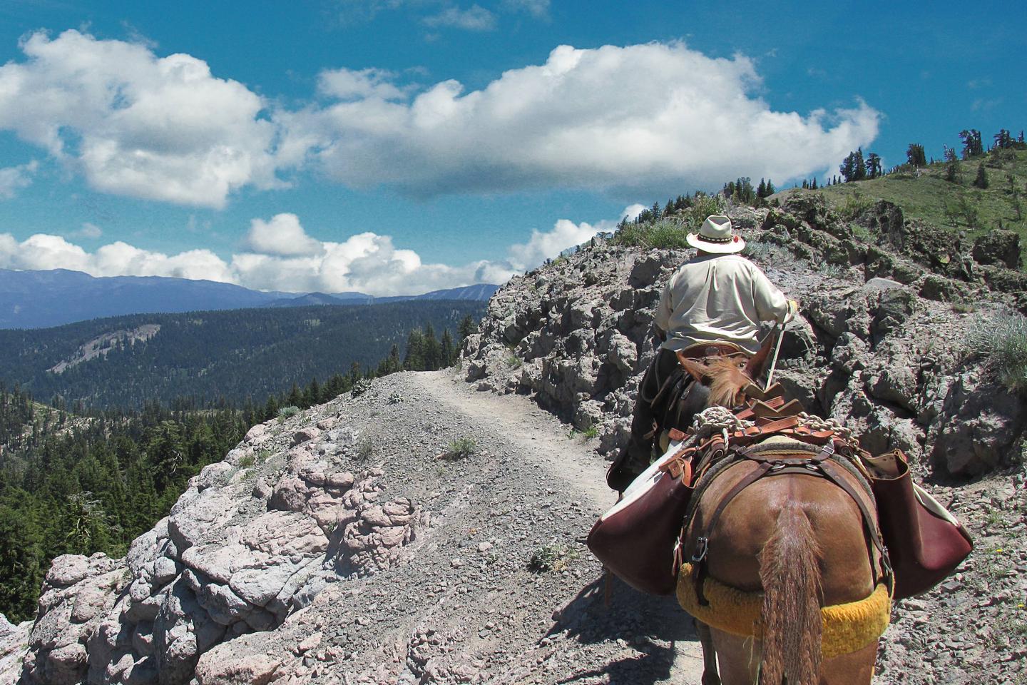
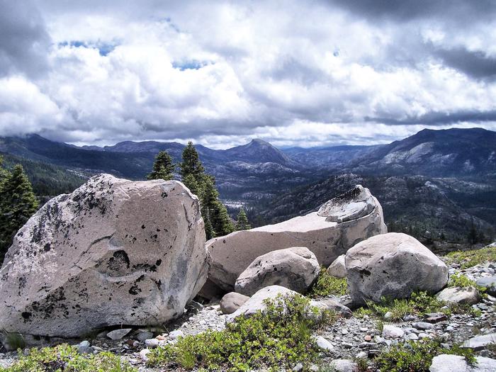
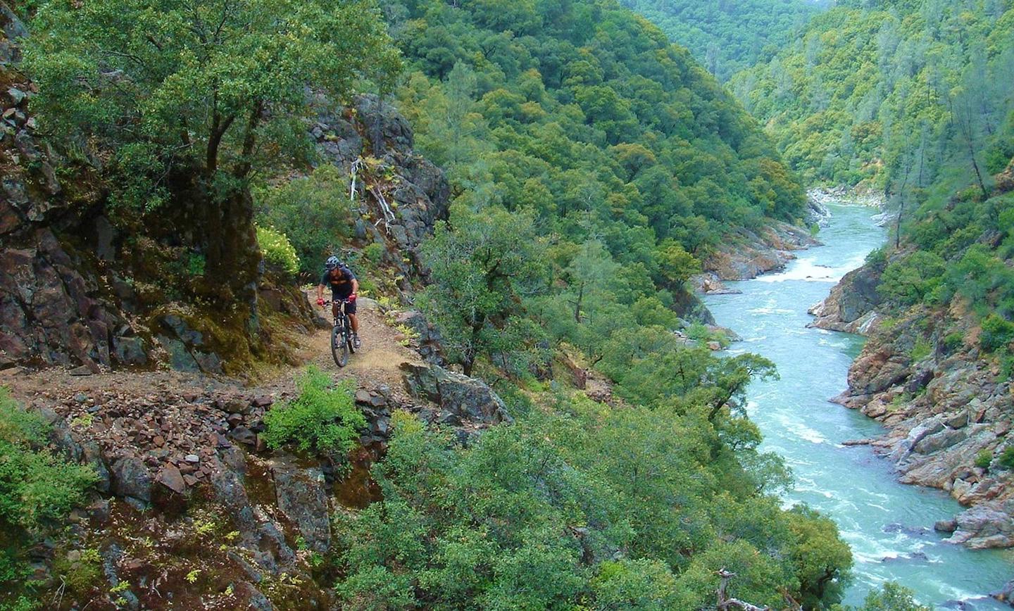
Tahoe National Forest

The Tahoe National Forest is a year-round playground. So come for a visit, relax and rejuvenate with our mountain air!
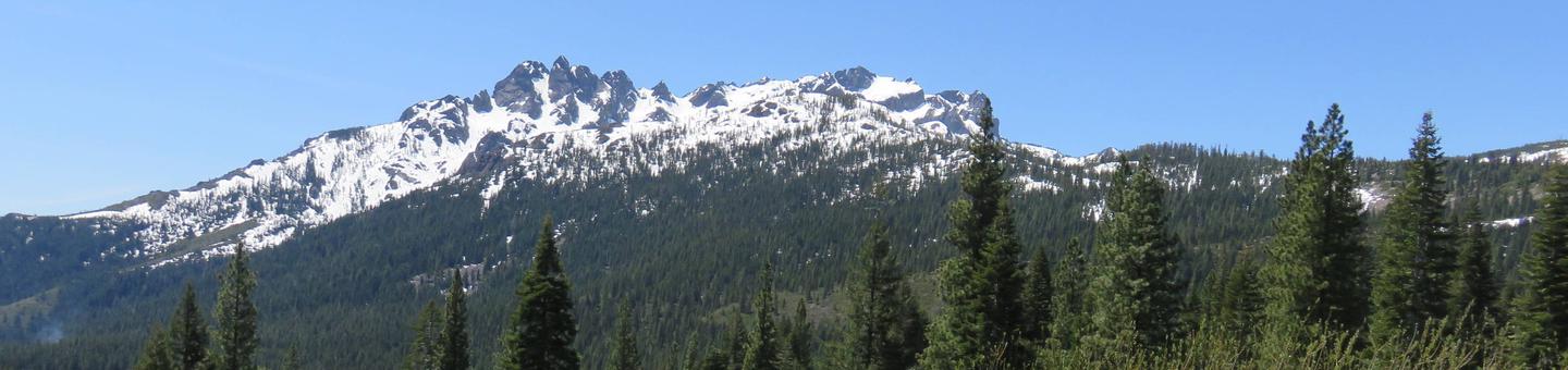
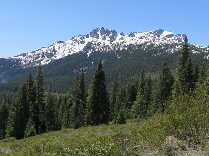
With breathtaking mountain peaks, lush meadows filled with wildflowers, historic mining towns, destination vacation spots at Goodyears Bar, Downieville, Sierra City, Truckee, Yuba River, the Lakes Basin Area and the Jackson Meadows Region, the Tahoe National Forest is one of the most popular recreation forests in the US.
- In winter, there are outstanding winter sports opportunities including world renowned downhill ski areas and extensive snowmobile and cross-country ski trails to experience.
- In the summer, an extensive array of hiking trails (including a portion of the Pacific Crest Trail) , OHV, equestrian and mountain biking trails provide access to many lakes, rivers, and mountain tops.
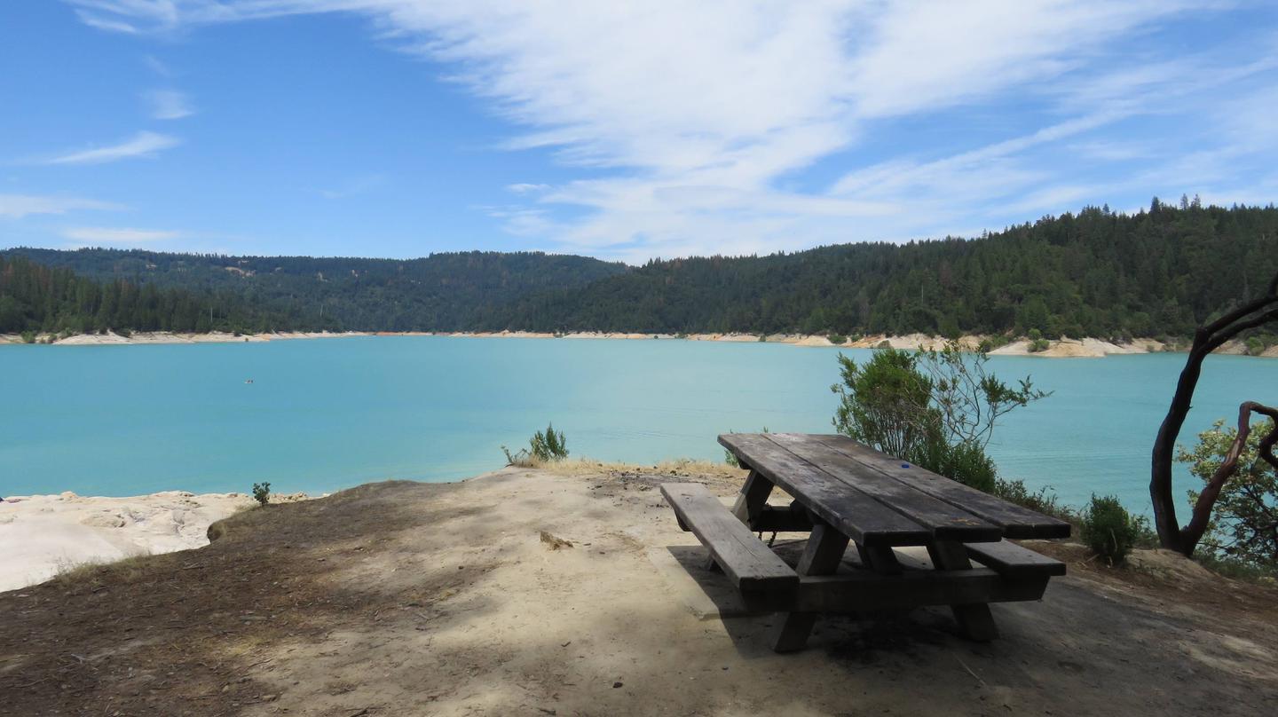
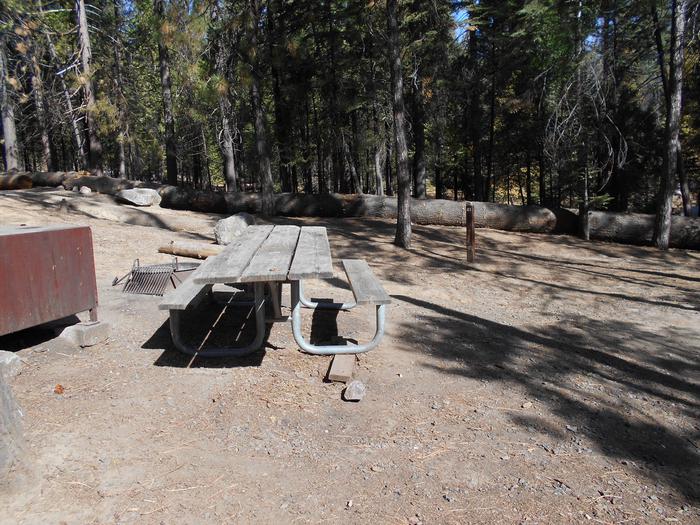
Developed recreation sites including campgrounds, boat ramps, picnic areas, nature trails and even a fire lookout or two that can be rented for overnight occupancy.
Travel Corridors
The recreation information is primarily organized by travel corridor. The main travel corridors are: Interstate 80, Highway 49, Highway 20, Highway 89 (North and South), Foresthill Divide Road, Mosquito Ridge Road, Bowman Road, Marysville Road, and Gold Lakes Road. Activities such as camping and hiking will also have related links to boating, biking, trailheads, parking, and OHV riding in the same corridor.
Accessible Recreation Facilities
Our accessible recreation guide lists facilities and recreation opportunities by Ranger District with features that are accessible for people with disabilities. (Not all locations/facilities listed are 100% accessible.) Because we are continually adding new accessible sites, please call ahead to the Ranger District for more information. The facilities listed meet federal accessibility standards (32-inch minimum width for doorways, adequate room for turning etc).
RecAreaDirections
N/A
Open with Google MapMisc
| Stay Limit | |
| Reservable | false |
| Keywords | |
| Map Link | |
| Contact Phone | |
| Contact Email |
Permits info
Facilities
Ahart Campground Campground
List of CampsitesOverview
Ahart Campground is located on the tree covered banks of the North Fork of the American River near French Meadows Reservoir, about 40 miles from the town of Foresthill, high in the Sierra mountains. Visitors enjoy the area for the rugged mountain beauty, fishing, boating and trail opportunities. This facility is operated and maintained by the Tahoe National Forest.
Natural Features
The campground is near the north shore of French Meadows Reservoir along the banks of the Middle Fork of the American River while nestled in a Coniferous Forest. Summer days can be warm and pleasant with cool evenings.
Dark Day Campground Campground
List of CampsitesOverview
Bullards Bar Reservoir is located on the North Yuba River at an elevation of 2000 feet. It is located approximately 21 miles north of Nevada City, California. It has a maximum surface area of 4,760 acres and a length of over 16 miles and shoreline of more than 60 miles.
Recreation
Activities include wildlife viewing, hiking, mountain biking, horseback riding, camping, fishing, boating, water skiing, and other water sports. Swimming opportunities are limited because of the steep slopes; however boaters will find numerous opportunities for swimming in various locations around the reservoir. The reservoir provides yearlong fishing opportunities for both warm and cold water fish species. Supplies are available at the marina as well as the nearby communities of Camptonville, North San Juan, and Dobbins.
Facilities
Public access for boating and recreation is limited to 2 developed and 1 undeveloped boat launches: the Cottage Creek Boat Launch ramp at Emerald Cove Marina, the Dark Day Boat Launch ramp, and the undeveloped site at the end of Moran Road. The area includes 5 campgrounds, 2 picnic areas, 2 boat launch ramps, 1 marina, 1 overlook, 1 day use area and several developed hiking trails.
Natural Features
The sides of the reservoir are generally steep and public access for boating and recreation is limited. The reservoir is surrounded by both conifer and hardwood forests with numerous brush spieces. There is plenty of shade at the campsites
Nearby Attractions
There is a beautiful non- motorized trail system in the area, with 5 different trails to choose from. Bullards Bar Trailhead is 14 miles, 7 Ball Trial is 1 mile, 8 Ball Trail is 3.8 miles, Rebel Ridge Trail is 1.6 miles and Schoolhouse Trail is 0.7 miles. Maps are available at the North Yuba Ranger Station just a couple miles east of the reservoir on Marysville Road.
Charges & Cancellations
No Show Policy
A no-show customer is one who does not arrive at a campground and does not cancel the reservation by check-out time on the day after the scheduled arrival date (or for day-use facilities, by check-in time the day of arrival).
* No-show customers are only recorded at staffed facilities. At most remote facilities, all customers are noted as automatically checked-in on the date of arrival.
* It is recommended that staffed facilities hold a campsite until check-out time on the day following the arrival date.
* It is recommended that staffed facilities hold group day-use facilities until check-in time on the arrival date.
There is no change fee if a customer extends or shortens a reservation if the change includes dates from the original reservation. If they choose to depart early, they may forfeit some or all of the recreation fees.
There is no change fee if the customer changes campsites that are the same price and on the same reservation dates in the same campground. If the campsite the customer is changing to has a price difference, the customer will be responsible for any additional fees or be provided with a refund, based on the price difference.
Where recorded, no-show customers are assessed a $20.00 no-show fee and forfeit the first night's recreation fee for a campsite or forfeit the entire day-use recreation fee for a day-use facility. We recommend customers contact the facility if they are en route to their reservation but cannot make it by the check-in date. In these cases, no refund will be issued, but the facility can ensure that a "no-show" fee is not assessed.
Garden Point Boat-in Campground Campground
List of CampsitesOverview
Bullards Bar Reservoir is located on the North Yuba River at an elevation of 2000 feet. It is located approximately 21 miles north of Nevada City, California. It has a maximum surface area of 4,760 acres and a length of over 16 miles and shoreline of more than 60 miles.
Recreation
This is a boat-in campground. You can not drive to this campground. You must launch a boat a Dark Day boat launch and boat to the campground. Activities include wildlife viewing, hiking, mountain biking, horseback riding, camping, fishing, boating, water skiing, and other water sports. Swimming opportunities are limited because of the steep slopes; however boaters will find numerous opportunities for swimming in various locations around the reservoir. The reservoir provides yearlong fishing opportunities for both warm and cold water fish species. Supplies are available at the marina as well as the nearby communities of Camptonville, North San Juan, and Dobbins.
Facilities
This is a boat-in campground. You can not drive to this campground. You must launch a boat a Dark Day boat launch and boat to the campground. Public access for boating and recreation is limited to 2 developed and 1 undeveloped boat launches: the Cottage Creek Boat Launch ramp at Emerald Cove Marina (aprox. 3 miles from campground by boat), the Dark Day Boat Launch ramp (aprox. 1 mile from campground by boat), and the undeveloped site at the end of Moran Road. The area includes 5 campgrounds, 2 picnic areas, 2 boat launch ramps, 1 marina, 1 overlook, 1 day use area and several developed hiking trails.
Natural Features
This is a boat-in campground. You can not drive to this campground. You must launch a boat a Dark Day boat launch and boat to the campground. The sides of the reservoir are generally steep and public access for boating and recreation is limited. The reservoir is surrounded by both conifer and hardwood forests with numerous brush species. There is plenty of shade at the campsites
Nearby Attractions
There is a beautiful non- motorized trail system in the area, with 5 different trails to choose from. Bullards Bar Trailhead is 14 miles, 7 Ball Trial is 1 mile, 8 Ball Trail is 3.8 miles, Rebel Ridge Trail is 1.6 miles and Schoolhouse Trail is 0.7 miles. Maps are available at the North Yuba Ranger Station just a couple miles east of the reservoir on Marysville Road.
Charges & Cancellations
No Show Policy
A no-show customer is one who does not arrive at a campground and does not cancel the reservation by check-out time on the day after the scheduled arrival date (or for day-use facilities, by check-in time the day of arrival).
* No-show customers are only recorded at staffed facilities. At most remote facilities, all customers are noted as automatically checked-in on the date of arrival.
* It is recommended that staffed facilities hold a campsite until check-out time on the day following the arrival date.
* It is recommended that staffed facilities hold group day-use facilities until check-in time on the arrival date.
There is no change fee if a customer extends or shortens a reservation if the change includes dates from the original reservation. If they choose to depart early, they may forfeit some or all of the recreation fees.
There is no change fee if the customer changes campsites that are the same price and on the same reservation dates in the same campground. If the campsite the customer is changing to has a price difference, the customer will be responsible for any additional fees or be provided with a refund, based on the price difference.
Where recorded, no-show customers are assessed a $20.00 no-show fee and forfeit the first night's recreation fee for a campsite or forfeit the entire day-use recreation fee for a day-use facility. We recommend customers contact the facility if they are en route to their reservation but cannot make it by the check-in date. In these cases, no refund will be issued, but the facility can ensure that a "no-show" fee is not assessed.
Hornswoggle Group Campground Campground
List of CampsitesOverview
Bullards Bar Reservoir is located on the North Yuba River at an elevation of 2000 feet. It is located approximately 21 miles north of Nevada City, California. It has a maximum surface area of 4,760 acres and a length of over 16 miles and shoreline of more than 60 miles.
Recreation
Activities include wildlife viewing, hiking, mountain biking, horseback riding, camping, fishing, boating, water skiing, and other water sports. Swimming opportunities are limited because of the steep slopes; however boaters will find numerous opportunities for swimming in various locations around the reservoir. The reservoir provides yearlong fishing opportunities for both warm and cold water fish species. Supplies are available at the marina as well as the nearby communities of Camptonville, North San Juan, and Dobbins.
Facilities
Public access for boating and recreation is limited to 2 developed and 1 undeveloped boat launches: the Cottage Creek Boat Launch ramp at Emerald Cove Marina, the Dark Day Boat Launch ramp, and the undeveloped site at the end of Moran Road. The area includes 5 campgrounds, 2 picnic areas, 2 boat launch ramps, 1 marina, 1 overlook, 1 day use area and several developed hiking trails.
Natural Features
The sides of the reservoir are generally steep and public access for boating and recreation is limited. The reservoir is surrounded by both conifer and hardwood forests with numerous brush species. There is plenty of shade at the campsites
Nearby Attractions
There is a beautiful non- motorized trail system in the area, with 5 different trails to choose from. Bullards Bar Trailhead is 14 miles, 7 Ball Trial is 1 mile, 8 Ball Trail is 3.8 miles, Rebel Ridge Trail is 1.6 miles and Schoolhouse Trail is 0.7 miles. Maps are available at the North Yuba Ranger Station just a couple miles east of the reservoir on Marysville Road.
Charges & Cancellations
No Show Policy
A no-show customer is one who does not arrive at a campground and does not cancel the reservation by check-out time on the day after the scheduled arrival date (or for day-use facilities, by check-in time the day of arrival).
* No-show customers are only recorded at staffed facilities. At most remote facilities, all customers are noted as automatically checked-in on the date of arrival.
* It is recommended that staffed facilities hold a campsite until check-out time on the day following the arrival date.
* It is recommended that staffed facilities hold group day-use facilities until check-in time on the arrival date.
There is no change fee if a customer extends or shortens a reservation if the change includes dates from the original reservation. If they choose to depart early, they may forfeit some or all of the recreation fees.
There is no change fee if the customer changes campsites that are the same price and on the same reservation dates in the same campground. If the campsite the customer is changing to has a price difference, the customer will be responsible for any additional fees or be provided with a refund, based on the price difference.
Where recorded, no-show customers are assessed a $20.00 no-show fee and forfeit the first night's recreation fee for a campsite or forfeit the entire day-use recreation fee for a day-use facility. We recommend customers contact the facility if they are en route to their reservation but cannot make it by the check-in date. In these cases, no refund will be issued, but the facility can ensure that a "no-show" fee is not assessed.
Madrone Cove Boat-in Campground Campground
List of CampsitesOverview
Bullards Bar Reservoir is located on the North Yuba River at an elevation of 2000 feet. It is located approximately 21 miles north of Nevada City, California. It has a maximum surface area of 4,760 acres and a length of over 16 miles and shoreline of more than 60 miles.
Recreation
Activities include wildlife viewing, hiking, mountain biking, horseback riding, camping, fishing, boating, water skiing, and other water sports. Swimming opportunities are limited because of the steep slopes; however boaters will find numerous opportunities for swimming in various locations around the reservoir. The reservoir provides yearlong fishing opportunities for both warm and cold water fish species. Supplies are available at the marina as well as the nearby communities of Camptonville, North San Juan, and Dobbins.
Facilities
Public access for boating and recreation is limited to 2 developed and 1 undeveloped boat launches: the Cottage Creek Boat Launch ramp at Emerald Cove Marina (aprox. 6 miles from campground by boat), the Dark Day Boat Launch ramp (aprox. 5 miles from campground by boat), and the undeveloped site at the end of Moran Road. The area includes 5 campgrounds, 2 picnic areas, 2 boat launch ramps, 1 marina, 1 overlook, 1 day use area and several developed hiking trails.
Natural Features
The sides of the reservoir are generally steep and public access for boating and recreation is limited. The reservoir is surrounded by both conifer and hardwood forests with numerous brush species. There is plenty of shade at the campsites
Nearby Attractions
There is a beautiful non- motorized trail system in the area, with 5 different trails to choose from. Bullards Bar Trailhead is 14 miles, 7 Ball Trial is 1 mile, 8 Ball Trail is 3.8 miles, Rebel Ridge Trail is 1.6 miles and Schoolhouse Trail is 0.7 miles. Maps are available at the North Yuba Ranger Station just a couple miles east of the reservoir on Marysville Road.
Charges & Cancellations
No Show Policy
A no-show customer is one who does not arrive at a campground and does not cancel the reservation by check-out time on the day after the scheduled arrival date (or for day-use facilities, by check-in time the day of arrival).
* No-show customers are only recorded at staffed facilities. At most remote facilities, all customers are noted as automatically checked-in on the date of arrival.
* It is recommended that staffed facilities hold a campsite until check-out time on the day following the arrival date.
* It is recommended that staffed facilities hold group day-use facilities until check-in time on the arrival date.
There is no change fee if a customer extends or shortens a reservation if the change includes dates from the original reservation. If they choose to depart early, they may forfeit some or all of the recreation fees.
There is no change fee if the customer changes campsites that are the same price and on the same reservation dates in the same campground. If the campsite the customer is changing to has a price difference, the customer will be responsible for any additional fees or be provided with a refund, based on the price difference.
Where recorded, no-show customers are assessed a $20.00 no-show fee and forfeit the first night's recreation fee for a campsite or forfeit the entire day-use recreation fee for a day-use facility. We recommend customers contact the facility if they are en route to their reservation but cannot make it by the check-in date. In these cases, no refund will be issued, but the facility can ensure that a "no-show" fee is not assessed.
Schoolhouse Campground (CA) Campground
List of CampsitesOverview
Bullards Bar Reservoir is located on the North Yuba River at an elevation of 2000 feet. It is located approximately 21 miles north of Nevada City, California. It has a maximum surface area of 4,760 acres and a length of over 16 miles and shoreline of more than 60 miles.
Recreation
Activities include wildlife viewing, hiking, mountain biking, horseback riding, camping, fishing, boating, water skiing, and other water sports. Swimming opportunities are limited because of the steep slopes; however boaters will find numerous opportunities for swimming in various locations around the reservoir. The reservoir provides yearlong fishing opportunities for both warm and cold water fish species. Supplies are available at the marina as well as the nearby communities of Camptonville, North San Juan, and Dobbins.
Facilities
Public access for boating and recreation is limited to 2 developed and 1 undeveloped boat launches: the Cottage Creek Boat Launch ramp at Emerald Cove Marina, the Dark Day Boat Launch ramp, and the undeveloped site at the end of Moran Road. The area includes 5 campgrounds, 2 picnic areas, 2 boat launch ramps, 1 marina, 1 overlook, 1 day use area and several developed hiking trails.
Natural Features
The sides of the reservoir are generally steep and public access for boating and recreation is limited. The reservoir is surrounded by both conifer and hardwood forests with numerous brush species. There is plenty of shade at the campsites
Nearby Attractions
There is a beautiful non- motorized trail system in the area, with 5 different trails to choose from. Bullards Bar Trailhead is 14 miles, 7 Ball Trial is 1 mile, 8 Ball Trail is 3.8 miles, Rebel Ridge Trail is 1.6 miles and Schoolhouse Trail is 0.7 miles. Maps are available at the North Yuba Ranger Station just a couple miles east of the reservoir on Marysville Road.
Charges & Cancellations
No Show Policy
A no-show customer is one who does not arrive at a campground and does not cancel the reservation by check-out time on the day after the scheduled arrival date (or for day-use facilities, by check-in time the day of arrival).
* No-show customers are only recorded at staffed facilities. At most remote facilities, all customers are noted as automatically checked-in on the date of arrival.
* It is recommended that staffed facilities hold a campsite until check-out time on the day following the arrival date.
* It is recommended that staffed facilities hold group day-use facilities until check-in time on the arrival date.
There is no change fee if a customer extends or shortens a reservation if the change includes dates from the original reservation. If they choose to depart early, they may forfeit some or all of the recreation fees.
There is no change fee if the customer changes campsites that are the same price and on the same reservation dates in the same campground. If the campsite the customer is changing to has a price difference, the customer will be responsible for any additional fees or be provided with a refund, based on the price difference.
Where recorded, no-show customers are assessed a $20.00 no-show fee and forfeit the first night's recreation fee for a campsite or forfeit the entire day-use recreation fee for a day-use facility. We recommend customers contact the facility if they are en route to their reservation but cannot make it by the check-in date. In these cases, no refund will be issued, but the facility can ensure that a "no-show" fee is not assessed.
Cottage Creek Campground (CA) Campground
List of CampsitesOverview
Cottage Creek is a new campground with all new amendities. It has double and triple sites. It has a beautiful view of the Bullards Bar Reservior.
Recreation
Activities include wildlife viewing, hiking, mountain biking, horseback riding, camping, fishing, boating, water skiing, and other water sports. Swimming opportunities are limited because of the steep slopes; however boaters will find numerous opportunities for swimming in various locations around the reservoir. The reservoir provides yearlong fishing opportunities for both warm and cold water fish species. Supplies are available at the marina as well as the nearby communities of Camptonville, North San Juan, and Dobbins.
Facilities
Public access for boating and recreation is limited to 2 developed and 1 undeveloped boat launches: the Cottage Creek Boat Launch ramp at Emerald Cove Marina, the Dark Day Boat Launch ramp, and the undeveloped site at the end of Moran Road. The area includes 6 campgrounds, 2 picnic areas, 2 boat launch ramps, 1 marina, 1 overlook, 1 day use area and several developed hiking trails.
Natural Features
The sides of the reservoir are generally steep and public access for boating and recreation is limited. The reservoir is surrounded by both conifer and hardwood forests with numerous brush spieces. There is plenty of shade at the campsites
Nearby Attractions
There is a beautiful non- motorized trail system in the area, with 5 different trails to choose from. Bullards Bar Trailhead is 14 miles, 7 Ball Trial is 1 mile, 8 Ball Trail is 3.8 miles, Rebel Ridge Trail is 1.6 miles and Schoolhouse Trail is 0.7 miles. Maps are available at the North Yuba Ranger Station just a couple miles east of the reservoir on Marysville Road.
Charges & Cancellations
No Show Policy
A no-show customer is one who does not arrive at a campground and does not cancel the reservation by check-out time on the day after the scheduled arrival date (or for day-use facilities, by check-in time the day of arrival).
* No-show customers are only recorded at staffed facilities. At most remote facilities, all customers are noted as automatically checked-in on the date of arrival.
* It is recommended that staffed facilities hold a campsite until check-out time on the day following the arrival date.
* It is recommended that staffed facilities hold group day-use facilities until check-in time on the arrival date.
There is no change fee if a customer extends or shortens a reservation if the change includes dates from the original reservation. If they choose to depart early, they may forfeit some or all of the recreation fees.
There is no change fee if the customer changes campsites that are the same price and on the same reservation dates in the same campground. If the campsite the customer is changing to has a price difference, the customer will be responsible for any additional fees or be provided with a refund, based on the price difference.
Where recorded, no-show customers are assessed a $20.00 no-show fee and forfeit the first night's recreation fee for a campsite or forfeit the entire day-use recreation fee for a day-use facility. We recommend customers contact the facility if they are en route to their reservation but cannot make it by the check-in date. In these cases, no refund will be issued, but the facility can ensure that a "no-show" fee is not assessed.
PROSSER RANCH GROUP Campground
List of CampsitesOverview
Prosser Ranch Group Campground is located on the picturesque Prosser Reservoir, within the Tahoe National Forest, about 10 minutes north of Truckee. Visitors enjoy the area for its boating, kayaking, swimming, fishing and abundant hiking and off-road trails.Recreation
Prosser Reservoir is a popular location for kayaking, swimming and fishing. Power boating is allowed but a 10-mph speed limit is enforced. A boat ramp is located on-site. The surrounding area offers many hiking, biking, horseback riding and off-road vehicle trails.Facilities
The campground offers one large-group, tent-only campsite, that can accommodate up to 50 people and 10 vehicles. The site is not suitable for RV camping. Picnic and serving tables, a large BBQ, and a campfire circle are provided, along with vault toilets and drinking water.Natural Features
The campground is situated on the western shore of the reservoir. A scenic forest of Jeffrey pine and fir trees covers the area, while sagebrush dots the forest floor. The site affords views of the reservoir and the surrounding mountains can be seen through the trees.Nearby Attractions
Boca Reservoir is 30 minutes east of the campground, offering additional boating, water skiing, swimming and fishing opportunities. Truckee, 10 minutes south, offers all the amenities of a year round recreational mountain town including Interstate highway connectivitiy, top notch restaraunts, resorts and hotels, grocery stores, gas stations, shopping, and historic sites, Lake Tahoe is located 30 minutes south and offers excellent boating, kayaking, fishing, hiking and scenic driving opportunities, as well as dining, shopping and lodging options. Other recreational opportunities include Donner Camp Interpretive Trail, Overland Emigrant Commemorative Trial, Stampede Reservoir Recreation Area, Prosser Pits OHV area, and numerous hiking, mountain biking, and OHV trails.COYOTE GROUP Campground
List of CampsitesOverview
Coyote Group Campground is located on the northeast end of French Meadows Reservoir, near the Middle Fork of American River. The facility is located in a remote area approximately 40 miles from Foresthill. Visitors enjoy the area for its fishing, boating and trail opportunities. This campground is operated and maintained by the Tahoe National Forest.Recreation
The Middle Fork of American River provides visitors with ample opportunities for fishing and swimming. Popular activities on the nearby reservoir include boating, canoeing, fishing and swimming. Two boat ramps are located within three miles of the campground. A variety of hiking and biking trails are found in the surrounding area, including some that provide access to the nearby Granite Chief Wilderness and The Western States Trail. Just down the road is the Granite Chief Wilderness which provides amazing hiking opportunities for adventurous party to explore historic aspen tree stands and secluded mountain passes and trail. The Western States Trail provides great opportunity for hiking, horesback riding, dirt biking, and for adventurous mountain bikers.Facilities
The campground offers four group campsites. The Black Bear site is accessible and can accommodate up to 50 people. Brush Wolf, Little Wolf and Prairie Wolf sites can accommodate up to 25 people each. Multiple picnic tables, campfire circles and grills are provided. Vault toilets and drinking water are available throughout the campground.Natural Features
The campground is situated near the river, just north of French Meadows Reservoir. A coniferous forest covers the area. At an elevation of 5,200 feet, summertime temperatures are warm throughout the day and cool at night.FORBES CREEK Campground
List of CampsitesOverview
Forbes Creek Group Campground is located near the southeast shore of Sugar Pine Reservoir in the Tahoe National Forest. Visitors enjoy the area for its fishing, canoeing and hiking opportunities. This facility is operated and maintained by the Tahoe National Forest.Recreation
Fishing, canoeing, swimming and boating are popular activities on the reservoir. A trail system for walking and non-motorized biking connects the two group sites at the campground, to the lake and nearby boat ramp. The North Fork of the American River is nearby, offering opportunities for additional fishing and swimming. Many miles of hiking, biking and off-road vehicle trails are in the surrounding area.Facilities
The campground offers two group campsites, Madrone and Rocky Ridge. Each site can accommodate up to 50 people and 18 vehicles. Both sites are equipped with a central cooking and picnic area, with a large campfire circle and multiple tables. RVs, trailers and tents are allowed within the campground. An unloading area and accessible parking are available within the campground.Natural Features
The 160-acre Sugar Pine Reservoir sits at an elevation of 3,600 feet. Stands of cedar and ponderosa pine provides ample shade in the campground, which overlooks the reservoir. Summertime temperatures are warm during the day and cool at night.FRENCH MEADOWS Campground
List of CampsitesOverview
French Meadows Campground is located along the shores French Meadows Reservoir, about 40 miles from the town of Foresthill. Visitors enjoy the area for its fishing, boating and trail opportunities. This facility is operated and maintained by the Tahoe National Forest.Recreation
Popular activities on the reservoir include boating, canoeing, fishing and swimming. A boat ramp is located adjacent to the campground. The North Fork American River can be accessed nearby and provides additional opportunities for fishing and swimming. A variety of hiking and biking trails are found in the surrounding area, including some that provide access to the nearby Granite Chief Wilderness and The Western States Trail. Just down the road is the Granite Chief Wilderness which provides amazing hiking opportunities for an adventurous party to explore historic aspen trees and secluded mountain passes and trails. The Western States Trail provides great opporunity for hiking, horse back riding, dirt biking, and for adventurous mountain bikers.Facilities
The campground offers single-family campsites, a few of which are wheel chair accessible. Each site is equipped with a picnic table, fire ring and food locker. Flush and vault toilets as well as drinking water are provided. Roads and parking spurs are paved. Several campsites are available on a first-come, first-served basis.Natural Features
The campground sits on the southern shore of French Meadows Reservoir, in a pine/fir forest. Summer days can be hot, but evenings are usually cool.GATES GROUP Campground
List of CampsitesOverview
Gates Group Campground is located on the North Fork American River, at the north end of the French Meadows Reservoir in the Tahoe National Forest. It is 40 miles from the town of Foresthill. Visitors enjoy the area for its fishing, boating and trail opportunities.Recreation
The North Fork American River provides fishing and swimming. The reservoir can be accessed nearby. Popular activities include boating, canoeing, fishing and swimming. Two boat ramps are located within three miles of the campground. A variety of hiking and biking trails are found in the surrounding area, including some that provide access to the nearby Granite Chief Wilderness. Just down the road is the Granite Chief Wilderness which provides amazing hiking opportunities for an adventurous party to explore historic aspen trees and secluded mountain passes and trails. The Western States Trail provides great opportunity for hiker, horseback riders, dirt bikers, and for adventurous maintain bikers.Facilities
The campground offers three group campsites. Two sites can accommodate up to 25 people and eight vehicles each. Another group site can accommodates up to 75 people and 25 vehicles.Picnic tables, campfire circles and grills are provided, as are vault toilets and drinking water.
Natural Features
The campground is situated along the river, just north of French Meadows Reservoir. A coniferous forest covers the area. At an elevation of 5200 feet, summertime temperatures are warm in the day and cool at night.HAMPSHIRE ROCKS Campground
List of CampsitesOverview
Hampshire Rocks Campground is located in the Tahoe National Forest on the banks of the South Yuba River, near the Rainbow/Big Bend exit along Interstate 80. Visitors enjoy the area for its cool temperatures, access to the South Yuba River, fishing, and trail opportunities, as well as its historic significance along the California Emigrant Trail. This facility is operated and maintained by the Tahoe National Forest.Recreation
The South Yuba River offers swimming, and rainbow trout fishing. The surrounding area offers hiking, road biking, mountain biking, and off-road vehicle trails. The historic California Emigrant Trail passes through the campground.Facilities
The campground offers single-family campsites, a few of which are designated for tent camping only. Each site is equipped with a picnic table and campfire ring. Vault toilets and drinking water are provided.Natural Features
The campground is situated on the north bank of the upper South Yuba River in a forest of lodgepole pines. Some sites are adjacent to the river, which flows gently through this particular area.Nearby Attractions
Donner Lake is located 14 miles east of the campground via Historic Route 40/Lincoln Highway, known as the nation's first transcontinental highway. Many points of interest lie along Route 40, including China Wall, Rainbow Bridge, Sugar Bowl, Lake Van Norden and Ice Lakes. Other attractions include Donner Summit PCT, Loch Leven, and Castle Peak Trailheads, Fordyce 4x4 jeep trail, and Grouse Ridge Non-Motorized Area.Charges & Cancellations
No Show Policy
A no-show customer is one who does not arrive at a campground and does not cancel the reservation by check-out time on the day after the scheduled arrival date (or for day-use facilities, by check-in time the day of arrival).
* No-show customers are only recorded at staffed facilities. At most remote facilities, all customers are noted as automatically checked-in on the date of arrival.
* It is recommended that staffed facilities hold a campsite until check-out time on the day following the arrival date.
* It is recommended that staffed facilities hold group day-use facilities until check-in time on the arrival date.
There is no change fee if a customer extends or shortens a reservation if the change includes dates from the original reservation. If they choose to depart early, they may forfeit some or all of the recreation fees.
There is no change fee if the customer changes campsites that are the same price and on the same reservation dates in the same campground. If the campsite the customer is changing to has a price difference, the customer will be responsible for any additional fees or be provided with a refund, based on the price difference.
Where recorded, no-show customers are assessed a $20.00 no-show fee and forfeit the first night's recreation fee for a campsite or forfeit the entire day-use recreation fee for a day-use facility. We recommend customers contact the facility if they are en route to their reservation but cannot make it by the check-in date. In these cases, no refund will be issued, but the facility can ensure that a "no-show" fee is not assessed.
TUNNEL MILLS II Campground
List of CampsitesOverview
Tunnel Mills Group Campground is located along the East Fork of the North Fork of the North Fork American River in the Tahoe National Forest. It can be accessed off of Interstate 80, at the Emigrant Gap exit. Visitors enjoy fishing, hiking and hunting in this scenic area.Recreation
Rainbow trout fishing is a popular activity on the river. Hiking and OHV trails and hunting opportunities are found in the surrounding area.Facilities
The campground offers two group sites that can accommodate up to 30 people and six vehicles each. Site 1 is for tent and RV camping, while site 2 is designated for tent camping only. Picnic tables and campfire rings are provided, as are vault toilets.Natural Features
The campground is near the creek-sized East Fork of the North Fork of the North Fork American River, in a remote location of north central California. A forest of cedar, pine and fir trees shades the campground.Nearby Attractions
Many hiking, and OHV trails are located nearby as well as foot trail access into the North Fork American Wild and Scenic River canyon. Many more trails can be found a short distance east on Interstate 80 at Grouse Ridge Non-Motorized Area and Donner Summit.Charges & Cancellations
No Show Policy
A no-show customer is one who does not arrive at a campground and does not cancel the reservation by check-out time on the day after the scheduled arrival date (or for day-use facilities, by check-in time the day of arrival).
* No-show customers are only recorded at staffed facilities. At most remote facilities, all customers are noted as automatically checked-in on the date of arrival.
* It is recommended that staffed facilities hold a campsite until check-out time on the day following the arrival date.
* It is recommended that staffed facilities hold group day-use facilities until check-in time on the arrival date.
There is no change fee if a customer extends or shortens a reservation if the change includes dates from the original reservation. If they choose to depart early, they may forfeit some or all of the recreation fees.
There is no change fee if the customer changes campsites that are the same price and on the same reservation dates in the same campground. If the campsite the customer is changing to has a price difference, the customer will be responsible for any additional fees or be provided with a refund, based on the price difference.
Where recorded, no-show customers are assessed a $20.00 no-show fee and forfeit the first night's recreation fee for a campsite or forfeit the entire day-use recreation fee for a day-use facility. We recommend customers contact the facility if they are en route to their reservation but cannot make it by the check-in date. In these cases, no refund will be issued, but the facility can ensure that a "no-show" fee is not assessed.
WHITE CLOUD Campground
List of CampsitesOverview
White Cloud Campground is located in the Tahoe National Forest along Highway 20 near Nevada City. The area provides a great escape from urban life.Recreation
The Pioneer Trail stretches 25 miles through the Tahoe National Forest and can be accessed from the campground. The popular path was designated a National Recreation Trail in 2003. Horseback riding, hiking, mountain biking and cross-country skiing are favorite activities on this popular trail.Facilities
The campground offers several single-family sites, a few of which are designated for tent camping only as well as one double site. Each site is equipped with a picnic table and campfire ring. Flush toilets and drinking water are provided.Natural Features
The campground is situated in a forest of cedar, pine, and Douglas fir trees, at an elevation of 4,200 feet.Nearby Attractions
White Cloud Campground is located on the Highway 20 portion of the Yuba Donner Scenic Byway near many gold rush era historical sites and old mining towns such as Washington and Nevada City. Nevada City, about 14 miles west, is a scenic historical mining town with many historical attractions, top notch restaraunts, various lodging options, shopping, and stores for everything you may need. Other attractions include the Pioneer Trail, South Yuba River, Washintong Scenic Overlook, Alpha and Omega Scenic Overlook and Interpretive Trail, Rock Creek Nature Trail, Chalk Bluff OHV trails, and Grouse Ridge Non-Motorized Area.Charges & Cancellations
No Show Policy
A no-show customer is one who does not arrive at a campground and does not cancel the reservation by check-out time on the day after the scheduled arrival date (or for day-use facilities, by check-in time the day of arrival).
* No-show customers are only recorded at staffed facilities. At most remote facilities, all customers are noted as automatically checked-in on the date of arrival.
* It is recommended that staffed facilities hold a campsite until check-out time on the day following the arrival date.
* It is recommended that staffed facilities hold group day-use facilities until check-in time on the arrival date.
There is no change fee if a customer extends or shortens a reservation if the change includes dates from the original reservation. If they choose to depart early, they may forfeit some or all of the recreation fees.
There is no change fee if the customer changes campsites that are the same price and on the same reservation dates in the same campground. If the campsite the customer is changing to has a price difference, the customer will be responsible for any additional fees or be provided with a refund, based on the price difference.
Where recorded, no-show customers are assessed a $20.00 no-show fee and forfeit the first night's recreation fee for a campsite or forfeit the entire day-use recreation fee for a day-use facility. We recommend customers contact the facility if they are en route to their reservation but cannot make it by the check-in date. In these cases, no refund will be issued, but the facility can ensure that a "no-show" fee is not assessed.
YUBA PASS CAMPGROUND Campground
List of CampsitesOverview
Yuba Pass Campground is located in the North Yuba River area, atop Yuba Pass on Highway 49. Visitors enjoy a wide variety of recreational activities in the area, including birding, hiking, biking, hunting, and fishing. This facility is operated and maintained by the Tahoe National ForestRecreation
Bird watching is a favorite activity on Yuba Pass. The peaceful and scenic surroundings attract a wide variety of birds, including sandhill cranes, hermit warblers, black-backed woodpeckers, sapsuckers, calliope hummingbirds, sooty grouse, northern pygmy-owls, mountain quail, bald eagles, osprey, hawks and geese. A large network of trails is available in the area, including the Pacific Crest Trail in the Lakes Basin area.Facilities
The campground offers several single-family campsites. Each site is equipped with a picnic table and campfire ring. Vault toilets and drinking water are provided.Natural Features
A forest of old-growth red fir provides ample shade for campsites. A variety of wildlife make its home in the area.Nearby Attractions
Yuba Pass Campground is located on the Yuba Donner Scenic Byway (Highway 49) near many gold rush era historical sites and scenic mountain vistas. Many points of interest lie along Highway 49 and are part of the 49 miles of Highway 49 driving tour; look for interpretive signs and other historical sites along this tour route. Gold Lakes Basin offers boating, fishing, biking, and hiking. Boating, fishing and swimming are available at nearby Sardine Lakes, about nine miles west of the campground. Sardine Lakes Resort offers boat rentals. Anglers will find rainbow and brook trout in many of the lakes, streams, and rivers throughout the basin. Over 30 miles of maintained trails for hiking, mountain biking, and motorcycle singletrack branch out across the area and the Pacific Crest Trail can be accessed at a few spots in the Lakes Basin area. The historic towns of Sierra City and Sierraville offer historic and cultural attractions, restaurants, shops, churches, and vistor information.Charges & Cancellations
No Show Policy
A no-show customer is one who does not arrive at a campground and does not cancel the reservation by check-out time on the day after the scheduled arrival date (or for day-use facilities, by check-in time the day of arrival).
* No-show customers are only recorded at staffed facilities. At most remote facilities, all customers are noted as automatically checked-in on the date of arrival.
* It is recommended that staffed facilities hold a campsite until check-out time on the day following the arrival date.
* It is recommended that staffed facilities hold group day-use facilities until check-in time on the arrival date.
There is no change fee if a customer extends or shortens a reservation if the change includes dates from the original reservation. If they choose to depart early, they may forfeit some or all of the recreation fees.
There is no change fee if the customer changes campsites that are the same price and on the same reservation dates in the same campground. If the campsite the customer is changing to has a price difference, the customer will be responsible for any additional fees or be provided with a refund, based on the price difference.
Where recorded, no-show customers are assessed a $20.00 no-show fee and forfeit the first night's recreation fee for a campsite or forfeit the entire day-use recreation fee for a day-use facility. We recommend customers contact the facility if they are en route to their reservation but cannot make it by the check-in date. In these cases, no refund will be issued, but the facility can ensure that a "no-show" fee is not assessed.
GOOSE MEADOWS Campground
List of CampsitesOverview
Goose Meadow Campground is located along the Truckee River adjacent to Highway 89, about half-way between Tahoe City and Truckee. Visitors enjoy the area for its fishing and hiking opportunities, as well as its proximity to Lake Tahoe and Squaw Valley. This facility is operated and maintained by the Tahoe National Forest.Recreation
Fly-fishing for rainbow trout in the Truckee River is a popular activity enjoyed by visitors to the campground. Campers also enjoy swimming and tubing. The surrounding area offers hiking and biking trails, including the Western States Trail, Five Lakes Trail, and Pacific Crest Trail.Facilities
The campground offers single-family campsites, each equipped with a picnic table and campfire ring with grill. Vault toilets and drinking water are provided.Natural Features
The campground is situated on the banks of the Truckee River. A scenic forest of lodgepole pine and fir trees covers the area.Nearby Attractions
Goose Meadow Campground is centrally located between the Prosser, Boca and Stampede reservoirs to the north, and Lake Tahoe and Squaw Valley to the south. A variety of outdoor recreational activities are available at each location. Truckee, 10 minutes north, offers all the amenities of a year round recreational mountain town including interstate highway connectivity, top notch restaurants, resorts and hotels, grocery stores, gas stations, shopping, and historic sites. Lake Tahoe is located 30 minutes south and offers excellent boating, kayaking, fishing, hiking and scenic driving opportunities, as well as dining, shopping and lodging options. Other recreational opportunities include Donner Camp Interpretive Trail, Overland Emigrant Commemorative Trail, Stampede Reservoir Recreation Area, Prosser Pits OHV area, and numerous hiking, mountain biking, and OHV trails.FIR TOP CAMPGROUND Campground
List of CampsitesOverview
Fir Top Campground is located alongside the scenic Jackson Meadow Reservoir, in the Tahoe National Forest. The location, part of the Woodcamp Recreation Area, makes a great base camp for a wide range of recreational activities available in the surrounding area, including boating, fishing, hiking and hunting. Fir Top Campground is operated by Nevada Irrigation District in cooperation with the Tahoe National ForestRecreation
The reservoir offers excellent opportunities for boating, canoeing, water skiing, swimming and fishing. Anglers will find rainbow and brown trout. A boat ramp and designated swim beach are located within the recreation area. A half-mile interpretive nature trail wanders through the adjacent Woodcamp Campground. A portion of the Pacific Crest Trail meanders along the east side of the lake. Hunting and biking are popular activities in the surrounding area.Facilities
The campground offers single-family campsites, each equipped with a picnic table and campfire ring. Flush toilets and drinking water are provided.Natural Features
Jackson Meadow Reservoir is situated in a rolling forested valley, where visitors are awarded beautiful views of the Sierra Crest and English Mountain. The campground lies on the western shore in a forest of pine and fir trees.contact_info
For facility specific information, please call (530) 994-3401.FINDLEY CAMPGROUND Campground
List of CampsitesOverview
Findley Campground is located alongside the scenic Jackson Meadow Reservoir in the Tahoe National Forest. The location, part of the Woodcamp Recreation Area, makes a great base camp for a wide range of recreational activities found in the surrounding area, including boating, fishing, hiking and hunting. Findley Campground is operated by Nevada Irrigation District in cooperation with the Tahoe National Forest.Recreation
The reservoir offers excellent opportunities for boating, canoeing, water skiing, swimming and fishing. Anglers will find rainbow and brown trout. A boat ramp and designated swim beach are located within the Woodcamp Recreation Area.A half-mile interpretive nature trail wanders through adjacent Woodcamp Campground. A portion of the Pacific Crest Trail meanders along the east side of the lake. Hunting and biking are popular activities in the surrounding area.
Facilities
The campground offers single-family campsites, each equipped with a picnic table and campfire ring. Flushing toilets and drinking water are provided.Natural Features
Jackson Meadow Reservoir is situated in a rolling forested valley, where visitors are awarded beautiful views of the Sierra Crest and English Mountain. The campground lies on the western shore of the lake, in a forest of pine and fir trees.contact_info
For facility specific information, please call (530) 994-3401.WOODCAMP CAMPGROUND Campground
List of CampsitesOverview
Woodcamp Campground is located on the scenic Jackson Meadow Reservoir, in the Tahoe National Forest. Its location, part of the Woodcamp Recreation Area, provides a great base camp for a wide range of recreational activities, including boating, fishing, hiking. Woodcamp Campground is operated by Nevada Irrigation District in cooperation with the Tahoe National Forest.Recreation
Jackson Meadow Reservoir offers excellent opportunities for boating, canoeing, water skiing, swimming and fishing. Anglers will find rainbow and brown trout. A boat ramp and designated swim beach are located within the recreation area.A half-mile interpretive nature trail wanders through the campground. A portion of the Pacific Crest Trail meanders along the east side of the lake. Hunting and biking are popular activities in the surrounding area.
Facilities
The campground offers several single-family campsites, each equipped with a picnic table and campfire ring. Flush and vault toilets and drinking water are provided.Natural Features
Jackson Meadow Reservoir is situated in a rolling forested valley, where visitors are awarded beautiful views of the Sierra Crest and English Mountain. The campground lies on the western shore in a forest of pine and fir trees.contact_info
For facility specific information, please call (530) 994-3401.Nearby Attractions
Grouse Ridge Non-Motorized area, Bowman corridor lakes, camping, and hiking. PCT access on the east side of the lake.PASS CREEK CAMPGROUND Campground
List of CampsitesOverview
Pass Creek Campground is located on scenic Jackson Meadow Reservoir, in the Tahoe National Forest. Its location provides a great base camp for a wide range of recreational activities, including boating, fishing, hiking and hunting. Pass Creek Campground is operated by Nevada Irrigation Distriict in cooperation with the Tahoe National Forest.Recreation
Jackson Meadow Reservoir offers excellent opportunities for boating, canoeing, water skiing, swimming and fishing. Anglers will find rainbow and brown trout. A boat ramp is located at Pass Creek Campground. A designated swim beach is nearby.A portion of the Pacific Crest Trail meanders along the east side of the lake. Hunting and biking are popular activities in the surrounding area.
Facilities
The campground offers several single-family campsites, each equipped with a picnic table and campfire ring. Flushing and Vault toilets and drinking water are provided.Natural Features
Jackson Meadow Reservoir is situated in a rolling forested valley, where visitors are awarded beautiful views of the Sierra Crest and English Mountain. The campground lies on the northeastern shore in a dense forest of pine and fir trees.Nearby Attractions
Grouse Ridge Non-Motorized area, Bowman corridor lakes, camping, and hiking. PCT access on the east side of the lake.contact_info
For facility specific information, please call (530) 994-3401.EAST MEADOW CAMPGROUND Campground
List of CampsitesOverview
East Meadow Campground is located alongside the scenic Jackson Meadow Reservoir, in the Tahoe National Forest. Its location provides for a great base camp, allowing visitors to enjoy a wide range of recreational activities, including boating, fishing, hiking and hunting. East Meadow Campground is operated by Nevada Irrigation District in cooperation with the Tahoe National ForestRecreation
The adjacent 1,000-acre lake offers excellent opportunities for boating, canoeing, water skiing, swimming and fishing. Anglers will find rainbow and brown trout. A boat ramp is located at Pass Creek Campground. A designated swim beach is nearby. The lake is an irrigation source, meaning its level will drop as the season progresses.A portion of the Pacific Crest Trail meanders along the east side of the lake. It is open to hiking and horseback riding and provides opportunities for viewing wildlife. Hunting and biking are popular activities in the surrounding area.
Facilities
The campground offers single- and double-family campsites, each equipped with a picnic table and campfire ring. Flushing and Vault toilets and drinking water are also provided.Natural Features
Jackson Meadow Reservoir is situated in a rolling forested valley, where visitors are awarded beautiful views of the Sierra Crest and English Mountain. The campground lies on the northeastern shore of the lake, in a forest of pine and fir trees. Some sites have a view of the lake, and boats can be moored nearby.contact_info
For facility specific information, please call (530) 994-3401.LOGGER CAMPGROUND Campground
List of CampsitesOverview
Logger Campground sits on beautiful Stampede Reservoir on the Tahoe National Forest, 30 minutes from Truckee, Calif. Visitors enjoy the area for its boating, fishing and abundant hiking and off-road trails. This facility is operated and maintained by the Tahoe National Forest.Recreation
Boating, water skiing, swimming and fishing are popular activities on the reservoir. Anglers will find rainbow and brown trout and kokanee salmon. A boat ramp is located on-site. Many miles of hiking and off-road vehicle trails crisscross the surrounding area. The nearby Commemorative Emigrant Trail is open to hiking and mountain biking.Facilities
This large campground offers over 200 single, double, and triple family campsites. Campsites are arranged in six loops: Cross Cut (1-60), Iron Ox (61-115), Steam Donkey (116-161), Whistle Punk (162-187), Ox Bow (188-209), and Double Bit (210-252). Picnic tables and campfire rings with grills are provided, along with vault toilets and drinking water. A boat ramp and boat trailer parking is located less than a mile away. An amphitheater is located within the campground and is accessed by car or the shoreline hiking trail. The dump station is a quarter mile from the campground entrance and is $10 per dump, credit card only.Natural Features
The campground is situated on the south side of Stampede Reservoir, which is located on the Little Truckee River, approximately eight miles above the confluence of the Little Truckee and Truckee Rivers. A forest of ponderosa pine, Jeffrey pine and fir trees covers the area. Sagebrush dots the forest floor.Nearby Attractions
Boca Reservoir is 10 minutes south of the campground, offering additional boating, water skiing, swimming and fishing opportunities. Truckee, 30 minutes south, offers all the amenities of a year round recreational mountain town including Interstate highway connectivitiy, top notch restaraunts, resorts and hotels, grocery stores, gas stations, shopping, and historic sites. Lake Tahoe is located about an hour south and offers excellent boating, kayaking, fishing, hiking and scenic driving opportunities, as well as dining, shopping and lodging options. Other recreational opportunities include Boca Townsite Interpretive Trail, Donner Camp Interpretive Trail, Overland Emigrant Commemorative Trail, Prosser Reservoir Recreation Area, Prosser Pits OHV area, and numerous hiking, mountain biking, and OHV trails.EMIGRANT GROUP Campground
List of CampsitesOverview
Emigrant Group Campground is located alongside the beautiful Stampede Reservoir. The campground is located approximately 30 minutes from the town of Truckee, Calif. Visitors enjoy the area for its boating, fishing and abundant hiking and off-road trails. This facility is operated and maintained by the Tahoe National Forest.Recreation
Boating, water skiing, swimming and fishing are popular activities on the reservoir. Anglers will find rainbow and brown trout and kokanee salmon. A boat ramp is located a half-mile away. Many miles of hiking and off-road vehicle trails crisscross through the surrounding area. The nearby Overland Emigrant Commemorative Trail is open to hiking and mountain biking.Facilities
The campground offers four group sites, the largest of which are called the Woodsman and Prospector sites. They each can accommodate up to 50 people. The Rancher and Trapper sites can accommodate up to 25 people. Each group site has a central cooking and picnic area, equipped with a large campfire ring. Approximately six tables and four grills are provided at each site as well. Horseshoe pits are located at the Woodsman site.Natural Features
The campground is situated on the south side of Stampede Reservoir, which is located on the Little Truckee River, approximately eight miles above the confluence of the Little Truckee and Truckee Rivers. A forest of ponderosa pine, Jeffrey pine and fir trees covers the area providing ample shade.Nearby Attractions
Boca Reservoir is 10 minutes south of the campground, offering additional boating, water skiing, swimming and fishing opportunities. Truckee, 10 minutes south, offers all the amenities of a year round recreational mountain town including interstate highway connectivity, top notch restaurants, resorts and hotels, grocery stores, gas stations, shopping, and historic sites. Lake Tahoe is located 45 minutes south and offers excellent boating, kayaking, fishing, hiking and scenic driving opportunities, as well as dining, shopping and lodging options. Other recreational opportunities include Boca Townsite Interpretive Trail, Donner Camp Interpretive Trail, Overland Emigrant Commemorative Trial, Prosser Pits OHV area, and numerous hiking, mountain biking, and OHV trails.COLD CREEK Campground
List of CampsitesOverview
Cold Creek Campground is located on Highway 89, 4.5 miles south of Sierraville, California. The facility location makes Cold Creek a great base camp for a variety of recreational activities, including fishing, hunting, hiking and biking. This is a small campground recommended for tent camping and small campers. Large RVs will not be able to make the turnaround exit at this facility. There are a couple of hike-in sites within this campground that share a small parking area toward the back of this facility. This facility is operated and maintained by the Tahoe National Forest.Recreation
Cold Creek offers rainbow trout fishing and swimming. Cottonwood Creek Botanical Trail and Overlook Trail both begin at nearby Cottonwood Creek Campground.Facilities
The campground offers single-family campsites, each equipped with a picnic table and campfire ring. Vault toilets are provided.Natural Features
The campground lies in a meadow between Cold Creek and Highway 89. Jeffrey pine and white fir trees cover half the campground, while the other half is situated closer to the creek among cottonwoods, willow and aspen trees.Nearby Attractions
Lake Tahoe is conveniently close, only 35 minutes away. Tahoe offers excellent boating, kayaking, fishing, hiking and scenic driving opportunities. Sardine Lakes, and the beautiful Lakes Basin is a 35-minute drive northwest via the Golden Chain/Highway 49. Stampede Reservoir is a 45-minute drive southeast.COTTONWOOD CREEK Campground
List of CampsitesOverview
Cottonwood Creek Campground is located on Highway 89, four miles south of Sierraville. Its location makes it a great base camp for a variety of recreational activities, including fishing, hunting, hiking and biking. This facility is operated and maintained by the Tahoe National Forest.Recreation
Cottonwood Creek Botanical Trail and Overlook Trail are both short, foot trails that begin in the campground. The surrounding area offers additional trails and fishing opportunities.Facilities
The campground offers several single-family campsites, each equipped with a picnic table and campfire ring. Vault toilets, drinking water and trash collection are provided.Natural Features
The campground sits along Cottonwood Creek, in a stand of Jeffrey pine, and red and white fir trees. The forest provides shade and privacy between sites, but noise from the highway can be heard within the campground.Nearby Attractions
Lake Tahoe is located about 40 minutes from the campground. Scenic Tahoe offers excellent boating, kayaking, fishing, hiking and scenic driving opportunities.Sardine Lakes, within the beautiful Lakes Basin, is a 35-minute drive northwest of the campground, via the Golden Chain/Highway 49. Stampede Reservoir is a 45-minute drive southeast.
GRANITE FLAT (CALIFORNIA) Campground
List of CampsitesOverview
Granite Flat Campground is located between the Truckee River and Highway 89, just one mile from Truckee and a short distance from Tahoe City. Visitors enjoy the area for its fishing and hiking opportunities, as well as its proximity to Lake Tahoe. This facility is operated and maintained by the Tahoe National Forest.Recreation
Fly-fishing for rainbow trout on the Truckee River is a popular activity enjoyed by visitors to the area. Campers also enjoy swimming and tubing on the river. The surrounding area offers numerous hiking and biking trails, including the Western States Trail, Five Lakes Trail, and Pacific Crest Trail.Facilities
The campground offers several single-family and a few double campsites, some of which are accessible. Each site is equipped with a picnic table, campfire ring and bearproof food storage locker. Vault toilets and drinking water are provided. Seven campsites are walk-in tent sites with parking provided outside the campsite: #69, #70, #71, #72, #73, #74, and #75. Please be aware that the following campsites are located adjacent to busy Highway 89 and more subject to motor vehicle noise: #7, #9, #11, #13, #15, #17, #19, #21, #23, #47, #49, #51, #53, #67, and #68.Natural Features
The campground is situated on the banks of the Truckee River. A scenic forest of Jeffrey and lodgepole pine trees covers the area.Nearby Attractions
Granite Flat is centrally located between the town of Truckee and Prosser, Boca and Stampede reservoirs to the north, as well as Lake Tahoe and Squaw Valley to the south. A variety of outdoor recreational activities are available at each location. Truckee, 1 mile north, offers all the amenities of a year round recreational mountain town including interstate highway connectivity, top notch restaurants, resorts and hotels, grocery stores, gas stations, shopping, and historic sites. Lake Tahoe is located 15 minutes south and offers excellent boating, kayaking, fishing, hiking and scenic driving opportunities, as well as dining, shopping and lodging options. Other recreational opportunities include Donner Camp Interpretive Trail, Overland Emigrant Commemorative Trail, Stampede Reservoir Recreation Area, Prosser Pits OHV area, and numerous hiking, mountain biking, and OHV trails.SILVER CREEK-TRUCKEE Campground
List of CampsitesOverview
Silver Creek Campground is located on the Truckee River, off of Highway 89, between Truckee and Tahoe City. Visitors enjoy the area for its fishing and hiking opportunities, as well as its proximity to Lake Tahoe and Squaw Valley. This facility is operated and maintained by the Tahoe National Forest.Recreation
Fly-fishing for rainbow trout in the Truckee River is a popular activity. Campers also enjoy swimming and tubing. The surrounding area offers abundamt hiking and biking trails, including the Western States Trail, Five Lakes Trail, and Pacific Crest Trail.Facilities
The campground offers single-family sites, seven of which are designated for tent-camping only. Each site is equipped with a picnic table, campfire ring with grill. Vault toilets and drinking water are provided.Natural Features
The campground is situated on the banks of the Truckee River. A few sites overlook the river. A scenic forest of lodgepole pine and fir covers the area.Nearby Attractions
Silver Creek Campground is centrally located between Prosser, Boca and Stampede Reservoirs to the north and Lake Tahoe and Squaw Valley to the south. A variety of outdoor recreational activities is available at each location. Truckee, 10 minutes north, offers all the amenities of a year round recreational mountain town including interstate highway connectivity, top notch restaurants, resorts and hotels, grocery stores, gas stations, shopping, and historic sites. Lake Tahoe is located 10 minutes south and offers excellent boating, kayaking, fishing, hiking and scenic driving opportunities, as well as dining, shopping and lodging options. Other recreational opportunities include Donner Camp Interpretive Trail, Overland Emigrant Commemorative Trail, Stampede Reservoir Recreation Area, Prosser Pits OHV area, and numerous hiking, mountain biking, and OHV trails.SHIRTTAIL CREEK Campground
List of CampsitesOverview
Shirttail Campground is located on the north shore of Sugar Pine Reservoir, in the Tahoe National Forest, 15 miles from Foresthill. Visitors enjoy the area for its fishing, boating, OHV, and hiking opportunities. This facility is operated and maintained by the Tahoe National Forest.Recreation
Fishing, swimming and both motorized and non-motorized boating are popular activities on the reservoir. A paved, non-motorized accessible trail connects recreation sites on the north shore with recreation sites on the south shore and has interpretive signs and shaded benches for rest breaks. The North Fork of the American River is nearby, with additional fishing, white water boating, and swimming. Many miles of hiking, biking and off-road vehicle trails are in the surrounding area.Facilities
The campground offers single and double family campsites and one triple site; a few of the campsites are accessible. Picnic tables, campfire rings and grills are provided, as well as vault toilets and drinking water. Firewood is available for purchase from the host.Natural Features
Sugar Pine Reservoir covers 160 acres at an elevation of 3600 feet. The campground lies above the north shoreline, in a forest of manzanita and ponderosa pine. Summertime temperatures are warm during the day and cool at night.Nearby Attractions
Shirttail Creek Campground is a recreation site within the Sugar Pine Recreation Area which includes an additional family campground, a group campground, a boat ramp, and a day use picnic site, as well as a trail that circles the entire lake. The North Fork American Wild And Scenic River can be accessed near by. Other recreation opportunities include many hiking, equestrian, mountain biking, and OHV trails.GIANT GAP Campground
List of CampsitesOverview
Giant Gap Campground is located on the north shore of Sugar Pine Reservoir, in the Tahoe National Forest. It is just 15 miles from Foresthill. Visitors enjoy the surrounding area for its fishing, canoeing, OHV and hiking opportunities.Recreation
Fishing, canoeing, swimming and boating are popular activities on the reservoir. A paved, non-motorized trail circles the campground and connects to the day use area and Shirttail Creek Campground.The North Fork of the American River is nearby, with additional fishing and swimming. Many miles of hiking and off-road vehicle trails are in the surrounding area.
Facilities
The campground offers several single- and double-family campsites, a few of which are accessible. Picnic tables, campfire rings and grills are provided, as are vault toilets and drinking water. Firewood is available for purchase from the host.Natural Features
The campground and the adjacent 160-acre Sugar Pine Reservoir are situated at an elevation of 3,600 feet. The campground is situated in stands of cedar and ponderosa pine trees. Summertime temperatures are hot during the day and cool at night.LOWER LITTLE TRUCKEE Campground
List of CampsitesOverview
Lower Little Truckee Campground is located along the Little Truckee River on Highway 89, about 11 miles north of Truckee. Its convenient location makes it a great base camp for a variety of recreational activities, including fishing, hunting, hiking and biking. This facility is operated and maintained by the Tahoe National Forest.Recreation
Fishing for rainbow and brown trout in the Little Truckee River is a popular activity enjoyed by visitors to the area. The surrounding area offers hiking and biking trails.Facilities
The campground offers single-family campsites, each equipped with a picnic table and campfire ring. Vault toilets and drinking water are provided.Natural Features
The campground is situated on the banks of the Little Truckee River, at an elevation of 6,100 feet. A forest of lodgepole pine, aspen and juniper trees covers the area, offering partial shade. A few sites overlook the river.Nearby Attractions
The Town of Truckee, 10 minutes south, offers all the amenities of a year round recreational mountain town with Interstate highway connectivitiy including top notch restaraunts, resorts, and hotels, grocery stores, gas stations, shopping, and historic sites. Lake Tahoe is located 30 minutes away and offers excellent boating, kayaking, fishing, hiking and scenic driving opportunities as well as dining, shopping and lodging options. Stampede Reservoir and recreation area is a 35-minute drive southeast of the campground. Sardine Lakes, within beautiful Lakes Basin, is a 40-minute drive northwest, via the Golden Chain/Highway 49. Other recreational opportunities include Donner Camp Interpretive Trail, Overland Emigrant Commemorative Trial, Prosser Pits OHV area, and numerous hiking, mountain biking, and OHV trails.UPPER LITTLE TRUCKEE Campground
List of CampsitesOverview
Upper Little Truckee Campground is located on Highway 89, about 12 miles north of Truckee. Its location makes it a great base camp for a variety of recreational activities, including fishing, hunting, hiking and biking.Recreation
Fishing for rainbow and brown trout in the Little Truckee River is a popular activity enjoyed by visitors to the area. The surrounding area offers hiking and biking trails.Facilities
The campground offers single-family campsites, each equipped with a picnic table and campfire ring. Vault toilets and drinking water are provided.Natural Features
The campground is situated on the banks of the Little Truckee River, at an elevation of 6,200 feet. A forest of lodgepole pine, aspen and juniper trees covers the area, offering partial shade. A few sites overlook the river.Nearby Attractions
The town of Truckee, 10 minutes south, offers all the amenities of a year-round recreational mountain town including top notch restaraunts, resorts, hotels, grocery stores, gas stations, shopping, and historic sites. Lake Tahoe is located an additional 30 minutes south and offers excellent boating, kayaking, fishing, hiking and scenic driving opportunities as well as dining, shopping and lodging options. Stampede Reservoir and recreation area is a 35-minute drive southeast of the campground. Sardine Lakes, within beautiful Lakes Basin, is a 40-minute drive northwest, via the Golden Chain/Highway 49. Other recreational opportunities include Donner Camp Interpretive Trail, Donner Memorial State Park, Overland Emigrant Commemorative Trial, and numerous hiking, mountain biking, and OHV trails.LITTLE LASIER MEADOWS CAMPGROUND Campground
List of CampsitesOverview
Little Lasier Meadows Campground is a horse camp near scenic Jackson Meadow Reservoir, approximately 32 miles north of Truckee, in the Tahoe National Forest. The location provides a great base camp for a wide range of recreational activities, including boating, fishing, hiking, horseback riding and hunting. The Pacific Crest Trail passes just half a mile away from the campground. This facility is operated and maintained by the Tahoe National Forest.Recreation
Jackson Meadow Reservoir offers excellent opportunities for boating, canoeing, water skiing, swimming and fishing. Anglers will find rainbow and brown trout. A boat ramp is located at Pass Creek Campground. A designated swim beach is nearby. A portion of the Pacific Crest Trail meanders a half-mile near the campground. Hunting and biking are popular activities in the surrounding area.Facilities
The campground offers equestrian sites for campers with horses. Sites are equipped with picnic tables, campfire rings and hitching racks. A shared horse corral is on-site. Vault toilets and drinking water are provided.Natural Features
Nearby Jackson Meadow Reservoir is situated in a rolling forested valley, where visitors are awarded beautiful views of the Sierra Crest and English Mountain. The campground lies in a grassy meadow surrounded by lodgepole pine and fir trees, at an elevation of 6,511 feet.Nearby Attractions
Jackson Meadows Reservoir and Recreation Area, numerous hiking, biking, and equestrian trails including the Pacific Crest Trail. A connector trail links the campground to the PCT only a half mile away. Milton and Bowman Reservoirs, and the Grouse Ridge Non-Motorized Area are also nearby.LEWIS at FRENCH MEADOWS Campground
List of CampsitesOverview
Lewis Campground is located on French Meadows Reservoir in the Tahoe National Forest, 40 miles east Foresthill. Visitors enjoy the area for its fishing, boating and trail opportunities.Recreation
Popular activities on the reservoir include boating, canoeing, fishing and swimming. McGuire boat ramp is located within a mile of the campground. The Middle Fork American River can be accessed nearby and provides fishing and swimming. A variety of hiking and biking trails are found in the surrounding area, including the Western States Trail, Tevis Cup Trail, and some that provide access to the nearby Granite Chief Wilderness.Facilities
The campground offers single-family campsites, a few of which are accessible. Each site is equipped with a picnic table and a grill. Flush and vault toilets and drinking water are provided. Roads and parking spurs are paved.Natural Features
The campground sits on the north shore of French Meadows Reservoir in a coniferous forest. The reservoir is on the Middle Fork of the American River and is the western gateway to the Granite Chief Wilderness.Nearby Attractions
Lewis Campground is a recreation site within the French Meadows Recreation Area which includes many other recreation facilities. The Granite Chief Wilderness can be accessed nearby at Talbot Trailhead and access to the Western States Trail and Tevis Cup Trail also can be accessed nearby. Other recreation opportunities include many hiking, equestrian, mountain biking, and motorcycle singletrack trails, Duncan Canyon, Duncan Peak Lookout, Robinson Flat historic ranger station, Placer County Big Tree Grove Botanical Area, and Grouse Falls Scenic Area.BOYINGTON MILL Campground
List of CampsitesOverview
Boyington Mill Campground is located along the Little Truckee River, just 20 minutes from Truckee. Visitors enjoy the area for its fishing, abundant hiking opportunities and off-road trails. Stampede and Boca reservoirs are nearby for boating and swimming. This facility is operated and maintained by the Tahoe National Forest.Recreation
Fly-fishing for rainbow and brown trout in the Little Truckee River is a popular activity enjoyed by visitors to the campground. The surrounding area offers hiking, mountain biking and off-road vehicle trails.Facilities
The campground offers single-family campsites, each equipped with a picnic table and campfire ring with grill. Vault toilets are provided, but there is no drinking water available at the site.Natural Features
The campground is situated on the banks of the Little Truckee River, which is known as one of Northern California's best catch-and-release fly-fishing streams. It is situated among sparse Jeffrey pine and fir trees and shade within the campground is limited.Nearby Attractions
Boca Reservoir is a couple miles south of the campground. Stampede Reservoir is less than six miles north. Boating, water skiing, swimming and fishing are popular activities on both scenic lakes. Lake Tahoe is located about 35 minutes from the campground and offers excellent boating, kayaking, fishing, hiking and scenic driving opportunities, as well as popular dining, shopping and lodging options. Truckee, 20 minutes away, offers all the amenities of a year round recreational mountain town including interstate highway connectivity, top notch restaurants, resorts and hotels, grocery stores, gas stations, shopping, and historic sites. Other recreational opportunities include Historic Boca Townsite Interpretive Trail, Donner Camp Interpretive Trail, Overland Emigrant Commemorative Trial, Stampede Reservoir Recreation Area, Prosser Pits OHV area, and numerous hiking, mountain biking, and OHV trails.BOCA CAMPGROUND Campground
List of CampsitesOverview
Boca Campground is located on a plateau above the shores of beautiful Boca Reservoir, 15 minutes northeast of Truckee, California. Visitors enjoy the area for its boating, swimming, and fishing opportunities. This facility is operated and maintained by the Tahoe National Forest.Recreation
Boca Reservoir is a popular location for boating, water skiing, swimming and fishing. A boat ramp is located less than a mile from the campground. The Little Truckee River is nearby and offers some of Northern California's best catch-and-release fly-fishing. The surrounding area offers hiking, biking, horseback riding and off-road vehicle trails. Boca Townsite Interpretive Trail showcases the boom and bust of the historic town of Boca as it transitioned from a construction camp for the Central Pacific Railroad to the Boca Mill and Ice Company and later to the Boca Brewery. It is located between Boca Dam and the railroad tracks.Facilities
The campground offers single-family sites, a few of which are designated for tent camping only. Each site is equipped with a picnic table and campfire ring with grill. Vault toilets are provided, but there is no drinking water available.Natural Features
The campground is located on a peninsula along the western shore of Boca Reservoir. Stands of mature Jeffrey pine and fir trees provide some shaded sites in this open campground overlooking the reservoir.Nearby Attractions
Truckee, 15 minutes away, offers all the amenities of a year round recreational mountain town including interstate highway connectivity, top notch restaurants, resorts and hotels, grocery stores, gas stations, shopping, and historic sites. Stampede Reservoir is 12 miles north, where boating, water skiing, swimming and fishing are popular activities available. Lake Tahoe is conveniently located just 25 minutes away. Tahoe offers excellent boating, kayaking, fishing, hiking and scenic driving opportunities, as well as dining, shopping and lodging options. Other recreational opportunities in the area include Donner Camp Interpretive Trail, Overland Emigrant Commemorative Trial, Stampede Reservoir Recreation Area, Prosser Pits OHV area, and numerous hiking, mountain biking, and OHV trails.BOCA REST CAMPGROUND Campground
List of CampsitesOverview
Boca Rest Campground is located along the shores of Boca Reservoir, 20 minutes from Truckee, California. Visitors enjoy the area for its boating, swimming, fishing and abundant hiking opportunities. This facility is operated and maintained by the Tahoe National Forest.Recreation
Boca Reservoir spans over 900 acres and is a popular location for boating, water skiing, swimming and fishing. A boat ramp is located on the west shore of Boca Reservoir, and an unimproved boat launching area is due south of the campground. The Little Truckee River is nearby and offers some of Northern California's best catch-and-release fly-fishing. The surrounding area offers hiking, biking, horseback riding and off-road vehicle trails. Boca Townsite Interpretive Trail showcases the boom and bust of the historic town of Boca as it transitioned from a construction camp for the Central Pacific Railroad to the Boca Mill and Ice Company and later to the Boca Brewery.Facilities
The campground offers single-family sites, with a few located right along the waterfront. Most sites are fairly exposed with little to no shade, but are well-spaced, providing for plenty of separation between sites. Each site is equipped with a picnic table and campfire ring. Vault toilets and drinking water are provided.Natural Features
The campground is situated on the northeastern shores of the Boca Reservoir, near where the reservoir meets the Little Truckee River. The campground is characterized by open areas dotted with sagebrush. A few pines are scattered throughout the site but shade is very limited.Nearby Attractions
Stampede Reservoir is located 9 miles north of the campground, where boating, water skiing, fishing, and swimming are popular activities. Truckee, 20 minutes away, offers all the amenities of a year round recreational mountain town including interstate highway connectivity, top notch restaurants, resorts and hotels, grocery stores, gas stations, shopping, and historic sites. Lake Tahoe is conveniently located only 30 minutes away. Tahoe offers excellent boating, kayaking, fishing, hiking and scenic driving opportunities, as well as dining, shopping and lodging options. Other recreational opportunities include Donner Camp Interpretive Trail, Overland Emigrant Commemorative Trail, Stampede Reservoir Recreation Area, Prosser Pits OHV area, and numerous hiking, mountain biking, and OHV trails.BOCA SPRING Campground
List of CampsitesOverview
Boca Spring Campground is located approximately one-mile east of Boca Reservoir, 20 minutes from Truckee, California. Visitors enjoy the area for its boating, swimming, fishing and abundant trail opportunities. This facility is operated and maintained by the Tahoe National Forest.Recreation
Boca Reservoir is just a mile west of the campground. Boating, water skiing, swimming and fishing are popular activities. A boat ramp is located near Boca Campground on the southwest end of the reservoir. The Little Truckee River is nearby and offers some of Northern California's best catch-and-release fly-fishing. The surrounding area offers hiking, biking, horseback riding and off-road vehicle trails. Boca Townsite Interpretive Trail showcases the boom and bust of the historic town of Boca as it transitioned from a construction camp for the Central Pacific Railroad to the Boca Mill and Ice Company and later to the Boca Brewery.Facilities
The campground offers single-family sites and one group site that can accommodate up to 25 people and eight vehicles. Picnic tables, campfire rings and grills are provided, as are vault toilets and drinking water.Natural Features
The campground is located within a heavily forested stand of towering pine and fir trees. Boca Spring feeds a pretty meadow adjacent to the campground.Nearby Attractions
Stampede Reservoir is 9 miles north, where boating, water skiing, swimming and fishing are popular activities. Truckee, 20 minutes away, offers all the amenities of a year round recreational mountain town including interstate highway connectivity, top notch restaurants, resorts and hotels, grocery stores, gas stations, shopping, and historic sites. Other recreational opportunities include Donner Camp Interpretive Trail, Overland Emigrant Commemorative Trial, Stampede Reservoir Recreation Area, Prosser Pits OHV area, and numerous hiking, mountain biking, and OHV trails. Lake Tahoe is a convenient 35 minutes away. Tahoe offers excellent boating, kayaking, fishing, hiking and scenic driving opportunities, as well as dining, shopping and lodging options.LAKESIDE (TRUCKEE) Campground
List of CampsitesOverview
Lakeside Campground is located on the picturesque Prosser Reservoir in the Tahoe National Forest, just 10 minutes north of Truckee. Visitors enjoy the area for its boating, canoeing, fishing and abundant hiking and off-road trails. This facility is operated and maintained by the Tahoe National Forest.Recreation
Prosser Reservoir is a popular location for canoeing, swimming and fishing. Power boating is allowed but a 10-mph speed limit is enforced. A boat ramp is located about a mile south of the campground near Prosser Ranch Group Campground. The surrounding area offers many hiking, biking, horseback riding and off-road vehicle trails.Facilities
The campground offers single-family campsites. Each site is equipped with a picnic table and campfire ring. Vault toilets and drinking water are provided.Natural Features
The campground is situated on the northwestern shore of the reservoir, in an open area with scattered lodgepole pine and fir trees. Some sites have limited shade, while others are in full sun. Many sites have views of the reservoir and surrounding mountains.Nearby Attractions
Boca Reservoir is 30 minutes east of the campground, offering additional boating, water skiing, swimming and fishing opportunities. Truckee, 10 minutes south, offers all the amenities of a year round recreational mountain town including interstate highway connectivitiy, top notch restaraunts, resorts, and hotels, grocery stores, gas stations, shopping, and historic sites. Lake Tahoe is located 30 minutes south and offers excellent boating, kayaking, fishing, hiking and scenic driving opportunities, as well as dining, shopping and lodging options. Other recreational opportunities include Donner Camp Interpretive Trail, Overland Emigrant Commemorative Trial, Stampede Reservoir Recreation Area, Prosser Pits OHV area, and numerous hiking, mountain biking, and OHV trails.CALPINE LOOKOUT Campground
List of CampsitesOverview
Calpine is a forest fire lookout tower that was constructed in 1934 by the Civilian Conservation Corps, and is one of three remaining examples of the enclosed windmill-style lookout in California. The lookout was actively used every summer until 1975. It is a three-story structure with external stairs. The top room or observation cab is the only rentable space at this time. This is a popular rental facility that is booked almost every night of the year. Calpine sits at an elevation of 5,980 feet in the Sierra Nevada Mountains of the Tahoe National Forest, approximately 40 miles from Truckee, California. During the summer, renters can drive directly to the base of the tower. In winter, the road is often closed due to snow and ice so access is by snowshoes, skis or snowmobile. The lookout has propaned-powered appliances but does not have electricity or water.Recreation
Hiking and mountain biking trails are within 15 miles of the lookout. The Pacific Crest Trail can be accessed approximately 20 miles away.Facilities
The interior of the cab measures 14' by 14' and currently has two single twin beds, a dry sink, a table and chairs, three propane lights, a propane heater, a propane stove/oven and a fire finder. A limited assortment of cooking utensils, pots and pans are provided. The facility has its own propane tank. An accessible vault toilet,a picnic table and fire ring are located outside, at the base of the lookout. Firewood is not provided. When fire restrictions go into effect during the summer, no campfires are permitted. Visitors should plan on bringing their own bedding, groceries, toilet paper and other personal items. Check-in is after 1:00 pm, check-out is by 12:00 pm.Natural Features
The lookout tower sits on a mountain top with views of the Sierra Valley, Haskell Peak to the west, Nevada to the east and Lassen Peak to the far northwest. The lookout is approximately a half hour of travel time from Sand Pond, Sardine Lakes and the Lakes Basin Area. Wildlife is abundant in the area. On a clear night, renters can gaze on an almost endless galaxy of stars and meteorites.PROSSER FAMILY Campground
List of CampsitesOverview
Prosser Family Campground is located on the picturesque Prosser Reservoir within the Tahoe National Forest, 10 minutes north of Truckee. Visitors enjoy the area for its many recreational opportunities such as boating, canoeing, paddeling, fishing, and abundant hiking, biking, and off-road trails. This facility is operated and maintained by the Tahoe National Forest.Recreation
Prosser Reservoir is a popular location for canoeing, swimming and fishing. Power boating is allowed but a 10-mph speed limit is enforced. A boat ramp is located a half-mile away near Prosser Ranch Group Campground. The surrounding area offers many hiking, biking, horseback riding and off-road vehicle trails.Facilities
The campground offers single-family campsites with large parking spurs. Each site is equipped with a picnic table and campfire ring with grill. Vault toilets and drinking water are provided.Natural Features
The campground is situated within walking distance of the western shore of the reservoir. A scenic forest of Jeffrey pine and fir trees covers the area, while sagebrush dots the forest floor. Some sites have views of the reservoir and the surrounding mountains can be seen through the trees.Nearby Attractions
Boca Reservoir is 30 minutes east of the campground, offering additional boating, water skiing, swimming and fishing opportunities. Truckee, 10 minutes south, offers all the amenities of a year round recreational mountain town including interstate highway connectivity, top notch restaraunts, resorts and hotels, grocery stores, gas stations, shopping, and historic sites. Lake Tahoe is located 30 minutes south and offers excellent boating, kayaking, fishing, hiking and scenic driving opportunities, as well as dining, shopping and lodging options. Other recreational opportunities include Donner Camp Interpretive Trail, Overland Emigrant Commemorative Trail, Stampede Reservoir Recreation Area, Prosser Pits OHV area, Boca Townsite Interpretive Trail, and numerous hiking, mountain biking, and OHV trails.UNION FLAT Campground
List of CampsitesOverview
Union Flat Campground is located on the North Yuba River, near Highway 49. Visitors enjoy a wide variety of recreational activities in the area, including hiking, hunting, fishing, canoeing and gold panning.Recreation
The North Yuba River offers swimming, wading and rainbow trout fishing. Seasonal rafting, tubing and kayaking is available.Facilities
The campground offers several single-family campsites and one double site. Some sites are designated for tent camping only. Each site is equipped with a picnic table and campfire ring. Vault toilets are provided.Natural Features
The campground stretches along the north bank of the North Yuba River. A tumbled rock wall from early gold dredging activity separates campsites from the river. A forest of pine, fir, maple and oak trees covers the area, offering shade in many sites.Nearby Attractions
Union Flat Campground is located on the Yuba Donner Scenic Byway (Highway 49) near many gold rush era historical sites and old mining towns such as Goodyears Bar, Sierra City, and Downieville. Many points of interest lie along Highway 49 and are part of the 49 miles of Highway 49 driving tour; look for interpretive signs and other historical sites along this tour route. Gold Lakes Basin offers boating, fishing, biking, and hiking. Boating, fishing and swimming are available at nearby Sardine Lakes, about 14 miles east of the campground. Sardine Lakes Resort offers boat rentals, lodging, and a restaurant. On the water, visitors enjoy boating and fishing. Anglers will find rainbow and brook trout in many of the lakes, streams, and rivers throughout the basin. Over 30 miles of maintained trails for hiking, mountain biking, and motorcycle singletrack branch out across the area and the Pacific Crest Trail can be accessed at a few spots east of Sierra City and in the Gold Lakes Basin area. The historic towns of Sierra City and Downieville offer historic and cultural attractions, restaurants, shops, churches, and vistor information.Charges & Cancellations
No Show Policy
A no-show customer is one who does not arrive at a campground and does not cancel the reservation by check-out time on the day after the scheduled arrival date (or for day-use facilities, by check-in time the day of arrival).
* No-show customers are only recorded at staffed facilities. At most remote facilities, all customers are noted as automatically checked-in on the date of arrival.
* It is recommended that staffed facilities hold a campsite until check-out time on the day following the arrival date.
* It is recommended that staffed facilities hold group day-use facilities until check-in time on the arrival date.
There is no change fee if a customer extends or shortens a reservation if the change includes dates from the original reservation. If they choose to depart early, they may forfeit some or all of the recreation fees.
There is no change fee if the customer changes campsites that are the same price and on the same reservation dates in the same campground. If the campsite the customer is changing to has a price difference, the customer will be responsible for any additional fees or be provided with a refund, based on the price difference.
Where recorded, no-show customers are assessed a $20.00 no-show fee and forfeit the first night's recreation fee for a campsite or forfeit the entire day-use recreation fee for a day-use facility. We recommend customers contact the facility if they are en route to their reservation but cannot make it by the check-in date. In these cases, no refund will be issued, but the facility can ensure that a "no-show" fee is not assessed.
PACKSADDLE Campground
List of CampsitesOverview
Packsaddle Campground is located in the Packer Lake area near the Sierra Buttes, north of the Yuba River. Visitors enjoy a wide variety of recreational activities in the area, including hiking, horseback riding, hunting, fishing, canoeing and gold panning. This facility is operated and maintained by the Tahoe National Forest.Recreation
A large network of trails is available in the area, including Deer Lake Trail. This 2.9-mile trail is open to hiking, horseback riding and mountain biking. The Pacific Crest Trail can easily be accessed nearby. Many lakes in the area offer fishing. Canoeing and paddeling is available on nearby Packer Lake.Facilities
The campground offers single-family campsites and two equestrian sites for campers with horses. Each site is equipped with a picnic table and campfire ring. The equestrian sites share a corral and have ample space for stock trailers. Vault toilets and drinking water are provided.Natural Features
The campground is split into two loops. The first is more open but is shaded by towering Jeffrey pine and fir trees. The second is located on a forested hillside above the first loop. Some sites have views of the open, wildflower-dotted meadow, while others overlook a ravine and mountain peaks beyond it.Nearby Attractions
Lakes Basin offers many opportunities for boating, fishing and hiking. Boating, fishing and swimming are available at nearby Packer Lake less than a mile to the west and Sardine Lakes, about three miles south of the campground. Sardine Lakes Resort offers boat rentals. Anglers will find rainbow and brook trout in many of the lakes, streams, and rivers throughout the basin. A more developed boat ramp is located at Gold Lake and accomodates launching of larger boats. Over 30 miles of maintained trails for hiking, mountain biking, and motorcycle singletrack branch out across the area and the Pacific Crest Trail can be accessed at a few spots in the Lakes Basin area. The historic towns of Sierra City and Downieville offer historic and cultural attractions, restaurants, shops, churches, and vistor information.Charges & Cancellations
No Show Policy
A no-show customer is one who does not arrive at a campground and does not cancel the reservation by check-out time on the day after the scheduled arrival date (or for day-use facilities, by check-in time the day of arrival).
* No-show customers are only recorded at staffed facilities. At most remote facilities, all customers are noted as automatically checked-in on the date of arrival.
* It is recommended that staffed facilities hold a campsite until check-out time on the day following the arrival date.
* It is recommended that staffed facilities hold group day-use facilities until check-in time on the arrival date.
There is no change fee if a customer extends or shortens a reservation if the change includes dates from the original reservation. If they choose to depart early, they may forfeit some or all of the recreation fees.
There is no change fee if the customer changes campsites that are the same price and on the same reservation dates in the same campground. If the campsite the customer is changing to has a price difference, the customer will be responsible for any additional fees or be provided with a refund, based on the price difference.
Where recorded, no-show customers are assessed a $20.00 no-show fee and forfeit the first night's recreation fee for a campsite or forfeit the entire day-use recreation fee for a day-use facility. We recommend customers contact the facility if they are en route to their reservation but cannot make it by the check-in date. In these cases, no refund will be issued, but the facility can ensure that a "no-show" fee is not assessed.
BERGER Campground
List of CampsitesOverview
Berger Campground is located in the Packer Lake area near Packer Creek and the Sierra Buttes, north of the Yuba River. Visitors enjoy a wide variety of recreational activities in the area, including hiking, equestrian use, hunting, fishing, canoeing and OHV use. This campground is operated and maintained by Forest Service staff.Recreation
A large network of trails is available in the Packer Lake area, including the Pacific Crest Trail, which is just a short trip from the campground. Many lakes in the area, including Packer Lake and Lower Sardine Lake, offer stocked rainbow and brook trout fishing, in addition to canoeing. During the late spring months, visitors looking for a more extreme adventure might want to try whitewater rafting on the North Yuba River.Facilities
The campground offers single-family tent sites on two loops. Each site is equipped with a picnic table and campfire ring. Vault toilets are provided. Drinking water is not provided.Natural Features
The campground is located at an elevation of 5,900 feet, near the banks of Packer Creek and just a short distance from Packer Lake. The campground is located within stands of lodgepole pine, cedar and fir trees. Packer Lake is a remote six-acre body of water tucked at the foot of the Sierra Buttes in Tahoe National Forest.Nearby Attractions
The Lakes Basin offers boating, fishing and hiking. Over 30 miles of maintained trails branch out across the area. Many of the trails are also open to biking and horseback riding. On the water, visitors enjoy boating, canoeing and fishing. Anglers will find rainbow and brook trout in many of the lakes throughout the basin. A boat ramp is located at Gold Lake.Charges & Cancellations
No Show Policy
A no-show customer is one who does not arrive at a campground and does not cancel the reservation by check-out time on the day after the scheduled arrival date (or for day-use facilities, by check-in time the day of arrival).
* No-show customers are only recorded at staffed facilities. At most remote facilities, all customers are noted as automatically checked-in on the date of arrival.
* It is recommended that staffed facilities hold a campsite until check-out time on the day following the arrival date.
* It is recommended that staffed facilities hold group day-use facilities until check-in time on the arrival date.
There is no change fee if a customer extends or shortens a reservation if the change includes dates from the original reservation. If they choose to depart early, they may forfeit some or all of the recreation fees.
There is no change fee if the customer changes campsites that are the same price and on the same reservation dates in the same campground. If the campsite the customer is changing to has a price difference, the customer will be responsible for any additional fees or be provided with a refund, based on the price difference.
Where recorded, no-show customers are assessed a $20.00 no-show fee and forfeit the first night's recreation fee for a campsite or forfeit the entire day-use recreation fee for a day-use facility. We recommend customers contact the facility if they are en route to their reservation but cannot make it by the check-in date. In these cases, no refund will be issued, but the facility can ensure that a "no-show" fee is not assessed.
DIABLO Campground
List of CampsitesOverview
Diablo Campground is located in the Packer Lake area near the Sierra Buttes, in northern California. It is north of the Yuba River and next to Packer Creek. Visitors enjoy a wide variety of recreational activities in the area, including hiking, biking, hunting, fishing and canoeing. This facility is operated and maintained by the Tahoe National Forest.Recreation
A large network of trails is available in this area including the Pacific Crest Trail which can easily be accessed from the trailhead adjacent to the nearby Packsaddle Campround. Hikers can reach a variety of alpine lakes, which offer plentiful fishing. Canoeing opportunities are available at Packer Lake.Facilities
The campground offers single-family, tent campsites on two loops. Each site is equipped with a picnic table and campfire ring. Vault toilets are provided.Natural Features
The campground lies near the banks of Packer Creek. Stands of lodgepole pine provides partial shade at many sites.Nearby Attractions
The Lakes Basin area offers boating, fishing, hiking and more than 30 miles of maintained trails, that are also open to biking and horseback riding. The lakes provide visitors with ample opportunities to enjoy boating, canoeing and fishing. Anglers will find rainbow and brook trout in many of the scenic bodies of water in the area. A boat ramp is located at Gold Lake.Charges & Cancellations
No Show Policy
A no-show customer is one who does not arrive at a campground and does not cancel the reservation by check-out time on the day after the scheduled arrival date (or for day-use facilities, by check-in time the day of arrival).
* No-show customers are only recorded at staffed facilities. At most remote facilities, all customers are noted as automatically checked-in on the date of arrival.
* It is recommended that staffed facilities hold a campsite until check-out time on the day following the arrival date.
* It is recommended that staffed facilities hold group day-use facilities until check-in time on the arrival date.
There is no change fee if a customer extends or shortens a reservation if the change includes dates from the original reservation. If they choose to depart early, they may forfeit some or all of the recreation fees.
There is no change fee if the customer changes campsites that are the same price and on the same reservation dates in the same campground. If the campsite the customer is changing to has a price difference, the customer will be responsible for any additional fees or be provided with a refund, based on the price difference.
Where recorded, no-show customers are assessed a $20.00 no-show fee and forfeit the first night's recreation fee for a campsite or forfeit the entire day-use recreation fee for a day-use facility. We recommend customers contact the facility if they are en route to their reservation but cannot make it by the check-in date. In these cases, no refund will be issued, but the facility can ensure that a "no-show" fee is not assessed.
CAL-IDA Campground
List of CampsitesOverview
Cal-Ida Campground is located on Highway 49, across the road from the North Yuba River and 13 miles from Downieville. Visitors enjoy a wide variety of recreational activities in the area, including hiking, fishing, biking and enjoying the cool waters of the North Yuba River. This facility is operated and maintained by the Tahoe National Forest.Recreation
The North Yuba River offers swimming, wading and rainbow trout fishing. Seasonal rafting, and kayaking are popular water activities. A network of trails is located within the surrounding area including the nearby North Yuba River Trail.Facilities
The campground offers single-family campsites, some of which are designated for tent camping only. Each site is equipped with a picnic table and campfire ring. Vault toilets and drinking water are provided.Natural Features
The campground lies across the highway from the North Yuba River. Oak, maple and locust trees are scattered throughout the campground, offering some shade.Charges & Cancellations
No Show Policy
A no-show customer is one who does not arrive at a campground and does not cancel the reservation by check-out time on the day after the scheduled arrival date (or for day-use facilities, by check-in time the day of arrival).
* No-show customers are only recorded at staffed facilities. At most remote facilities, all customers are noted as automatically checked-in on the date of arrival.
* It is recommended that staffed facilities hold a campsite until check-out time on the day following the arrival date.
* It is recommended that staffed facilities hold group day-use facilities until check-in time on the arrival date.
There is no change fee if a customer extends or shortens a reservation if the change includes dates from the original reservation. If they choose to depart early, they may forfeit some or all of the recreation fees.
There is no change fee if the customer changes campsites that are the same price and on the same reservation dates in the same campground. If the campsite the customer is changing to has a price difference, the customer will be responsible for any additional fees or be provided with a refund, based on the price difference.
Where recorded, no-show customers are assessed a $20.00 no-show fee and forfeit the first night's recreation fee for a campsite or forfeit the entire day-use recreation fee for a day-use facility. We recommend customers contact the facility if they are en route to their reservation but cannot make it by the check-in date. In these cases, no refund will be issued, but the facility can ensure that a "no-show" fee is not assessed.
SARDINE LAKE Campground
List of CampsitesOverview
Sardine Lake Campground is located in the North Yuba River area, near the beautiful Sardine Lakes. Visitors enjoy a wide variety of recreational activities in the area, including hiking, hunting, fishing, canoeing and gold panning. This facility is operated and maintained by the Tahoe National Forest.Recreation
Boating, fishing and swimming are available at nearby Sardine Lakes and Sand Pond. Sardine Lakes Resort offers boat rentals, lodging, and a restaurant. A large network of trails is available in the area, including Deer Lake and Tamarack Lakes Trails and the Pacific Crest Trail.Facilities
The campground offers several single-family campsites and one double site. Each site is equipped with a picnic table, campfire ring, and a food storage locker. Vault toilets and drinking water are provided.Natural Features
The campground stretches along a wet meadow at the base of the scenic Sierra Buttes. A forest of lodgepole pine offers partial shade. Beautiful high mountain lakes and rugged peaks can be found throughout the surrounding area.Nearby Attractions
Lakes Basin offers many opportunities for boating, fishing and hiking. Boating, fishing and swimming are available at nearby Sardine Lakes, less than a mile to the west. Sardine Lakes Resort offers boat rentals. Anglers will find rainbow and brook trout in many of the lakes, streams, and rivers throughout the basin. A more developed boat ramp is located at Gold Lake and accomodates launching of larger boats. Over 30 miles of maintained trails for hiking, mountain biking, and motorcycle singletrack branch out across the area and the Pacific Crest Trail can be accessed at a few spots in the Lakes Basin area. The historic towns of Sierra City and Downieville offer historic and cultural attractions, restaurants, shops, churches, and vistor information.Charges & Cancellations
No Show Policy
A no-show customer is one who does not arrive at a campground and does not cancel the reservation by check-out time on the day after the scheduled arrival date (or for day-use facilities, by check-in time the day of arrival).
* No-show customers are only recorded at staffed facilities. At most remote facilities, all customers are noted as automatically checked-in on the date of arrival.
* It is recommended that staffed facilities hold a campsite until check-out time on the day following the arrival date.
* It is recommended that staffed facilities hold group day-use facilities until check-in time on the arrival date.
There is no change fee if a customer extends or shortens a reservation if the change includes dates from the original reservation. If they choose to depart early, they may forfeit some or all of the recreation fees.
There is no change fee if the customer changes campsites that are the same price and on the same reservation dates in the same campground. If the campsite the customer is changing to has a price difference, the customer will be responsible for any additional fees or be provided with a refund, based on the price difference.
Where recorded, no-show customers are assessed a $20.00 no-show fee and forfeit the first night's recreation fee for a campsite or forfeit the entire day-use recreation fee for a day-use facility. We recommend customers contact the facility if they are en route to their reservation but cannot make it by the check-in date. In these cases, no refund will be issued, but the facility can ensure that a "no-show" fee is not assessed.
SALMON CREEK Campground
List of CampsitesOverview
Salmon Creek Campground is located in the North Yuba River area. Visitors enjoy a wide variety of recreational activities in the area, including hiking, biking, hunting, fishing, and gold panning. This facility is operated and maintained by the Tahoe National Forest.Recreation
A large network of trails is available in the area, including Tamarack Lake and Deer Lake Trails and the Pacific Crest Trail. Boating, fishing and swimming are available at nearby Sardine Lakes, which is a short drive from the campground. Sardine Lakes Resort offers boat rentals.Facilities
The campground offers 31 single-family sites, including some tent-only sites. Each site has a picnic table and campfire ring. Vault toilets and drinking water are provided.Natural Features
The campground stretches along the banks of Salmon Creek. A forest of cottonwood, lodgepole pine and cedar offers shade. The surrounding area contains an abundance of beautiful high mountain lakes, rugged peaks, and scenic views.Nearby Attractions
Lakes Basin offers many opportunities for boating, fishing and hiking. Boating, fishing and swimming are available at nearby Sardine Lakes, about a mile to the west. Sardine Lakes Resort offers boat rentals, lodging, and a restaurant. Anglers will find rainbow and brook trout in many of the lakes, streams, and rivers throughout the basin. A more developed boat ramp is located at Gold Lake and accomodates launching of larger boats. Over 30 miles of maintained trails for hiking, mountain biking, and motorcycle singletrack branch out across the area and the Pacific Crest Trail can be accessed at a few spots in the Lakes Basin area. The historic towns of Sierra City and Downieville offer historic and cultural attractions, restaurants, shops, churches, and vistor information.Charges & Cancellations
No Show Policy
A no-show customer is one who does not arrive at a campground and does not cancel the reservation by check-out time on the day after the scheduled arrival date (or for day-use facilities, by check-in time the day of arrival).
* No-show customers are only recorded at staffed facilities. At most remote facilities, all customers are noted as automatically checked-in on the date of arrival.
* It is recommended that staffed facilities hold a campsite until check-out time on the day following the arrival date.
* It is recommended that staffed facilities hold group day-use facilities until check-in time on the arrival date.
There is no change fee if a customer extends or shortens a reservation if the change includes dates from the original reservation. If they choose to depart early, they may forfeit some or all of the recreation fees.
There is no change fee if the customer changes campsites that are the same price and on the same reservation dates in the same campground. If the campsite the customer is changing to has a price difference, the customer will be responsible for any additional fees or be provided with a refund, based on the price difference.
Where recorded, no-show customers are assessed a $20.00 no-show fee and forfeit the first night's recreation fee for a campsite or forfeit the entire day-use recreation fee for a day-use facility. We recommend customers contact the facility if they are en route to their reservation but cannot make it by the check-in date. In these cases, no refund will be issued, but the facility can ensure that a "no-show" fee is not assessed.
LOGANVILLE Campground
List of CampsitesOverview
Loganville Campground is located along the North Yuba River, off of Highway 49 about 1.5 miles west of Sierra City. Visitors enjoy a wide variety of recreational activities in the area, including hiking, hunting, fishing, biking, swimming and gold panning.Recreation
Nearby activities include fishing, hiking, white water boating, mountain bike and motorcycle trails, and seasonal hunting. The scenic and historic town of Sierra City is a short drive from the campground where a variety of lodging and dining options are available as well as a grocery store and some boutique stores.Facilities
The campground offers several single-family sites, all of which are designated for tent camping only. Each site has a picnic table and campfire ring. Vault toilets and drinking water are provided.Natural Features
The campground has two loops situated in a scenic, dense forest of oak, pine, and fir trees, which provide ample shade. One section of the campground meanders up a hillside, while the other lies on level ground.Nearby Attractions
Gold Lakes Basin offers boating, fishing, biking, and hiking. Boating, fishing and swimming are available at nearby Sardine Lakes, about nine miles east of the campground. Sardine Lakes Resort offers boat rentals. Over 30 miles of maintained trails for hiking, mountain biking, and motorcycle singletrack branch out across the area and the Pacific Crest Trail can be accessed at a few spots east of Sierra City and in the Gold Lakes Basin area. The historic towns of Sierra City and Downieville offer historic and cultural attractions, restaurants, shops, churches, and vistor information. On the water, visitors enjoy boating and fishing. Anglers will find rainbow and brook trout in many of the lakes, streams, and rivers throughout the basin.Charges & Cancellations
No Show Policy
A no-show customer is one who does not arrive at a campground and does not cancel the reservation by check-out time on the day after the scheduled arrival date (or for day-use facilities, by check-in time the day of arrival).
* No-show customers are only recorded at staffed facilities. At most remote facilities, all customers are noted as automatically checked-in on the date of arrival.
* It is recommended that staffed facilities hold a campsite until check-out time on the day following the arrival date.
* It is recommended that staffed facilities hold group day-use facilities until check-in time on the arrival date.
There is no change fee if a customer extends or shortens a reservation if the change includes dates from the original reservation. If they choose to depart early, they may forfeit some or all of the recreation fees.
There is no change fee if the customer changes campsites that are the same price and on the same reservation dates in the same campground. If the campsite the customer is changing to has a price difference, the customer will be responsible for any additional fees or be provided with a refund, based on the price difference.
Where recorded, no-show customers are assessed a $20.00 no-show fee and forfeit the first night's recreation fee for a campsite or forfeit the entire day-use recreation fee for a day-use facility. We recommend customers contact the facility if they are en route to their reservation but cannot make it by the check-in date. In these cases, no refund will be issued, but the facility can ensure that a "no-show" fee is not assessed.
FIDDLE CREEK Campground
List of CampsitesOverview
Fiddle Creek Campground is located alongside the North Yuba River, just off Highway 49, about 12 miles from Downieville. Visitors enjoy a wide variety of recreational activities in the area, including hiking, hunting, fishing and mountain biking. This facility is operated and maintained by the Tahoe National Forest.Recreation
The North Yuba River offers swimming, wading and rainbow trout fishing. Seasonal rafting, kayaking and tubing are popular water activities. Hiking and hunting are available in the surrounding area. A network of trails crisscrosses the surrounding area. A footbridge accessing the North Yuba Trail is located at nearby Rocky Rest Campground.Facilities
The campground offers several single-family sites, all of which are designated for tent camping only. Each site is equipped with a picnic table, campfire ring and bearproof food locker. Vault toilets and drinking water are provided. While located close to the parking areas, campsites cannot be directly accessed by motor vehicles.Natural Features
The campground stretches along the north bank of the North Yuba River. Stands of oak, maple, locust and pine trees covers the area providing ample shade at this location.RAMSHORN Campground
List of CampsitesOverview
Ramshorn Campground is located off of Highway 49, in the North Yuba River area west of Downieville. Visitors enjoy a wide variety of recreational activities in the area, including hiking, mountain biking, motorcycle singletrack, hunting, fishing, and gold panning. This facility is operated and maintained by the Tahoe National Forest.Recreation
A network of trails crisscrosses the surrounding area. The 5.8-mile Halls Ranch Trail is open to hiking, mountain biking, and motorized use. The Yuba River Trail can be accessed nearby at the Rocky Rest Trailhead. The North Yuba River offers swimming, floating, and rainbow trout fishing. The river is a popular destination for seasonal rafting, kayaking and tubing.Facilities
The campground offers several single-family sites, all of which are designated for tent camping only. Each site is equipped with a picnic table and campfire ring. Vault toilets are provided.Natural Features
Ramshorn Campground is located on the steep slopes of the North Yuba River Valley between the Indian Valley Recreation Area and Downieville. The campground's two loops are situated among abundant blackberry bushes in a forest of cedar and fir trees. Shady oak trees are scattered around the upper loop.Nearby Attractions
Ramshorn Campground is located along the Yuba Donner Scenic Byway (Highway 49) near many gold rush era historical sites and old mining towns such as Camptonville, Goodyears Bar, and Downieville. Many points of interest lie along Highway 49 and are part of the 49 miles of Highway 49 driving tour; look for interpretive signs and other historical sites along this tour route. Other attractions include the North Yuba River, Indian Valley Outpost, New Bullards Bar Reservoir, Downieville, and a network of miles of multi use hiking, biking, and motorcycle singletrack.Charges & Cancellations
No Show Policy
A no-show customer is one who does not arrive at a campground and does not cancel the reservation by check-out time on the day after the scheduled arrival date (or for day-use facilities, by check-in time the day of arrival).
* No-show customers are only recorded at staffed facilities. At most remote facilities, all customers are noted as automatically checked-in on the date of arrival.
* It is recommended that staffed facilities hold a campsite until check-out time on the day following the arrival date.
* It is recommended that staffed facilities hold group day-use facilities until check-in time on the arrival date.
There is no change fee if a customer extends or shortens a reservation if the change includes dates from the original reservation. If they choose to depart early, they may forfeit some or all of the recreation fees.
There is no change fee if the customer changes campsites that are the same price and on the same reservation dates in the same campground. If the campsite the customer is changing to has a price difference, the customer will be responsible for any additional fees or be provided with a refund, based on the price difference.
Where recorded, no-show customers are assessed a $20.00 no-show fee and forfeit the first night's recreation fee for a campsite or forfeit the entire day-use recreation fee for a day-use facility. We recommend customers contact the facility if they are en route to their reservation but cannot make it by the check-in date. In these cases, no refund will be issued, but the facility can ensure that a "no-show" fee is not assessed.
WILD PLUM Campground
List of CampsitesOverview
Wild Plum Campground is located on Haypress Creek in the North Yuba River area. Visitors enjoy a wide variety of recreational activities in the area, including hiking, biking, hunting, fishing, and gold panning. this facility is operated and maintained by the Tahoe National Forest.Recreation
Wild Plum Loop Trail can be accessed from the campground. The 2.5-mile trail is open to hiking and horseback riding and provides access to the Pacific Crest Trail and Haypress Trail. The scenic and historic town of Sierra City is just two miles from the campground. A variety of lodging and dining options are available.Facilities
The campground offers several single-family sites, many of which are designated for tent camping only. Each site has a picnic table and campfire ring. Vault toilets and drinking water are provided. The campground's two smaller loops have paved roads and parking spurs; the larger upper loop has a gravel road and spurs.Natural Features
The campground is situated on the banks of Haypress Creek. A forest of hardwood and pine trees covers the area, offering pleasant shade. Many rocks, from early gold dredging activity, cover the forest floor. Several sites overlook the creek.Nearby Attractions
Wild Plum Campground is located about 1 mile east of historic Sierra City which is on the Yuba Donner Scenic Byway (Highway 49) near many gold rush era historical sites and scenic mountain vistas. Gold Lakes Basin offers boating, fishing, biking, and hiking. Boating, fishing, and swimming are available at nearby Sardine Lakes, about 7 miles north of the campground. Sardine Lakes Resort offers boat rentals. Anglers will find rainbow and brook trout in many of the lakes, streams, and rivers throughout the basin. Over 30 miles of maintained trails for hiking, mountain biking, and motorcycle singletrack branch out across the area and the Pacific Crest Trail can be accessed from with in the campground as well as at a few spots in the Lakes Basin area. The historic town of Sierra City offers historic and cultural attractions, restaurants, shops, churches, and vistor information.Charges & Cancellations
No Show Policy
A no-show customer is one who does not arrive at a campground and does not cancel the reservation by check-out time on the day after the scheduled arrival date (or for day-use facilities, by check-in time the day of arrival).
* No-show customers are only recorded at staffed facilities. At most remote facilities, all customers are noted as automatically checked-in on the date of arrival.
* It is recommended that staffed facilities hold a campsite until check-out time on the day following the arrival date.
* It is recommended that staffed facilities hold group day-use facilities until check-in time on the arrival date.
There is no change fee if a customer extends or shortens a reservation if the change includes dates from the original reservation. If they choose to depart early, they may forfeit some or all of the recreation fees.
There is no change fee if the customer changes campsites that are the same price and on the same reservation dates in the same campground. If the campsite the customer is changing to has a price difference, the customer will be responsible for any additional fees or be provided with a refund, based on the price difference.
Where recorded, no-show customers are assessed a $20.00 no-show fee and forfeit the first night's recreation fee for a campsite or forfeit the entire day-use recreation fee for a day-use facility. We recommend customers contact the facility if they are en route to their reservation but cannot make it by the check-in date. In these cases, no refund will be issued, but the facility can ensure that a "no-show" fee is not assessed.
SIERRA Campground
List of CampsitesOverview
Sierra Campground is located on the north bank of the North Yuba River between Sierra City and Yuba Pass. Visitors enjoy a wide variety of recreational activities in the area, including hiking, hunting, fishing, canoeing and gold panning.Recreation
A large network of trails is available in the area, including the Pacific Crest Trail. Boating, fishing, and swimming are available at nearby Sardine Lakes, about 5 miles from the campground. Sardine Lakes Resort offers boat rentals.Facilities
The campground offers single-family tent-only sites. Each site has a picnic table and campfire ring. Vault toilets are provided.Natural Features
The campground is situated between the highway and the creek-sized North Yuba River in a forest of mature fir trees. Many sites overlook the river.Nearby Attractions
Lakes Basin offers many opportunities for boating, fishing, swimming, and hiking. Sardine Lakes Resort offers boat rentals, lodging, and a restaurant. Anglers will find rainbow and brook trout in many of the lakes, streams, and rivers throughout the basin. A developed boat ramp is located at Gold Lake and accomodates launching of larger boats. Over 30 miles of maintained trails for hiking, mountain biking, and motorcycle singletrack branch out across the area and the Pacific Crest Trail can be accessed at a few spots in the Lakes Basin area. The historic towns of Sierra City and Downieville offer historic and cultural attractions, restaurants, shops, churches, and vistor information.Charges & Cancellations
No Show Policy
A no-show customer is one who does not arrive at a campground and does not cancel the reservation by check-out time on the day after the scheduled arrival date (or for day-use facilities, by check-in time the day of arrival).
* No-show customers are only recorded at staffed facilities. At most remote facilities, all customers are noted as automatically checked-in on the date of arrival.
* It is recommended that staffed facilities hold a campsite until check-out time on the day following the arrival date.
* It is recommended that staffed facilities hold group day-use facilities until check-in time on the arrival date.
There is no change fee if a customer extends or shortens a reservation if the change includes dates from the original reservation. If they choose to depart early, they may forfeit some or all of the recreation fees.
There is no change fee if the customer changes campsites that are the same price and on the same reservation dates in the same campground. If the campsite the customer is changing to has a price difference, the customer will be responsible for any additional fees or be provided with a refund, based on the price difference.
Where recorded, no-show customers are assessed a $20.00 no-show fee and forfeit the first night's recreation fee for a campsite or forfeit the entire day-use recreation fee for a day-use facility. We recommend customers contact the facility if they are en route to their reservation but cannot make it by the check-in date. In these cases, no refund will be issued, but the facility can ensure that a "no-show" fee is not assessed.
CHAPMAN Campground
List of CampsitesOverview
Chapman Creek Campground is located next to Chapman Creek, near the North Yuba River. Visitors enjoy a wide variety of recreational activities in the area, including hiking, mountain biking, hunting, fishing and wildlife viewing, This facility is operated and maintained by the Tahoe National Forest.Recreation
A large network of hiking trails is available in the area, including the nearby Pacific Crest Trail. The trailhead for the 2-mile long Chapman Creek Trail is located within the campground. Boating, fishing and swimming opportunites are available at nearby Sardine Lakes, about five miles from the campground. Sardine Lakes Resort offers boat rentals.Facilities
The campground offers several single-family campsites. Each site is equipped with a picnic table, food storage locker and campfire ring. Vault toilets and drinking water are provided.Natural Features
The campground is split into two loops, with one overlooking Chapman Creek and the other, neighboring a small meadow. Stands of mature fir and lodgepole pine trees covers the area, providing pleasant shade at most campsites.Nearby Attractions
The nearby Lakes Basin area offers boating, fishing, hiking and more than 30 miles of maintained trails, that are also open to biking and horseback riding. The lakes provide visitors with ample opportunities to enjoy boating, canoeing and fishing. Anglers will find rainbow and brook trout in many of the scenic bodies of water in the area. A boat ramp is located at Gold Lake.Charges & Cancellations
No Show Policy
A no-show customer is one who does not arrive at a campground and does not cancel the reservation by check-out time on the day after the scheduled arrival date (or for day-use facilities, by check-in time the day of arrival).
* No-show customers are only recorded at staffed facilities. At most remote facilities, all customers are noted as automatically checked-in on the date of arrival.
* It is recommended that staffed facilities hold a campsite until check-out time on the day following the arrival date.
* It is recommended that staffed facilities hold group day-use facilities until check-in time on the arrival date.
There is no change fee if a customer extends or shortens a reservation if the change includes dates from the original reservation. If they choose to depart early, they may forfeit some or all of the recreation fees.
There is no change fee if the customer changes campsites that are the same price and on the same reservation dates in the same campground. If the campsite the customer is changing to has a price difference, the customer will be responsible for any additional fees or be provided with a refund, based on the price difference.
Where recorded, no-show customers are assessed a $20.00 no-show fee and forfeit the first night's recreation fee for a campsite or forfeit the entire day-use recreation fee for a day-use facility. We recommend customers contact the facility if they are en route to their reservation but cannot make it by the check-in date. In these cases, no refund will be issued, but the facility can ensure that a "no-show" fee is not assessed.
CARLTON Campground
List of CampsitesOverview
Carlton Campground is located along the North Yuba River, adjacent to Highway 49 and 13 miles from Downieville. Visitors enjoy a wide variety of recreational activities in the area, including hiking, hunting, fishing, canoeing and biking. This facility is operated and maintained by the Tahoe National Forest.Recreation
The North Yuba River offers swimming, wading and rainbow trout fishing. Seasonal rafting and kayaking are popular water activities. A network of trails through the surrounding area providing opportunities for hiking, biking and OHV use. The North Yuba River Trail can be accessed from the nearby Rocky Rest trailhead.Facilities
The campground offers single-family campsites suited for both tent and trailer camping. Each site is equipped with a picnic table and campfire ring. Vault toilets and drinking water are provided.Natural Features
The campground stretches along the North Yuba River, next to the highway. Stands of cedar, ponderosa pine and oak trees cover the area providing shade from the afternoon sun.Charges & Cancellations
No Show Policy
A no-show customer is one who does not arrive at a campground and does not cancel the reservation by check-out time on the day after the scheduled arrival date (or for day-use facilities, by check-in time the day of arrival).
* No-show customers are only recorded at staffed facilities. At most remote facilities, all customers are noted as automatically checked-in on the date of arrival.
* It is recommended that staffed facilities hold a campsite until check-out time on the day following the arrival date.
* It is recommended that staffed facilities hold group day-use facilities until check-in time on the arrival date.
There is no change fee if a customer extends or shortens a reservation if the change includes dates from the original reservation. If they choose to depart early, they may forfeit some or all of the recreation fees.
There is no change fee if the customer changes campsites that are the same price and on the same reservation dates in the same campground. If the campsite the customer is changing to has a price difference, the customer will be responsible for any additional fees or be provided with a refund, based on the price difference.
Where recorded, no-show customers are assessed a $20.00 no-show fee and forfeit the first night's recreation fee for a campsite or forfeit the entire day-use recreation fee for a day-use facility. We recommend customers contact the facility if they are en route to their reservation but cannot make it by the check-in date. In these cases, no refund will be issued, but the facility can ensure that a "no-show" fee is not assessed.
INDIAN VALLEY Campground
List of CampsitesOverview
Indian Valley Campground is located alongside the North Yuba River just off Highway 49, about 11 miles west of Downieville. Visitors enjoy a wide variety of recreational activities in the area, including hiking, biking, hunting, fishing, white water boating, and gold panning. This facility is operated and maintained by the Tahoe National Forest.Recreation
The North Yuba River offers swimming, wading, and rainbow trout fishing. Seasonal rafting, kayaking and tubing are also popular water activities. A network of trails for hiking, mountain biking, and motorcycle singeltrack criss-crosses the surrounding area including the Yuba River, Halls Ranch, and Butcher Ranch trails and the Downieville Downhill.Facilities
The campground offers both single and double family campsites. Each site is equipped with a picnic table and campfire ring. Vault toilets and drinking water are provided.Natural Features
The campground sits on the north bank of the North Yuba River. Tumbled rock piles from early gold dredging activity are scattered around the campground. A forest of oak, fir, pine and madrone trees provides ample shade. Many sites have views of the river.Nearby Attractions
Indian Valley Campground is located on the Yuba Donner Scenic Byway (Highway 49) near many gold rush era historical sites and old mining towns such as Camptonville, Goodyears Bar, and Downieville. Many points of interest lie along Highway 49 and are part of the 49 miles of Highway 49 driving tour; look for interpretive signs and other historical sites along this tour route. Other attractions include the North Yuba River, Indian Valley Outpost, New Bullards Bar Reservoir, Downieville, and a network of miles of motorcycle singletrack.Charges & Cancellations
No Show Policy
A no-show customer is one who does not arrive at a campground and does not cancel the reservation by check-out time on the day after the scheduled arrival date (or for day-use facilities, by check-in time the day of arrival).
* No-show customers are only recorded at staffed facilities. At most remote facilities, all customers are noted as automatically checked-in on the date of arrival.
* It is recommended that staffed facilities hold a campsite until check-out time on the day following the arrival date.
* It is recommended that staffed facilities hold group day-use facilities until check-in time on the arrival date.
There is no change fee if a customer extends or shortens a reservation if the change includes dates from the original reservation. If they choose to depart early, they may forfeit some or all of the recreation fees.
There is no change fee if the customer changes campsites that are the same price and on the same reservation dates in the same campground. If the campsite the customer is changing to has a price difference, the customer will be responsible for any additional fees or be provided with a refund, based on the price difference.
Where recorded, no-show customers are assessed a $20.00 no-show fee and forfeit the first night's recreation fee for a campsite or forfeit the entire day-use recreation fee for a day-use facility. We recommend customers contact the facility if they are en route to their reservation but cannot make it by the check-in date. In these cases, no refund will be issued, but the facility can ensure that a "no-show" fee is not assessed.
ROCKY REST Campground
List of CampsitesOverview
Rocky Rest Campground is located off of Highway 49, in the North Yuba River area near Downieville. Visitors enjoy a wide variety of recreational activities in the area, including hiking, biking, hunting, fishing, white water boating, and gold panning. This facility is operated and maintained by the Tahoe National Forest.Recreation
A trailhead for the North Yuba Trail is located within the campground. This 7.5-mile trail is open to hiking and biking. The North Yuba River offers swimming, floating, and rainbow trout fishing. A small rocky beach and swimming hole are situated at the water's edge. The river is a popular destination for seasonal rafting, kayaking and tubing.Facilities
The campground offers several single-family sites. Each site is equipped with a picnic table and campfire ring. Vault toilets and drinking water are provided.Natural Features
The campground is situated on the north bank of the North Yuba River, where a forest of Douglas fir, pine, and oak provides ample shade, but limited privacy between sites.Nearby Attractions
Rocky Rest Campground is located along the Yuba Donner Scenic Byway (Highway 49) near many gold rush era historical sites and old mining towns such as Camptonville, Goodyears Bar, and Downieville. Many points of interest lie along Highway 49 and are part of the 49 miles of Highway 49 driving tour; look for interpretive signs and other historical sites along this tour route. Other attractions include the North Yuba River, Indian Valley Outpost, New Bullards Bar Reservoir, Downieville, and a network of miles of multi use hiking, biking, and motorcycle singletrack.Charges & Cancellations
No Show Policy
A no-show customer is one who does not arrive at a campground and does not cancel the reservation by check-out time on the day after the scheduled arrival date (or for day-use facilities, by check-in time the day of arrival).
* No-show customers are only recorded at staffed facilities. At most remote facilities, all customers are noted as automatically checked-in on the date of arrival.
* It is recommended that staffed facilities hold a campsite until check-out time on the day following the arrival date.
* It is recommended that staffed facilities hold group day-use facilities until check-in time on the arrival date.
There is no change fee if a customer extends or shortens a reservation if the change includes dates from the original reservation. If they choose to depart early, they may forfeit some or all of the recreation fees.
There is no change fee if the customer changes campsites that are the same price and on the same reservation dates in the same campground. If the campsite the customer is changing to has a price difference, the customer will be responsible for any additional fees or be provided with a refund, based on the price difference.
Where recorded, no-show customers are assessed a $20.00 no-show fee and forfeit the first night's recreation fee for a campsite or forfeit the entire day-use recreation fee for a day-use facility. We recommend customers contact the facility if they are en route to their reservation but cannot make it by the check-in date. In these cases, no refund will be issued, but the facility can ensure that a "no-show" fee is not assessed.
NORTH FORK (CA) Campground
List of CampsitesOverview
North Fork Campground is located along the North Fork of the North Fork American River in the Tahoe National Forest, off of Interstate 80, at the Emigrant Gap Exit. Visitors enjoy fishing and swimming in this scenic area.Recreation
A great swimming hole is located a short walk from the end of the campground, on the river. Rainbow trout fishing is a popular activity enjoyed by visitors to the campground. Hiking trails and hunting opportunities are found in the surrounding area.Facilities
The campground offers single-family sites, a few of which are designated for tent camping only. Each site is equipped with a picnic table and campfire ring. Vault toilets and drinking water are provided.Natural Features
The campground is near the beautiful creek-sized river, in a remote location. It is shaded by cedar, pine and fir trees and is a pleasant escape from urban life.Nearby Attractions
Many hiking, and OHV trails are located nearby as well as foot trail access into the North Fork American Wild and Scenic River canyon. Many more trails can be found a short distance east on Interstate 80 at Grouse Ridge Non-Motorized Area and Donner Summit.Charges & Cancellations
No Show Policy
A no-show customer is one who does not arrive at a campground and does not cancel the reservation by check-out time on the day after the scheduled arrival date (or for day-use facilities, by check-in time the day of arrival).
* No-show customers are only recorded at staffed facilities. At most remote facilities, all customers are noted as automatically checked-in on the date of arrival.
* It is recommended that staffed facilities hold a campsite until check-out time on the day following the arrival date.
* It is recommended that staffed facilities hold group day-use facilities until check-in time on the arrival date.
There is no change fee if a customer extends or shortens a reservation if the change includes dates from the original reservation. If they choose to depart early, they may forfeit some or all of the recreation fees.
There is no change fee if the customer changes campsites that are the same price and on the same reservation dates in the same campground. If the campsite the customer is changing to has a price difference, the customer will be responsible for any additional fees or be provided with a refund, based on the price difference.
Where recorded, no-show customers are assessed a $20.00 no-show fee and forfeit the first night's recreation fee for a campsite or forfeit the entire day-use recreation fee for a day-use facility. We recommend customers contact the facility if they are en route to their reservation but cannot make it by the check-in date. In these cases, no refund will be issued, but the facility can ensure that a "no-show" fee is not assessed.
BIG BEND GROUP (YUBA RIVER) Campground
List of CampsitesOverview
Big Bend Group Campground is located 19 miles west of Truckee, California in the Tahoe National Forest at an elevation of 5,700 feet. Visitors enjoy the area for its fishing and hiking opportunities, as well as its historic significance along the California Emigrant Trail. This campground is operated and maintained by Forest Service staff.Recreation
The South Yuba River offers swimming and rainbow trout fishing. The historic California Emigrant Trail and Loch Leven Trail are located nearby. The surrounding area offers many additional hiking, biking and off-road vehicle trails.Facilities
The campground offers two accessible group sites, Lincoln and Victory, which can accommodate up to 25 people and five vehicles each. Picnic tables, grills and large campfire rings are provided, as well as vault toilets and drinking water.Natural Features
The campground lies along the gentle South Yuba River; just behind and across the river from the Big Bend Fire Station. Stands of pine and fir covers the area, offering pleasant shade at the group sites.Nearby Attractions
Donner Lake is located 15 miles east via historic Route 40/Lincoln Highway, the nation's first transcontinental highway. Many points of interest lie along Route 40, including China Wall, Rainbow Bridge, Sugar Bowl, Lake Van Norden and Ice Lakes.Charges & Cancellations
No Show Policy
A no-show customer is one who does not arrive at a campground and does not cancel the reservation by check-out time on the day after the scheduled arrival date (or for day-use facilities, by check-in time the day of arrival).
* No-show customers are only recorded at staffed facilities. At most remote facilities, all customers are noted as automatically checked-in on the date of arrival.
* It is recommended that staffed facilities hold a campsite until check-out time on the day following the arrival date.
* It is recommended that staffed facilities hold group day-use facilities until check-in time on the arrival date.
There is no change fee if a customer extends or shortens a reservation if the change includes dates from the original reservation. If they choose to depart early, they may forfeit some or all of the recreation fees.
There is no change fee if the customer changes campsites that are the same price and on the same reservation dates in the same campground. If the campsite the customer is changing to has a price difference, the customer will be responsible for any additional fees or be provided with a refund, based on the price difference.
Where recorded, no-show customers are assessed a $20.00 no-show fee and forfeit the first night's recreation fee for a campsite or forfeit the entire day-use recreation fee for a day-use facility. We recommend customers contact the facility if they are en route to their reservation but cannot make it by the check-in date. In these cases, no refund will be issued, but the facility can ensure that a "no-show" fee is not assessed.
SKILLMAN Campground
List of CampsitesOverview
Skillman Campground has individual sites with enough room for parking trucks with trailers. Some of the sites have horse pens and water troughs for horses. It is located in the Tahoe National Forest near Nevada City and three historic mining towns.
Recreation
The Pioneer Trail stretches 25 miles through the Tahoe National Forest and can be accessed from the campground. The popular trail was designated a National Recreation Trail in 2003. Horseback riding, hiking, mountain biking and cross-country skiing are favorite activities on this popular trail.
Facilities
Two horse pens are in sites 7,9,13, and 15. Water troughs are found in the campground. Site 4 is a double site and has 4 horse pens. Each single site can accommodate up to six people, four horses and two vehicles.
Natural Features
The campground is situated in a forest of dogwood, cedar and Douglas fir trees, at an elevation of 3,700 feet.
Nearby Attractions
Skillman Campground is located on the Yuba Donner Scenic Byway (Highway 20) near many gold rush era historical sites and old mining towns such as Washington and Nevada City. Nevada City, about 14 miles west, is a scenic historical mining town with many historical attractions, top notch restaraunts, various lodging options, shopping, and stores for everything you may need. Other attractions include the South Yuba River, Washintong Scenic Overlook, Alpha and Omega Scenic Overlook and Interpretive Trail, Rock Creek Nature Trail, Chalk Bluff OHV trails, and Grouse Ridge Non-Motorized Area.Charges & Cancellations
No Show Policy
A no-show customer is one who does not arrive at a campground and does not cancel the reservation by check-out time on the day after the scheduled arrival date (or for day-use facilities, by check-in time the day of arrival).
* No-show customers are only recorded at staffed facilities. At most remote facilities, all customers are noted as automatically checked-in on the date of arrival.
* It is recommended that staffed facilities hold a campsite until check-out time on the day following the arrival date.
* It is recommended that staffed facilities hold group day-use facilities until check-in time on the arrival date.
There is no change fee if a customer extends or shortens a reservation if the change includes dates from the original reservation. If they choose to depart early, they may forfeit some or all of the recreation fees.
There is no change fee if the customer changes campsites that are the same price and on the same reservation dates in the same campground. If the campsite the customer is changing to has a price difference, the customer will be responsible for any additional fees or be provided with a refund, based on the price difference.
Where recorded, no-show customers are assessed a $20.00 no-show fee and forfeit the first night's recreation fee for a campsite or forfeit the entire day-use recreation fee for a day-use facility. We recommend customers contact the facility if they are en route to their reservation but cannot make it by the check-in date. In these cases, no refund will be issued, but the facility can ensure that a "no-show" fee is not assessed.
INDIAN SPRINGS Campground
List of CampsitesOverview
Indian Springs Campground is located in the Tahoe National Forest along Interstate 80 the South Yuba River. It is about three miles west of Big Bend and 23 miles west of Truckee. Visitors enjoy the area for its swimming, fishing, and trail opportunities, as well as its historic significance along the California Emigrant Trail.Recreation
The South Yuba River offers rainbow trout fishing and a popular swimming hole is located alongside the campground in the South Yuba River. The Indian Springs OHV Staging Area is adjacent to the campground and offers access to many OHV trails including the popular Fordyce 4x4 jeep trail. The historic California Emigrant Trail passes nearby. Many additional hiking, biking and off-road vehicle trails are in the surrounding area, including the Indian Springs OHV Trailhead.Facilities
The campground offers single-family campsites, a few of which are designated as walk-to sites for tent camping only. Each site is equipped with a picnic table and campfire ring. Vault toilets, drinking water and trash collection are provided.Natural Features
The campground is situated on the north bank of the South Yuba River in a scenic forest of mature cedar and pine trees, which offer ample shade. The elevation is 5,600 feet.Nearby Attractions
Donner Lake is located 19 miles east via Interstate 80 and historic Route 40, which is also known as the Lincoln Highway, the nation's first transcontinental highway. Many points of interest lie along Route 40, including China Wall, Rainbow Bridge, Sugar Bowl, Lake Van Norden and Ice Lakes. Other attractions include Donner Summit PCT, Loch Leven, and Castle Peak Trailheads, Alpha and Omega Scenic Overlook and Interpretive Trail, Chalk Bluff OHV trails, and Grouse Ridge Non-Motorized Area.Charges & Cancellations
No Show Policy
A no-show customer is one who does not arrive at a campground and does not cancel the reservation by check-out time on the day after the scheduled arrival date (or for day-use facilities, by check-in time the day of arrival).
* No-show customers are only recorded at staffed facilities. At most remote facilities, all customers are noted as automatically checked-in on the date of arrival.
* It is recommended that staffed facilities hold a campsite until check-out time on the day following the arrival date.
* It is recommended that staffed facilities hold group day-use facilities until check-in time on the arrival date.
There is no change fee if a customer extends or shortens a reservation if the change includes dates from the original reservation. If they choose to depart early, they may forfeit some or all of the recreation fees.
There is no change fee if the customer changes campsites that are the same price and on the same reservation dates in the same campground. If the campsite the customer is changing to has a price difference, the customer will be responsible for any additional fees or be provided with a refund, based on the price difference.
Where recorded, no-show customers are assessed a $20.00 no-show fee and forfeit the first night's recreation fee for a campsite or forfeit the entire day-use recreation fee for a day-use facility. We recommend customers contact the facility if they are en route to their reservation but cannot make it by the check-in date. In these cases, no refund will be issued, but the facility can ensure that a "no-show" fee is not assessed.
Government Springs Mumford Bar North Trailhead Facility
Government Springs Mumford Bar North Trailhead
Euchre Bar North Trailhead Facility
Euchre Bar North Trailhead
Talbot Equestrian Trailhead Facility
...
Sugar Pine Staging Area Facility
This is the main staging area for the Foresthill OHV Trails. The large gravel parking lot area is the best location for day users to park and for RV or toy hauler camping. There are no hookups or water. There are vault toilet restrooms and trash containers centrally located. Loading ramps are available.
Sierra Valley Shooting Range Facility
The shooting range facility is available to the public through a partnership with the U.S. Forest Service and the Sierra Valley Sportman's Club (SVSC). Range target backstops/frames, shooting benches, gun racks, tables, etc. are provided courtesy of SVSC. Please respect their generosity and dedication by picking up all trash, brass and shot cases and placing them in the receptacles provided and by shooting at authorized targets only. The SVSC has also provided hand-operated target throwers at the Trap Range for your convenience. Use at your own risk. It is recommended you provide your own paper targets and/or clay pigeons.
Operating season approximately April 15 to November 15 (Weather Permitting)
Operating Hours: 7:00 am to 8:00 pm or dusk (No shooting after dark)
In order to check out a range key, an individual must:
1) Be at least 16 years of age and have a valid state ID card.
2) If under 16 years of age, have a parent, legal guardian or other adult present who will leave state ID information and be responsible for the actions of the minor.
3) Read and sign the Range Rules form.
A key may be checked out at the following locations - In Sierraville: Sierraville Ranger Station (Mon- Fri, 8:00 am-4:30 pm), and the Sierraville Service & Country Store (Mon-Fri 6am - 7pm, Sat 7am- 7pm, Sun, 8:00am- 7:00pm). In Truckee: Truckee Ranger Station (Mon- Fri, 8:00 am - 5pm, Sat 8-4:30)
Please check out keys at a location where you can return it during business hours. Keys MUST be returned the same day to the location key was checked out. The key is non-transferable, government property. The person checking out the key is reponsible for returning the key.
The gate is to remain closed and locked at all times, even during periods of use. The individual responsible for the key is also responsible for ensuring the gate is closed and locked after entering and upon leaving the facility.
Cold Stream Trailhead Facility
Cold Stream Trailhead
Donner Summit Rest Area Picnic Site Facility
Donner Summit Rest Area Picnic Site
Glacier Meadow Trailhead Facility
Glacier Meadow Trailhead
Salmon Lake -boat Ramp Boating Site Facility
...
Chalkbluff Trailhead (530) 478-6253 Ext. 243 Facility
Trailhead
For Open/Closed status, please call the Tahoe National Forest, Yuba River Ranger District office in Camptonville, CA at (530) 478-6253, ext. 243
Verdi Peak OHV Routes Facility
Location: Take the Hirschdale exit off Interstate 80 and head north to Boca Reservoir. The first point of entry is 2 miles north of the freeway. This takes you to roads on Boca Ridge, ending up on Verdi Peak Road. The second entry is 3 miles north of the freeway at Boca Springs Road. Turn right at Boca Springs Road, and then right again before the campground at Forest Road 72 to Verdi Peak. The third entry is at the end of the paved road where the Boca-Stampede Road makes a T-intersection with the Henness Pass Road. Turn right and continue up to the junction of the Tahoe and Toiyabe National Forests. Turn right again and you are on the Verdi Peak Road (the other end of Forest Road 72).
Features: These roads are moderately difficult and provide good views of Boca and Stampede Reservoirs and the Sierra crest. From Verdi Peak, the Nevada landscape and the City of Reno are visible. Most roads are recommended for 4x4 only and are great for motorcycles and ATV's.
Precautions: The Boca-Verdi OHV routes traverse areas of vegetation that are highly susceptible to wildfire during the dry season. Stay on roads and trails and please help prevent wildfires!
Tamarack Lake Trailhead Facility
Tamarack Lake Trailhead
Mumford Bar Trailhead Facility
The trailhead at Mumford Bar is a small equestrian friendly campground. Located 17 miles northeast of Foresthill on Foresthill Divide Road. Offers hiking, mountain biking, or equestrian access to the North Fork of the American River. There is no fee for camping here.
CAUTION! Trail workers are currently cleaning up the trail to Mumford Cabin. Be aware of crews and equipment in the area.
Prosser Reservoir - Water Recreation Facility
Prosser Reservoir -Speed restricted use - Power boating is allowed, but a 10-mph speed limit is enforced.
Popular for canoeing, paddle boarding, kayaking, fishing and swimming. Located approximately 1.5 miles above the confluence of Prosser Creek and the Truckee River. Year round fishing. Ice fishing during winter depending on conditions. Access by snow machine, cross country skis or snow shoes in winter months depending on snow level. Paved access in the summer months.
A boat ramp is located at Prosser Ranch Group Campground at the end of Prosser and Lakeside Campground Road on the west side of Prosser Reservoir.Boat trailer parking available. Hand-off launching possible at Lakeside campground and other areas on the north and south ends of reservoir depending on water level.
Camping opportunities on northwest side of Prosser Reservoir accessed from Highway 89 North. Single family sites and Prosser Ranch Group campground.
Most single family sites and group campgrounds can be reserved at www.recreation.govor (877) 444-6777.
NO CAMPING OR CAMPFIRES ALLOWED OUTSIDE OF DEVELOPED CAMPGROUNDS.
Glenshire Drive Staging Area Picnic Site Facility
Glenshire Drive Staging Area Picnic Site
Kyburz Flat Interpretive Site Facility
The Kyburz Flat Interpretive Area has three historic areas within this driving and walking tour. Interpretive and directional signs at each stop provide information on a Native American petroglyph type known as cupules, a boardwalk that meanders through the site of an early stage route on Henness Pass road and a picnic area and reconstructed brick oven from the days of the Wheeler Sheep Camp. The entire tour should take less than an hour.
The Kyburz marsh lies southeast of the interpretive area and is a California Watchable Wildlife site for migrating birds. The road continues east and links to additional forest roads and a couple of fire lookouts that may be of interest to backroad travelers, mountain bikers or even hikers.
Loganville Scenic Hwy Center Picnic Site Facility
Picnic area and RV dumpstation. Located approximately two miles west of Sierra City on Highway 49.
Bowman Road Facility
The recreation information for the Tahoe National Forest is primarily provided by travel corridor. The main travel corridors are: Interstate 80, Highway 49, Highway 20, Highway 89 (North and South), Foresthill Divide Road, Mosquito Ridge Road, Bowman Road, Marysville Road, and Gold Lakes Road.
Bowman Road
The Bowman Road begins at Hwy 20 and travels north through a highly granitic and scenic area to Bowman Reservoir. It provides access to many popular reservoirs used by fishermen and boating enthusiasts, a variety of rustic campgrounds and many non-motoirzed trails within the Grouse Lakes Vehicle Closure area.
From January 1 through March 31 of each year, the road is closed to wheeled traffic per Tahoe NF Motor Vehicle Use Maps. Forest Service Road Closure Order 17-17-01, effective from February 17, 2017, through June 1st, 2017.
The unpaved portion of this road is very rocky and rough; 4x4 clearance is strongly recommended.
Activities such as camping and hiking are listed below for this corridor.
Dark Day Picnic Site Facility
14 picnic sites located near boat ramp.
Packer Lake - Picnic Site Facility
Located three miles west off the Gold Lake Highway on the Packer Lake Road.
Gold Lake Road Facility
Gold Lake Road
The Gold Lake Road travels from Hwy 49 beneath the towering Sierra Buttes and heads north to Graeagle. An abundance of campgrounds, picnic sites, and small lakes dot this picturesque area. A variety of winter and summer trails can be accessed off the Gold Lakes Road, one of which is a hike to the top of the Sierra Buttes Lookout.
Activities such as camping and hiking are listed below for this corridor.
Billy Hill OHV Route Facility
Location: From I-80, exit Highway 89 North. Travel north 4.9 miles. Turn right at Hobart Mills and follow road 88-6 to Tahoe Timber Trails Campground. Take the left fork and proceed .3 mile. Billy Hill OHV area is to your left, marked with a designated route marker.
Features: This is a loop with several off-shoot roads. One ends up at Highway 89 North. Most roads are recommended for 4x4 only and are also suitable for motorcycles and ATV's.
Precautions: Many of these roads are used by a variety of vehicles - caution is advised.
French Meadows Picnic Site Facility
Located within a State Game Refuge on the south shore of French Meadows Reservoir, adjacent to the boat ramp. Seven picnic tables with cooking grills.
Donner Summit Day Use Area Facility
...
Salmon Lakes Trailhead Facility
Salmon Lakes Trailhead
Pelham Flat Day Use Area Facility
Pelham Flat Day Use Area
Boca Reservoir - Water Recreation Facility
Boca reservoir is a popular spot for water recreation of all kinds. Heavy motorized boat and personal watercraft use, and water skiing on summer weekends. Also popular for wind surfing on the east shore. Kayaking and canoeing when the water is calm (morning and evening). Swimming and fishing too. Year round fishing. Ice fishing during winter depending on conditions.
Camping on both the east and west shores of Boca Reservoir. A boat ramp is located near Boca Campground on the southwest end of the reservoir, but may be subject to closure during low water levels.
Most single family sites and group campgrounds can be reserved at www.recreation.govor (877) 444-6777.
NO CAMPING OR CAMPFIRES ALLOWED OUTSIDE OF DEVELOPED CAMPGROUNDS.
Directions: From Truckee take Interstate 80 east for six miles to the Hirschdale exit. Go north and under I-80 for approximately one mile to Boca Reservoir.
Forks House Trailhead Facility
Forks House Trailhead
Capt Roberts Boating Site Facility
Capt Roberts Boating Site
Oregon Creek Day Use Area Facility
Day Use Area
Mosquito Ridge Road Facility
The recreation information for the Tahoe National Forest is primarily provided by travel corridor. The main travel corridors are: Interstate 80, Highway 49, Highway 20, Highway 89 (North and South), Foresthill Divide Road, Mosquito Ridge Road, Bowman Road, Marysville Road, and Gold Lakes Road.
Mosquito Ridge Road
Mosquito Ridge Road heads east from the town of Foresthill to French Meadows Reservoir. It is a twisty, curvy mountain road and provides access to the Middle Fork American River as well as the Big Trees, the most northerly grove of Giant Sequoias, and the recreation facilities at French Meadows Reservoir. It also provides access to the Granite Chief Wilderness.
Activities such as camping and hiking are listed below for this corridor
Barker Pass Pacific Crest Trailhead Facility
Take Highway 89 South from Tahoe City four miles to Blackwood Canyon Road and turn west. Kaspian Campground is located at this intersection. Continue up Blackwood Canyon to Barker Pass Road. Pacific Crest Trail crosses Barker Pass Road approximately 0.1 mile after pavement ends and just west of the Ellis Peak Trailhead. Also access to Tahoe Rim Trail.
Dark Day Boating Site Facility
Dark Day Boating Site is located on beautiful Bullard's Bar Reservoir. Bullard’s Bar Reservoir activities include fishing, boating, water skiing, and other water sports. Swimming opportunities are limited because of the steep slopes; however boaters will find numerous opportunities for swimming in various locations around the lake. Bullards fishing is available for a variety of warmwater fish as well as coldwater species to include: kokanee, smallmouth bass, northern spotted bass, largemouth bass, catfish, bluegill, sunfish, bullhead catfish and red ear. Bullards fishing is year around.
McGuire Boat Ramp Facility
Located on the north shore of French Meadows Reservoir
Fuller Lake Picnic Site Facility
Pretty site with picnic tables, restrooms, and small boat ramp at north west side of the Lake
Sawtooth Trailhead Facility
Sawtooth Trailhead
Prosser Pits OHV Area Facility
Please read information on bulletin board at entrance to Prosser Pits before proceeding into the area.
Features: Suitable for motorcycles and OHV use. Difficulty level ranges from easy to difficult. Large open area to ride with additional access to designated trails and roads. All level of riders can find a place to challenge themselves, or relax and take an easy ride. Please respect other riders and be aware on any day there may be a variety of levels of rider experience in the pit.
Precautions: This area is very close to private homes. Caution should be exercised. Do not trespass onto private property and keep noise to a minimum. There are environmentally sensitive meadows in the proximity that must be protected. Outside of the actual pit area, use is restricted to designated roads and trails only. This is not a closed course area; approved spark arrestors are required on all vehicles.
Location: From Truckee take Highway 89 North for approximately one mile north of I-80. Take a right onto Prosser Dam Road at roundabout. Proceed east on Prosser Dam Road until pavement ends. Please respect the speed limit in the neighborhood as you pass through. At the end of pavement take a right and proceed approximately 0.10 mile. Entrance to the pits will be on your right. Please read information on bulletin board at entrance to Prosser Pits before proceeding into the area.
Cherry Point Trailhead Facility
Cherry Point Trailhead
COET Stampede Trailhead Facility
Commemorative Overland Emigrant Trail - Stampede Trailhead. Start your hike or ride where the road to Captain Roberts Boat Ramp intersects Dog Valley Road on the south side of Stampede Reservoir (east of Russel Valley on County Road 889). Trailhead is on the north side of Dog Valley Road (County Road 889). The full length of the COET is 15 miles, spanning from Stampede Reservoir to Alder Creek Road near the Tahoe Donner Subdivision in the Town of Truckee. Many forest and county roads intersect the trail with multiple places to start or end your day. Intermediate skill level with rolling hills to climb and ascend. Heavy use, especially on weekends. This trailhead parking is not as busy as the COET Prosser Trailhead, but the trail is still very popular. Hiking and mountain biking.
Highway 89, South Facility
The recreation information for the Tahoe National Forest is primarily provided by travel corridor. The main travel corridors are: Interstate 80, Highway 49, Highway 20, Highway 89 (North and South), Foresthill Divide Road, Mosquito Ridge Road, Bowman Road, Marysville Road, and Gold Lakes Road.
Highway 89
Highway 89 starts its journey through the Tahoe National Forest near Tahoe City on Lake Tahoe and travels north through Truckee and Sierraville Ranger Districts into the Plumas National Forest. A host of campgrounds, winter and summer trail heads, ski resorts, reservoirs, a motorcycle area, and picnic sites are available. Highway 89 South follows the Truckee River and accesses trails into the Granite Chief Wilderness. Also included in this corridor section are trails located in the Barker Pass and Rubicon areas which are accessed from Lake Tahoe.
Activities such as camping, mountain biking, off road vehicle riding and hiking are listed below for this corridor.
Highway 89, North Facility
The recreation information for the Tahoe National Forest is primarily provided by travel corridor. The main travel corridors are: Interstate 80, Highway 49, Highway 20, Highway 89 (North and South), Foresthill Divide Road, Mosquito Ridge Road, Bowman Road, Marysville Road, and Gold Lakes Road.
Highway 89
Highway 89 starts its journey through the Tahoe National Forest near Tahoe Cityon Lake Tahoe and travels north through Truckee and Sierraville onto the Plumas National Forest. A host of campgrounds, winter and summer trail heads, ski resorts, reservoirs, a motorcycle area, and picnic sites are available. Highway 89 South starts at the Lake and follows the Truckee River to Truckee passing many ski resorts and access trails into the Granite Chief Wilderness. Highway 89 north starts in Truckee and proceeds north.
Activities such as camping and hiking are listed below for this corridor.
Washington Overlook Observation Site Facility
Washington Overlook Observation Site
Alpha Omega Observation Site Facility
Alpha Omega Observation Site
Packer Lake Facility
Packer Lake offers a high altitude lake for fishing, swimming, boating and nearby camping.
Mcguire Picnic Site Facility
Located on the north shore of French Meadows Reservoir. 10 picnic tables with cooking grills. Day use only. Adjacent to beach and swimming area.
Sierra Buttes Trailhead Facility
Sierra Buttes Trailhead
Big Bend Day Use Facility
From eastbound I-80, take Big Bend exit and continue east one-quarter mile to the day use area. From westbound I-80, take the Rainbow Road exit and continue west for one and one-half mile to the day use area.
Elevation: 5,900
Facilities: 3 picnic tables, 3 grills
Potable water and vault toliets are available at the Big Bend Group Campground.
Castle Valley Road Facility
Road along Castle Valley. Provides access to Donner Lake Rim Trail, Hole in the Ground Trail, the Pacific Crest Trail (PCT), and the Peter Grub hut via Castle Pass and the PCT.
Rebel Ridge Trailhead Facility
Rebel Ridge Trailhead
COET Prosser Trailhead Facility
Commemorative Overland Emigrant Trail, Prosser Trailhead. Travel approximately five miles north of Truckee on Highway 89 N. Go east on Hobart Mills Road for approximately 200 feet. Prosser Trailhead parking is on the right. The full length of the COET is 15 miles, spanning from Alder Creek Road to Stampede Reservoir. Many forest and county roads intersect the trail with multiple places to start or end your day. Intermediate skill level with rolling hills to climb and ascend. Heavy use, especially on weekends. Hiking and mountain biking.
Wild Plum Pct Trailhead Facility
The trail is open for the following uses: Hiking
Interstate 80 Facility
The recreation information for the Tahoe National Forest is primarily provided by travel corridor. The main travel corridors are: Interstate 80, Highway 49, Highway 20, Highway 89 (North and South), Foresthill Divide Road, Mosquito Ridge Road, Bowman Road, Marysville Road, and Gold Lakes Road.
Interstate 80
Interstate 80 bisects the forest and is one of the primary corridors to access recreation sites. I-80 enters the Forest east of Auburn and leaves the Forest east of Truckee. Many campgrounds, trail heads, or other recreation sites are located along the Interstate.
Activities such as camping and hiking are listed below for this corridor.
French Lake Trailhead Facility
French Lake Trailhead
Big Reservoir Campground Campground
List of CampsitesBig Reservoir Campground is located outside of Foresthill, adjacent to the Morning Star Campground at Big Reservoir.
For reservations at Morning Star campground call: (530)367-2129
Sand Pond/swim/trailhead Picnic Site Facility
Off Gold Lake Highway near Lower Sardine Lake. Restrooms, picnic area and interpretive trail. Swimming allowed at Sand Pond. Gentle, sandy unpaved slope into the pond.
49 Miles On Hwy 49 Interpretive Site (minor) Facility
49 Miles On Hwy 49 Interpretive Site (minor)
Lindsey Lake Trailhead Facility
This trailhead is located off the Bowman Lake Road, north of Highway 20, adjacent to the Lindsey Lake Campground and the Grouse Ridge Non-Motorized Area.
Stampede VIsta Point Facility
Scenic overlook of Stampede Reservoir. Nice place for a picnic. Accessible viewing platform. Accessible vault toilets. Paved parking lot.
No camping or campfires allowed outside of developed campgrounds.
Sagehen Creek Campground Campground
List of CampsitesSagehen Creek Campground is a remote, rustic campground along Sagehen Creek approximately seven miles west of Highway 89 North. It is adjacent to a beautiful meadow with shade provided by lodgepole pine. Prepare for mosquitos in the early camping season. Not suitable for large RVs. Rough native surface roads in campground. Accessible vault toilet. Picnic tables and fire rings provided. Firewood not available for purchase. Elevation: 6500 feet.
No water or trash services provided. Pack it in, pack it out
No fee for staying in Sagehen Creek campground. No reservations – first come, first served.
CAMPING IS LIMITED TO 14 DAYS PER YEAR.
Directions: From Truckee take Highway 89 North for approximately eight miles to Sagehen Summit. Take a left onto 260 Road and go approximately 0.10 mile to four-way intersection. Continue on 260 Road (middle road, not to field station) for approximately 1.5 miles. Take a left onto 11 Road for approximately three miles. At bottom of paved hill, take a left at Sagehen Campground sign. Campground will be on the right in approximately 0.5 mile.
Donner Summit Snowpark Facility
Safe area to park and have the whole family play in the snow. Jump off point for nordic skiers to explore the backcountry in winter.
Salmon Lake Trailhead Facility
...
Prosser Hill OHV routes. Facility
Location: From Truckee take Highway 89 North approximately 4 miles north from I-80. Follow the signs to the Prosser Hill OHV Staging Area. Turn left at sign.
Features: This is a good family riding area; suitable for motorcycles and OHVs and easily accessible. The staging area is paved and has ramps for loading and unloading as well as vault restrooms. Many miles of OHV roads are accessible from the staging area and range from easy to moderately difficult. The Prosser Hill Motorcycle Trail is accessed across the dirt road directly south of the parking lot. This is a nine mile loop that takes you to the top of Prosser Hill. The trail is fairly challenging with some sharp switchbacks and has some outstanding views. A bridge crossing for motorcycles and OHVs on Prosser Creek accesses roads into the Sagehen Hills.
Parker Flat Staging Area Facility
Staging area for Foresthill OHV Trails with limited camping available.
Marysville Road Facility
The recreation information for the Tahoe National Forest is primarily provided by travel corridor. The main travel corridors are: Interstate 80, Highway 49, Highway 20, Highway 89 (North and South), Foresthill Divide Road, Mosquito Ridge Road, Bowman Road, Marysville Road, and Gold Lakes Road.
Marysville Road
The Marysville Road leaves Hwy 49 and travels west providing access to Bullards Bar Reservoir with its many campgrounds, picnic sites, boat ramps, and trails.
Activities such as camping and hiking are listed below for this corridor.
French Meadows Boat Ramp Facility
Located within a State Game Refuge on the south shore of French Meadows Reservoir, approximately 40 miles from Foresthill on Mosquito Ridge Road.
Frenchy Point Campground Campground
List of CampsitesLocated on Bullards Bar Reservoir, boat in only access. It is used as an over flow campground. There are campsites, but no bathrooms.
Meadow Lake Shoreline Campground Campground
List of CampsitesMeadow Lake Shoreline Campground is located on Meadow Lake. Meadow Lake is a beautiful high elevation lake. It is a popular spot for off highway vehicle enthusiasts as there are nearby trails to access. There are ten campsites with tables, grills and vault toilets. There are an additional 15 rustic sites at the Meadow Lake Campground.
Foresthill Divide Road Facility
The recreation information for the Tahoe National Forest is primarily provided by travel corridor. The main travel corridors are: Interstate 80, Highway 49, Highway 20, Highway 89 (North and South), Foresthill Divide Road, Mosquito Ridge Road, Bowman Road, Marysville Road, and Gold Lakes Road.
The Gate at China Wall is OPEN
Foresthill Divide Road
The Foresthill Divide Road extends from the town of Foresthill east to Robinson Flat Campground and then veers to the north and intersects old Highway 40 near Soda Springs. Much of the north eastern part of this corridor is not paved. Campgrounds, picnic sites, reservoirs, OHV trails, and access trails into the North Fork American Wild and Scenic River are available along the Foresthill Divide Road.
Activities such as camping and hiking are listed below for this corridor.
Fuller Lake Boating Site Facility
Fuller Lake Boating Site is located four miles north of Highway 20 and adjacent to Fuller Lake.
Golden Quartz Picnic Site Facility
Located on the South Fork of the Yuba River, five miles upstream from the town of Washington on a rough road.
Golden Quarts day use area is temporarily closed from August 29, 2016 to December 20, 2016 due to County Bridge Replacement. Read the news release here.
Downieville Mt Bike & Hiker Trailhead Facility
Downieville Mt Bike & Hiker Trailhead
Sugar Pine Boat Ramp Facility
Located on the southern shore of Sugar Pine Reservoir, there is a concrete ramp and metal floating dockwith handrails and tie ups.
The Foresthill Public Utility District (FPUD) will transfer water from Sugar Pine Reservoir to the Central Valley during the month of September.
Water levels will be dropping during this time, exposing underwater hazards and changing conditions along shorelines. Please use caution.
For more information, please contact
Foresthill PUD - (530) 367-2511
Manzanita Day Use, Swim Area Picnic Site Facility
Day use area at Sugar Pine Reservoir. Picnic tables and BBQ grills.
The Foresthill Public Utility District (FPUD) will transfer water from Sugar Pine Reservoir to the Central Valley during the month of September.
Water levels will be dropping during this time, exposing underwater hazards and changing conditions along shorelines. Please use caution.
For more information, please contact
Foresthill PUD - (530) 367-2511
Gold Country Trailhead Facility
Gold Country Trailhead
Pierce Creek Wetland Trailhead Facility
Pierce Creek Wetland Trailhead
Loch Leven Trailhead Facility
Provides parking and access to the Loch Leven Trail.
Highway 20 Facility
HISTORY: Highway 20 between Bear Valley and Nevada City largely follows the trace of the 1850 cutoff of the Emigrant Trail. Although it later became a toll road, and later a public turnpike, it was still referred to as the Old Emigrant Road. You can see signs of this road on either side of Highway 20 as it winds along Washington Ridge. Pioneer Trail sections follow the trace of the old Emigrant road. There are many historic sites along the way.
Lone Grave is the burial site of two-year old Julius Apperson who died in 1858. The Apperson’s were some of the first settlers along the Old Emigrant Road. In 1859, the family left the area, leaving the grave unmarked. A Nevada City resident erected a permanent marker and fence in 1863. Since then, volunteers have cared for the grave as a memorial to the many pioneers who lie buried in solitary, unmarked graves.
Central House is an old white house on Missouri Bar Road near Highway 20. Now a private residence, it was once a stagecoach stop.
White Cloud was named for the clouds of dust kicked up by wagon teams during the dry season. In 1890 Deer Creek Sawmill was constructed here. In 1895 it was one of the largest mills on the west coast.
Skillman Flat is the site of a lumber mill that burned down in 1858. The trail here follows the Ridge Ditch, constructed in 1857-58. It is one of many ditches built by the South Yuba Canal Company to carry water to Nevada County gold mines.
Omega Overlook. From the overlook one can see the Alpha and Omega Diggins, one of the largest hydraulic mine operations in the Sierra. Yuba River water was diverted to the Omega Ditch and into wood flumes hung from granite cliffs above the Yuba River.
Fifty yards beyond the historic marker you’ll find the trace of the Old Emigrant Road. The Pioneer Trail follows it to the Diamond Creek Road, one and one half miles east.
Bear Valley was a welcome site to emigrants in the 1850s. After crossing Donner Pass and the steep granite slopes, this flat, grass covered valley must have looked like heaven.
Lang Crossing has been used as a river crossing since the 1850s. The 1867 General Land Office plat shows the Culbertson's House immediately southeast of the crossing.
Spaulding Powerhouse #3 was completed in 1929. Lake Spaulding’s dams were under construction from 1907 to 1912. Powerhouse #1 was completed in 1917 and Powerhouse #2 in 1920.
For More Information: Tahoe National Forest
Yuba River Ranger District - South
631 Coyote Street
Nevada City, CA 95959
530-265-4531 (voice)
530-478-6118 (TDD)
Oxbow Raft Put-in Site Facility
Located on the Middle Fork American River, this is the place to put in for the runs down to Ruck-a-Chucky, Mammoth Bar, or the Confluence. Though this site is primarily used by commercial rafting companies, individual users are welcome. Class II-VI runs exist between Oxbow and Confluence. Individuals are strongly encouraged to obtain a boating trail guide for the Middle Fork and be aware of your skill level before attempting any rafting/boating/kayaking run.
Highway 49 Facility
The recreation information for the Tahoe National Forest is primarily provided by travel corridor. The main travel corridors are: Interstate 80, Highway 49, Highway 20, Highway 89 (North and South), Foresthill Divide Road, Mosquito Ridge Road, Bowman Road, Marysville Road, and Gold Lakes Road.
Highway 49
Highway 49 travels through the Gold Country passing the Tahoe National Forest Headquarters in Nevada City. It travels north through Yuba County and then turns east and follows the North Yuba River through Sierra County. Many trail heads, campgrounds, river access points, resorts, and quaint gold rush towns are found along the length of Highway 49.
Activities such as camping and hiking are listed below for this corridor
Donner Summit Pac Crest Trailhead Facility
Donner Summit Pac Crest Trailhead
Rocky Rest Trailhead Facility
Rocky Rest Trailhead
Foresthill OHV Area Facility
Foresthill has an outstanding, nearly 100 mile OHV trail system suitable for both motorcycles and ATVs less than 50 inches in overall width. There is little or no four-wheel-drive country on the District. The trail system is mostly easy to moderate routes, with a few miles of difficult, challenging trail. There is no flat track or motocross arena. This system is trail riding out in the woods.
Traffic on the trails is two-way and in some cases, the trails cross paved roads. Please be aware that unless you have a State driver’s license with motorcycle endorsement and your motorcycle is street legal and insured, riding on the pavement (except going straight across at "official" crossings mentioned above) is prohibited.
There are three Staging Areas to access the trail system. Parker Flat and Sugar Pine Staging Areas, accessed by driving nine miles east of Foresthill on the Foresthill Divide road, then turning left on the Sugar Pine road, and traveling 3.5 miles to the staging areas, provide access to the majority of the trails and are best suited for families and for riders new to the trail system.
China Wall Staging area is located approximately 14 miles east of Foresthill on the Foresthill Divide road, and is the best access for loops 5 and 6, which are the most difficult routes in the system and are for motorcycles only. During winter, China Wall is a good place for snowmobile staging.
OHVs are required to have current proof of registration, as well as a USFS approved spark arrestor year round. For complete details about green sticker (registration) requirements, visit the California DMV or the CA State Parks Off-Highway Motor Vehicle Recreation Division. Riders from out-of-state must have proof of registration from their home state, or a CA non-resident OHV permit.
The Foresthill OHV trail system map is available for download as a PDF document from our Maps and Publications page.
Moran Road Day Use Area Facility
Moran Road is about a 20 minute drive from Cottage Creek boat ramp. It isn't used by too many people just because it is a further drive to the water and there are closer swimming areas that are just as good. You can also launch small boats such as kayaks and kanoes.
Ralston Picnic Site Facility
Located twelve miles east of Foresthill on Mosquito Ridge Road (forest road 96) and one mile south on Forest Road 23. Located on the Middle Fork of the American River. Five picnic sites with tables and fire rings. Firewood scarce.
Little Truckee Summit OHV/Snowmobile Staging Area Facility
Easy to More Difficult trails depending on length and trail selected, Terrain: Generally comprised of gentle slopes. Use: Heavy snowmobile use. Because of snowmobile use, ski use is not recommended. Use of wheeled vehicles on snowmobile routes is prohibited. Topographic maps: Sierraville, Sattley, Independence Lake and English Mountain
Trailhead: Intersection of Jackson Meadow Road and Highway 89, 17 miles north of Truckee. Overnight camping for seven days or less is permitted from November 16 to April 14 at the Little Truckee Summit Parking Area. Restrooms and fire rings available. No garbage services or water is available.
French Lake Fishing Info Facility
Vehicle access limited due to the Grouse Lakes Vehicle Closure Area. Twelve to fifteen thousand fingerling hybrid Kamloops are planted every two years. Kamloops are a special strain of rainbow trout which grow to be very large.
Wildlife Viewing (Birds) Facility
Sierra Valley, east of Portola is one of the better known birding locations on the Sierraville Ranger District. The best birding is during the spring and fall, but interesting species can be found generally any time of year. For a loop tour, travel on Highway 70 to the Nirvino Airport east of the community of Beckwourth. At the east end of the runway, turn south on County Road A-24.The road crosses several riparian areas where waterfowl can be spotted. Follow the paved road about four miles until it reaches a ranch, and take the right fork, which is Marble Hot Springs Road. The road makes a right turn and then becomes gravel. There are several wetland areas that are attractive to waterfowl. The road eventually intersects with County Road A-23. Turn north and you will return to Highway 70. Birders may spot white faced ibis, sandhill cranes, American bitterns, black crowned night herons, Canada geese and a variety of ducks and songbirds. The Sierra Valley is also well known for its population of raptors including bald eagles, golden eagles, hawks, prarie falcons and kestrels.
Jackson Meadow Reservoir Facility
Jackson Meadow Reservoir is a high altitude lake at 6100 feet situated in a rolling forested valley on the eastern crest of the Sierra Nevada. Visitors are awarded with beautiful views of the Sierra Crest and English Mountain.
Jackson Meadow Reservoir offers excellent opportunities for boating, canoeing, water skiing, swimming and fishing. Anglers will find rainbow and brown trout. Hikers can take advantage of a portion of the Pacific Crest Trail which meanders along the east side of the lake.
There are eight campgrounds located adjacent to and on both sides of the lake that are operated by Nevada Irrigation District. There is also a horse camp for equestrain users operated by the Forest Service.
Independence Lake Facility
Independence Lake Preserve is one of five preserves managed by the Nevada chapter of the Nature Conservancy and the Tahoe Donner Land Trust. Independence Lake's beauty and rustic nature are matched only by the amazing biodiversity that it supports. It is home to one of only two wild, self-sustaining lake populations of Lahontan cutthroat trout in the world - a fish that has been lost from 99% of its historic range. The lake also plays an important role in providing clean drinking water to western Nevada.
The pristine status of Independence Lake faces threats. Aquatic invasive species such as quagga mussels, New Zealand mud snails, and Eurasion water-milfoil can easily infiltrate into the region and severely disrupt the lake's healthy ecosystem and the delivery of clean drinking water. In addition, these invasives could affect the lake's unique assemblage of native fish.
The lake is open year-round for walk-in day use. Preserve staff are on-site daily from June through October and irregularly the remainder of the year. No boats, float tubes or paddlecraft from outside the preserve are permitted to protect the area from invasive species. A fleet of float tubes, kayaks and small motor boats are available to the public, courtesy of the Nature Conservancy to offset the prohibited use of outside watercraft.
Milton Reservoir Facility
The Middle Fork of the Yuba River flows into the east end of Milton Lake. This small 12-acre lake is part of the wild trout program of California's Department of Fish and Wildlife. There are some trophy size trout found here. The deepest part of the lake is on the west end near the dam. The elevation of the lake is 5650 feet.
No motors are allowed on this lake. Float tubes or wader fishing is popular in the shallower sections of the lake. Special fishing regulations apply to this area. Anglers may use only artificial lures with barbless hooks. A two-fish limit applies and fish must be less than 12 inches in length. Large brown trout have been reported in the creek below the reservoir. Fishing is open from the last Saturday in April through November 15th. The closest developed campgrounds are at Jackson Meadow Reservoir to the south.
White Rock Lake Facility
White Rock Lake is managed by PG&E. This lake is popular with hikers using the Mt Lola Trail and with anglers. There are 6 primitive campsites with fire rings and picnic tables. There is no piped water for drinking. As the campground is rustic with minimal facilities, there are no restrooms, fees or reservations.
To get there: From Hwy 80, exit on to Hwy 89 north. At the Little Truckee Summit, turn left on the 07 road towards Independence Lake and Jackson Meadow. Turn left for Independence Lake and follow it 9.5 miles and turn left on Forest Service Road 86. Continue on this road 6.7 miles, when you come to a Y in the road, continue on the left going another 5 miles to the lake. A four wheel drive vehicle is necessary for the last few miles to this lake. The lake is operated from approximately mid-June to late October.
Baltimore Lake Facility
Baltimore Lake lies in a heavily timbered basin within the Grouse Ridge Non-Motorized Area. This lake supports a brook trout fishery through the planting of 1,500 fingerlings every other year. There are a number of good campsites and fishing is generally good.
Lake of the Woods Facility
Lake of the Woods is a nice small lake. It can be quite popular especially on weekends. There are approximately 15 camping spots with fire pits and picnic tables situated along the shoreline. There is no piped water available. This lake generally opens later in the spring as it sits at a high elevation and takes longer for winter snows to melt to gain access. Camping is free and on a first come - first served basis. The lake has both public and private property. Fire restrictions may be different depending on where you locate your camp.
Macklin Creek Fishing Info Facility
The entire Macklin Creek is closed to fishing all year.
Smithneck Creek Facility
This creek has a self-sustaining population of brown trout. There is state-owned land near the town of Loyalton, which supports a nice meadow fishery. Smithneck Creek has very good road access from Smithneck Road at Loyalton.
Kyburz Marsh Watchable Wildlife Site Facility
Set amid the sagebrush and pine is this small 260 acre wetland. From spring through fall, the marsh is a stopover for many migratory species. The marshes and bulrushes support mallards, northern pintails, American wigeons, cinnamon teal and gadwalls. Each spring Canada geese use the elevated structures for nesting. American avocets, common snipe, and two species of rails may be spotted in the shallows of the marsh. Yellow-headed blackbirds will weave nests amoung the tall bulrushes and sedges. The nearby adjacent sagebrush uplands often provide views of mule deer, coyotes, badgers and numerous songbirds. Watch for bat flights in the early evenings. Bald eagles and ospreys also visit the marsh from spring through fall, look in the snags near the west shore of the marsh where they often roost.
Peak viewing is spring to early summer. This is also a great area to view wildflowers from May through June. Due to snows, there is no winter access to this site.
From Highway 89 turn east on Forest Service Road S450 (Henness Pass Road) and drive 2 miles to a parking area and interpretive sign. Walk south about 400 yards to the marsh.
Hwy 89/Kyburz Flat Wildlife Mitigation Facility
Travelers driving on Hwy 89 between Truckee and Sierraville might be surprised to learn about a section of the road that has been selected as an “Experimental Highway” for the purpose of benefitting local wildlife.
The Kyburz Flat/Hwy 89 corridor historically experienced a high number of animal-vehicle collisions especially with young fawns. The Forest Service as part of an inter-agency research group has set goals to (1) reduce the number of animal/vehicle collisions, (2) maintain habitat connectivity, and (3) develop and test innovative solutions to these wildlife challenges.
Stop at the Kyburz Flat pullout along the east side of Hwy 89 for a glimpse of some of the projects that have been completed. The first project was installing a wildlife underpass. Deer and other wildlife can now cross underneath the road surface through a large culvert and avoid on-coming traffic. To encourage wildlife to utilize the culvert, fencing was installed in the fall of 2013 to help funnel animals through the underpass. Wildlife that might still enter the fencing and roadbed can climb out using the strategically placed hill ramps or “jump outs” for escape. Travelers can obtain additional information from the interpretive signs at the pullout. If you visit this site during the early morning or late evening hours; you may be lucky enough to see wildlife “on the move.”
Stampede Reservoir - Water Recreation Facility
Stampede reservoir is a popular spot for water recreation of all kinds. Fishing, motorized boat and personal watercraft use, and water skiing. Kayaking, paddle boarding, and canoeing when the water is calm (morning and evening). Swimming and fishing too. Ice fishing during winter depending on conditions.
Single family site and group camping in developed campgrounds on the south shore of Stampede Reservoir. Captain Roberts boat ramp is located adjacent to Logger Campground.
Most single family sites and group campgrounds can be reserved at www.recreation.gov or (877) 444-6777.
NO CAMPING OR CAMPFIRES ALLOWED OUTSIDE OF DEVELOPED CAMPGROUNDS.
Directions: From Truckee take Interstate 80 east for six miles to the Hirschdale exit. Go north and under I-80 for approximately one mile to Boca Reservoir. Continue north past Boca Reservoir for approximately eight miles. Access campgrounds and boat ramp by taking a left onto 261 Road and crossing Stampede Dam. Continue one mile west to campground. Go another mile west and take paved road to the right to boat ramp.
Loves Falls Facility
Loves Falls actually has an upper, middle and lower drop on the North Yuba River. The name is derived from the upper cascade where a large heart-shaped boulder splits the water in two during higher flows. A massive bridge vaults the North Yuba River here. The river has cut a small gorge through the rock. It thunders from fall to fall, with a deep pool lying at the base of each fall.
Access by auto: The shortest walk to Loves Falls is from the intersection of Hwy 49 and the Pacific Crest Trail (PCT), 0.2 miles northeast of Sierra City. From Hwy 49, walk 1/4 miles southeast on the PCT. You'll see the falls on your right. The Loves Falls trail ends here but you can travel further on the PCT if you desire.
If you are looking for a bit longer walk, turn off Highway 49 onto Wild Plum Road at the sign for the Wild Plum Campgound. Follow Wild Plum Road for 1 mile to the trailhead parking facility. Walk the trail from the trailhead to where it crosses the road. Take the road over the bridge and through the campground. About 1/2 mile past the campground the trail takes off from the road to the left. Follow it to a fork in the trail past the bridge over Haypress Creek. Take the left fork staying on the PCT. After 1/4 miles you'll come to another fork. The right fork is the Loves Falls Trail section of the PCT. The left fork completes the Wild Plum Loop Trail.
Webber Falls Facility
Webber Falls plunges 76 feet into a deep gorge carved out of basaltic bedrock. It is located in Sierra County, between the towns of Truckee and Sierraville off of Hwy 89. The water for Webber Falls comes out of Webber Lake which is privately operated and not open to public access. The falls themselves drop in several cascades with the largest cascade at the bottom level falling about 50 feet. From approximately March to June, the falls can be quite spectacular, plunging into the canyon with exceptional force. By mid to late summer, the water can trickle down to just a fine spray.
To get there, take Hwy 89 north of Truckee to Little Truckee Summit. Turn left toward Jackson Meadows on Road 07. At about 6.5 miles watch for signage to Lake of the Woods. A few hundred feet after is a pullout on your left lined with boulders. Park here and walk directly down the embankment from the road due south. Listen for the sound of the water. The falls lie about 500 feet from the parking area. Use extreme caution as there is an extemely steep gorge below the falls. The cliffs do not have the best footing and can be slippery or crumble. Not recommended for children.
Sierra Valley Road Cycling Facility
For a great road riding location, the Sierra Valley offers unsurpassed beauty, never ending stretches of beautiful meadows, wetlands with many bird species, free-range cattle and quaint ranches that have been active since the Gold Rush. Riders can select a number of routes to adjust their trip from twenty to sixty mile loops. Sierraville annually hosts the Sierra Valley Metric Century Tour de Manure Ride.
Webber Lake Facility
Webber Lake is a beautiful mountain lake with a reputation for great fishing. It was once a stop on the Henness Pass Road for stage visitors and freight haulers between California's gold fields and Nevada's silver mines. The Webber Lake Hotel was built in the 1860's and still stands on the property today. The property has been in one family's holdings for over 100 years. The family sold its holdings in November of 2012 to the Nature Conservancy and Truckee Donner Land Trust to preserve its pristine beauty and not have it developed. Calls from sandhill crane, coyote and other animals echo over the lake as sunset paints the surrounding peaks orange and purple. The location provides the perfect base camp to explore nearby Perazzo Meadows, Mt. Lola, Independence Lake, the Pacific Crest Trail, Webber Falls and Sierra Valley to the north.
French Meadows Reservoir Facility
4/27/2018: Mosquito Ridge Road is plowed to French Meadows but the road around the reservoir is not plowed. You are not able to reach the boat ramp or the campgrounds at this time.
A CDF&W target fishery for hatchery catchables. Good boat launching facilities and campgrounds. 5,000 lbs of catchable rainbow trout were planted in 2014. 25,000 Eagle Lake trout fingerlings have also been stocked historically. Large rainbow and brown trout can be found in the lake and in the river above and below the dam. The area around the lake is a State Game Refuge and no firearms are permitted. Be aware that many areas around the reservoir and into Duncan Canyon burned in the 2001 Star Fire. Use caution in burned areas due to safety hazards from dead trees.
SARDINE PEAK LOOKOUT Campground
List of CampsitesOverview
Sardine Peak is a forest fire lookout tower that was constructed in 1935 by the Civilian Conservation Corps. It is a three story enclosed tower with external stairs. Presently the top room or observation cab is the only rentable space. Sardine sits at an elevation of 8,138 feet in the Eastern Sierra Nevada Mountains of Tahoe National Forest, approximately 20 miles from Truckee, California. The lookout does not have electricity, water or garbage service. It does have a propane tank to operate propane-powered appliances.Recreation
Hiking, mountain biking and off road vehicle use are popular around this lookout. Stampede and Boca Reservoirs are nearby for fishing, boating and swimming.Facilities
The interior of the cab is 14 feet long and 14 feet wide and contains two twin beds, a dry sink, a table and four chairs, three propane lights, a propane cast iron heat stove and a propane stove/oven for cooking. A limited assortment of cooking utensils, pots and pans are provided. There is an accessible vault toilet, a picnic table and fire ring are located outside below the lookout. Firewood is not provided. Visitors need to bring their own bedding, toilet paper and other personal items.Natural Features
The lookout tower sits on a mountain top with spectacular views of Stampede Reservoir, Boca Reservoir, Sardine Valley, Independence Lake, the top of the Sierra Buttes and western Nevada.Nearby Attractions
Kyburz Flat Interpretive Area, The Boca Townsite Interpretive Area, and a mountain bike loop within Sardine Valley are all nearby.Sunset Observation Site Facility
Sunset Observation Site
Foresthill Divide Driving Tour Interpretive Site Facility
The Foresthill Divide Road Driving Tour is a self-guided journey through the history of the Foresthill Divide. Beginning in the town of Foresthill, the tour route is 27 miles (one way) to Robinson Flat. Tour booklets can be aquired at the American River Ranger District office at 22830 Foresthill Road. The district office is stop #1 on the drive tour.
Indian Springs Trailhead Facility
Indian Springs Trailhead
Cottage Creek Launch Ramp Facility
Cottage Creek Boat Ramp is CLOSED due to low water level, you can launch your boat at Dark Day Boat Launch.
China Wall Staging Area Facility
China Wall is used as a staging area in summer by 2-wheeled OHV dirt bikes and motorcycles. The trail is not wide enough to accomodate quad OHV's. In the winter China Wall is a staging area for snowmobiles, cross-country skiers, and snowshoe users. When there is snow on the ground it is an easy place for kids to play in the snow, but there are no designated sledding hills.
Henness Pass Road Auto Tour Facility
The Henness Pass Road links Highway 49 through the forest until it meets Highway 89 north of Truckee and then continues on through the Kyburz Flat area to Verdi, NV. The road passes by Jackson Meadow Reservoir, Milton Reservoir and Webber Lake. This road is a historic route that stage coaches, freight wagons, miners, immigrants and highway men followed in their searches for fame and fortune.
In the spring, you will find some wonderful spots for wildflower viewing. The section of the road from Highway 49 to Jackson Meadow is a dirt road that is rough in places; however, it is passable by two-wheel drive. Pick up a copy of the Henness Pass Road Driving Tour to take along with you and learn about some of the stagecoach stops, mining towns and historic ranches along the route. There are so many sights to see and visit, you may find you want to spend the whole day just at one particular spot. You can start from either the east or west side of the forest to explore this route. Each stop can be visited independently letting you take as long as you want at each one. You may want to plan for overnight accomodations. Food and lodging are available in Nevada City, Truckee, Sierraville, Loyalton, Downieville, Sierra City or the Reno area. You can also stay in one of the numerous campgrounds on or near the route.
