
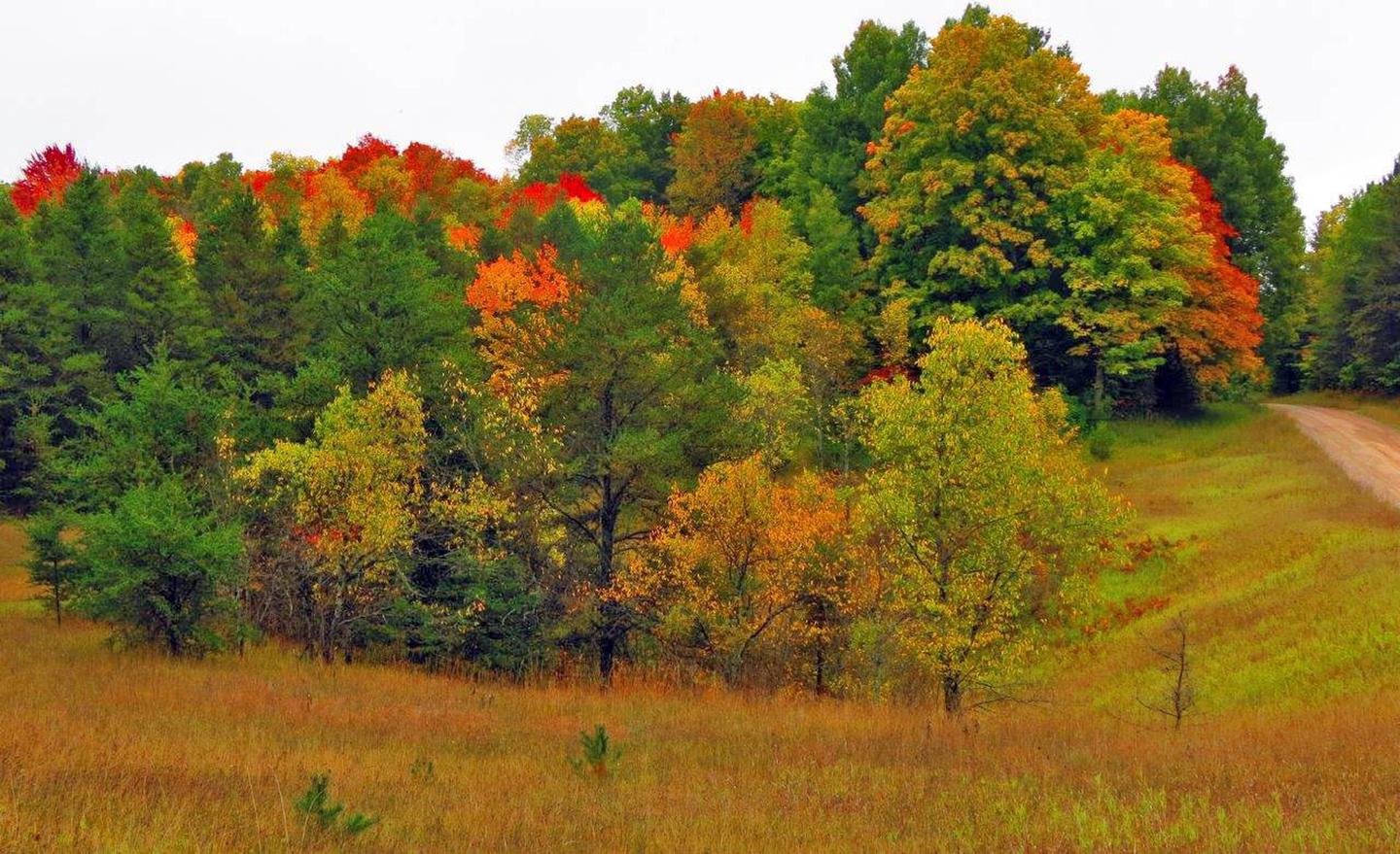
Huron-Manistee National Forests
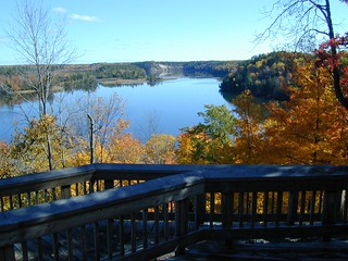
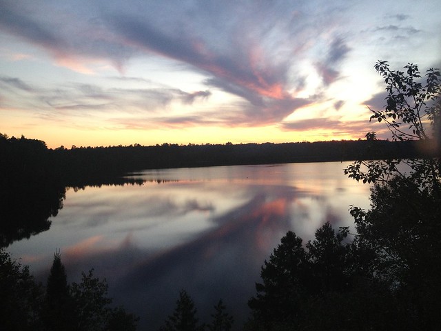
Lying between the shores of Lake Michigan and Lake Huron in the northern half of the Lower Peninsula of Michigan, is the nearly one-million-acre Huron-Manistee National Forests.
RecAreaDirections
Huron-Manistee National Forests Supervisors Office 1755 S Mitchell St. Cadillac, MI 49601
231-775-2421
Open with Google MapMisc
| Stay Limit | |
| Reservable | false |
| Keywords | |
| Map Link | |
| Contact Phone | |
| Contact Email |
Permits info
Facilities
Upper Manistee River Backcountry Campsites Campground
List of CampsitesOverview
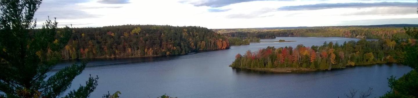
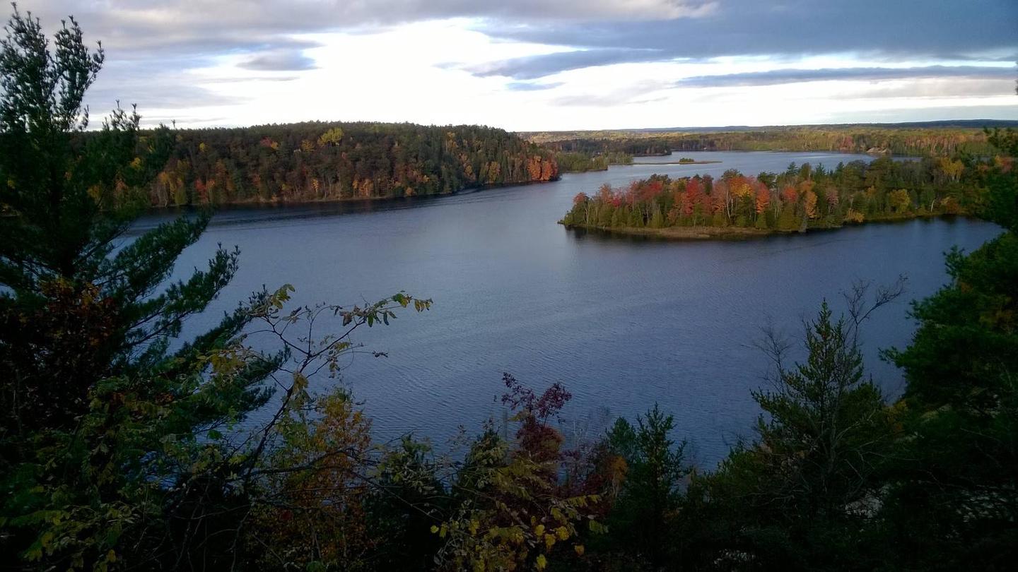
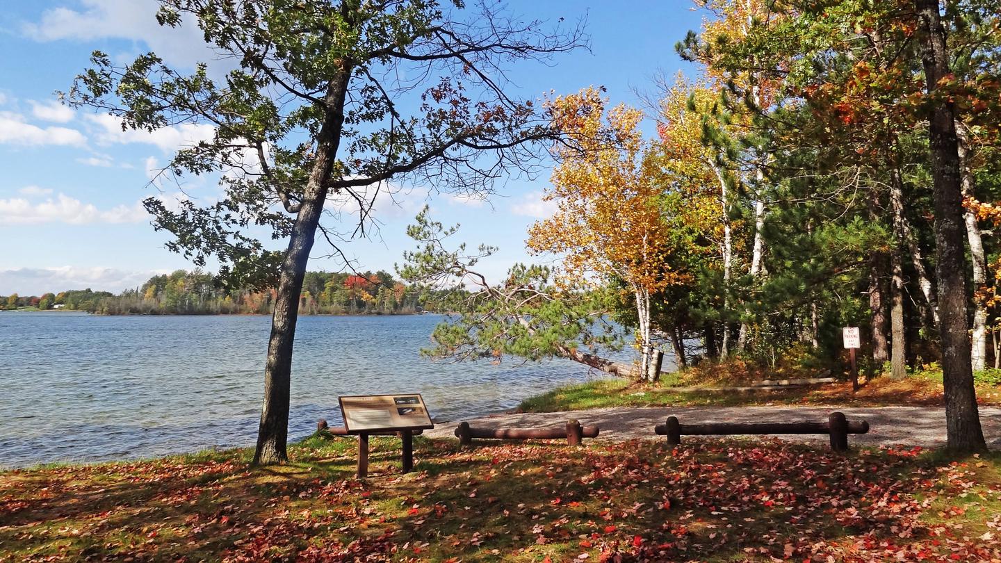
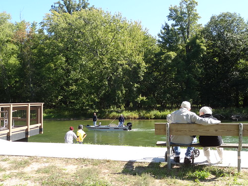
The Upper Manistee dispersed campsites are primitive campsites on the Manistee River Backwaters of Tippy Dam Pond, located along the banks of the Manistee River between Tippy Dam and Hodenpyl Dam. The Government Landing location includes 7 sites, in which, 5 are located on the water and 2 sites are on higher ground overlooking the water. There are 2 sites located on the water that are walk in only. The Red Bridge River Access offers 4 sites that are walk in only and allow easy access to the Manistee River. These sites are very popular and are by reservation only Memorial Day Weekend through Labor Day Weekend.
Recreation
The Upper Manistee River Area offers motorized and non-motorized boating opportunities, and fishing is excellent on the Manistee River. Wildlife viewing may include encounters with a variety of species such as bald eagles, loons, trumpeter swans, black bears, white tailed deer, river otters, and turtles. Many of these species are secretive and sensitive to disturbances, so please view them from a distance. Hiking opportunities in the area are numerous with the North Country Trail and the Manistee River Trail, as the top draw to the area. Both trails offer excellent views of the forested terrain and the Manistee River.
Facilities
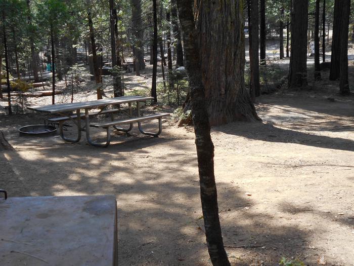
Each site is designed for single camp unit use with a maximum of 8 people and 2 vehicle per site. Sites include a picnic table, fire ring, and a lantern hook. Vault toilets are located with in walking distance of each site. A boat ramp is located at both Government Landing and Red Bridge. No drinking water is available at Government Landing, but drinking water is available at Red Bridge.
Natural Features
The Upper Manistee River Area is one of the more scenic areas of the Manistee National Forest and the outdoor enthusiast will enjoy a rustic camping experience enhanced by the scenic river, peace and solitude, and abundant wildlife. The Manistee River with its steep slopes and sharp turns meanders through native hardwoods and pines.
contact_info
This location is unstaffed. To speak with our main office for general information, please call: (877) 444-6777.MONUMENT CAMPGROUND Campground
List of CampsitesOverview
Monument Campground was established in 1909 as one of the first campgrounds built in the Huron National Forest. The campground is a fully accessible camping area within a red pine plantation.Families love this conveniently located campsite, just 15 minutes from Lake Huron off the River Road National Scenic Byway.
Recreation
Campers can access the Highbanks Hiking Trail from the campground or explore the 22-mile River Road National Scenic Byway that overlooks the lovely AuSable River valley.Beside the campground is the Lumberman's Monument Visitor Center, replete with information about the area's rich lumbering history. Here, visitors can climb through a log jam, use a peavey, cut a wooden cookie with a cross-cut saw, and learn about the life of a lumberjack through video and displays.
Facilities
Pressurized drinking water, vault toilets, trash collection and grills are among the amenities offered at the campground. A host is onsite to answer questions.
In the nearby visitor center, campers can partake in educational programs and browse through the gift shop.
Natural Features
Each site is secluded and shaded with large oak and red pine near the AuSable River. The river flows from west to east for 138 miles until it reaches the great lake, Lake Huron.Nearby Attractions
Explore the many trails of the Huron-Manistee National Forests and spend time at Lake Huron.ROLLWAYS CAMPGROUND Campground
List of CampsitesOverview
Rollways Campground is located 7 miles from Hale, Michigan along the beautiful AuSable River. The site was built in 1909 as one of the first campgrounds established in Huron National Forest. The space is small and secluded and features an observation area, picnic grounds and log shelter..The facility is located just off the River Road National Scenic Byway in northeast Lower Michigan. The byway showcases incredible views of the AuSable River Valley.
Recreation
Hike on the accessible trail that connects the campground and picnic area to Westgate Scenic Overlook. Bring binoculars and a camera to take advantage of the epic view.The same hiking path passes a stairway leading down to the river where visitors can fish and wade.
Facilities
The campground offers 19 pull-through campsites with picnic tables, a lantern post, grills, tent pads and campfire rings. At the picnic area, a log shelter, picnic tables and grills are available.Vault toilets and drinking water spigots are dispersed throughout the campground and all roads and camping spurs are paved.
Natural Features
Rollways is perched on a high bluff overlooking Loud Dam Pond on the AuSable River. The river flows from west to east for 138 miles until it reaches the great Lake Huron.Nearby Attractions
Follow the length of the 22-mile River Road National Scenic Byway, which parallels the AuSable River.PETERSON BRIDGE Campground
List of CampsitesOverview
Peterson Bridge Campground is located on the Pine River in Michigan’s Manistee National Forest. The location on the river makes it ideal for canoeists and those looking to experience the adventure of this swift moving river.Recreation
With access to the river so close, floating the Pine River is a popular activity at Peterson Bridge. Several locations near the campground offer canoe rentals. Supporting outstanding trout fishing, the Pine River is also a “Blue Ribbon” cold-water fishery. For State Fishing Regulations consult the Michigan Department of Natural Resources website, website http://www.michigan.gov/dnr/.Facilities
The facility offers several tent sites which are walk-in only. Those tent sites on the river bank can also be accessed from the river.In addition, the facility offers RV sites with many of the sites at this facility offering shade and seclusion.
Natural Features
The Pine River is well known as one of the most outstanding canoeing and trout fishing rivers in the Midwest. The river gradient is 7% and, depending upon the season, offers the fasted average flow of any river in lower Michigan. The lower 26 miles of the Pine River have been designated a National Wild and Scenic River.LAKE MICHIGAN AT MANISTEE Campground
List of CampsitesOverview
Lake Michigan Campground is perched on the shores of Lake Michigan, 15 miles south of Manistee. The area creates an incredible setting with a scenic overlook of the lake and a sandy swimming beach. This family campground provides an array of hiking and biking trails, plus swimming, fishing and kayaking.Recreation
A hardwood forest gives way to a beautiful sandy beach at the shores of the lake with a playground for younger campers. Trout fishing in Lake Michigan is another big draw.Bird watchers delight in seeing unique species like the piping plover and prairie warbler.
The Arrowhead Trail, a short loop trail created by Boy Scouts, forms a loop between the campground and the beach. A trailhead for the Nordhouse Dunes Wilderness Area is also within the recreation area.
Facilities
An amphitheater offers educational programs throughout the peak season. Other amenities include flush and vault toilets, beach access and an overlook deck. Campsites are equipped with picnic tables and pedestal grills.Group campsites can each accommodate a maximum of 50 guests.
Natural Features
The recreation area sits on the eastern banks of Lake Michigan along Porter Creek, due north of Hamlin Lake. As the second largest of the five Great Lakes, Lake Michigan provides stunning views and limitless options for water recreation. It covers a whopping 22,400 square miles and ranks as the fifth largest lake in the world.The Huron-Manistee National Forests encompass nearly a million acres of public protected land. Nearly 6,000 acres is wetlands that extend over the northern portion of Michigan's Lower Peninsula.
Nearby Attractions
The nearby Nordhouse Dunes Wilderness Area has abundant trails for hiking and backpacking.SAND LAKE CAMPGROUND Campground
List of CampsitesOverview
Sand Lake Campground is situated on the scenic shores of Sand Lake and provides a selection of sites shaded by a mixed hardwood forest. Just beyond the trees is a well-loved, sandy swimming beach. The campground is located 15 minutes from the Pine National Scenic River and several other lakes.The popular campground sits within the Huron-Manistee National Forests, far enough from town to let its natural splendor shine, but close enough for convenient access to gas and groceries.
Recreation
Power boating, sailing, canoeing, hiking and swimming are some of the most common activities on the lake. Anglers delight in the waters well-stocked with bluegill, perch and smallmouth bass. A picnic area and boat ramp are available for use.Facilities
The campground provides conveniences like coin showers, flush toilets and drinking water faucets. Visitors often rave about the nice, private bathrooms with vanities.Natural Features
Sand Lake boasts about 50 acres of mostly shallow waters. The campground is nicely wooded; some sites are heavy shaded while others are much more open. Summertime temperatures are generally around 80 degrees.The Huron-Manistee National Forests encompass nearly a million acres of public protected land, including nearly 6,000 acres of wetlands that extend over the northern portion of Michigan's Lower Peninsula.
BOWMAN BRIDGE Campground
List of CampsitesOverview
Bowman Bridge Campground is perfect for true nature immersion. Campers come here for easy access to the Pere Marquette National Scenic River and for the delightful views of the great outdoors.Recreation
The top three activities for campers at Bowman Bridge are canoeing, fishing and hiking. Anglers cast for brown trout, salmon, steelhead and rainbow trout.Watercraft rentals are available at two nearby liveries in Baldwin. A permit is required to float the river from the Friday of Memorial Day weekend through Monday of Labor Day weekend. Watercraft hours during the permit season are 9 a.m. to 6 p.m.
Hikers can head up the campground's connector trail to the North Country National Scenic Trail. This "north country" trail weaves through many scenic, historic and cultural areas across seven states, measuring 4,600 miles end-to-end.
Facilities
Campsites are in a wooded setting, but due to a tornado that passed through in 2005, tall trees and shade are less dense than in neighboring campgrounds.The campground has a single loop 16 paved family campsites. There are also 4 walk-in family campsites and 4 tent-only group sites that can accommodate up to 20 people each.
Natural Features
The campground is situated along the Pere Marquette National Scenic River, a 66-mile stretch of clear, unspoiled waters within the Huron-Manistee National Forests in Michigan. Large blocks of public land offering opportunities for hiking, birdwatching, photography, and hunting can be found in the surrounding area.Nearby Attractions
Visitors enjoy exploring the extent of the Pere Marquette National Scenic River. Other nearby attractions include the Bowman Lake Foot Travel Area and the historic community of Idlewild.GLEASONS LANDING Campground
List of CampsitesOverview
Gleasons Landing is a very popular campground on the banks of the Pere Marquette River. With a selection of shaded and secluded spots, the campground is perfect for peaceful nature immersion.The Pere Marquette River was designated a National Scenic River in 1978, the first in Michigan, and it regularly attracts many canoeing, kayaking and fishing enthusiasts. The 66-mile stretch of river begins east of Baldwin and empties into Lake Michigan at Ludington.
Recreation
A major draw to the campground is world-class fishing. The free flowing river maintains large populations of resident brown trout, steelhead and salmon. Gleason Landing marks the start of a zone for fly fishing and catch and release only. Reel fishing is available upstream. A boat ramp is located within the campground.Canoeing and kayaking is very popular on the river, and boat rentals are available in Baldwin. A permit is required to float the river from Memorial Day weekend through Labor Day weekend.
Trails along the river provide shore access for anglers and short, scenic nature walks for hikers.
Facilities
The walk-in campsites promise lovely views of the river. Family sites are each equipped with a picnic table, lantern post and campfire ring. Two group sites can accommodate up to 20 people each. Drinking water is provided but no hookups are available.Natural Features
The campground sits on a bluff overlooking the picturesque Pere Marquette River. It is surrounded by a mix of white pine and oak trees.The Huron-Manistee National Forests encompass a million acres throughout the northern portion of Michigan's Lower Peninsula. The forests provide recreation opportunities for visitors, habitat for fish and wildlife and resources for local industry.
Nearby Attractions
A trailhead for the North Country National Scenic Trail is a short drive away. The trail extends from New York to North Dakota, spanning 4,600 miles.Pines Point Campground (MI) Campground
List of CampsitesOverview
Pines Point Campground is located on the banks of the White River with several campsites overlooking the river. The family campground includes a loop designed for groups containing five sites with a capacity of 20 guests each. Large groups can reserve the entire loop.Find out how the campground got its name when you tube or kayak the â??pointâ?? and see the majestic white pines standing watch over the river. Fishing is also popular in these waters.
Recreation
Fish for trout, salmon and sucker, or float in a canoe, kayak or tube around the point, a leisurely 1 hour float. The canoe landing is walk-in.Facilities
Five group campsites and 27 family campsites lie along the river. Each site is equipped with a picnic table, fire ring and lantern post. Drinking water and flush toilets are provided. Electric hookups are not available.Natural Features
The campground is quiet and secluded, surrounded by towering white pines and rolling hills. The White River runs for 23.6 miles on the western side of Michigan's Lower Peninsula. Summer temperatures are generally around 80 degrees Fahrenheit.The Huron-Manistee National Forests extend over almost a million acres, including nearly 6,000 acres of wetlands. The forests provide recreation opportunities for visitors, habitat for fish and wildlife and resources for local industry.
Nearby Attractions
Hikers can explore the White River Special Area, a primarily non-motorized area surrounded on three sides by the White River.AUSABLE RIVER CAMPING Campground
List of CampsitesOverview
AuSable River Dispersed Camping is a unique series of 102 individually designated single-family campsites on a 55-mile stretch of the lovely AuSable River. All campsites are within Alcona and Iosco Counties in Michigan.These rustic sites are divided into sections near Alcona Pond, the AuSable Semi-Primitive Non-Motorized Area, Loud Pond, Five Channels Pond, Cooke Pond, Foote Pond and Lower Ausable. Each are ideal for family camping, with opportunities for fly fishing, swimming, canoeing and bird watching.
Recreation
Both river and lake fishing are available for perch, bass and pike walleye. One recommended spot is the Whirlpool Angler access point. All sites are also near the River Road National Scenic Byway, which offers wonderful views of the river valley.The campground has boat-in camping, and canoe rentals are available in Glennie, Hale, Mio and Oscoda.
Facilities
All sites are primitive with no drinking water, toilets or trash removal. Campers are expected to bring plenty of water, portable toilets and garbage bags. Parking aprons are dirt or gravel.Natural Features
Campsites sit on bluffs that range from five to 300 feet above the waterline of the lower AuSable River. Depending on the site, access to the river may be difficult due to steep or eroding slopes.The AuSable River meanders across 138 miles of Michigan and flows into the great lake, Lake Huron.
HUNGERFORD EQUESTRIAN GROUP CAMPSITE Campground
List of CampsitesOverview
The Hungerford Recreation Area offers access to over 50 miles of trails for horseback riding, hiking and mountain biking.The horse trails connect to the group campsite. There are a few small lakes located nearby, including, Hungerford Lake, Toogood Lake and Mud Lake.
Recreation
Forty-seven plus miles of horseback riding trails and 10 miles of mountain biking trails make the campground an ideal place for both equestrian campers and outdoors enthusiasts.Hungerford Lake is located a half mile south of the Hungerford Family Campground and one and a quarter miles south of the Hungerford Equestrian Group Campsite. The area offers fishing and boating opportunities. Horses are not allowed in or around the lake area, but visitors interested in fishing are welcome to cast for bass, pike and pan fish. There is a boat ramp located at the lake.
Facilities
There are eight individual sites within the group camp area. Each site can accommodate one large horse trailer, two vehicles and eight people.
Picnic tables, lantern posts, fire rings, and picket poles to highline horses are provided at each of the eight sites. A vault toilet, manure disposal area, trash disposal, and large group campfire ring are provided for the campground. Drinking water is available at the Hungerford Campground, located 1.25 miles south of the site.
The group site's check in and check out time is 12 noon.
Natural Features
The campground is perched along lightly rolling hills in the Manistee National Forest. It is about a mile north of Hungerford Lake and the 48 site Hungerford Campground.The lake spans 30 acres and is a favorite spot to see fall colors. The Manistee National Forest comprises 540,000 acres and meets the eastern shore of Lake Michigan.
Nearby Attractions
Visit the city of Big Rapids, Michigan, or the Loda Lake Wildflower Sanctuary. Benton, Indian, Brush, and Shelley lakes are also nearby.Charges & Cancellations
Cancellations will not be accepted within 7 days of scheduled date of arrival.
SOUTH BRANCH TRAIL CAMP GROUP SITE Campground
List of CampsitesOverview
South Branch Trail Campground Group Site is ideal for equestrian camping. The group area impresses with its beautiful scenery and convenient access to horseback riding and hiking along the 240-mile Michigan Shore-to-Shore Horseback Riding and Hiking Trail. Priority will be given to campers with horses, however everyone is welcome. The spacious site holds up to 250 campers and features a day-use horse parking area.Recreation
Hike or horseback ride on the Michigan Shore-To-Shore Riding and Hiking Trail. The trail begins in the town of Empire near Lake Michigan, on the west side of Michigan and ends near Oscoda, Michigan on the Lake Huron eastern side of the state. The eastern part of the trail follows the historic AuSable River to its end in AuSable, just south of Oscoda.Facilities
Facilities include at the South Branch Trail Campground Group Site include three sets of vault toilets, an electric water pump - which requires campers to furnish a 5,000 watt generator, one garbage bin and picket posts. Parking allows for up to 65 vehicles.Natural Features
Campsites are situated in a stand of oak and pine at an elevation of 880 feet. The campground is adjacent to the South Branch River and is also not too far from the AuSable River. The magnificent Lake Huron is only a short drive east of the campground.ROUND LAKE Campground
List of CampsitesOverview
Round Lake Campground offers a scenic, rustic, wooded camping area offering a wide variety of recreation opportunities in the Huron-Manistee National Forest in Michigan.Recreation
There is a wide variety of recreational opportunities located in and around the campground. Anglers can fish for sunfish, bass and pike while campers can relax at the sandy beach. The campground has a gravel boat ramp.Facilities
Round Lake Campground has 33 sites in two camping loops. Approximately a quarter of the sites in this campground have access to water. Amenities at the campground include vault toilets and garbage service along with picnic tables and campfire rings at each campsite.Natural Features
Round Lake's 91-acres is mostly surrounded by private land. Round Lake Campground provides the only public access to the lake.Nearby Sand Lake Picnic and Swimming Area are located on the 248-acre Sand Lake. The beach and picnic area provide the only public access to Sand Lake.
Nearby Attractions
The campground is located in the village of Sand Lake, MI and groceries and fuel are nearby. Lumberman's Monument Visitor's Center is less than 15 miles from the campground. There are hiking trails nearby, a picnic day use area on nearby Sand Lake, bird watching, and hunting opportunities.Au Sable Area Facility
Along the Au Sable River is the Au Sable Special Area, a 10,628 acre area characterized by flat to gently rolling hills with some steep banks along the Au Sable River. This area is located in Iosco and Alcona counties. The Au Sable Special Area stretches the southern end of Alcona Dam Pond (Bamfield Road) to just before Cook Pond on either side of the river.
The area is densely forested and inhabited by bald eagles, deer, bear, bobcat, porcupine and various songbirds. Campers and day-use visitors enjoy boating, tubing, rafting, canoeing and fishing on the Au Sable River. Other popular recreation activities include viewing the river and wildlife, hiking, swimming, picnicking, horseback riding, hunting, trapping and berry and mushroom gathering. The Forest Service requires camping permits from May 15 through September 30 at the 19 designated primitive campsites along the river in this area.
Two developed campgrounds are located in this area, South Branch Trail Camp and Rollways Campground.
Cooke Area Facility
The 2,419 acre Cooke area is located in Oscoda Township in Iosco County, Michigan
The terrain is mostly lowlands. Much of the area is densely forested with a mix of conifers including cedar, fir and red and white pine. Pockets of aspen and open areas also occur in the area. Wildlife species that commonly inhabit this area include white-tailed deer, bald eagles, swans, raccoon, porcupine, squirrel, pileated woodpecker and various songbirds.
Dispersed camping is a popular activity at the eight designated campsites along the southern boundary of the area. From May 15 through September 30, permits are required to camp at these sites. Boating and fishing on the Au Sable River are very popular in this area. Other recreation activities include deer and small-game hunting, berry picking and bird watching.
South Branch Au Sable Area Facility
This area is superb for hunting and fishing.
Bowman Lake Area Facility
This area not only has the Pere Marquette River running through it, but also contains a portion of the North Country National Scenic Trail and habitat for the federally endangered Karner blue butterfly.
The Bowman Lake area is located in Lake and Sweetwater Townships in Lake County. A total of 1,145 acres of NFS lands and 368 acres of private lands are within the boundary of the Bowman Lake area.
The terrain is characterized by rolling hills, glacial depressions and leatherleaf bogs. A 3-acre lake is located within the area. The area tends to be densely forested with a mix of hardwoods, red and white pine and aspen. Wildlife species that commonly inhabit this area include white-tailed deer, bobcat, coyote, red fox, raccoon, porcupine, squirrels, pileated woodpecker, ruffed grouse, wild turkey and various songbirds.
Visitor recreation activities include camping, fishing, mushroom gathering, bird-watching, hunting, hiking and canoeing. Mountain biking and horseback riding are also common uses on the area trails. Although trails are not groomed in the winter, the area is popular for snowshoeing and cross-country skiing.
The Bowman Lake Trailhead serves as a main entry point onto the North Country National Scenic Trail (NCT). A 3-mile segment of the NCT is located within this area and mountain biking is allowed on this section of trail. In addition, a small trailhead is located on NFS Road 6267, giving access to the Bowman Lake Campground Trail, which is approximately 7.5 miles of loop trail designed for nonmotorized recreation.
This trail system can also be used by mountain bikers and horseback riders. Four improved campsites are located on Bowman Lake. Segments of the State of Michigan snowmobile trail system and Michigan Cycle Conservation Club Trail (MCCCT) system are located immediately south of the area.
Condon Lakes West Facility
This area is very popular for mushroom and berry picking, as well as hunting, fishing and camping.
Manistee River Area Facility
Portions of the North Country National Scenic Trail run through this area, as well as it being a popular area for hunting and fishing. Aspen is a managed tree in this area, creating good grouse habitat throughout.
White River Area Facility
The White River runs through this area and there are several campgrounds and boat launches associated with the river.
The White River Semi-Primitive Nonmotorized Area has several acres of habitat for the federally endangered Karner blue butterfly.
Sawmill Point Boat Launch Facility
 This site is adjacent to primitive campsites on Cook Pond. The boat ramp is gravel. This is a small site that gets full quickly on summer weekends. Other Cooke Pond launches are located at Pine Acres and at Cooke Dam.
Brochure with map:
- River Road National Scenic Byway (pdf) - this brochure shows River Road, the Au Sable River and Lumberman's Monument
- Highbanks River Trail Map (coming soon)
- Eagle Run Trail Map (coming soon)
The brochure is set to print on 11 x 17 paper, landscape (wide) orientation. To print on 8 1/2 x 11 paper set the print area to "shrink to printable area", this will make the text on the page smaller. The trail maps are set to printon 8.5x11 paper.
Flickr Photo Albums:
- Au Sable River - Alcona Dam to Lake Huron
- Visitor Center and Grounds
- River Road National Scenic Byway
- Highbanks River Trail
- Eagle Run Trail
Manistee National Recreation River Facility
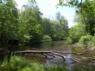
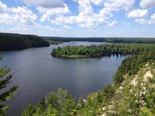
The Manistee River between Tippy Dam and the M-55 Bridge was designated as a National Recreational River in 1996. The river is wide and characterized by steep banks and sharp bends, with a swift current and mostly slow, wide bends.
The river corridor supports a wide variety of recreational activities throughout the year, including hiking on the North Country National Scenic Trail and Manistee River Trail.
In the fall, hunters come from all over to take advantage of the abundant white-tailed deer, waterfowl and small game hunting available along the river.
Anglers are lured by the annual salmon and steelhead runs, as well as brown trout, smallmouth bass and walleye. However, salmon season is particularly busy on the river.
Backwater bayous, extensive riparian areas and mature forest communities provide habitat for a diverse number of wildlife species. The lower Manistee River is considered to be the most extensive and least disturbed remnant of true red-shouldered hawk habitat in the state.
Brochure with map:
This brochure is set to print on 11 x 17 paper, landscape (wide) orientation. To print on 8 1/2 x 11 paper set the print area to "shrink to printable area", this will make the text on the page smaller.
Flickr Photo Albums
Bear Creek Scenic River Facility

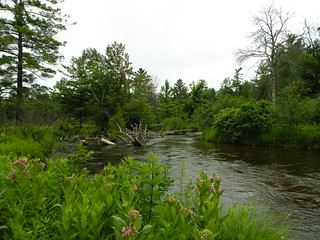
There is only 3.5 miles of Bear Creek located on the National Forest. The remainder is on private property. This river is a designated national scenic study river and is great for cold water fishing. Bear Creek was added as a Scenic River in 1996, at the same time the Manistee River was designated a National Scenic River. The only Forest Service access for the river is at Bear Creek.
Bear Creek contains many unique wetland communities, floodplain marshes, swamp forested bottomlands, braided channels and large amounts of natural woody debris. Many wildlife species, such as, wood turtles, hawks, waterfowl, and many species of songbirds, find fairly isolated nesting habitat along Bear Creek. What makes Bear Creek unique to recreationists is the rare opportunity to experience solitude and challenge in an undeveloped river setting. Many paddlers who seek a leisurely trip through meandering narrows and broad flat wetlands will appreciate this area. Fishing is particularly heavy at the junction with the Manistee River. The corridor for the river provides a peaceful experience in a natural, densely vegetated river setting. Vegetation overhangs the shoreline, contributing to a feeling of seclusion, a rare commodity in rivers in the Lower Peninsula. The stream meanders through many types of landscapes and riverine ecosystems. Around every bend, visitors are treated to a wide variety of sights and sounds, swamps, marshes and a sinuous river channels that combine to offer visitors a glance of an unmodified river.
White River Facility
Three sections of the White River are currently being study for inclusion as a National Scenic River. Currently the White River is designated Scenic by the State of Michigan.
The White River is characterized by a primarily sand bottom with deep pockets of water and small sections of gravel bottom. Paddlers find the river to be a steady and moderate float, with a meandering course.
The forest on either side of the river is primarily stands of oak, maple and aspen hardwoods mixed with red and white pine.
Wildlife abounds and fishing is a popular activity. A large portion of the river flows through the White River Semi-Primitive Nonmotorized Area.
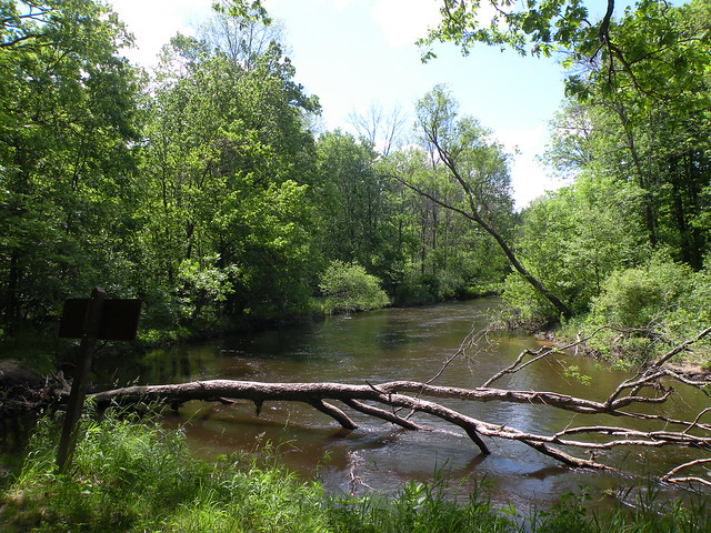
Little Manistee River, National Scenic Study River Facility
The Little Manistee River offers many opportunities for steelhead and trout fishing. The river banks are covered with lowland brush, swamp conifers, white pine and a variety of oak. The river has many bends and large logs. Water levels can become fairly shallow during dry summer months. There are a number of dispersed fishing access sites along the river, some of which allow camping.
Map: This brochure is set to print on 8.5x11 paper, landscape (wide) orientation.
South Branch Pine River Facility
This river is not navigable for canoeing or boating, however it is an excellent river for cold-water fishing.
Udell Trailhead Facility

Going North - From Udell Trailhead to Upper River Road Trailhead, particularly in the Dilling Road area, visitors will traverse many hills. After crossing Coates Highway, visitors will climb up a hill to a flat, forested area.
Difficulty going north from Udell -
- Udell Trailhead to Highbridge River Access - Easy
- Highbridge River Access to Dilling Rd. - Easy
- Dilling Rd. to Upper Branch Trailhead/Red Bridge River Access - Difficult
Dilling Road to Udell Trailhead -
- Bicycles Allowed?: No
- Miles: 10
Going South - Heading south will take you to the Freesoil Trailhead. The trail from Udell Trailhead to Freesoil Trailhead traverses the Udell Hills. After the trail crosses the Little Manistee River the terrain changes form mixed hardwoods to wetlands. The trail heading north was formerly a narrow gauge railroad that was elevated above the wetlands in the early 1900's by lumberjacks. The trail winds through the wetlands and swamp in this section. However, about 3.5 miles north of the trailhead a boardwalk has been put in through the wetland areas. Mountain bikes are allowed going south from this trailhead. There is no connector to the Big "M" Cross-Country Ski Trail, however the two trails do cross at several points.
Difficulty going south from Udell -
- Udell Trailhead to 6-Mile Rd. - Intermediate
- 6-Mile Rd. to 3-Mile Rd. - Easy
- 3-Mile Rd. to Freesoil Trailhead - Easy
Udell Trailhead to M-55 -
- Bicycles Allowed?: No
- Miles: 10
M-55 to Bowman Lake Trailhead -
- Bicycles Allowed?: Yes
- Miles: 41
Brochure with map: This brochure is set to print on 11 x 17 paper, landscape (wide) orientation. To print on 8 1/2 x 11 paper set the print area to "shrink to printable area", this will make the text on the page smaller.
M-55: Manistee to Cadillac Facility
This section includes all recreation areas along M-55 or a short distance from M-55 located between Cadillac and Manistee, except the Pine and Manistee Rivers.
Manistee River Facility
The Manistee River, from Tippy Dam to the M-55 Bridge, is a designated National Recreation River. There are several river access sites, day use areas and campgrounds located along this section of river. During the summer the river is popular with canoers and kayakers, while during the fall salmon season, sites such as Suicide Bend and Sawdust Hole are popular with anglers.
The section north of Tippy Dam, up to Hodenpyl Dam Pond, is bordered on either side by the Manistee River Trail and the North Country National Scenic Trail. This area is also within the Manistee River Semi-Primitive Nonmotorized Area, a 7,900 acre area of the Forest.
Brochure with map:
This brochure is set to print on 11 x 17 paper, landscape (wide) orientation. To print on 8 1/2 x 11 paper set the print area to "shrink to printable area", this will make the text on the page smaller.
Flickr Photo Albums
M-37: White Cloud to Baldwin Facility
This area covers all recreation areas along M-37 between White Cloud and Baldwin. This does not include trailheads for the North Country National Scenic Trail or Hungerford Recreation Area.
Wakeley Lake Area Facility
Recreation areas near the Wakeley Lake Area. This is the section of the Huron National Forest furthest west, and most sites are located along or north of M-72.
Sprinkler Lake Access Site Facility
This is a small fishing access with a short path to the 60-acre Sprinkler Lake.
Kiwanis Monument Facility
Kiwanis Monument commemorates the efforts of private citizens in the reforesting of Michigan's barren lands.
Brochure with map:
- River Road National Scenic Byway (pdf) - this brochure shows River Road, the Au Sable River and Lumberman's Monument
- Highbanks River Trail Map (coming soon)
- Eagle Run Trail Map (coming soon)
The brochure is set to print on 11 x 17 paper, landscape (wide) orientation. To print on 8 1/2 x 11 paper set the print area to "shrink to printable area", this will make the text on the page smaller. The trail maps are set to printon 8.5x11 paper.
Flickr Photo Albums:
- Au Sable River - Alcona Dam to Lake Huron
- Visitor Center and Grounds
- River Road National Scenic Byway
- Highbanks River Trail
- Eagle Run Trail
Kirtland's Warbler and Jack Pine Wildlife Tours Facility
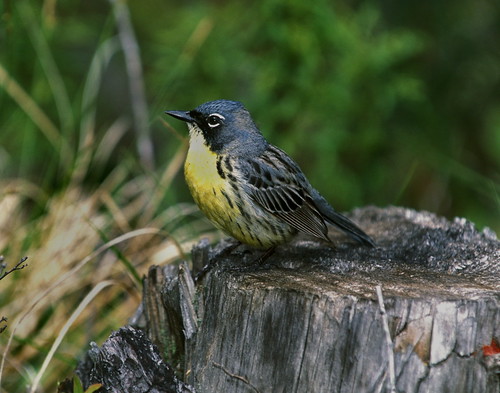
Self-Guided Jack Pine Wildlife Viewing Tour
The Jack Pine Wildlife Viewing Tour is a self-guided, 58-mile auto-tour through jack pine ecosystems that are home to a variety of wildlife, including the endangered Kirtland's warbler. The tour is marked with signs that display an image of the Kirtland's warbler and the watchable wildlife symbol. Along the route are also opportunities to stop at one of the many recreation sites available to access the Au Sable River.
Along the route there are many examples of wildlife habitat. Interpretive signs discuss specific management methods at the five stops. Occupied Kirtland's warbler habitat is closed to public entry during nesting seasons to protect the birds. Closed areas will be posted with signs.
Maps are available at the Mio Ranger Station.
Guided Kirtland's Warbler Tours
Kirtland’s warbler tours will be offered daily from May 15 through May 31, 7 days a week at the Mio Ranger District of the Huron National Forest.
Guided Kirtland’s warbler tours are the best opportunity to view this endangered songbird, as Kirtland’s warbler nesting areas are closed and posted against public entry during the nesting season. Kirtland’s warblers are rarely seen in Michigan outside of their nesting habitat.
The Kirtland’s warbler tour begins at 7:30 am at the Mio Ranger District office at 107 McKinley Road. Please arrive at 7:15 am to check in and pay before the tour begins. The tour begins with a short video that highlights the natural history and management of the Kirtland’s warbler. The tour participants then follow the tour guide in their own vehicle to a field site. At the field site, participants have an excellent chance of seeing a Kirtland’s warbler, as well as other birds that live in the jack pine habitat. The tour participants visit a cowbird trap and learn about the jack pine ecosystem. The entire tour lasts approximately three hours.
Tour participants are encouraged to bring binoculars. Tape recorders, pets, and smoking are not allowed on the tour. Reservations are not required, but are recommended for groups of four or larger. The Kirtland’s warbler tour costs $10 per adult and is free for children. Funds from the tours help cover costs associated with the tours. For more information, call the Mio Ranger District office at (989) 826-3252. Interested community groups and teachers can arrange for a free tour by contacting Kim Piccolo, (989) 826-3252 ext. 3334 or email.
Tours will be available at Hartwick Pines State Park in Grayling through the Michigan Audubon Society. For more information on Grayling tours, contact [email protected] or 517-580-7364.
Wagner Lake Area Facility
This section contains information on the sites located in the southern section of the Huron National Forest.
Au Sable River Facility
From Mio Pond to Lake Huron, the Au Sable is primarily managed by the HMNF. The river is managed in two sections, one from Mio Pond to Alcona Dam Pond, the second from Alcona Dam to Lake Huron.
Au Sable National Wild and Scenic River
The Au Sable National Scenic River stretches 23-miles, from Mio to Alcona Pond.
Au Sable River - Alcona Dam to Lake Huron
This section provides motorboat opportunities with a lake fishing atmosphere.
Highbanks River Trail
A short, 7-mile hike along the bluffs of the Au Sable River will provide day hikers with some of the best, and most dramatic, views of the Au Sable River, where hikers or skiers will be able to look over the river valley, with clear views almost to Lake Huron in some spots.
Lubmerman's Monument Visitor Center and Forest Discovery Trial
Lumberman’s Monument Visitor Center interprets the area’s colorful lumbering past. The 14-foot Lumberman’s Monument stands on a high bank with the Au Sable River providing a scenic backdrop.
River Road National Scenic Byway
The twenty-two mile River Road National Scenic Byway extends westward from Lake Huron into the Huron National Forest. It parallels the historic Riviere aux Sable (River of Sand). Lumbermen’s Monument Visitor Center sits at the center of the byway.
Brochures and Maps:
- Au Sable National Scenic River (pdf)
- River Road National Scenic Byway (pdf) - this brochure shows River Road, the Au Sable River and Lumberman's Monument
- Highbanks River Trail Map (coming soon)
- Eagle Run Trail Map (coming soon)
Flickr Photo Albums:
Pere Marquette National Scenic River Watercraft Permits (Huron Manistee) Permit
Overview:
In 1978, sixty-six miles of the Pere Marquette were designated a National Scenic River. The Pere Marquette River is the longest unregulated (no dams or impoundments) river system in Michiganâ??s Lower Peninsula. The river is a nationally known, high-quality stream supporting large populations of resident trout, steelhead and salmon.The Pere Marquette River, within the Forestâ??s boundary, has been divided into three non-motorized watercraft segments: Segment 1 - Forks to Bowman Bridge; Segment 2 - Bowman Bridge to Upper Branch Bridge; and Segment 3 - Upper Branch Bridge to Indian Bridge. The riverâ??s characteristics and the setting vary by river segment. Someone wanting a recreation experience where there is a good chance of encountering others would enjoy Segment 1; those wanting the opportunity to experience more solitude would appreciate Segment 3.
Camping within the river corridor on National Forest lands is allowed only at designated sites. Sites range from developed campgrounds to primitive, canoe-in only sites. Fees for camping and using river access sites are charged under the Recreation Fee Enhancement Act. Check the bulletin board at each site for fees and additional information.
Pine National Scenic River Watercraft Permits (Huron Manistee) Permit
Overview:
The lower 26 miles of the Pine River was designated as a National Scenic River in 1992. Scenery is one of the most outstanding attributes of the river. The designated portion of the river contains a unique riparian landform with a deeply incised river channel and high, exposed, fragile sand banks. Dense vegetation contributes to the picturesque setting of the river.Camping within the river corridor on National Forest lands is prohibited, except at Peterson Bridge Campground . Fees for using river access sites are charged under the Recreation Fee Enhancement Act. Check the bulletin board at each site for fees and additional information.
SEATON CREEK CAMPGROUND Campground
List of CampsitesOverview
Seaton Creek Campground adjoins Seaton Creek and is at the upper end of the backwater of Hodenpyl Dam Pond on the Big Manistee River. The forest surrounding the campground is mostly pine and the sites are rustic. The closest town is Mesick.Recreation
The surrounding waters offer excellent fishing opportunities for both panfish (perch, bluegil, crappie, sunfish) and game fish (trout, bass, pike, salmon). For State Fishing Regulations consult the Michigan Department of Natural Resources website, website http://www.michigan.gov/dnr/ . Kayakers may access the campground by traveling up the very shallow Seaton Creek, however canoeing is not recommended unless you're putting in at the Hodenpyl Backwaters. From there, you can canoe the Big Manistee. There is a connector trail to the Manistee River Trail from this site. The North Country National Scenic Trail can be reached by crossing the suspension bridge over the Manistee River. The Upper Branch Trailhead is also nearby.Facilities
Two group sites and 17 family sites area situated near a picnic area on the Hodenpyl Backwater of the Manistee River. There are two vault restroom buildings. Sites have fire rings and picnic tables. Drinking water is available.Natural Features
The terrain surrounding Hodenpyl Dam Pond is characterized as hilly with a mix of hardwoods and conifers. Briar Hill, which has the second-highest elevation in the lower peninsula, is located about five miles east of Hodenpyl Dam Pond. A number of other tributaries enter Hodenpyl Dam Pond from the east, flowing off the slopes of Briar Hill. These streams are characterized by very high gradient and cold temperatures. They include Seaton Creek, Small Creek, Preston Creek, Cripple Creek, and several unnamed streams. These streams mostly host a mix of brown and brook trout, although a few have only brook trout. The trailhead for the Manistee River Trail is within the campground.NICHOLS LAKE SOUTH CAMPGROUND Campground
List of CampsitesOverview
Located on the south side of Nichols Lake, the campground and surrounding area offer excellent opportunities for fishing, swimming, picnicking, hiking, camping, or just relaxing.Recreation
Fishing and boating are popular activities at Nichols Lake. There is a paved boat launch at the campground. This site is one of the locations on the National Forest's for Kids Fishing Day Events for Michigan's Free Fishing Day in early June. Ice fishing is also popular in the winter. Swimming areas are marked with buoys, but there are no lifeguards. The North Country National Scenic Trail goes through the site near the boat ramp, providing good hiking opportunities.Facilities
Nichols Lake has 29 family sites on paved spurs. Drinking water, flush toilets, and showers are provided. Each site has a fire pit and picnic table. A wood ramp and stairs lead down to the lake from the campground. A short path along the lake provides access for fishing.Natural Features
At 160 acres, Nichols Lake offers shore, pier, and boat fishing. Typical fish species available include bass, bluegill, pumpkinseed, black crappie, and northern pike. There is a swimming beach and accessible fishing pier available.Those wishing to enjoy the day at Nichols Lake will find a day use area located on the north side of the lake.
Nearby Attractions
The North Country Trail covers 4,600 miles from Crown Point, NY, to Lake Sakakawea State Park, ND. The segment that includes Nichols Lake has beautiful sections for both the advanced and weekend hikers. The nearest towns are Woodland, Bitely, and Brohman, about two miles to the south.CHIMNEY LOOP CAMPGROUND Campground
List of CampsitesOverview
Chimney Loop Campground is located on the shores of Wagner Lake. Wagner Lake is a shallow sandy bottom lake that is entirely surrounded by National Forest. The lake has excellent bass and pan fish fishing. Chimney Loop campground can accommodate groups of up to 30 people and six cars.Recreation
Popular recreation activities at Chimney Loop Campground include canoeing, kayaking and fishing on Wagner Lake as well as day trips on the AuSable River located just a few miles to the north.
Facilities
Facilities at Chimney Loop Campground include a vault toilet, three picnic tables, three fire rings, use of a historic chimney, garbage service and drinking water is provided around the corner at Wagner Lake Campground.Natural Features
The group site is a very short walk from the shores of Wagner Lake in a forest of oak and pine. Chimney Loop Campground is located just a short drive from the AuSable River and is close to ORV trails.
Hoist/Reid Lake Areas Facility
Recreation areas located near Hoist and Reid Lakes, north of the Au Sable River in the northeast corner of the Huron National Forest.
